Posts Tagged With: views

The Vandeleur Walled Garden, Kilrush. Of Fragrance and Famine.


IG3C0215

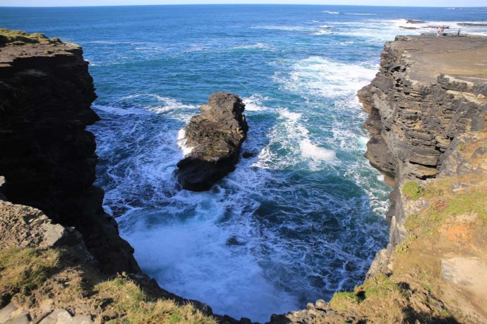
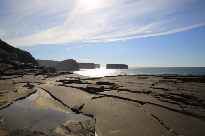
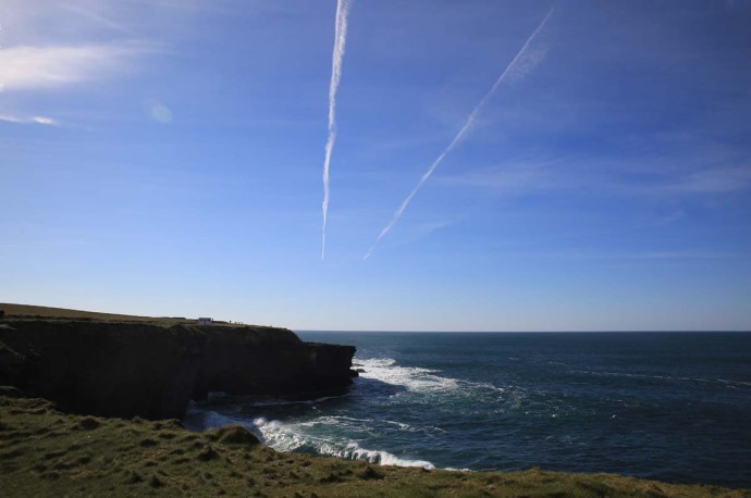
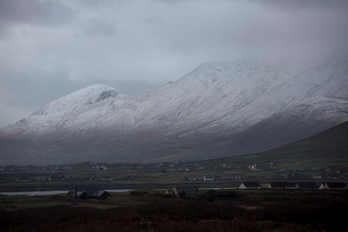
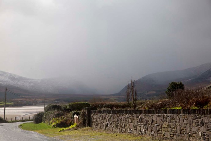
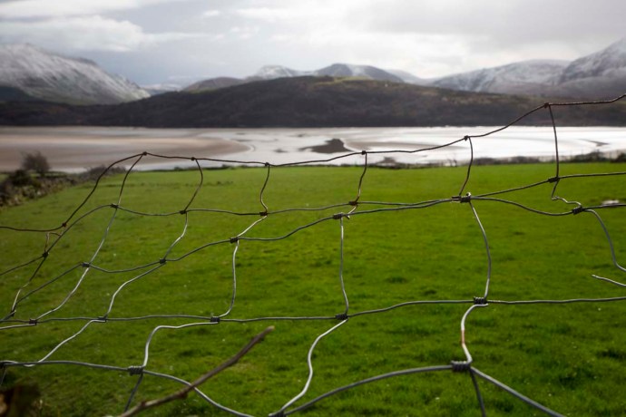
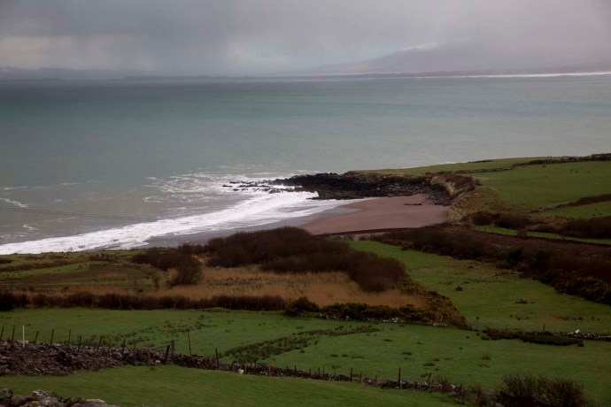
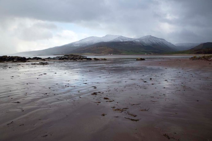
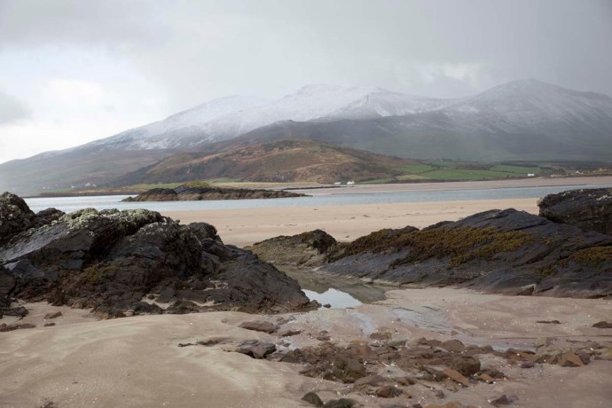
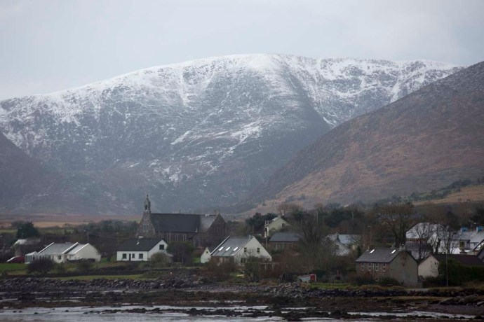
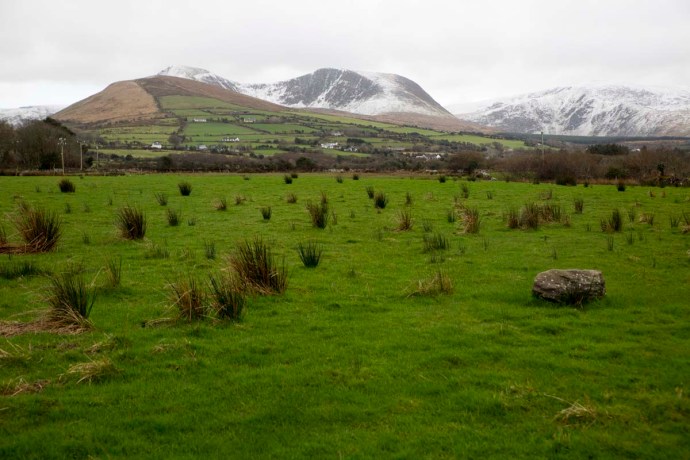
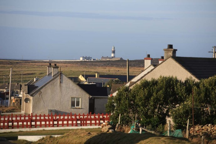
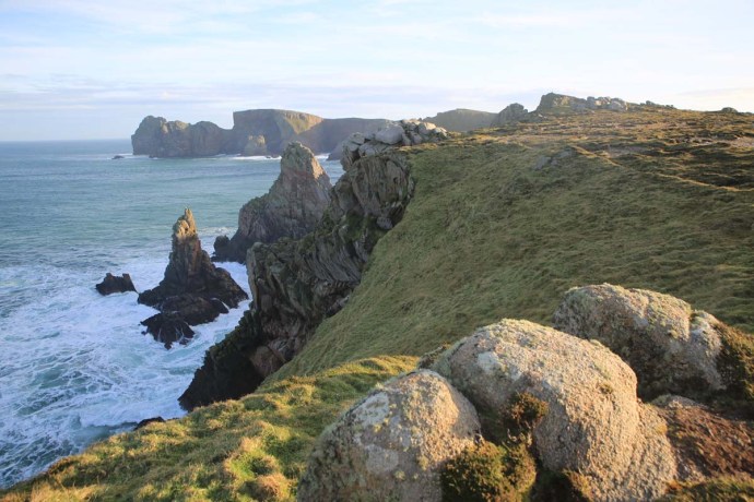
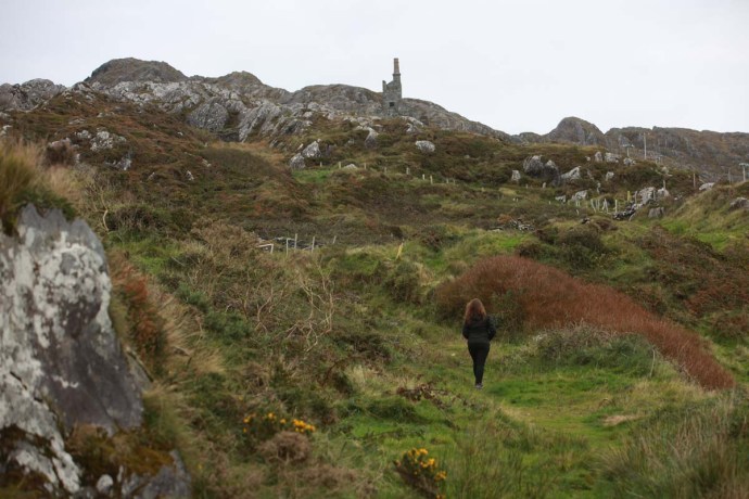
The Vandeleur Walled Garden is located near Kilrush in the south western corner of Clare. I visited it in the middle of Spring when it was at its charming best. It is a formal garden space within high walls and is now a place of calm, peace and reflection. Especially reflection.

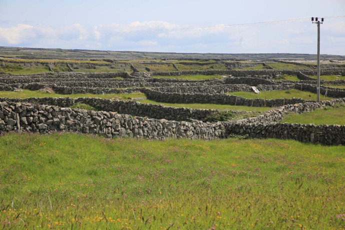
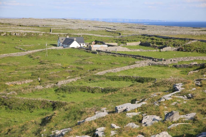
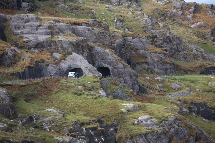
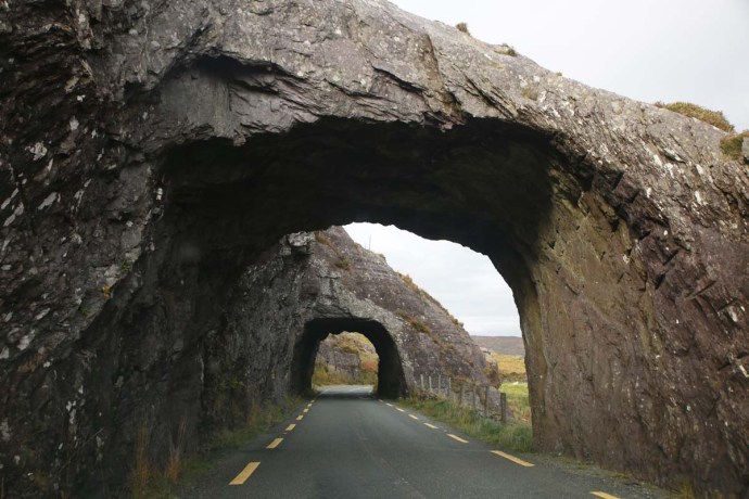
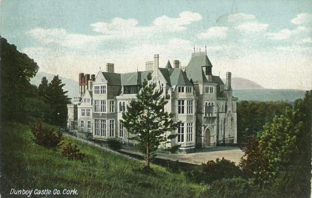
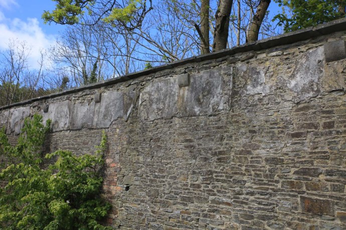
Historically it was the private garden of the Vandeleurs, who were the largest landowners in the area. It is completely surrounded by enormous stone walls and was located close to the family home, which was destroyed by fire in the 1890s and demolished in the 1970s and is now a car park.  The rectangular design was oriented to catch maximum sun so today Mediterranean plants thrive.

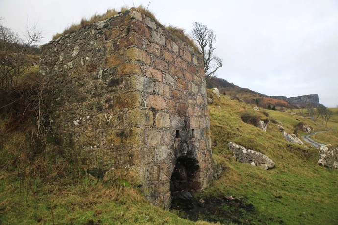
The original garden design was simple and functional as it was mainly used for produce, fruit and supplies for the household. It also included a large greenhouse. All that is gone and the garden lay forgotten for decades. Restoration commenced in 1997 and it was opened in 2000.   It has been redesigned as a recreational space with lawns, an horizontal maze, an hedge maze, plantings of exotics and an arboretum. It is a lovely space. There is a red theme throughout with furniture and installations matching some of the plantings.

IG3C0299

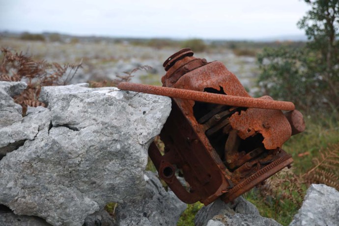
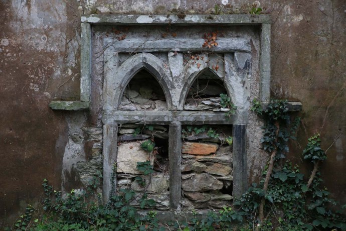
Remnants of the supports for the roof of the greenhouse


IG3C0303

Lawns and plantings cut by gravel paths


IG3C0281

Mediterranean plants thrive.


IG3C0254

Vigorous growth under the high walls


IG3C0234

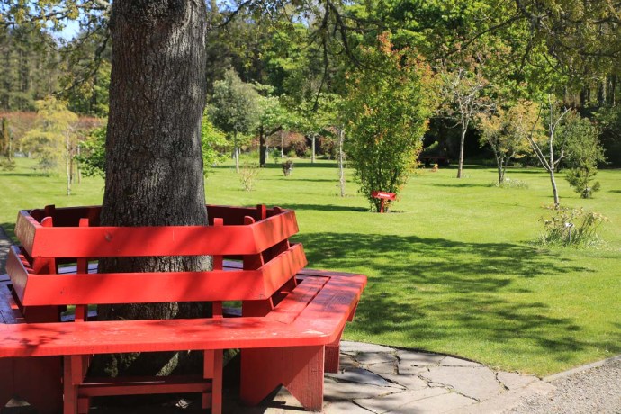
The Garden has a red theme

IG3C0557

Red theme reflected in plantings.

But despite all this beauty as I stroll around my mind remained troubled.

Near the entrance is a small plaque.  It says “Dedicated to the memory of the people evicted from the Estate of Landlord Hector Stewart Vandeleur. July August 1888”. The effect is somewhat diminished though with the tag “Erected by the Kilrush Tidy Towns committee April 2010”

IG3C0220

Memorial plaque near entrance to Garden

I suspect most people just walk by and give only a passing thought to this hint of the awful history that accompanies the family responsible for this garden. I   wonder further how many people actually are aware of what happened in this place during the 1800s, as their children skip and play on the lawns and chase each other through the hedge maze or as they wander along gravel paths and admire the plantings from all over the world.

IG3C0436

skip and play

IG3C0451

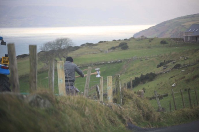
Children take a short cut across the Horizontal Maze

There is no information provided so I too was in the dark. My interest piqued though I explored further a little later.

So who were the The Vandeleurs? Descended from Dutch merchants, they settled in county Clare at Sixmilebridge in the early 17th Century.  In 1712 the Earl of Thomond leased the Kilrush estate to the family who eventually purchased it in 1749,   The lands amounted to almost 20,000 acres spread over a very wide area of West Clare.  John Ormsby Vandeleur played a major role in the development of the town of Kilrush in the early 19th century and built Kilrush House (to which the garden was attached) in 1808. Later the Vandeleurs gave land for the building of the Catholic Church, convent, a fever hospital and, ironically, the workhouse.

The family however is remember more for the large number of evictions that took place in the famine years and then again some forty years later.

As I said the brochures you collect at the entrance make only passing reference to these events with the words that “history must never be repeated”.  But behind this is a painful picture of despair, cruelty and terrible injustice.  I am sure all my readers will be well aware of the Famine. An event that killed one million people and forced another million to flee to other lands. But as I dug deeper the sense of injustice increased and I think it is worth retelling the story at least as it impacts the Vandeleurs.

As the Famine took hold in 1847 and tenants were unable to pay rent mass evictions began. Not just by the Vandeleurs but by landowners all over the country.

County Clare however had the highest level of evictions, relative to its population, of any county in Ireland and Kilrush Poor Law Union had the highest level of mass evictions in Clare. So the Vandeleurs were right in the centre of it.

We are lucky that the records of Captain Kennedy who was the administrator for the Kilrush Union are available and they make extraordinary reading. Captain Kennedy was extremely disturbed by what was going on and though he was diligent in administering the regulations he did what he could to alleviate the plight of those affected and destined for starvation, disease and the workhouse.

A quick word on Kennedy.  He was a good man caught in terrible times.  He later went on to be Governor of Western Australia but he never forgot Kilrush and regularly sent money back there.

In early 1848 he observed in one of his regular Reports.

“I scrutinized a list of 575 families here, and saw each individual; On one estate alone, little short of 200 houses have been ‘tumbled’ within three months, and 120 of this number, I believe, within three weeks! The wretched, houseless, helpless inmates, for the most part an amphibious race of fishermen and farmers, scattering disease, destitution, and dismay in every direction. Their lamentable state of filth, ignorance, destitution, and disease, must be seen to be comprehended.”

In July of that year things were desperate:

“Twenty thousand, or one-fourth of the population, are now in receipt of daily food, either in or out of the workhouse.

“I may state in general terms, that about 900 houses, containing probably 4,000 occupants, have been levelled in this Union since last November. The wretchedness, ignorance, and helplessness of the poor on the western coast of this Union prevent them seeking a shelter elsewhere; and to use their own phrase, they “don’t know where to face;” they linger about the localities for weeks or months, burrowing behind the ditches, under a few broken rafters of their former dwelling, refusing to enter the workhouse till the parents are broken down and the children half starved, when they come into the workhouse to swell the mortality, one by one. It is not an unusual occurrence to see 40 or 50 houses levelled in one day, and orders given that no remaining tenant or occupier should give them even a night’s shelter.

“I have known some ruthless acts committed by drivers and sub-agents, but no doubt according to law, however repulsive to humanity; wretched hovels pulled down, where the inmates were in a helpless state of fever and nakedness, and left by the road side for days.

“As many as 300 souls, creatures of the most helpless class, have been left houseless in one day, and the suffering and misery resulting therefrom attributed to insufficient relief or mal-administration of the law: “

I could go on. In total there were close to 7,000 evictions. The event, of course, changed the nation. It was surely inconceivable that it could happen again. But extraordinarily it did; and the Vandeleurs were in the forefront.

A series of bad harvests plagued the country from 1870. This had led to a movement in the next decade for tenants’ rights and land reform with the foundation by William O’Brien of the National Land League.   The ‘land question’ caused major upheaval in the county and people flocked to Ennis in 1880 to hear Charles Stuart Parnell make his famous “Boycott” speech.

Landleagueposter

Irish Land League poster from the 1880s

By1885, bad weather, poor harvests, falling prices and declining markets had again taken their toll, and thousands of tenants, especially in the western parts of the county, found themselves unable to pay rents.

The National League introduced the Plan of Campaign in 1886. This was adopted by many tenants who got into trouble. Where a landlord refused to lower his rents voluntarily to an acceptable level the tenants were to combine to offer him reduced rents. If he refused to accept these, they were to pay him no rent at all, but instead contribute to an “estate fund”.

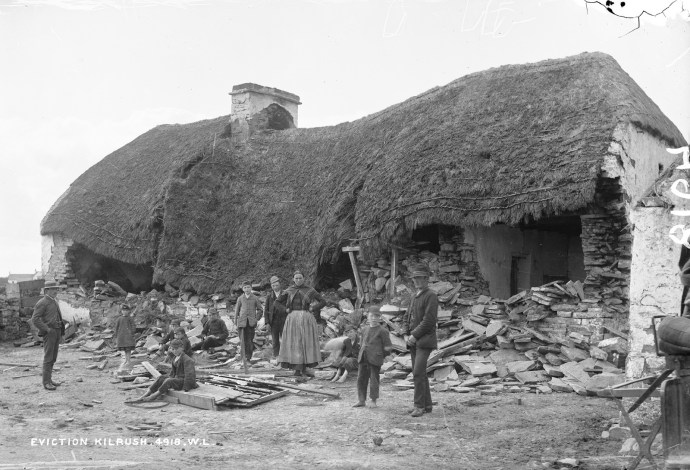
Vandeleur’s tenants adopted this strategy, which was summarily rejected and negotiations went nowhere. And after a long stand off the evictions commenced in October 1887. But the main evictions of the Vandeleur tenants were not until July 1888. It was a massive operation. A procession moved from house to house that comprised hundreds of men and was 1¼ mile in length.  It included detachments of police, hussars, government representatives, the landowners, Emergency men, Infantry, cart loads of observers, visitors and a massive battering ram. It is estimated that up to 10,000 people were there on some days.

battering

The Irish Collection

23144955540_e65c53e0ef_h
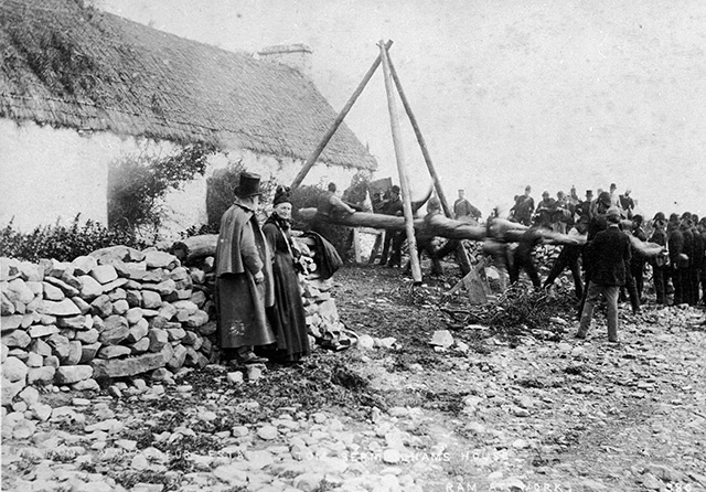
The mob was resolute in its intent and ruthless in its implementation. Here is a description of the demolition of the house of Michael Cleary, near Moneypoint.

Cleary had strongly barricaded the house and was clearly prepared to resist. First of all cordon of police and soldiers were drawn up about the house, but at some distance. Smoke was coming from the chimney – and the first action taken was to block the chimney with straw. Possession was then demanded and the only reply heard was a laugh from some girls inside. The police were now ordered to fix their bayonets, while the bailiffs got to work with crowbars and hatchets, but to little effect. An attack on the door moved it only slightly and hot water was thrown out. The tripod and battering ram were then brought up – and after a long time eventually made a breach in the wall. A shower of hot water was thrown out through the breach.

Finally, a large section of the wall crashed down to a cheer from the Emergency men. Two girls and their two brothers who were in the house were seized by the police The house was then knocked to the ground.

The eviction of Mathaiass Macgrath from Moyasta a week later received the most attention as he resisted strongly and was brutally beaten. His mother, watching this, collapsed and died that night. The evictions ended two days later.

photographing_evictions_vandeleur

These Vandeleur evictions were on a much smaller scale than those in the Famine years. only 22 houses were destroyed compared to the many thousands previously. However, Because the event was so well documented and photographed and because of the resistance of the tenants it received wide publicity. This was a factor in reaching a settlement which led to the tenants being able to resume their land a year later.

The photographs above and many others were taken by Robert French and are now in the collection of the National Library in Dublin. They were a major factor in changing perceptions. Maybe more would have been done if the public had been better appraised of what was happening during the earlier evictions.

So back to the garden. Earlier I commented that there was no informaton on these events. But I am now in two minds. Perhaps we don’t need an Interpretive Centre to tell us of these terrible events.  Perhaps it is a place for people to enjoy in their own way.   For some just to walk and contemplate and for others to run and play.

And for others it is a place to honour and respect an extraordinary formative time in Irish history. To reflect on inhumanity and injustice. To ponder on the harm man can do to their own. To contemplate and to evince hope for the future.

IG3C0305

Enter a caption


Categories: My Journey, Real Ireland | Tags: , , , , , , , , , , , , , , , , , , , , | 1 Comment

Ireland’s Wild Atlantic Way! Avoid it?

I don’t really mean that – I just wanted to get your attention.  Now that I have it……

Well, actually I sort of do mean it. Let me explain.

The Wild Atlantic Way was inaugurated in 2014. It is a 2,500 km coastal route that extends from Kinsale in County Cork to the tip of Donegal. Of course the roads were always there and nothing much has changed except lots of blue signs with a wiggly white line. It has been a roaring success as a focus for visitors to the western counties and has become one of the great coastal drives in the world.

So this is good but my concern is that it funnels people along those coastal roads and it means that travellers become a bit blinkered and are less likely to visit the many gems that lie off this road and away from the coast.

The coastline is magnificent.  I won’t sing its praises here because there are many who have done that already. But it’s only one Ireland. There are others and the best way to see them is to leave the N-roads and take the R’s and L’s.  Sticking to the coast in Clare for instance you will miss Miltown Malbay, Ennistymon and Lisdoonvarna, not to mention Corofin, Kilfenora, Ennis and all of East Clare.

This was highlighted to me the other day. I regularly drive from my home near Quilty to Ennistymon. I habitually take the coastal route through Spanish Point and Lahinch, which happens to coincide with the WAW.  This time though I sought an alternative and Google Maps in her infinite wisdom sent me inland through Miltown Malbay along the Ballard Road and then along a number of boreens to Ennistymon, avoiding Lahinch. It was only 2 minutes longer. I was amazed that I hadn’t come this way before.

Rural view 2

It was stunning countryside.  Rolling hills, stone walls, full of those fabled forty shades of green that defines this country. It benefited from being that little bit higher with stunning vistas to the ocean and Aran Island in the distance. There was no traffic. The narrow lanes entice you to take your time and soak it in and maybe even get out and walk. You can guarantee you will discover the unexpected.

As US poet Robert Frost put it:

I shall be telling this with a sigh
Somewhere ages and ages hence:
Two roads diverged in a wood, and I –
I took the one less travelled by,
And that has made all the difference.

Categories: My Journey, Real Ireland | Tags: , , , , , , , , | Leave a comment

The Stone Walls of Aran. A Triumph of Adaptability.


IMG_5678


The Aran Islands are one of the harshest environments in Ireland. Hardly a tree, little natural soil, plenty of rock, no surface water.   But it does have, for Ireland, a relatively benign climate and its greatest resource – a resilient and enterprising people.  It once supported 3,500 people in the 1840s but how has around 1,300.

The islands (Inis Mór, Inis Meáin, Inis Oírr)  are stunningly beautiful but the feature of the landscape that strikes you most when you visit the islands. are the walls and the limestone pavements so typical of the Burren. The two go hand in hand.  There are over 2,000 km of stone walls on the Aran Islands. This is mind boggling considering the total area of the islands is only 46 square kilometres.  I doubt that there is such a concentration of stone walls anywhere else in the world.

IMG_5799

A typical Aran scene.  Narrow walled roads and houses on a treeless landscape.  

IG3C7179

Lush paddocks surrounded by Aran walls.

IG3C7333


In fact at ground level staring out over the paddocks often all you can see is stone walls forming a continuous covering of the landscape.

IMG_7349

Walls form a continuous blanket over the landscape


Most of the walls were probably built in modern times (since the 1820s). They are made of limestone gathered from the adjacent fields, Of course in our mindset we tend to think of these walls as boundaries of land holdings. Most are not.


But first. The oldest surviving walls on the Aran Islands are those associated with the famous ring forts. At Dún Aonghasa,  one of the most impressive forts in Europe,  the earliest of the walls appear to date from 1100 to 1000 BC, that is Late Bronze age though considerable additions and modifications were made in medieval times (c800AD). Extensive further additions and repairs were made in the nineteenth century in the name of conservation. Clear differences in the masonry or these three periods are apparent. Especially obvious are the buttresses which were controversially added in the 1800s to ensure stability of the earlier walls. The stone for the walls here was quarried nearby, as revealed by the regular shapes. The quality of the stonework is amazing, especially the oldest parts of the wall,  and much of it has been in place for 3,000 years.

IMG_6661

Dun Aonghasa.  Ancient wall from 1000BC


IMG_6636


But back to the other stone walls.  Up until the 1840s there was a system of shared common land ownership in the west of Ireland, known as the Rundale System. So there was no great need for farm boundaries. However following the abandonment of this system, stone wall, ditches and hedges were used to define land boundaries.


However the farm walls on Aran, as I have already aluded to, are largely not the boundaries to land holdings. The paddocks are too small and irregular. They appear to be a method of handling waste rock gathered from the fields to improve the quality of the pasture and to enable soil improvement by the use of seaweed and to allow the growing of potatos. They define manageable parcels of land and protect the soil from being blown away by the wind. Quite brilliant really.


They are always built without mortar – the ‘dry stone’ technique and require constant maintenance. A number of styles are apparent and these may be a response to the availability of source rock, the type or shape of the source rock, the needs of the site or the skills of the craftsmen.


For me the most striking and beautiful are the Lace Walls. They are essentially see-through and come with lot of variations presumably at the whim of the builder. Some have large gaps and some are tight.  All are so called single walls unlike the double walls more characteristic of other parts of Ireland.   By the way, there have never been professional stone masons on the islands.  The walls are all built by residents who acquire the skills as a normal part of their farming tool kit.

IG3C7451

Open lace wall using regular vertical ‘mother’ stones

IMG_5812

Open Lace wall in very slabby terrain.


IMG_7742

Closer packed lace wall with some larger and more regular stones


IG3C7379

Tight lace wall with even sized stones.  

IMG_7500

Tight lace wall.  Very few gaps.


Feiden Walls (from the Irish for ‘family’) are characteristic of Aran and the west of Ireland. They are built with a ‘family’ of stacked stones. Often there will be vertical slabs (mother stones) which act as a frame within which smaller stones (children) are stacked.  There are countless variations.

IMG_7851

Feiden wall


IG3C7499

Two stage wall with Feiden wall at base and tight lace wall at top.


Between the fields are narrow roads know as róidín but access is usually across fields rather than around them. This seems strange as there are very few gates. This didn’t really hit me at first but most fields appear to have no access. A closer look however reveals “phantom gates”. A ‘gap’ roughly filled with stone. These are called bearna, or “Aran gaps”.   Many are filled with rounded stones as they are easier to dismantle and roll away. There are many variations and again, they appear to be unique to the west of Ireland.

IMG_7818

Note the narrow walled roads between the fields.


IMG_7697

A bearna.  Stones in ‘gate’ were removed to gain access and then replaced after.


Each time you visit these islands you see more.  It’s like reading a book over and over and seeing something different each time. Initially the sheer scale and quantity of the walls is a little overwhelming. But they are a aesthetic and functional marvel and a wonderful example of man’s ingenuity in adapting to his/her environment.

Stone, earth, land, climate, food; all intricately woven together, driven by remoteness, resilience and the need for self sufficiency has created something truly unique.

IMG_7917IMG_7914

IG3C7449

Categories: My Journey, Real Ireland | Tags: , , , , , , , , , , , , , , , , , , , , , , | 6 Comments

Kilkee, Co Clare. The Rhythm of the Waves.


IG3C4933IG3C5849IG3C4912

Kilkee is a small resort town on the west coast of Clare. One of its major attractions are the cliff walks. Every bit as dramatic as the more famous Cliffs of Moher but no Interpretive Centre and no entry fee! If you take the walk west from the Diamond Rocks Cafe along the coastal trail you are rewarded with striking cliff vistas and easy access, with concrete stairs, to the rock platform in a number of places; something you can’t do at the other Cliffs.

One glorious March day I visited with my camera. I descended one of these stairways towards the shore. There was much of interest. A ‘blow hole’ where you could see the swirling ocean underneath through a hole in the rock layers, perfectly preserve ripple marks reminding us this was once an ancient shallow sea in the Carboniferous. And of course spectacular views in all directions. If you keep walking west on this massive and smooth ledge you come to a point you can go no further. I’ll call this Valda’s Rock.

IG3C5228IG3C5237

I met Valda there. She was sitting on the edge where it drops off into the sea. I could tell she wasn’t a tourist and she had that look that she was waiting for something. I have learnt a lot by taking my cues from locals, so a polite distance away I sat and watched and waited too.

It was a perfectly calm day. There was nothing breaking the surface of the ocean. It sparkled with the glint of the sun bouncing off the ripples. Together but separately we waited and watched. IG3C5245


Then without warning a series of waves arrived and the ocean came alive. You couldn’t predict where they would arrive from or where they would break and they had me turning this way and that. There were waves reflected from the cliffs and this added extra complexity. Some would smash against the rocks and the spray would ride up, at least on one occasion sending some foolhardy visitors scurrying. It would only last a couple of minutes and then the energy dissipated and all was calm again. She snapped photos on her phone, while I clicked away on my beast making full use of the burst function. Then she plugged her earphones in and went back to her waiting. After a while though I disturbed her peace and we struck up a conversation.

IG3C5336aIG3C5617IG3C5623IG3C5518IG3C5665aIG3C5701IG3C5679


She had grown up in Kilkee though now lives and works in the ‘City’, as she called it (Limerick), but returns home every weekend and comes down to this very spot regularly. She told me she had been watching these waves since she was a little girl. She talked about what she called ‘the rhythm’. You wait and the big waves come. Not regular but they come. Interrupting our chat was the next big set.


Each set was uniquely different and some were well into ‘Wow’ territory. You just couldn’t leave as you wanted to see what the next one would bring.


But she did leave. After all it was Mother’s Day and she was supposed to cook dinner.


I had enjoyed meeting Valda but I stayed. Another hour. I tried to pick a pattern but there was nothing obvious. There must, I thought, be something driving this. It’s like the earth’s beating heart sets off mini tsunamis somewhere in the distant Atlantic and they pulse into waves that eventually funnel into this bay at Kilkee; the kinetic content released explosively as it meets land for the first time.


So thanks Valda for introducing me to this very special place.

IG3C5161a


Categories: My Journey, Real Ireland, Wild Ireland | Tags: , , , , , , , , , , | 4 Comments

Dingle Peninsula. The Irish Alps

I have blogged about Dingle quite a few times and posted many photos. Even the name has a delightful ringle to it.  So what else could I possibly say about it?  But. There’s the thing about Ireland. There are always surprises and you can go back time after time and each time it’s like you’re there for the first time.

It was the end of February and my annual pilgrimage to Ballyferriter was completed (I have written about this Festival in previous years and it delivered yet again). It was time to go home. I’d been up that night until 4am playing tunes with wonderful people whose friendship is renewed every year.  That’s what’s great about Festivals.  It’s not just the music.

Anyway, during my short time in bed I lay awake listening to the wind lashing and the hail thrashing. A wild night.  Next morning it was calm and there were patches of sun, so I decided to head around the Slea Road back to Dingle, one of my favourite drives. I’d had Aidan Connolly in the cd player all weekend so it was time for a change. I stopped to retrieve a new CD and something made me look back towards Mt Brandon. I was stunned by the view. Completely shrouded in snow with Ballyferriter nestled at the bottom. This is what I saw.

kerry2_154

Mt Brandon, the third highest mountain in Ireland looms over Ballyerriter.

A quick change of plans and I headed the other way making the instant decision to return via Conor Pass.

Perhaps a little foolhardy but the weather looked ok and I doubted I would get another opportunity like this. It turned out to be an inspired decision. As I got closer to the pass the patchwork of paddocks gave way to a carpet of white.  The weather came and went in waves as I headed up the hill.   I was greeted at the top by another snowfall. But also enough sun to revel in the alpine glory. I was in the heart of the Kingdom and I had been granted admission to the Palace. I was lost for words and I really can’t describe the feeling I had immersed in this wilderness.

On this occasion I will let the camera talk. And talk it will. Loudly. Driving over the top and down Conor Pass, there were surprises with every turn in the road . I headed to the villages of Cloghane and Brandon and out to Brandon Point and then returned along the coast to Aughacasla. All the time snow clad ranges framed the views.

Please enjoy these photos of an Ireland rarely seen.

kerry2_157

The green fields of Kerry on the road up the Conor Pass, from Dingle, turned progressively whiter,

kerry2_160

and whiter,

kerry2_159

and whiter,

kerry2_167

and whiter.

dingle-4

The view from the top.

kerry2_172

Heading down the mountain

kerry2_2

Corrie lakes in the glacial valley

kerry2_10

The start of the steep bit! Or the end if you’re coming down.

kerry2_13

kerry2_14

And then…..

kerry2_18

It started to snow.

kerry2_26

It’s not easy to photograph snow.

kerry2_30

At the bottom of the pass is this view towards Mt Brandon.

dingle-1

And the light kept changing.

kerry2_34

This is still Ireland.

kerry2_38

The Irish Alps

kerry2_41

Slieveanea from the base of the Pass

kerry2_51

Approaching Cloghane

kerry2_55

A view of Mt Brandon near Cloghane

kerry2_56

Cloghane with Mt Brandon.

kerry2_57

Mt Brandon looms above Cloghane Church

kerry2_61

Mt Brandon

kerry2_66

The sun shone

kerry2_69

The road from Cloghane to Brandon

kerry2_70

looking across the bay to Beenoskee

kerry2_72

And then it was raining

kerry2_75

Fenced in

kerry2_78

The mountain disappears in the mist

kerry2_85

View from the pier at Brandon

kerry2_86

The pier at Brandon

kerry2_89

kerry2_90

Another view across the bay towards Beenoskee

kerry2_92

Incongruity.  Surfers in the bay.

kerry2_100

Colours.

kerry2_105

The village of Brandon

kerry2_109

kerry2_115

Cappagh Strand near Brandon village

kerry2_116

View across Brandon Bay and Cappagh Strand

kerry2_126

Cappagh Strand

kerry2_131

View from Cappagh Strand back towards Mt Brandon

kerry2_139

The village of Cloghane

kerry2_142

Cloghane or have I been teleported to Switzerland?

kerry2_147

The hills are alive with the sound of……

kerry2_150

A last view of Mt Brandon.

Categories: My Journey, Wild Ireland | Tags: , , , , , , , , , , , , , , , , , | 1 Comment

The Waves of Tory

ig3c0890

Magheroarty Beach, where the ferry departs to Tory Island


Tory Island. Those two words resonate loudly in my ears.

Back in the late 70s and early 80s when I played in Bush Bands in various remote parts of Australia, one of the favourite dances was the Waves of Tory. Well our version of it. With that lovely descriptive name reflecting the motion of the dancers with high potential for total chaos yet at the same time conjuring up romantic notions of a windswept wild wasteland in the North Atlantic.

As far away from the beautiful windswept wild wasteland of the Australian desert as could be.

ig3c1778

Waves of Tory


Well now I have ridden the Waves of Tory and the imagined and fanciful has become real. It is wild and it was windy and those waves were something to behold but it was not a wasteland. It is surprisingly different to the other inhabited islands I have visited here such as Achill, the Aran Islands and Sherkin.  It is stunningly beautiful.

ig3c0773

Tory Island as seen from Magheroarty Beach

Tory Island, or just plain Tory, lies about  14km off the coast of Bunbeg in western Donegal. On the day I decided to go the ferry had already left from Bunbeg but I had time to drive to Magheroarty and catch the 11:30am.


I picked my day and was lucky. The forecast was spot on with sun predicted all day because I really wanted to photograph it in a clear light. But I forgot to check the ocean conditions and boy was there a mighty swell which made for a very rough trip.

We were warned to be back at the boat by 2pm, much earlier than scheduled,  and if we didn’t get it we would be there for at least four days as storm conditions were expected to prevent the boat sailing for that time. This gave me about 1 ½ hours on the Island . I was disappointed but it is amazing how much I could see in that time, albeit fleetingly.

So back to the Waves Of Tory. We took the smaller of the boats, the romantically named Whispering Dawn, that usually do this run and it was filled with returning residents, with their shopping and all sorts of oddments that can only be got on the mainland. There was plenty of Guinness and whiskey and a massive birthday cake. Well that was what I guessed it was by its shape and the way they were carrying it, and a big bag of helium filled balloons which said 40th.  So many things to plan for with life on a remote outpost. Goods were passed down the steps in a human chain, as they probably were since the boat started sailing there.

ig3c0935

Everyone joins in to load the boat.


So the boat was packed finally, though a few late comers forced us to turn around after we had already headed out to sea. Wouldn’t happen with the Manly Ferry! When we finally got going it was rough. we were tossed around like one of those toy boats in a bathtub that Hollywood used to simulate a violent storm.  Except this was real. Waves would swamp the deck as we listed first one way then the other.  The Captain doing a marvellous job to turn the boat into the massive waves to avoid them hitting us broadside. Photography was pretty difficult with salt on the camera and the cameraman, but I got a few. Remarkably I didn’t get sea sick.

ig3c1124

Ploughing through the waves on the way to Tory

ig3c1146

All kinds of passengers


The Island loomed into view so slowly. The eastern end looked rugged and mountainous while the western seemed more topographically restrained. We pulled into the wharf with some relief and the passengers disappeared into their little slice of this Island world.

ig3c1556

I knew Tory had a King.  The current king is local artist and musician, Patsy Dan Mac Ruaíri.  Elected by popular vote of the Islanders he has ruled since 1993. I was expecting to be met by him and his accordion.   Every account of a visit to Tory talks about the King. Well not this one, because he just wasn’t there.  Perhaps he was engaged on other official duties.  I can only assume that it was of the gravest urgency to have kept him from meeting the boat and welcoming me.

The Island is fringed with granite boulders and slopes gently up from the seashore with a treeless plain that heads off to the horizon where there are a few rocky knolls.

ig3c1219

There is a cluster of houses which is the main village and in the distance I could see other smaller clusters with only a few scattered houses in between. Much of the land seems barren and empty but you are drawn to explore.

ig3c1423

The village is just a lovely higgledy piggledy jumble. Nothing is straight. The main road snakes around and the houses are built at different angles to each other. One suspects people here over time have just done what they pleased. Many vacant and ruined houses sit next door to beautifully painted and maintained cottages. In the centre of it all is the remains of a round tower, a bell tower from the 7th century and the only remaining part of a Monastry founded by St Columcille as a sort of getaway from the no doubt stressful life of being a saint. Prominent in the town is a generator and you are reminded of what it must be like to live here.  Especially in winter.  Indeed, in 1974 a massive storm cut the island off for two months.  The response of the Government was to attempt to resettle the 130 residents on the mainland, but the islanders resisted and won the right to remain.  A pyrrhic victory as there are virtually no facilities remaining.

ig3c1159

The 6th Century bell tower is the only remains of the original monastery


ig3c1492

ig3c1235

ig3c1507

Boats share the main street with houses


It’s maritime connection is never far away. Old boats are scattered through the village most unlikely to see their hull in water again, now part of the permanent streetscape.

They must be a special breed, the people who live here.

I loved the feel of the place. The hand painted signs, the unpretentiousness. The rawness reflecting a life that this particular day’s relatively benign weather temporary masked.

I had less than an hour left and I had no idea what the Island had to offer. I could see a light house in the distance but no time to go there.  I should have done my homework I suppose but I went there on a whim. After walking through the town I kept seeing those knolls and ridges in the distance; so I headed across the bare paddocks.

ig3c1449

A view towards the lighthouse


ig3c1345ig3c1430a

Wind assisted. When I got there the ground suddenly dropped away into preciptious cliffs. I had to work hard to avoid being blown off into the Atlantic. The view was stunning.

ig3c1350

ig3c1297

Land bridge in quartzite cliffs

ig3c1360


Stunning, sublime, arresting, breathtaking.  Substitute any other hyperbolic synonymy and you still won’t be able to describe it adequately. Some of the cliffs were of granite and some were of quartzite. And they were different to each other and to the cliffs of Clare. The granite cliffs were smoother, more rounded and with boulders perched precariously. Those of quartzite which formed the high cliffs of the northern end of the island were jagged and irregular with many offshore stacks and islands and even a land bridge. I continued to walk along the cliff edge and each corner would reveal another spectacular vista of rugged bays and pinnacles.

ig3c1395ig3c1406ig3c1334

A quick look at the time and I had twenty minutes left to make it back to the boat. Got there no problem but disappointingly no sign of King Patsy to say goodbye to me and reluctantly just a handful of us embarked for the mainland.

But the trip back was not very pleasant. We had a bigger boat (Turasmara ) which seemed to handle the waves better but the sensible Islanders remained behind, ensconced in their homes in front of their warm fires while the few of us returning to ‘civilisation’ struggled with effects of the Rolling Waves. Some lost the battle. I fully expected to be a victim but somehow by standing outside in the open and clinging to a door handle with my legs braced against each wave and my eyes fixed on the receding Tory I rode it out

Forty five minutes later with heavy clouds moving in as if on cue, to announce the end of the journey, we were back somewhat unsteadily on land.

With my legs regaining their function I left the Kingdom of Tory behind and it was back to Bunbeg for a warm fire, a settling whiskey and a tune.

Two hours was definitely not enough. Next time I will stay and explore this remarkable place at my leisure. Definitely overnight.

Maybe I’ll even get a royal audience.

Categories: My Journey, Uncategorized | Tags: , , , , , , , , , , , | 2 Comments

The Torr Road Drive, Co Antrim. Lime Kilns, Game of Thrones and sublime beauty.

Travelling by car along the north coast of Antrim is spectacular to say the least. As seems to be the way of the world the drive has to have a label. So this is the Causeway Coastal Route because it features the Giant’s Causeway. I will blog on this and other places in due course because they warrant attention. But after Ballycastle, if you are heading east, the Causeway Coastal Route turns inland (away from the Coast – go figure!) towards Cushendun and Cushendall.  So most travellers miss a little pocket of Antrim that is staggeringly beautiful. This is the Torr Road which hugs the coast to Cunshendun.  Ireland is noted for its green of course but in many parts that green turns brown and red in winter.  Not here.  In this part of Antrim you seem to get the Forty Shades all year.

ig3c1463

View from the Torr Road, Antrim

ig3c1475

Green and gold.  Just add sunshine.  Torr Road.  Antrim

ig3c1607a

Green slopes that run down to the sea.  Torr Road, Antrim. That current looks pretty treacherous.  Scotland is visible on the horizon.

ig3c1616

Coastal view, Torr Road.

ig3c1670

Fences need repair whatever the weather.  Torr Road, Antrim.

Of course the road leads to Torr Head.  This is the closest point to Scotland and from here you look across to the Mull of Kintyre.  It was very cold this morning, so I resisted the temptation to climb to the top. At the top of the headland is a tower which watches over the Sruth na Maoile (Straits of Moyle), a former haunt for privateers, and acted as a signal tower, passing on messages of ship movements to Lloyds of London.  There is also a now ruined, customs station which was abandoned in 1922. Its stark ruin brings an evocative supernal element to the gorgeous views both along the coast and back towards the hinterland.  Awaiting you, at the end of this drive at Cushendun, is the gateway to the Glens of Antrim, but that’s another story.

ig3c1484

Torr Head.

ig3c1518

Ruined Customs House, Torr Head.  Antrim.

ig3c1500

Ruins of Customs House, Torr Head

ig3c1493

ig3c1576

Phone Box looking towards, Torr Head.

On my first drive along this road I went past a turn off to Murlough Bay. It was an inconspicuous sign and nothing drew my attention to it. If it hadn’t been for my B&B hosts that night at Teach an Cheol, just out of Ballycastle then I would have missed this little gem entirely. They insisted I go back there before leaving Antrim. Thank you  Micheál and Catherine.

The single lane road to Murlough Bay snakes off the Torr Road across brilliant green paddocks, and then suddenly drops off the plateau winding both perilously and picturesquely down to the sea. Remarkable views open up.

ig3c2107

Limestone cliffs at Murlough Bay.

ig3c2129

ig3c2412

I passed a solid stone structure which intrigued me, so I dragged my eyes away from the view.  It was like nothing I had seen before and I later discovered it was a lime kiln where broken limestone rock was melted to produce quicklime. This was used for mortar or for agriculture. It was a thriving industry wherever limestone and coal (for fuel) was found.

ig3c2080

Lime kiln near Murlough Bay.  Front view.

ig3c2093

Lime Kiln from above.  Showing hole where lime and coal are loaded.

ig3c2388

Limestone cliffs

A little simple chemistry.  Limestone with the application of heat breaks down to lime with the release of carbon dioxide gas as in the following reaction

CaCO3 + heat → CaO + CO2

The reaction requires about 1000 °C. They were extremely common around Ireland and Britain, indeed in the mid 1800s there were believed to be 23,000 in Cork alone. There was plenty of limestone here with the surrounding cliffs. I’m guessing there was also a good supply of coal nearby too. I am always impressed by the beauty and solidity of the industrial architecture I come across here in Ireland. The stone work of the multiple arches over the air intake is stunning.

ig3c2128

So continuing down towards the coast I see a sign reminding me that this area was used to film episodes of Game of Thrones that hugely successful television series, still running. Of course you can see why. Film tourism has always been a big thing in Ireland what with The Quiet Man, Ryan’s Daughter, Father Ted, PS I Love You, and it continues with Game of Thrones and Star Wars.

Murlough bay is a place of singular beauty. You leave the car and walk along the track which follows the coast to a whitewashed cottage with the most perfect location in Ireland. There is a second small abandoned cottage; padlocked but in reasonable condition. A peek in the window and I can see some bottles of disinfectant and cloths suggesting a level of optimism by the owner. What a place for a holiday batch. Nearby there is another lime kiln.

This place is everything that makes Ireland beautiful. Cliffs, washing waves on rocky shores, boulder beaches, jagged headlands, green fields rolling into the sea, craggy islands, little coves. The surprising variety of landscape is a result of a rich geological melange which I might talk more about at another time, but I saw metamorphosed schist and gneisses, basalts, sandstone and conglomerate, limestone and of course the ever-present carpet of bog over it all. A geological history of 600 million years on display in this little bay.  Again a sign tells us a little cove here was used in another episode of GOT.

ig3c2137

Distant view of Murlough Bay

ig3c2165

Murlough Bay looking east.

ig3c2184

Murlough Bay looking west.

ig3c2192

Basalt outcrops forming islands and bays

ig3c2211

Murlough Bay.

ig3c2264

Murlough Bay.  Sandstone rock platform with narrow bands of conglomerate.

ig3c2279

Murlough Bay.  This view has sandstone, basalt, gneiss and limestone.  A geological melange.

ig3c2294

Murlough Bay.  Abandoned cottage on the shore.

ig3c2178

Another lime kiln on the beach at Murlough Bay.

Again a sign tells us a little cove here was used in another episode of GOT.

It is hard not to use clichés in describing this spot. I was the only one there and it was so quiet and so still. the only activity was a fishing boat, way out in the channel and the only noise was the ripples lapping the shore and the occasional squawk of a gull. There was an undisturbed equanimity and you could feel tension disappearing with the tide. Just me and my thoughts. I didn’t want to leave. I have been to so many beautiful places in Ireland, but not felt this way before. Surrounded by natural beauty, yet somehow otherworldly.

Extraordinary.

ig3c2323

ig3c1741

Categories: My Journey, Wild Ireland | Tags: , , , , , , , , , , , , , , , , , , | 1 Comment

Glenties and the Blue Stack Mountains; The beating heart of Donegal fiddle music.

I hadn’t planned on going to Glenties. Don’t get me wrong it’s a delightful place in the west of Donegal set in mountainous country and its lovely leafy village setting is a surprising contrast to the treeless wild of this part of the world.

I had just spent a wonderful week of music at the Scoil Gheimhridh Ghaoth Dobhair (a winter school for traditional music at Gweedore) and was ready to go home. It was the last night and the final session was coming to a natural exhausted conclusion. I was saying my goodbyes when Sile Friel of the renowned Glasgow/Donegal based Friel Sisters asked if I was interested in attending a session the next night. This is how the conversation went.

Sile        “I’m trying to organise a session with a few of us and the Campbells at Glenties”

Me         “Um. Who are the Campbells?”

Sile        “You’ve never heard of them? Jimmy and Vince are fiddling royalty up here”

I felt embarrassed by my ignorance. But my interest was of course piqued and my travel plans instantly changed.

Next morning I headed south taking a detour to the Glengesh Pass (between Glencolmcille and Ardara), which ironically I had visited earlier in the year on a miserable summer day in stark contrast to this glorious winter’s day. Well worth the detour.

ig3c9620

Glengesh Pass.  On a sunny day in the middle of winter.  January 2017


ig3c7771

Glengesh Pass.  The same view on a foggy day in the middle of summer. August 2016


But my main objective was a little pub a few kilometres from Glenties in the middle of the Blue Stack Mountains.

I spent the afternoon discovering the Blue Stacks, also known as The Croaghgorms. It is the most significant mountain range in Donegal, separating the north from the south. Typical bare, rounded hills with the characteristic remote wilderness feel to it that makes Donegal so appealing. The special winter russet colour which takes on a red tinge when the sun shines.  And not a tree, except the occasional pine forest.  I took random roads, which turned into random lanes and then random boreens. It was beautiful but scary. The roads were so narrow that there was no chance for two cars to pass and there was bog on either side. And being so remote there were few houses and fewer laybys. I drove in fear of meeting someone and having my reversing skills challenged over distances measured in hundreds of metres.  This world though is well off the commuter trail and the major road traffic was of the four footed kind.

ig3c9732ig3c9649ig3c9676

ig3c9663ig3c9657ig3c9683

I arrived at the Glen Tavern (everyone calls it Dinny’s despite that name not appearing anywhere on the building) a respectable period before the nominated time of 7 pm. Of course I should have known better.

I had plenty of time to get to know the owners, Annie and Mary because it was at least an hour before the first patron arrived let alone musician. And then some. Of course, I was made to feel very welcome. I guess an Aussie fiddler tuning up was a bit unusual.  Or maybe it wasn’t.

ig3c9967

Mary and Annie.  Mine hosts at Dinny’s


The first surprise is that you enter the pub through a little shop. Just your basics mind you, but a shop nonetheless.

ig3c9950

Open for business.


As well as a shop and a bar it is also a residence. A door to the right took me into the now empty bar. Cosy and inviting with those corner lounges so typical in Ireland just waiting to be filled with musicians. This looked like a great place for music. But not right now.

I settled down for a chat with Mary and Annie and a glass of Jamieson and heard the stories of this place and its music. In my ignorance I had not realised that these mountains and this pub were at the beating heart of Donegal fiddle music.

ig3c9958

A bar with an house fiddle is my kind of pub.


The legendary itinerant master tinsmith and fiddler Johnny Doherty lived in these parts and played here and the Campbells (who Sile had mentioned) are a direct link to that legacy. Vince and Jimmy learnt their music from their father who played with him. Johnny had stayed with the Campbells as he had in many houses across the mountains.  I had inadvertently walked into this time capsule.

Gradually people arrived. Peter Campbell, Jimmy’s son, also a fiddler and Condy Campbell; not sure where he fitted in but he took up what looked like his regular spot in the corner and settled in for the night.

Two hours now and the musicians who were coming from Gweedore had yet to arrive. Occasional texts from the Friels advised they were ‘on their way’. But this is Ireland. Turns out they called in to visit Danny Meehan, another legend of Donegal fiddling and he wouldn’t let them go. I’m sure there’s a great story there.

So it was well after 9.00 pm when they finally arrived and then another half hour before the tunes began.

The place had gradually filled (I’m sure there were a few more Campbells among the crowd) as the pipes and fiddles took over. Joining Sile Friels on pipes and sister Clare on fiddle were brothers Fionnán and Iarlaith Mac Gabhann, from Dublin, on pipes and flute.

ig3c9822

Peter Campbell, Fionnan Mac Gabhann, Clare Friel, Sile Friel and Iarlaith Mac Gabhann at Dinny’s


The music was sensational. We were in full flight with, of course, a heavy smattering of highlands, mazurkas, flings and a waltz or two, which , for the most part, I had to sit out. We even played Donegal’s only polka. Well that was what I was told. We got the story of that tune from Condy but I have to be honest, I can’t tell you any of it because with his thick, but delightful, brogue, I didn’t get a word.

The musical visitors had decided to move on so about 11 they started to pack up ready to go. Then Jimmy Campbell arrived. That changed everything. “Just one for the road”.  Jimmy insisted that they keep playing and he just sat and listened. In that peculiarly endearing Irish way he would interject with “lovely”, “lovely”, which is surely the ultimate accolade. And it was meant.

ig3c9889

Jimmy Campbell watches and listens.


He was persuaded eventually to grab a fiddle. “I can’t play” he said wryly. “I can’t play like that”.

But he did and he could! No one joined. It was our turn to admire and just listen. He played solo and he played with son Peter.  The boys from Dublin had never been to Donegal before and I could see the reverence and joy writ all over their faces at hearing this music. I felt the same. Here was a whole world of playing I knew nothing about.

ig3c9907

Father and son.


ig3c9933

A good tune followed by a good laugh.


Of course no one left and the musical conversation continued until 1:30 am. Even the goodbyes took an hour.

I had the chance to sit and chat to Jimmy. A nicer gentleman would be hard to find. Nearly 80. He had left Donegal and lived in London much of his life but was now back home. His son Peter, born in England, followed him back. He is full of tales. A session with Jimmy is an experience. It is beyond now. Every tune has its moment. Often there are no sets. Just a single tune. We hear about where he learnt the tune or who wrote it or the story behind it or where the name came from. The tune is a window into a social history. With his words it ties us to people, time and place.

It was a special evening. Two worlds meet with both embracing each other. Music was just a facilitator for people to connect at completely different levels. A good session is more than just playing tunes together. This was a good session.

The beauty is though that I can take something away with me. On the wall is a framed musical notation of a tune, The Jack in the Tavern, written by Jimmy. It’s on my to-learn list now.

ig3c9945

To think that but for a chance conversation with Sile I would have missed this. That’s how it is in Ireland.

Happenstance and serendipity.

There is a music weekend every year in the Glen Tavern in September and I have marked it in my calendar already. Try and keep me away.

Hopefully I will have learnt Jimmy’s tune and a few more highlands and mazurkas by then.

.

Categories: Sessions, Stories, The Fiddle, Trad Irish Music, Wild Ireland | Tags: , , , , , , , , , , , , , , , , , , , , , | 2 Comments

Oliver O’Connell, Man of the Burren and the Track of Tears.

Ireland is a very popular destination with visitors. And for good reasons. I have met so many who have come here for a week and have rushed around to tick Dublin, Dingle, Cliffs of Moher and Galway off their list and happily report back home that they “did Ireland”. Don’t get me wrong most people genuinely enjoy Ireland, in fact love it. What’s not to love? There is of course wonderful scenery, friendly people, ruined castles, trad music, Guinness, bacon and cabbage, sheep on the road. Everything that brings people here. But very few of those short-term visitors would have tapped into the ‘real’ Ireland.  Ireland’s real treasure is its people. It’s through the people of Ireland you discover the Hidden Ireland.

I spent a day recently with one of these people. Oliver O’Connell may be known to some of you. Perhaps if I say he is Blackie O’Connell’s dad that may twig a few responses or the guy who started a session on an Aer Lingis flight last year, the video of which went viral; but really he should be better known as the great-great-great-great-great-great-great-great-great-great grandson of Maurice O’Connell ‘The Transplanted’. I’ll come back to that.

Oliver lives in an extraordinary spot in the middle of the Burren which is the beating heart of County Clare. Ten kilometres  from Corofin. You look out his kitchen window towards Mullaghmore , across a barren, stark tortured, limestone plain and you cannot see a single house. And at night the only light is the faint reflected glow from Galway City way to the north.

ig3c8720

View across the Burren National Park

Oliver is as much part of the Burren as the megalithic tombs and glacial erratics that dot the landscape. He took me for a little walk to show me a favourite spot of his; the so-called Famine Road. A little used part of the Burren Way walking trail.

Now I thought I knew what a ‘Famine Road’ was.  The walking tours of The Burren will take you to one and tell you these roadways were built as an assistance scheme to keep people out of the Workhouse.  This may indeed be the case but this one is different as Oliver tells it.  This road was here way before the Famine.  Indeed the 1842 map of Clare shows the route as a road in use and on the exact same line as the satellite image.  So it certainly well predated the Famine.

2016-11-04a

Satellite image of Famine Road.  Shown with red arrow.

2016-11-04-1

1842 Map showing same area as satellite image above.  Famine Road is clearly marked.

Oliver explained that it is called the ‘Famine Road’ for a very different reason.  The route was used by a number of families attempting to escape the deprivations of those terrible years but many did not survive. They are buried somewhere along the route in unmarked graves. It struck me as unusual that the road fell into disuse even though it would shorten the trip considerable from Corofin to Kinvara.  Oliver thinks the road has been there for perhaps a thousand years.  If this is true then it is a tribute to the engineering capabilities of the early residents.  It is roughly cobbled and raised in places, the summer grasses partly hide it now but its unique stone walls bounding it still stand proud today. They have regularly spaced jagged vertical stones. The road is straight as a die in places  and it traverses the country peacefully and silently.

ig3c8604

The start of the Famine Road near Aughrim.  Part of the Burren Way.

ig3c8716

View to the north along the Famine Road

ig3c8655

Cobbles forming the road base

ig3c8664

Detail of cobbling

2016-11-04-3

Detailed satellite view of portion of the Famine Road

ig3c8710

Jagged rocks standing upright form part of a wall along both edges of the road

So why was it no longer used?

Oliver is a poet. One whose poetry is raw, and highly descriptive.  It is personal and it is heartfelt.  It comes to him quickly almost as a stream of consciousness. He doesn’t massage it and as a result it doesn’t sound the least bit contrived.  In a poem he wrote about this road he describes what he calls the Track of Tears, thus:

Here in this place “bothar na muinne, ait ciunas gan uaigness”.

Where silence screams at you but the spirits of our people radiate a comforting presence as they lie here in peace in their final resting place.

You tread on their footsteps and on their tombstones as you weave your way through sacred structures and vertical stone walls in this land of myth and magic.

(‘bothar na muinne, ait ciunas gan uaigness’ translates to a ‘place of silence without loneliness’)

The silence screams. It quite literally does. Not a bird, no wind, no animals Just the sound of our footsteps and our breathing. It’s as if the Gods with quiet reflectance continue to mourn those who didn’t make it. And it is surrounded with a landscape of harsh but tranquil beauty described so well in Oliver’s poem.

It is perfectly fitting that the road is no longer used and it is tempting to think that this was by design as a memorial to those lost.

I was moved by the story of the road and this window into a distant Ireland.  Distant struggles, yes, but it recalls the many battles endured before and since by the Irish people.

But Oliver has a bigger story to tell.

ig3c8736

Oliver with the O’Connell Family Tree

ig3c8741

Detail of portion of the Family Tree

He has spent fifteen years trying to unravel it and his journey has as many twists and turns as a good detective yarn.

Oliver’s forebears have been in Clare since 1653. He has been able to trace them back continuously to Maurice O’Connell (The Transported) who led 59 members of his family from their home in Kerry, from where they were expelled by Cromwell. Those who survived resettled near Inagh and Liscannor. Clare was then part of Connacht and the expression To Hell or Connaught comes from that time and relates to this exodus. The barren plains of the Burren was the equivalent of being sent to Hell. But survive they did and Blackie’s children represent the fourteenth generation of O’Connell’s to live in Clare. But it’s even more interesting than that.

Oliver has managed to trace Maurice O’Connell’s antecedents back to 1340 when they were a well connected and important family in Kerry and Limerick and even earlier to Connaill Gabhra, “Connaill of the Swift Horses”, King of Munster, in the 1100s. What a fabulous heritage. Nearly a thousand years!

What is unique about this story is that documentation exists continuously since the 1300s. As Oliver explained most Irish families can only go back to the 1820s. Prior to that records were kept by the British only for Protestants and Military. The O’Connell’s have a long hsitory of military service so the story is still there for those with the patience and energy to root it out.

Oliver as well as being a poet and raconteur is a musician and has links to a generation of musicians sadly disappearing fast. He is full of stories all told with zest and enthusiasm, such as how Blackie started on the pipes, but I will leave that for Oliver to tell sometime as he surely will.

ig3c8753

How else would you end a day such as this but with some tunes, So I sat on a chair in the kitchen, a chair that I’m sure that Oliver’s old friend Finbar Furey would have sat on and it just seemed so perfectly logical that the fiddle and the box together would shatter that Burren silence.

Oliver has invited me back to see this place in a different mood. When the frosts arrive.

Keep me away.

ig3c8649_1

Categories: My Journey, Real Ireland, Wild Ireland | Tags: , , , , , , , , , , , , | 11 Comments

The Beara Peninsula, Co Cork. My New Favourite Place in Ireland.

I hope my blogs on Ireland aren’t getting too boring. Each time I discover or rediscover a new place I can’t stop scraping up the superlatives.  I’ve blogged recently on the magic of Glencolmcille and south west Donegal, on the spirit of Achill Island, on the beauty of Doughmore in West Clare and West Connemara and many places in between. Recently I visited the Beara Peninsula again for the first time in twenty years. And I’m sorry but I have to regale you with more resplendent words yet again.

The Beara Peninula is one of those wonderful headlands that define West Kerry and West Cork, jutting prominently into the Atlantic and adding a whole lot of extra kilometres to the Wild Atlantic Way.  Many have well known and evocative connotations. The Iveragh Peninsula, better known as the Dingle Peninsula,  and the famous Ring of Kerry are the prime destinations for visitors and do not fail to disappoint. Less well known are the Beara Peninsula, Sheep’s Head and the spectacular Mizen Head.

The attractions of the Beara Peninsula are however becoming better known and I am told by the locals that this summer it was crowded with visitors. I chose to visit in late October. The weather was good (in Irish-speak that translates to ‘no rain’) and it has to be the perfect time. At the western end, the roads are almost deserted and you feel you have this magnificent landscape to yourself.

An obvious draw of this place is that it is more compact than the Ring of Kerry but there is so much variety, so much of interest and so much to fill the shortening autumn days that it was hard to leave.

So what does this little treasure offer?  For a start magnificent vistas are around every corner. You can approach from the Northern Road or the Southern Road but my strong recommendation is you find time to do both.

panorama-beara-3

ig3c3378aig3c3484ig3c3436ig3c3681ig3c3706a

And sometimes you see something that you know could not be replicated anywhere else in the world.  The patchwork quilt and stone walls that say Ireland, Ireland, Ireland.

ig3c4109aig3c4224aig3c4066

There are a number of mountainous rocky passes. I explored the Caha Pass this time, which links Kenmare with Glengariff. Here there is stunning scenery and four remarkable tunnels (known as Turner’s Rock Tunnels) built in the 1840s when they decided to go through the rock rather than over it. Quite an engineering feat for its day and very unique for road construction as most tunnels in Ireland were built for railways. Indeed the railway construction boom did not start until the 1840s so these tunnels predate any rail tunnel in Ireland.   From this impressive road there are craggy mountains, magnificent pasture and grasslands, and sweeping panoramas. Next time I will do the Healy Pass.

ig3c4805aig3c4741ig3c4801ig3c4826aig3c4731

Elsewhere you will see wild, coastal panoramas, verdant forests, jagged islands or houses perched on grassy knolls with staggering views or nestled into rugged rocky cliffs.

panorama-beara-4ig3c3780ig3c3820

ig3c3635a

ig3c3716ig3c3493

ig3c3916aig3c3841a

The drive to the end of the Peninsula and Dursey Island is not to be missed. But be prepared for perhaps a little disappointment. Ireland’s only cable car which links the island to the mainland and at this time of the year only runs between 9.30am and 11am was ‘fully booked’ and not operating for transport of people. It was being used for the day by the local farmers to transport hay across the narrow channel. Where else would tourists be turned away, some mind you who had travelled especially, in favour of bales of hay? Only in Ireland. But somehow it didn’t matter, there was so much else to do and it will be there (possibly) next time. You’ve got to admire the ingenuity of the farmers here. I saw an old ‘retired’ cable car in a yard being used as a chook house. Love it.  And love the little insect houses thoughtfully provided by one farmer.

ig3c4000ig3c4016ig3c4034

Then there is the colourful palette of the charming village of Allihies, which single-handed may be responsible for keeping alive the paint pigment industry in Ireland. Purples, pinks, indigo and every other colour merged harmoniously into the greys, greens and reds of its rocky backdrop.

ig3c4383a

ig3c4264a

And towering over the town is the architectural masterpiece of the Engine House of the Mountain Copper Mine built around 1810. Maybe you think masterpiece too strong a word  but it is at least the equal from a heritage perspective of the megalithic ruins or the monastic abbeys that populate the tourist guide books.   This is the finest example of an historical mine building I have seen in this remarkable condition. It speaks of the confidence and wealth that the mine brought to this remote outpost as it became one of the jewels of European copper mining during its heyday from 1810 to its closure in the 1920s. There are plenty of reminders of the mining period; old shafts and adits, mine workings, two other engine house ruins, stone walls and in places the tell-tale green and blue staining of copper carbonates.

ig3c4369a

Mountain Mine engine house

ig3c4362ig3c4290ig3c4275

ig3c4321

Chasing the copper


There is a museum which gives a very good account of the mining story but unfortunately it is a bit expensive which turns some away. All aspects of the story are covered including the geology, mining technology and social impact.   As a geologist it was of course fascinating. And even more so for me having met the next generation of miner there, young J and his mum Frances, locals who had come to see if they could find any copper. As it happened I had seen some workings with strong copper on the way up the hill, so I offered to show them and took them there. J’s wide eyed fascination and enthusiasm was enough reward.  Maybe I have helped kick start another geologist’s career.

ig3c4394ig3c4389

Still on copper, I stopped at Puxley Manor near Castletownbere. Actually the site of the mansion is right near the ruins of Dunboy Castle but more on that later. It would seem that the location is well cursed having witnessed a number of tragedies over the past 4oo+ years.

24_ctb_ah-635x402

Puxley Manor around 1910

When I first saw the Puxley mansion it was 20 years ago it was a shell of a ruin. It had been the home of the Puxley family since the 1700s. They pretty much owned the copper mining industry here and ended up fabulously wealthy.  As the industry declined so did the Puxley wealth and when his wife died in childbirth Henry Puxley, the last owner, abandoned the castle. Worried that the British Army would take over the abandoned house, the IRA torched it in 1921, destroying it and its contents. The shell was sold at auction in 1927 but remained a forlorn ruin as this photo shows.

b-and-white-puxley

Puxley Manor in the 1990s

This is what it looked like when I saw it in 1996. It was sold to a developer in 1999 and the Celtic Tiger roared. It was to be transformed into a luxury 6-star resort hotel, the only one in Ireland. Massive restoration and conservation work was carried out and all progressed swimmingly with a soft opening in 2007. That was until the money dried up in 2008 with the GFC. By 2010 the project was abandoned and a mesh fence erected. The bats returned but not the visitors.  This is how it appears today. The rotting hull of a large boat sits in the harbour as if to reinforce the tragedy.  Such a grand vision. The restoration did not however extend to the gate house which stands impressively ruinous.

ig3c4651

Puxley Manor.  restored but empty

ig3c4532a

Puxley Manor

ig3c4496

Gatehouse.  Puxley Manor


I said earlier that Dunboy Castle remains were nearby. This was the ancestral home of Donal Cam O’Sullivan, last of the Gaelic chieftains and a thorn in the side of Elizabeth I during the nine years war which started in 1594.  In 1602 she sent a large battalion of troops to destroy O’Sullivan and the 143 men, who tried to defend the castle, could not withstand the British canon. Surrender was not an option after an emissary sent to discuss terms was hung in full view of the defenders. This ultimate fate awaited all those remaining once the British destroyed it and the castle was never lived in again.

The name O’Sullivan however is everywhere on the peninsula.  You can’t avoid it.

ig3c3538

This little enclave of Cork is truly a gem and you could spend a week here or even a lifetime. There are plenty of stone circles, forts, monuments, holy places (such as the Mass Rock) and extraordinary natural wonders to explore and discover.  Oh, and sheep.  And there’s Dursey Island, if the cable car is running.  And if you’re up for it you can walk it all on the Beara Way.

panorama-beara-6

Ring fort

ig3c3756

Mass rock

ig3c4147

The black sheep in the flock

ig3c3540

There once was a church

The beauty though is not just in the grand vistas but in a host of other details for me that capture the personality of a place.  Here are a few photos that speak loudly about the struggle for life for both nature and man.

ig3c4151

Abandoned bucket near a well.

ig3c3769

Perfect bonsai tree growing wild.


ig3c4080

Window treatment

ig3c4404

Ingenuity

ig3c3556

Maintenance can be a problem

ig3c3519a

Fantastically fertile for funghi


ig3c3434

Life hangs on


ig3c4692

True love

ig3c4547a

Faded hope

ig3c4505

Was this to avoid the window tax?

So that’s it.    I’ll be back and very soon.

Categories: My Journey, Real Ireland, Wild Ireland | Tags: , , , , , , , , , , , , , , , , , , , , , | 9 Comments

Blog at WordPress.com.