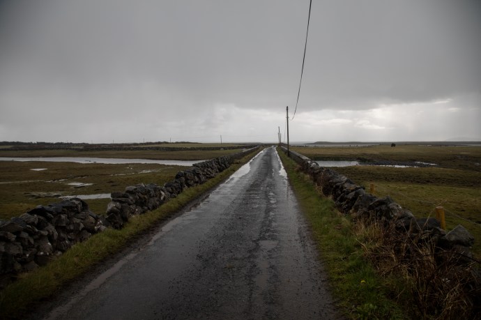
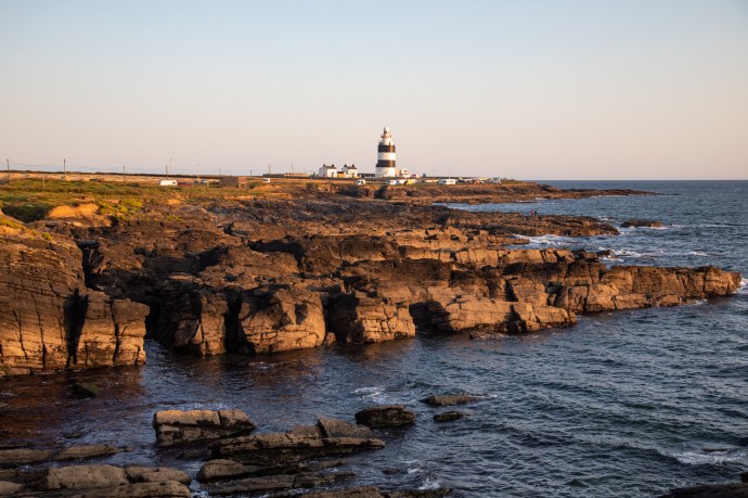
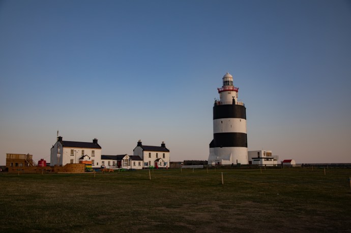
What a fabulous start to Day 2.
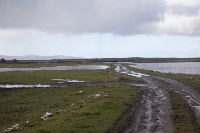
I was up before dawn to share with the sun its struggle to shine through the narrow band of cloud that hovered unhelpfully at the horizon. It would break through for a few moments here and there and the golden light would turn mundane walls, abandoned houses and mown hay fields into memorable works of art. I headed north from my overnight stop at Hook’s Head through the open but stunning countryside. Every few miles there was something that grabbed my attention sufficiently to point my camera in that direction.

Hay bales as far as the eye can see
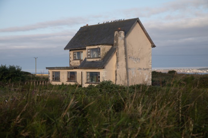
Abandoned house Templetown
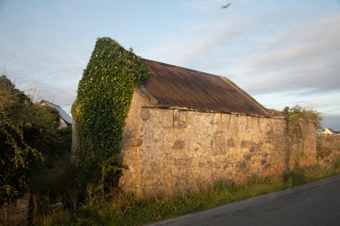
Abandoned old farm building
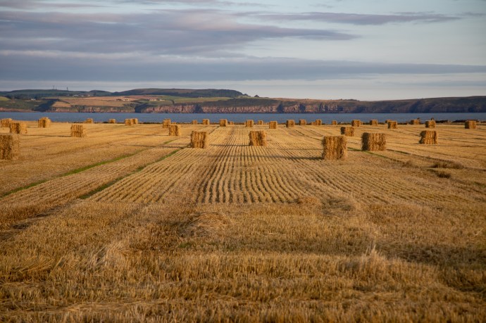
Hay bales come in all shapes

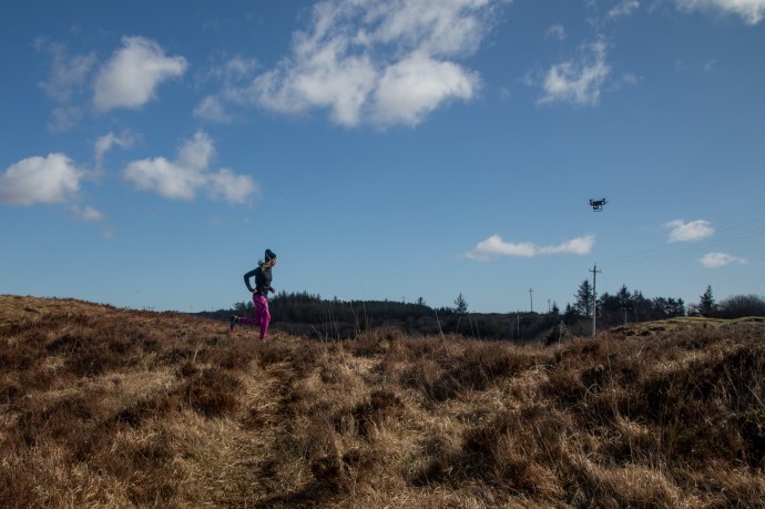
A horse at full stretch having its morning run.
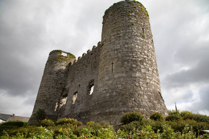
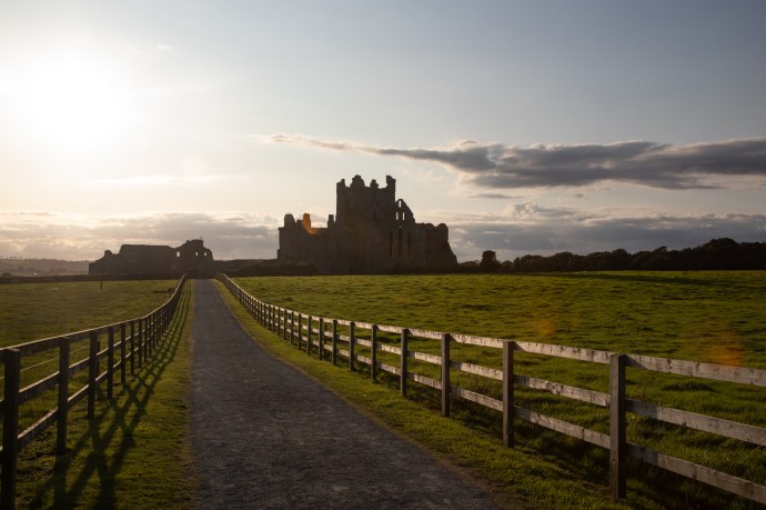
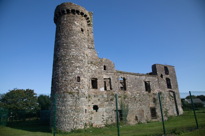
I’d seen Loftus Hall on the way down and had intended to visit, but it had closed the day before, for the season. That is really annoying; when you tour Ireland in the late Summer and, despite the weather being as good as anything in June or July, you find so many attractions close at the end of August. I had to be content with photographing it from distance or through the grand locked gates.

Loftus Hall from a distance
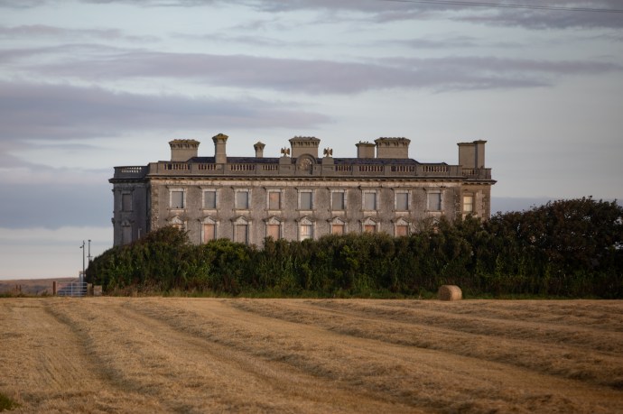
Loftus Hall. As close as I could get.
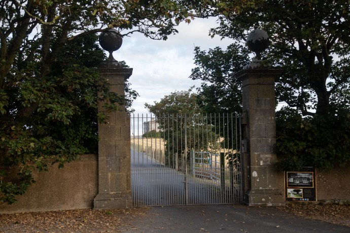
Entrance gates to Loftus Hall
Loftus HalI is a large country house, with a reputation for being haunted by the devil. The Most Haunted House in the country says the sign at the gate. Prior to the construction of the current house, an earlier mansion, Redmond House, had been occupied by the Redmond family since 1170. They successfully repelled an attack by the British during the Confederate War in 1642. Twice more the house was attacked by Cromwell but eventually it succumbed in 1650. The land was confiscated and granted to the Loftus family who occupied it until the 20th century. Later owners included the Sisters of Providence who ran it as a girls’ school, the Deveraux family who converted it to a luxury hotel in the 1980s and, it is rumored, Bono who bought it in 2008. It is now run as a tourist attraction with emphasis on paranormal experiences. Well it seems the ghosts can rest for a while now until the crowds return next summer.
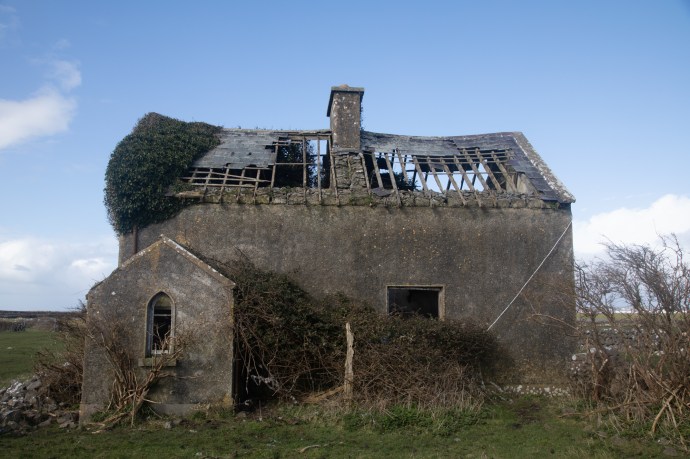
One abandoned house intrigued me. At the cross at Graigue Little, Templetown stood a ruinous house in a very sad state. Unroofed in part and unloved, it was overgrown with ivy and bushes and pigeons had taken up residence.
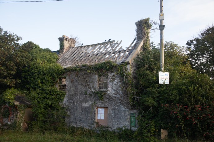
Mary Anne’s house at Graigue Little, Templetown.

Home for the pigeons
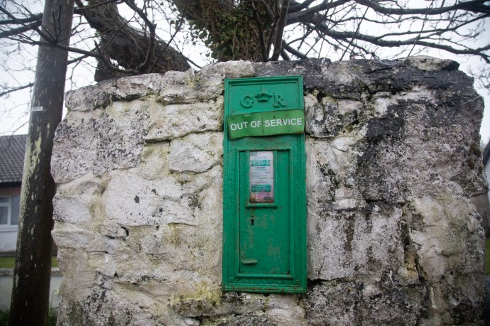
Four laminated notices are attached to a timbered up window. These notices from Wiklow County Council declared the house a dangerous structure and ordered the owner, I’ll call her Mary Anne, to obrain expert reports and do works to make it safe. It was not a demolition order because at the same time she was ordered to preserve heritage features, in particular the Victorian post box (it has the letters VR).

Notices from Wexford Council regarding dangerous condition of the hous

Heritage listed post box
A challenge to be sure. Mary Anne is given 1 month to seek the expert’s advice and 6 months to complete the works from receipt of the notice. Inexplicably the notice is undated, so I guess that’ll turn out to be 6 months of Irish time. I would love to go back in a year and see if any progress has been made.
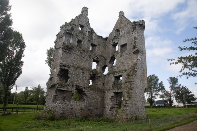
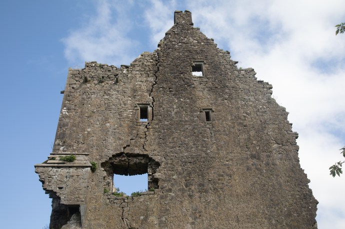
Every ruin has a story. Just a little further on, I saw another stone structure in a field near the road. It was a tower of some sort but was like nothing I had seen. It had only a portion of the wall remaining, but you could clearly see sloping walls suggesting a conical structure.

Ruin of windmill on Hook Head peninsula

Ruin of windmill on Hook Head peninsula. Another view.
I was baffled; I approached a car driving out from a nearby house. The helpful driver told me it was the remains of a windmill for grinding corn which made perfect sense. Turns out there are 112 windmills on the official list of windmills in Ireland, some still standing others ruined. None known in Clare apparently.
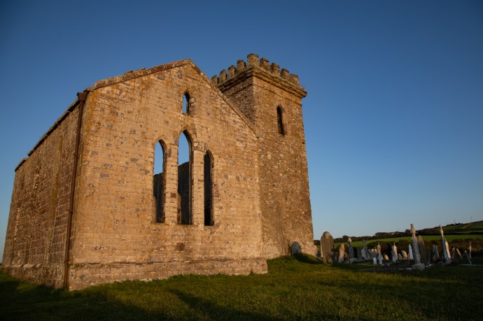
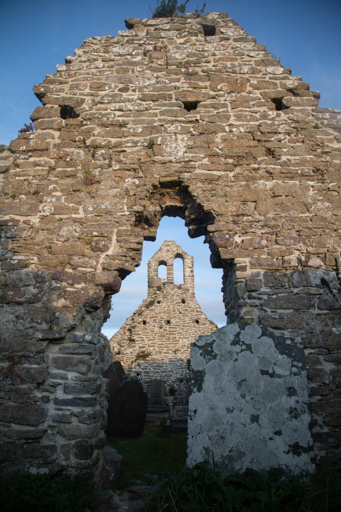
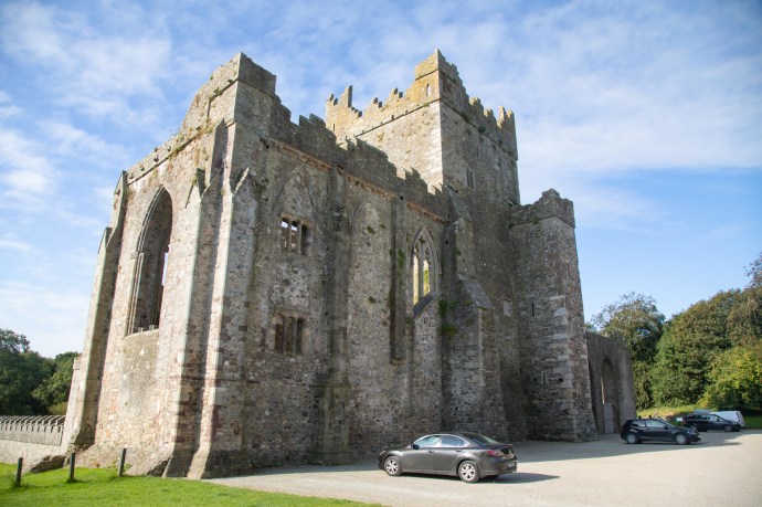
Here’s another ruin and another story. St Dubhan’s Church is a little gem and the story is worth telling. The church was founded by a Welshman, Dubhan, related to an Anglo Saxon king, who arrived in 452 AD. As an aside, these early monks had a predilection for fires (signal fires that is) and it is believed that they travelled to the coast to light beacons to guide passing ships, until Hook Lighthouse was built in the 1100s. That’s Impressive. That spot at Hook Head has been used to keep shipping safe for over 1,500 years. Anyway, back to the church.

St Dubhan’s Church and graveyard.
The current stone church replaced a wooden building in 11th century. Recent restoration costing €100,000 has been completed, in particular, on the bellcote which was toppled in a storm around 40 years ago. You see them on churches still today – a stone or metal frame for allowing bells to swing free; the double tower at St Dubhan’s has now been reinstated. I don’t remember seeing a bellcote in any other ancient church ruin. I imagine they would have had trouble surviving. I also found it interesting that the red smudges on the walls of the nave are believed to be original paint from the 14th century.
The restored bellcote at St Dubhan’s
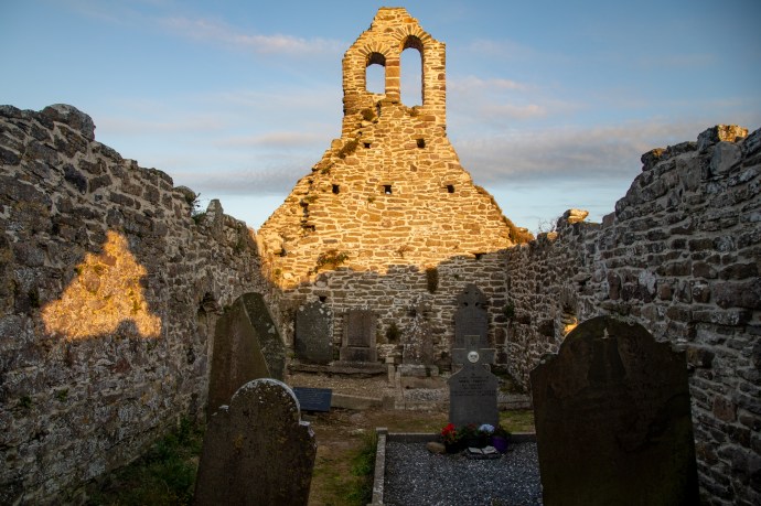
The bellcote at St Dubhan’s. Note also the red paint from the 14th Century under the bright patch on the left wall
Speaking of restoration there is a 10-year project, locally funded, to restore the Hook Head walls. These are very ancient and define the lands of the Loftus Hall demesne. I particularly liked the distinctive rounded turrets on either side of gates. In one instance I found a particularly elaborate one with an orb at a ruined house. Just one; the other one appears lost. The design is very similar to the towers on either side of the main gates at Loftus Hall.

Old walls around the Hook Head peninsula are being restored

Beautiful stone turrets for gateposts are a feature.

An elaborate gate post survives.
Heading north I saw a brown sign pointing to Baginbun Headland. Something made me veer off my route and take the detour. I think it was the pictograms of a beach and a tower? As I approached, I saw the tower. A well preserved Martello Tower, built at the beginning of the 19th century to protect Ireland from a Napoleonic invasion. It was off limits though as it is a private residence.
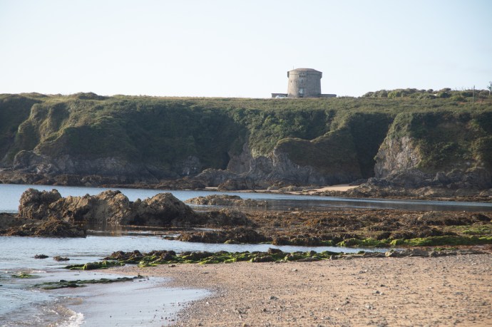
Martello Tower on the headland at Baginbun Beach
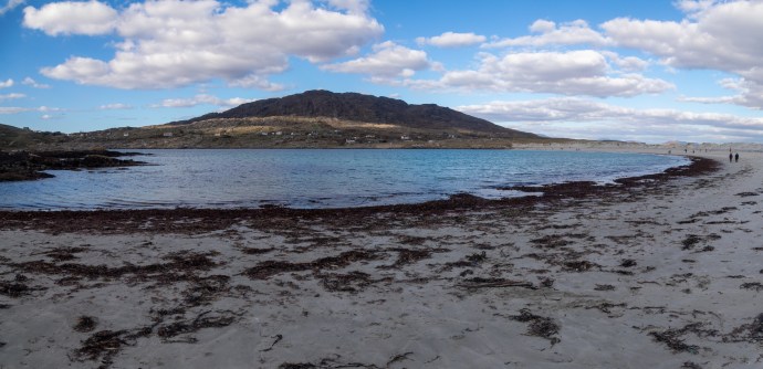
The beach though was something else indeed. It immediately jumped into my top 10 beaches in Ireland list. It is secluded and you don’t have any idea of what awaits you until you descend the ramp from the small car park. Golden sand broken by occasional rocky outcrops fringe the shore. At its southern end is the headland where sits the tower and another much smaller headland separates it from the broad gentle curve of more beach, fading into the distance to the north. On this calm day there was hardly a ripple on the ocean.

Baginbun Beach looking north
I tried not to disturb a group of a dozen or so doing their morning yoga as I walked past the cliffside rock exposures of steeply dipping and heavily faulted sediments. Structural Geology 101. But as I was to discover there is more to Baginbun than its peaceful ambience.
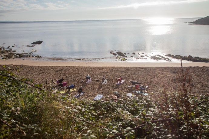
Morning yoga at Baginbun Beach
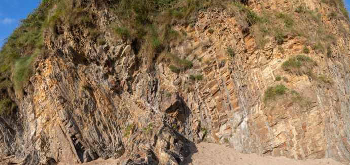
Cliffside exposures of steeply dipping interbedded sediments showing extensive faulting.
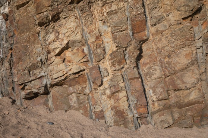
Structural Geology 101
It was about 8am now and a quad vehicle arrived on the beach with a load of kayaks. Locals Graham and Kimberly proceeded to unload the kayaks onto the beach. I wondered aloud whether they would have any takers in this remote spot on a Monday morning.
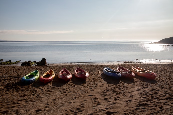
Kayaks await the morning rush at Baginbun Beach

Graham and Kimberly. Owners of The Irish Experience, which runs Sea Kayak tours of Baginbun.
“We’re booked out for two days” said Graham. He explained that he runs a company based on the Hook Head peninsula, called The Irish Experience, and that they do group tours that explore the heritage of the headland from the water and visit the sea arches and marine life around the point.
Heritage? It turns out that this spot is of huge significance in the history of Ireland. It is where a group of around 100 Anglo-Normans, under the leadership of Raymond Le Gros, Strongbow’s second-in-command, landed in May 1170. It was the first Norman presence in Ireland and is celebrated in the well-known medieval couplet:
‘At the creek of Baginbun. Ireland was lost and won’.
With his 100 men he defeated the Irish force of 3,000, apparently by rounding up a herd of cattle and driving them into the enemy, capturing or killing about 1,000. People that is, not cattle. Even the very un-Irish name, Baginbun, says Graham, comes from an Anglo Norman mash up of the names of the first ships, ‘Le Bag’ and ‘Le Bun’.
Graham pointed out a mound on the cliff above the beach, which is the remains of the fort they built to protect their position. Unfortunately, and controversially, a local landowner has placed a gate on the line of the fort and closed the headland off to visitors. The only way to see it easily is with Graham’s tour from the water.
Remains of Anglo Norman fort wall at Ballybungan. Dates from 1170 AD
Much as I would have loved to, my schedule was not flexible enough to wait the three days to join the tour. Next time I will book. Thanks, Graham, for opening my eyes to another hidden Irish story that would have otherwise escaped me.
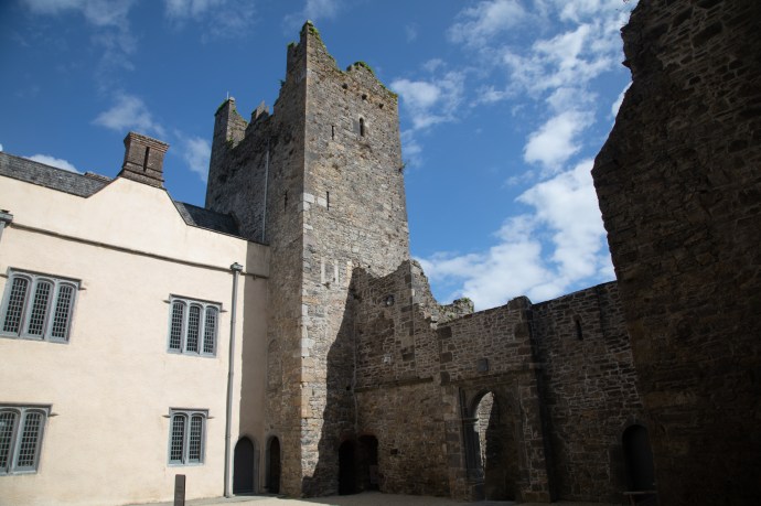
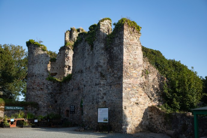
Baginbun Beach is right near the village of Fethard-on-Sea. In the middle of the village is yet another fifteenth century castle ruin, Fethard Castle. The original site was granted to an Anglo-Norman knight, Harvey de Montmorency (Strongbow’s brother-in-law) following the arrival of the Normans. He passed it on to the Church in Canterbury (England) who gifted it to Richard de Londres on the condition he would be build a castle there. That castle is long gone. The present castle was granted to Sir Nicholas Loftus (of Loftus Hall) in 1634 and it was occupied by them until the early 20th century.
Fethard Castle
Fethard Castle, view from the other side.
I popped down to the water nearby, a cute little harbour. Every seaside community has their maritime tragedies I have found. Fethard seems to have had more than its share. Here a lifeboat shed was built for the local fishermen to honour the tragic loss of nine crew of a lifeboat in 1914.

Lifebout Cottage at Fethard

Plaque on Lifegoat House at Fethard

Emblem of the LBI on Lifeboat House Fethard.
Another plaque right at the harbour recalls the deaths of five fishermen in one of the worst modern fishing tragedies in 2002 and reminds us that even today the sea remains a treacherous place.

Harbour at Fethard-on-Sea. Plaque to fishermen lost in 2002 is on left wall.
My next destination was Tintern Abbey. But I had to stop at this roadside ‘museum’ near Saltmills, which I passed on the way. To most people this is a junk heap. I get that, but I don’t see it in quite the same way as most people. This front yard to me is a window into what must have been an extraordinary and fascinating life. A boat, a crane, a hopper bin and all sorts of unidentifiable bits and pieces now competing with the ravages of nature and time for existence.
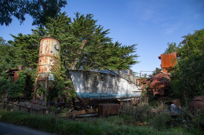
Open air ‘museum’ near Satlmills.
How did this man acquire this stuff and how did it end up neglected and forgotten? The crane intrigued me. It was made by Grafton & Co of Bedford in England. They produced cranes from 1883 to the mid-20th century. This one looks old, possibly older than 1900, and would have been steam driven. It is massive. How did it get here?
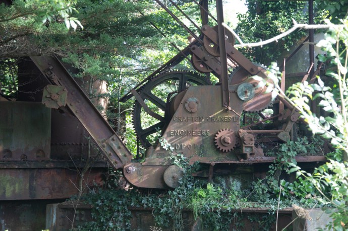
Early steam driven Grafton Crane
Perhaps even more interesting is an unidentifiable (to me) vintage car. It seems to be much larger that a normal family car and though only 4-door is long enough for a third row of seats. A huge boot and the doors, both front and rear open forward. What I am told are called Suicide Doors. Suicide doors on the front are pretty rare apparently. I would love to know the story behind the car and how it ended up here.

Front view of 30s/40s car

Note suicide doors on front and back. Als heaps of room behind the back seat

Giant boot and steel plate covering rear window?
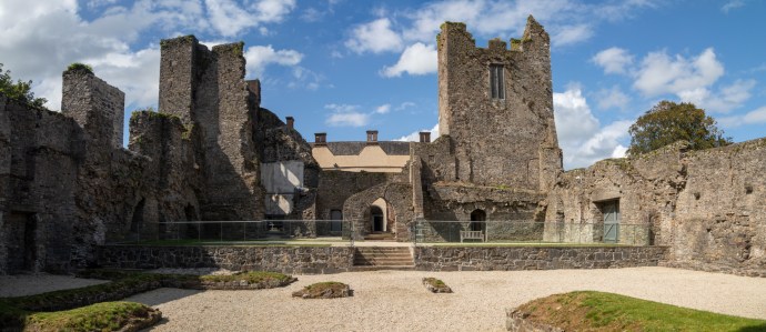
A few minutes later I was at Tintern Abbey. As I lined up my camera for the first photo of this impressive structure, I cursed the short-sightedness of the managers for allowing parking immediately adjacent to the building. Might sound like a real first world problem but you can’t get a decent shot of a 15th century building without including a 21st century car. There is plenty of parking space a short walk away. Anyway, I got over that and searched for another angle that avoided cars and scaffolding.
Front view of Tintern Abbey

Rear view of Tintern Abbey with battlement walls added later.
This Abbey, like Dunbrody, which I visited on Day 1, is Cistercian and was founded c1200 by William, the Earl Marshall (who we also met on Day 1, and was obviously a busy man with a hand in Templetown Church and the Hook lighthouse as well). There’s a great story about how Marshall, who was having a tricky crossing from Wales vowed that if he arrived safely he would build an abbey where he landed. He did and it became became know as Tintern de Vots (Tintern of the Vow) to distinguish it from the other Tintern Abbey in Wales. The remains consist of a nave, chancel, tower, chapel and cloister. I particularly liked the so called Lady’s Chapel has beautiful vauling and carvings adn a display of the wattle and daub walls that survive in the castle.

Vaulted ceiling of the Lady’s Chapel

carving in Lady’s Chapel

Display of method of wattle and daub used on internal castle walls.
The abbey was dissolved by Henry VIII in 1536 and it passed into the possession of the Colclough family, who held it until the 1950s. and used as their family home. ‘My home is my castle’. There were many modifications to the building over the years (centuries) including the construction of the battlements in the 17th century. They also constructed the battlement bridge nearby and a flour mill.

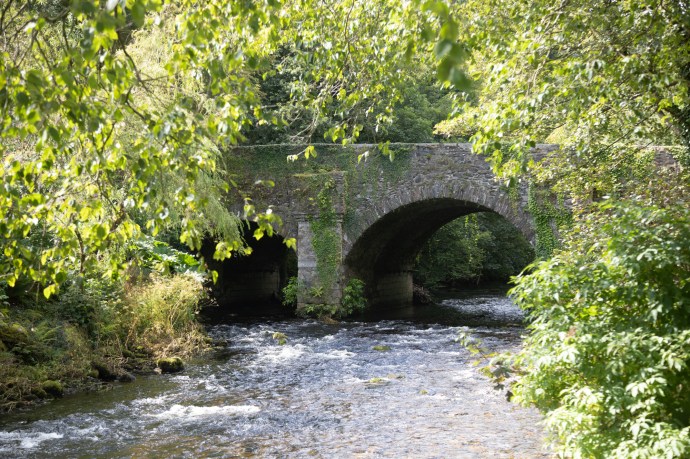
Bridge over the Tintern River to access the Abbey
The Colcloughs were smart. Sir Thomas, a catholic, married twice. First to a protestant with whom he had 11 children (Martha died in 1609 aged 34, perhaps of exhaustion after so many kids), then to a catholic who produced four more children before his death in 1624. This double lineage meant the owner of the estate could be changed to Catholic or Protestant, depending on the prevailing political winds, enabling them to avoid the confiscation of the estate.
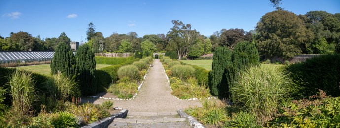
Another contribution of the Colcloughs (inexplicably pronounced Coke-lee by the way) was the creation of a walled garden around 1812. Located about half a kilometre from the House it had become a ruin with the planting of a Sitka Spruce forest within its walls. A community group commenced restoration in July 2010. It is now a treat. The original layout has been reinstated and this was only made possible by the existence of an historic map which showed the garden as it was in 1838. Paths through the garden, the location of the stream, five bridges, the outer enclosure. the location of fruit trees and the division between the Ornamental and the Kitchen gardens are all now as they were then. I loved the way that diamond shaped beds were identified by research into soil distribution. So many surprises. Plantings are themed with parts of the garden showing yellows, reds and pinks. A wonderful hour was spent here.

Being led up the Garden Path. Colclough Walled Garden

Colclough Garden. Faithfully reconstructed stream, bridges, fruit trees and diamond shaped beds in the Ornamental Garden.

Vegetable beds in the Kitchen Garden

Red and Orange

Yellow

Pink
I ummed and ahhed about going to my next destination, Johnstown Castle. Not because I had had my fill of castles but because it seemed very commercial and a bit like a theme park. But I went because I knew if I didn’t I would regret it. When I walked through the gate my suspicions were confirmed. A reception desk like a four star hotel, a gift shop a full-on restaurant, an agricultural museum, but I suppose I’m being a bit churlish as I guess most visitors would rave about how great the facilities were. I went in hoping that none of this would impact on my visit. Actually there was no drama. The site is so big and there is so much of interest that you are not that aware of the numbers. I booked the guided tour as I wanted to see inside the house, and that meant a three-quarter hour wait, which gave me time to enjoy the extraordinary gardens and lakes that surround the house.
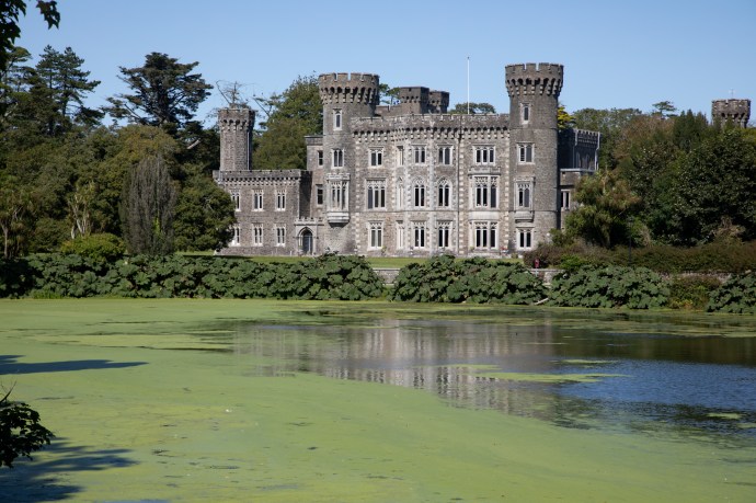
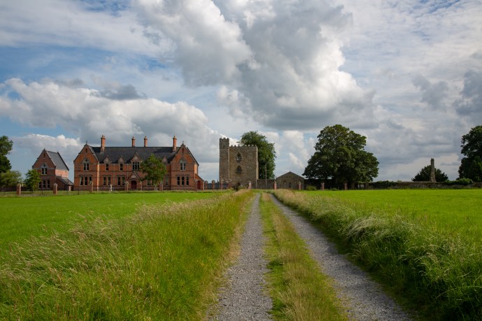
Johnsstown Castle
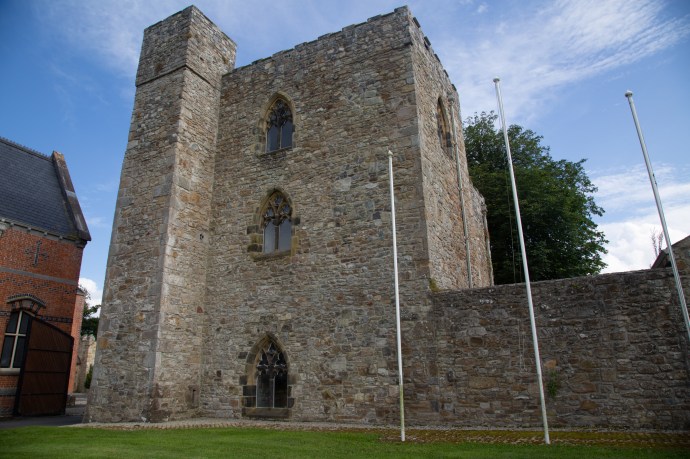
I think to understand this place we need to talk, again, a bit about the history. The estate itself dates back to the 12th century, when the Anglo-Norman family, the Esmondes settled there. They constructed a tower house on the grounds, and this ruin still stands today, a few hundred metres from the main castle which came much much later.

The original Tower House of the Emondes on the grounds of Johnstown Castle
Time to bring Cromwell back into the story. I haven’t said much about the man but, because of his abhorrent behaviour and that of his troops, his name is mud throughout Ireland. It struck me once, when doing a tour of Kilkenny years ago, how deep this feeling is. The passionate hatred of the tour guide in describing his atrocities there was palpable; as if it happened yesterday and not nearly 400 years ago. That said, Cromwell was particularly brutal in Wexford. After the sacking of Wexford Town, his army ran amok, massacring 1,500 civilians. It is believed that Cromwell stayed at Johnstown using the grounds to prepare for the attack on Wexford Town.
It was during the Cromwellian years that the Catholic Esmonde family were expelled. The estate was acquired by the Grogan family in 1682. Cornelious Grogan, the then owner of the estate in 1798 was hanged and beheaded on Wexford Bridge for his part in the Rebellion. After his execution, his estate in Johnstown was seized by the crown.
In 1810, Cornelius’ youngest brother, John Knox, managed to regain control of Johnstown Castle after he paid the crown a heavy fine. It was then that the castle, lakes and gardens came into existence. By the 1860s Johnstown Castle estate was at its peak and comprised of a large demesne of over 1,000 acres. It had a deer park, the castle, pleasure grounds, a farm and two ornamaental lakes and a sunken garden. The walled gardens and hothouses were originally laid out between 1844-1851 and retain their early design today.
A walk around the gardens is just wonderful. Astonishing views of the grand, almost over-the-top fairytale castle sitting on the shore of the lake appear between the trees. The castle is sited so it can be seen from the end of the Upper Lake.
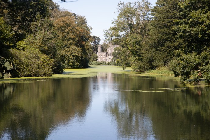
Jonestown Castle seen looking down the Upper Lake
Many wonderful touches enhance the experience. An observation tower on the lake edge designed to get a perfect view of the castle through its narrow window.

Obsrevation tower on the lake edge

View through one of the lower windows of the tower
A row of statues, peacocks wandering the lawns, manicured lawns and lots of nooks and crannies to explore. The walled garden is about 4 acres, very formal and quite different to Colclough.
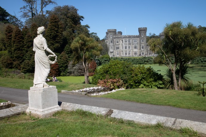
One of a number of statues that line the promenade.

A peacock that thinks it’s a statue.
The Walled Garden

Original greenhouse in the Walled Garden
We gathered for a fairly crowded tour of the house at the appointed time. Our guide was Megan, living here for a year and from the States. What a difference to have a knowledgeable and engaging guide to show you around. I have mixed feelings though, as I tour houses such as these. Much of the furniture and decorations are original and, if not, then in keeping with the time. There is an overwhelming feeling of extravagance and luxury, which grates somewhat when you think that this was achieved off the backs of their tenants who at the same time, were starving to death outside the castle walls. Putting that aside for the moment the tour was worth every cent as a window into life in the Big House. My favourite was, surprise surprise, the library with its beautiful carved bookcases and its hidden door that led to the drawing room.
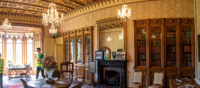

Guide Megan, shows us into the drawing room via the false door in the library
The drawing room had cleverly placed mirrors that made it look huge. There were original artworks of members of the family adorning many of the walls. I loved the bay window with the desk – the perfect study nook. And then there was a hidden tunnel which allow meat to be brought directly to the kitchen from the Meat House. One room of the house is set up as a laboratory to reflect its use since the 1940s by the Department of Agriculture (which owns the site) as a research facility.

Drawing Room. Note mirrors

Study nook

Original ceiling with carved wooden panels

Tunnel to Meat House

Soil research laboratory
Leaving the castle and, with the day disappearing, I had to forego a planned visit to Wexford Town and continue my drive up the Slaney River. But just out of Wexford I came across the ruin of Ferrycarrig Castle. Built in the 15th century by the Roche family to guard the river ferry crossing before there was a bridge (a wooden bridge was not constructed until 1795).
Ferrycarrig Castle
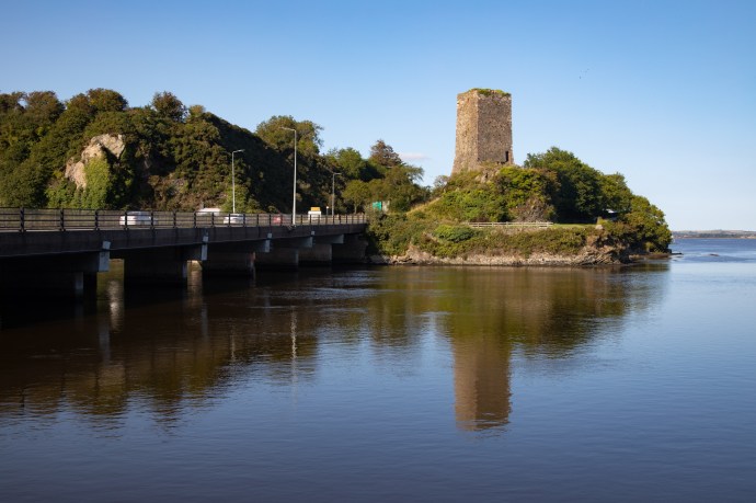
The Roches lost their castle and lands to Cromwell, of course, and as far as I know the castle has been uninhabited since. On the other side of the bridge is an incongruous looking round tower which looks horribly out of place. All is not what it seems. It is in fact a monument erected in 1858 to those from Wexford who fought in the Crimean war.

Crimean War monument Ferrycarrig
It is now part of the Irish National Heritage Park – a theme park which takes you on a journey through Irish history to the Norman invasion in the 12th century. Family oriented, it has reconstructed examples Mesolithic and Neolithic houses, megalithic dolmens, bronze age stone circles, ringforts, high crosses, early Christian monasteries and crannogs. These are the bread and butter of my travels around Ireland so, preferring the real thing, I thought I’d give it a miss but if you’re pressed for time it may be an option.
Before leaving Ferrycarrig, some movement in the water caught my eye. It was a seal and she popped her head out of the water. We made eye contact and she just stared at me. She soon tired though of this pointless and non-productive activity and disappeared into the river. I waited for a few minutes but her departure it would appear was permanent. Now I know the fisherfolk of Wexford Harbour are not keen on seals in the harbour but it was a lovely surprise.
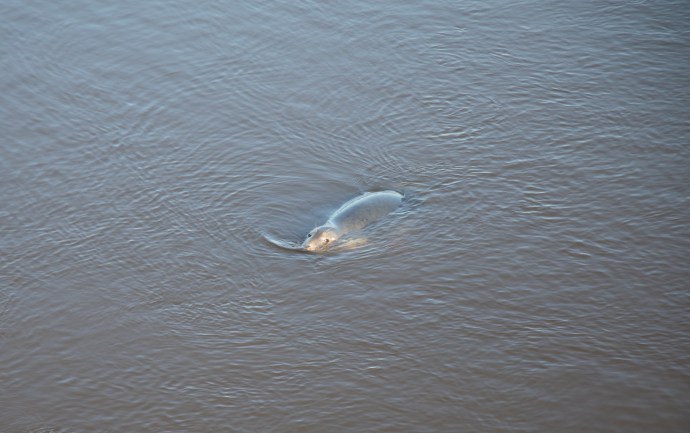
My seal friend
The road north took me through Bree. Nothing to do with cheese, though given the richness of the soil they probably do produce wonderful brie. No it was strawberries that grabbed my attention. Wexford and strawberries; two words nearly synonymous in Ireland. Who hasn’t seen the little van that pops up every summer just outside Ennis (and probably all over Ireland) selling strawberries and new potatoes? Well there were acres of polytunnels housing row after row of the luscious treats. Shh! Don’t tell but I can confirm that they are the best strawberries I have tasted. Well I had to didn’t i? In the interests journalistic integrity and accurate travel reporting.
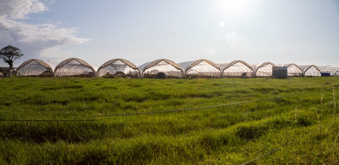
Strawberry Fields Forever

Wexford strawberries
A little further down the road and still in Wexford I caught a glimpse of an overgrown ruin in a field. I made my way over the traditional Irish single strand electric fence to find an enigmatic temple-like structure. It had a portico with doric columns but nothing to give any clue to what it was. It was so overgrown there was no way to get inside. I would be grateful for any information from my readers as to what this intriguing building may have been used for and when.
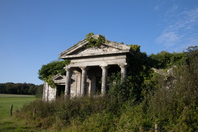
Ruined building of unknown origin
I had given John (the Aussie I had met yesterday) a call and he was waiting for me at Borris. That’s Borris-not-in-Ossory, but Borris-in-Carlow. This was definitely no horror movie though. John’s abode was a whitewashed classic Irish cottage down a narrow boreen with views towards Mt Leinster and the hills beyond. The house was surrounded by a beautifully tended garden that wrapped around the contours and which John had spent the afternoon mowing. The evening disappeared rapidly as we shared a bowl of delicious beef curry and I joined him on some tunes on my fiddle with John, who played bouzouki. I was very grateful for that overheard conversation.

A bed for the night in Borrs

The garden surrounding the cottage

A few tunes with John from Australia
Day 3 you can Follow me up to Carlow and then beyond to Wicklow. Coming soon.