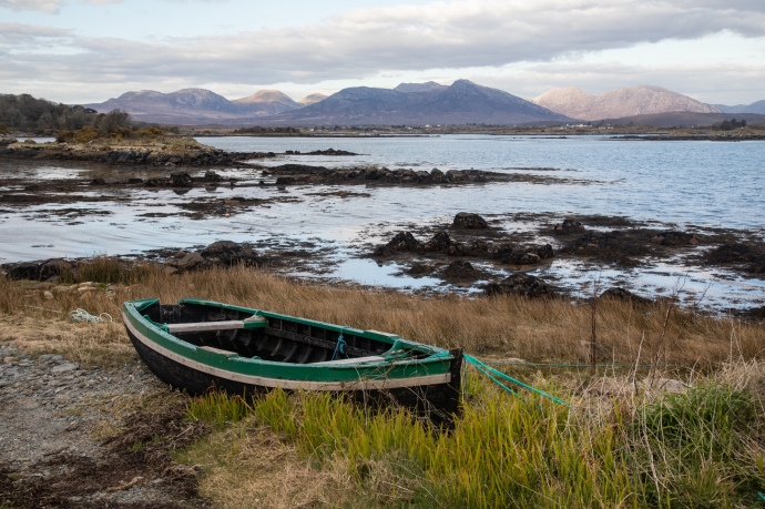
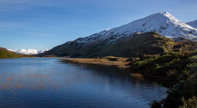
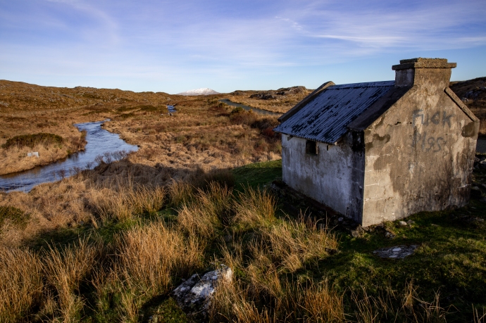
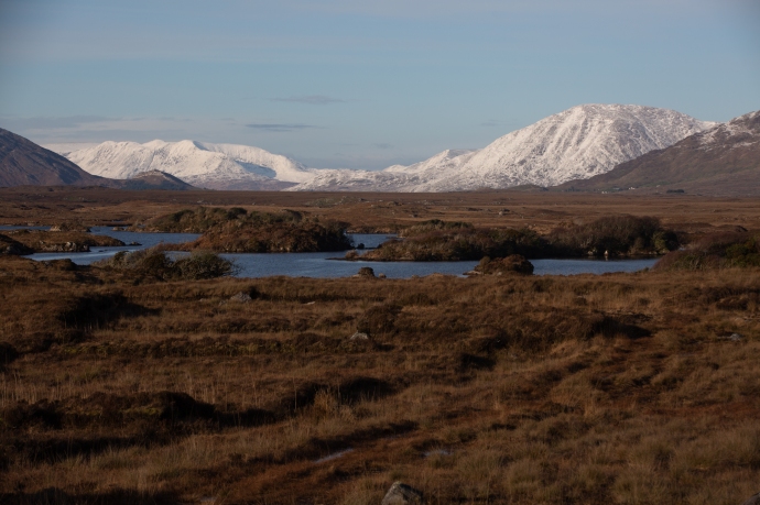
Posts Tagged With: mountains

A Viral Adventure in Connemara

After days of virally-enforced isolation I looked out my window one Friday morning in March, to a cloudless sky over Quilty.  For the five weeks I had been back such a day had only happened a couple of times.  I wasted no time, grabbed my camera and pointed the car northwards.  Don’t get me wrong; not to get away from Quilty but here was my opportunity to visit Connemara again.  OK, so it was a three-hour drive but I have experienced this place in all its moods and it is unbeatable in the sunshine.  My destination ths time was Roundstone, a little corner of Connemara that I hadn’t properly explored.  To get there you go through Oughterard and Maam and head out on the road to Clifden.

connemara-

The view from Pine Island lookout

connemara--2

Twelve Pines Island

And that is not too shabby a drive.  There’s one spot on this route that I cannot drive past without taking a photo.  Just past Recess is the Pine Island Lookout at the western end of Derryclare Lough.  Not surprisingly it looks out over a pine covered island, named Twelve Pines Island framed in the distance by the mountains of Connemara National Park. Not sure why it is called Twelve Pines, because there are more that 12 but ‘Twelve Pines’, ‘Twelve Pins’, maybe someone is having a little joke.  It certainly is the spot for a that classic Connemara postcard shot.

I met Hugh Sweeney there; a filmmaker from Galway, who was obtaining some drone footage. It was fascinating to watch the process and then to see the result, which he posted the following day.  I have added a link to the finished product. You can even see yours truly at the end of the first shot if you look closely.

connemara-4784

Tracked by a drone at Pine Island Lookout

We chatted, from a distance of course, and he told me about a little hut on the Owenmore River on the way to Roundstone.  which he thought would be a good location for a photo opportunity.

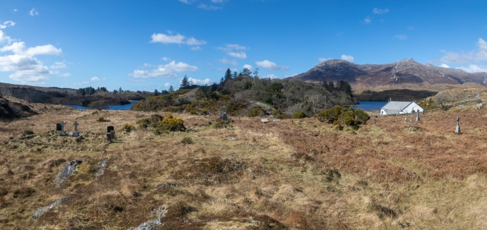
It was on my way; but of course I got distracted.  The road was winding along the shoreline of Ballynahinch Lake and on the left near a bridge just before Ballinafad was a little church and a graveyard behind it.  A simple building painted white and blue and nestled on a little river with those 12 Pins as a backdrop on one side and craggy hills with gravestones poking randomly out of the tussocky grass on the other.

connemara--4

St Bridget’s Church and Graveyard with the Twelve Pins in the background.
connemara--3

The graveyard extends for hundreds of metres along the lake shore.
connemara-4893

St Bridget’s Church viewed from the New Cemetery across the Lough.

It is hard to imagine a more peaceful, wild and naturally unkempt cemetery.  I think it’s marvelous that it has been left that way with no new burials.  The graves seem to continue for a considerable distance along the lake shore and beyond that is the New Cemetery visible on the other side of Lough Nacoogarrow.

connemara-4811

The New Cemetery at Ballinafad viewed from the Old cemetery.

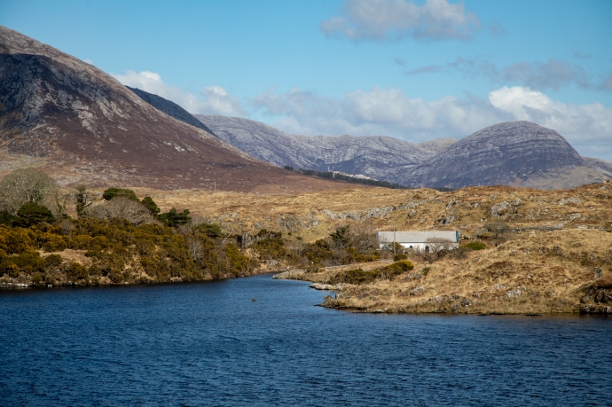
I found what I thought was the fishing hut Hugh had told me about on the banks of the Owenmore River. A priceless view and I took some pics.  I had to pinch myself to remind me that I was still in Ireland and not the Canadian Rockies.

connemara-4906

Fishing hut on the Owenmore River

connemara-4934

Fishing hut on the Owenmore River

Driving on a few hundred metres donw the  river was another hut and there I caught up with Hugh again.  So a few more pics of course.

connemara-4946

connemara-4966

Hugh Sweeney and Jenny  on the Owenmore River

Heading on to the sparklingly pretty village of Roundstone perched on the shore of Roundstone Bay across which the Twelve Bens can be seen in the distance.  A fishing village still, but well known now for its arts and crafts as well as its incredible natural beauty.  And with all the cafes restaurants and bars shut during the Corronavirus lockdown why were there so many people around I asked myself.

connemara--5

The village of Roundstone

connemara-5428

View across Roundstone Bay I

connemara-5441

View across Roundstone Bay II

The answer lies a few kilometres further down the road at Gurteen Bay.  Here are two beaches that regularly appear on the lists of Ireland’s Best Beaches.  The two beaches,  Poll na Madrai (Dog’s Bay) and Pol na Feadóige (Plover Bay, although Feadóige also means tin whistle – I think I prefer the alternative name Tin Whistle Beach) are on either side of a spit of sand and grassland with a granite island at the end.  This type of isthmus is known as a Tombola.

connemara--6

The Tombola near Roundstone. Plover Bay on the left and Don’s Bay on the right.

connemara--7

Dog’s Bay looking south.

Connemara-

Another view of Dog’s Bay looking north towards Errisbeg.

connemara-5233

Tin Whistle Beach

connemara-5229

Mad Dogs and Irishmen

White sandy beaches line each of the Bays bays and they are simply stunning 

The white sand is unique.  It is not quartz or coral as I have encountered regularly elsewhere but a mix of foraminifera and shell fragments.  What are foraminifera (forams for short)?  They are single-celled tiny marine organisms, related to amoeba, but with a hard shell  They are abundant, both today and in the fossil record going back to the Cambrian (540 million years).  The shells are made of crystalline CaCO3 and occasionally as at Dog’s Bay and Gurteen accumulate as beach sand.

The fine sand has crept over the granite hills nearby creating what I would like to call pseudo dunes.  But there are ‘real’ dunes however, particularly behind Dog’s Bay and continuing erosion has created moonscape of remnant pinnacles which are remarkable in their own right.

Connemara-5331

Sand dunes sculpted into pinnacles at Dog’s Bay

connemara-5350

Remnants of sand dunes at Dog’s Bay.  Looking towards Errisbeg.

Connemara-5362

Social distancing at Dog’s Bay

Despite it being a Friday in March and the coronavirus lockdown it was very difficult to find a car park at Dog’s Bay.  The beach is completely undeveloped with no facilities and that adds enormously to its appeal.  I can just imagine what it would be like in summer.

As the clouds rolled in about 4 pm the normal Irish winter-dull greyness reappeared.  But what a wonderful day of discovery I had, and a perfect cure for cottage fever and enforced distancing from society.  I can totally recommend it.  There is nowhere in Connemara you won’t be rewarded with a magic experience.  It never fails to deliver.

Categories: My Journey, Wild Ireland | Tags: , , , , , , , , , , , , , , | Leave a comment

Connemara. Beautiful.

I visited Connemara at the beginning of February 2019 after an extensive snowall and having mentioned this to a friend, and how beautiful it was, I was surprised at her response.  “What did I mean by beautiful? Was it just the snow?”

I hadn’t really thought about it; it just was.  I could have just quoted the Oxford definition – ‘pleasing the senses or mind aesthetically’ but that would have been too glib. For millenia philosophers and poets have struggled with the notion of beauty so who am I to think I can explain it, but I felt obliged to respond and to try to put my thoughts into words.

So what did I mean by beautiful?

I just love snow so of course that was part of it but it was a lot, lot more.  I’ve been to Connemara many times and each time it has presented a different face.  And each time I have loved it, but it is notorious for its bleak, drab weather; rain and fog has been the norm in my experience.  Never, for me, have the Gods conspired to produce such sheer perfection as this paraticular weekend.  A world that defies description and conditions attuned to capture every nuance of the landscape.  The mountains of Connemara, the Twelve Bens, have a sublime beauty at any time, but when covered in snow they are dizzyingly so.  And this was no ordinary snow.  Locals I talked to said it’s like this perhaps every ten years.  The purest white.  But what was so special was that the weather, the light and the landscape were in perfect harmony.  That’s what I mean by beautiful.

Let me explain a bit more.

On the Friday I travelled from Oughterard through Maam Cross to Letterfrack.  Taking in Lough Inagh and Kylemore Abbey. A continually moving image of the bluest of lakes, snow-covered rocky mountains, treeless bogs with tussocky grass, or rubble-strewn fields of boulder granite and cascading streams.  All illuminated by the low winter sun, with not a trace of haze, giving an extraordinary light, and enabling capture in my photos of every detail against an endless, azure, cloudless sky.  It was cold; the temperature hardly getting above 0°C, but around every corner I had to stop the car, rug up and get just a bit closer.

taster-8083-2

Levallinee, Connemara, Co Galway.

Lough Inagh-

Lough Inagh, Connemara

Lough Inagh-8163

A morning stroll

Lough Inagh-8172

Lough Inagh

Lough Inagh-8239

Monarch of the Glen

Lough Inagh-8241

Happy sheep

Lough Inagh-8463

May the road rise to meet you.

Lough Inagh-8539

Is this really Ireland?

Lough Inagh-8573

The bridge between ice and water.

Lough Inagh-8578

Sometimes the view is better when you turn around.

Lough Inagh-8653

A Connemara winterscape.

And then there was the beautiful Lough Kylemore and Kylemore Abbey.

kyleomore-8256kyleomore-kyleomore--2kyleomore-8336kyleomore-8390

Later that day I headed back east on a little travelled road that takes you across the middle of Connemara from Garroman to Inver.  The locals call it ‘The Bog Road’.  A tundra-like land of grassy plains, granite tors, lakes and bulrushes, turf cutting and the mighty Twelve Bens Range ever-present to the north.  A different beautiful.

Bog Road--2

Lough Avally iced over. A reflective scene

Bog Road-8673

Lough Nacoogarrow near Garroman

Bog Road-8698

The legacy of the turf cutter

Bog Road-8780

Cottage on the Owengowla River.

Bog Road-8826

Lougharnillam and the Owengowla River

Bog Road-8836

One Twelfth of the Bens

Bog Road-8844

Bog, lake, river and mountain. One of the prettiest views in Ireland?

Bog Road-8888

Another view of Lougharnillam and the Twelve Bens

Bog Road-8920

Lough Avally near Derryrush. Walking on thin ice.

Bog Road-8966

Winter colour.

Bog Road-8984

Where the plain meets the mountain

As the end of this extraordinary day approached and I took a little time to reflect at Inver on the southern shore of Connemara and watch the sun light up the clouds and the sea. Beautiful.

Bog Road-9053Bog Road-9074

Never far from the music I stayed with some friends at nearby Camus.  There is nothing on this planet sweeter than the sound of two fiddles.  More beautiful. Thanks Bridge.

That should have been enough but I was ready for another course of Connemara’s extraordinary visual degustation. Predicted showers saw me resist a return visit to the mountains and, following Bridge’s advice, I headed to the coast for a taste of what she calls the ‘real’ Connemara.  With unfamiliar names like Annaghvaan, Lettermore, Gorumna, Lettermullen, Furnace and Crappagh I travelled this string of rugged, unforgiving rocky islands, linked by causeways; so wild it was left out of the Wild Atlantic Way. I just loved it. Met Éireann was spot on though. Storms rolled in from the north bringing snow, sleet and hail and then just as quickly disappeared over Galway Bay.  The stunning landscape with its sculpted coastline and quiet inlets, ice covered mirror-blue loughs, stone walls, thick bogs, neat cottages and rocky fields creates a frowzled, disorderly wildness. Framed always by the serenity of the snowy mountains to the north. The interplay of black clouds, dappled sunshine and an extraordinary pallete of rich colours made for vistas that would have defied the painter. Truly beautiful.

ring-9206

The Ring near Camus

View north from Camus Hill.  Storm rollin in

View north from Camus Hill. A storm rolling in

The Twelve Bens completely blacked out.

A Connemara scene. The Twelve Bens completely shrouded in black cloud.

One minute before the snow and rain hit.. South of Camus

One minute before the snow and rain hit.. South of Camus

A Connemara cottage.  snow

A Connemara cottage under a light dusting of snow

Swans fishing through the ice.  Carrowmore West

Swans fishing through the ice. Carrowmore West

The storm has passed

The storm has passed.

Snow on ice. lake at Carrowroe West.

Snow settles on the ice over this lake at Carrowroe West.

Near Carrowroe West

Home sweet home. Near Carrowmore West.

Looking from Lettermore to Annaghvaan

Looking across the estuary from Lettermore to Annaghvaan

The estuary at Lettermore

The estuary at Lettermore

A cottage near The Hooker Bar on Annaghvaan Island

A cottage near The Hooker Bar on Annaghvaan Island

Cottage on teh island of Furnace.

Cottage, walls and a boreen on the island of Furnace.

Last post-2

A small iced lake at Derrynea, near Carraroe. Completely frozen over at 3:30 pm still.

Last post-0083

Lough Awilla on the island of Gorumna. [sounds like a kingdom in Game of Thrones] The ice is thawing. Twelve Bens in the distance.

Lough Awalia, Gorumna Island.  Bulrushes in ice,.

Lough Awalia, Gorumna Island. Bulrushes poke throught the ice.

Reflections on the ice. Loch Awalia,.  Handful of stones.

Reflections on the ice. Loch Awalia,. The handful of stones I threw rest on top of the ice.

Breaking the ice.

Breaking the ice.

Last post-9575

A Connemara granite wall incorporates existing granite boulders.

Last post-9677

The island of Lettermullen. Glowing in the afternoon sun

Lettermullen from Crappagh

Lettermullen from Crappagh as the rain sweeps by

Last post-9738

White cottages occupy the hills between the bogs. Lettermullen.

Last post-9801

A study in dark and light. Lettermullen.

Last post-9838

Connemara walls take everything in their stride.

Last post-9849

A thundercloud develops over the hills of Connemara

Last post-9962

…..and letterboxes.

golf-0312

The prettiest golf course in Ireland? Connemara Isles Golf Club on Annaghvaan Island.

golf-0332

The view from the Third Tee at Connemara Isles Golf Club

rainbow-

As I sorted through my images from those two days, I felt so grateful that I was able to be there, and to experience this release from the endless drabness of the Irish winter.  I got more images in those two days than a photographer should reasonably expect in a year.

That’s what I meant by beautiful.

Categories: My Journey, Wild Ireland | Tags: , , , , , , , , , , , , , , | Leave a comment

The Colorado Rockies 7. America’s Mountain. Pike’s Peak.

Pikes Peak

There are 54 peaks in the Colorado Rockies that are over 14,000 ft (4,267m). Keep in mind that the highest mountain in Australia is 7,228 ft!) There are however only two that you can drive up. Pikes Peak is one of these.  At 14,115 ft it is still only the 53rd highest mountain in North America. Nevertheless it dominates the landscape of this part of the Front Range. If you have read my last post on the Garden of the Gods you would have seen it in the distance in many of the photos.

It is also known somewhat cheesily as ‘America’s Mountain’, In 1893, Katherine Lee Bates wrote the song “America the Beautiful” after having admired the view from the top of Pikes Peak.

IG3C0650-Pano

The snow dusted Pikes Peak towering over the forest on the climb up the mountain

A 19 mile long toll road takes you off the US24 allowing you to drive to the top. Well not quite to the top this time. They were doing extensive rebuilding of the facilities so the last three miles were in a shuttle bus.  I loved the way you were given the choice to join the bus earlier if you were uncomfortable with the drive. And if you are not used to mountain roads, well it is scary. You shouldn’t underestimate the drive.  It requires a lot of concentration.  It is two lane but there are a lot of switchbacks, steep grades and with no barriers preventing drops of thousands of feet to the valley floor. And for some reason they seem to drive on the wrong side of the road.

IG3C0881

Hairpin bends on the way up the mountain.

The driver of your shuttle will probably point out the spot at Devil’s Playground, where Jeremy Foley went over the edge during the 2012 Pikes Peak Hill Climb (incredibly he and his navigator survived).

IG3C0870

The Devil’s Playground.  Near the top of the mountain.  The bollards are where rally driver Jeremy Foley left the road in 2012.  He survived unharmed.

The $15 toll will take you on an awesomely beautiful journey through different worlds with ever-changing landscapes. Firstly pine and fir forests and the calm waters of the fishing paradise, Crystal Lake.

IG3C0653

A view of the Peak through the forest

IG3C0611

Crystal Lake.  A reservoir for Colorado Springs.

IG3C0624

An idyllic fishing spot

Then through aspen groves just starting to turn and spruce forests and over the tree line to the wildness of the alpine zone and tundra with piles of bare burnt red-brown granite boulders.

IG3C0688

Leaving the Bus Station in the Shuttle near the 16 Mile point

IG3C0695

Above the tree line.  Alpine tundra and granite

IG3C0708

Granite tors covered with the previous night’s snowfall

IG3C0723IG3C0735IG3C0739

And the photo gods were hard at work as we had a snowfall the night before and plenty of blue sky and as we climbed the mountain some low cloud to add texture and interest to the images. I was in heaven.

IG3C0857IG3C0851IG3C0834IG3C0786

It was a tad cold at the top and I have to say not being used to altitude sickness, I felt all the classic symptoms, fatigue, breathlessness and headache. (same symptoms as after an all night trad session! just kidding).   None of this detracted from the thrill of being at the top of the world. At least this little part of it.

IG3C0791

The Summit

IG3C0800-Pano

The view from the Summit

That malady disappeared pretty quickly once the oxygen levels returned to normal on the descent. And anyway there were enough distractions as the descent gives another perspective as you slowly edge down the mountain in first or second gear.  In the distance was the Cripple Creek and Victor mines one of the largest gold mines in America.

IG3C0824

A view to the south towards the Cripple Creek and Victor Gold Mines

IG3C0833

Cripple Creek Mine

I was relieved and very satisfied to reach the bottom after a remarkable drive.  Well worth the $15 toll.  America the Beautiful.

Categories: America, My Journey | Tags: , , , , , , , , , , , , , , , , , , , | Leave a comment

The Colorado Rockies 2. Hanging Lake and the Spouting Rock.

Hanging Lake

This is the second of a series of blogs on the Rocky Mountains of Colorado.  I visited for a week in mid September 2018.  This spectacular part of the world comprises rugged mountain ranges that tower over the Mile High City of Denver.  Today I will talk about a difficult-to-get-to gem  in the hills above the Colorado River.

If you drive east from Glenwood Springs along Interstate I-70 towards Denver you pass into the incredible Glenwood Canyon. Twelve miles of precipitous sandstone walls loom beyond 1,000 feet above the Colorado River.  Nestled in these cliffs is Hanging Lake.  A short spur off the Highway takes you to the river where you need to arrive early if you want a park. There is a level concrete bike path that runs along the Colorado River and accesses the trail head, which follows the charmingly named tributary, Dead Horse Creek.

IG3C2535

Concrete path leads to the start of the Hanging Lake trail.

You get a temporary respite with the incredible beauty of the steep hills reflected in the calm river waters but make no mistake, this is the toughest hike I have done in a long long time.

IG3C2614

Calm reflection I

IG3C2578

Calm reflection II

The trail climbs relentlessly for more than 300m over the relatively short distance of 2 km. You traverse rough steps or traipse over boulder covered slopes and scree or over exposed tree roots; you have to carefully place every step to be sure of your foothold. I do not recall any downward sections. Every step is up.  The trail crosses the creek a few times on wooden bridges and you get delightful views of the mountain stream cascading over moss covered rocks and logs.

IG3C2496

Near the head of the Hanging Lake Trail. Picking your way over boulder slopes.

IG3C2006

A mountain stream I

IG3C2450

A mountain stream II

When you think you can’t go on, it gets steeper. The worst is right at the end where giant steps are cut into the rock and you are grateful for the sturdy railing that provides some sort of barrier to the steep drop on your right. But then you are there. The trail guide says to allow one hour. It took me two.

At an elevation of 7,200 feet (2,200m – that’s roughly the height of Mt Kosciusko, Australia’s highest mountain!) you reach Hanging Lake and all that strenuous effort is soon forgotten. Fed by a bridal veil falls, it was created by a fault with its waters dammed by travertine deposits created from the underlying limestone. Only 1.5 acres in area, the crystal clear turquoise, blue and aquamarine coloured waters reflect the verdant growth that drapes the cliffs and over which the water trickles.  Autumn colours and fallen logs enhance and add texture to this exquisite scene.

IG3C2152

Hanging Lake I

IG3C2228

Hanging Lake II

IG3C2249

Hanging Lake.  Bathed in autumn colours.

IG3C2083

Bridal veil falls over brown and white travertine

Travertine is formed from the re-precipitation of dissolved limestone which contributes the carbonates that give the water its unique colours. You can see small trout darting about in this mountain pool. The thin air, the high cliffs and the still waters (and a little exhaustion) create a calm contemplative quietude which infects all that make it here. But nature has one more little surprise.

IG3C2141

Mountain trout and travertine through clear waters

A further short climb takes you to the Spouting Rock. An impressive waterfall feeds the creek above the lake and dramatically spouts from a crack in the face of the cliff. You can easily walk behind the falls into a cave eroded into the limestone. Many miss this little gem and walk right on past the turn off.

IG3C2346

Spouting Rock I

Spouting Rock I

IG3C2389

Spouting Rock II

Time to return down the same path. Any thought that the homeward journey would be easier soon dissipates. The descent is treacherous. A wooden pole, thoughtfully left by a previous hiker was an essential aid in negotiating the rocky stretches. I took my time. Another two hours before I was at the bottom. Plenty of time to chat with and provide sage advice and support to the many climbers who pass you on their way up.

Well that’s Hanging Lake. For me it was Hang-in-there Lake. So glad I did.

Categories: America | Tags: , , , , , , , , , , , , , , , , , , , , , | Leave a comment

The Colorado Rockies 1. Twin Lakes. A Classic Photo Opportunity.

Twin Lakes

This is the first of a series of blogs on the Rocky Mountains of Colorado.  I visited for a week in mid September 2018.  This spectacular part of the world comprises rugged mountain ranges that tower over the Mile High City of Denver.  There is much to see.  It is a photographer’s paradise.  My early plans had me on an extensive road trip that would take me to the four corners but I soon realised how impractical that was, so my travels on this occasion concentrated on the area west of Denver to Glenwood Springs, south to Cañon City and north to Estes Park.  First up is my visit to the iconic Twin Lakes.

I had read about this location and its reputation for getting those classic Colorado photos if conditions are favourable. It is a half hour drive from Leadville in the Central Rockies  and on the way up the Independence Pass, which I’ll talk about in an upcoming blog. It is a well known fishing, camping and hiking spot and there are, as the name suggests, two lakes are connected by a channel. If there is no wind and the sun is shining, the location provides countless photographic opportunities for symmetrical reflection of the distant mountains in the still waters of the lake. Luckily, such were the conditions on the day I visited. And to top it off I had blue skies and autumn colours and a cooperative fisherman in the mix.  Here are a few of my favourites,

Quintessential Colorado.

IG3C0913IG3C0946IG3C0964IG3C0966IG3C0978

IG3C0895

Fall colors.  Twin Lakes

IG3C1052

A mountain stream that flows into Twin Lakes

Categories: America | Tags: , , , , , , , , , , , , , , | 1 Comment

Life is a beach. Keel is a beach.

My camera and I spent a few hours on the strand at Keel on Achill Island in Co.  Mayo.  I thought I would share some of those moments with my blog readers,

Life is a beach
Keel is a beach
Keel is Life
Keel is sand, sun, grass, clouds and mountains
Keel is hitting a ball
Keel is walking or running
Keel is reading and thinking
Keel is wheels
Keel is long shadows
Keel is a dune of cobbles
Keel is lost in clouds
Keel is reflections
Keel is people
Keel is light

IG3C2321

Keel is sand sun grass cloud and mountains


IG3C2352

Keel is hitting a ball


IG3C2523

Keel is walking

IG3C2544

Keel is running


IG3C2577

Keel is reading

IG3C2407

Keel is wheels I

IG3C2415

Keel is wheels II

IG3C2552

Keel is long shadows I

IG3C2596

Keel is long shadows II

IG3C2470

Keel is a dune of cobbles

IG3C2693

Keel is lost in clouds I

IG3C2720

keel is lost in clouds II

IG3C2604

Keel is reflections

IG3C2499_1

Keel is people


IG3C2715

Keel is light


Categories: My Journey, Real Ireland, Wild Ireland | Tags: , , , , , , , , , , , , , , , , , , , , , | 1 Comment

Blog at WordPress.com.