Posts Tagged With: landscape

Tiny Tawin Island and its Links to Two Giants of 1916

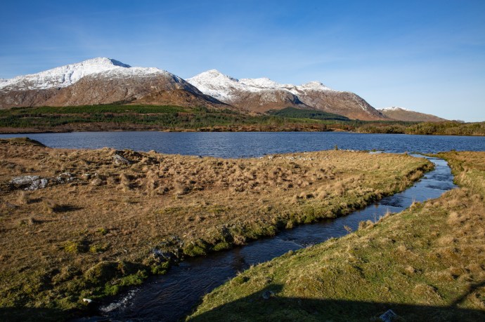
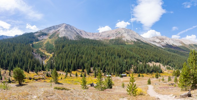
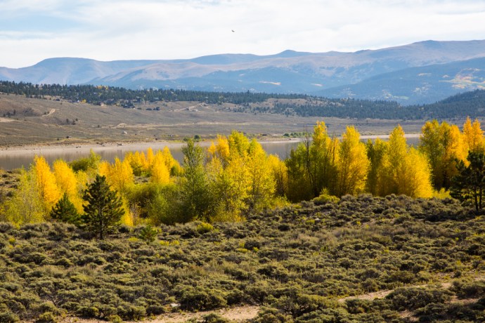
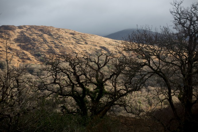
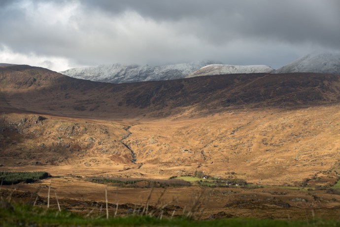
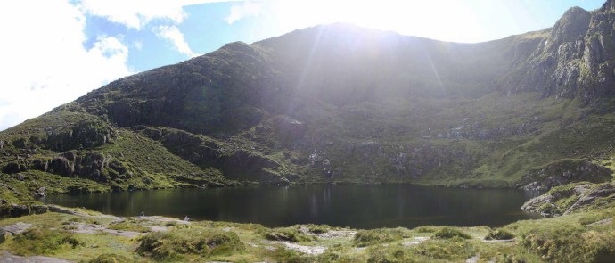
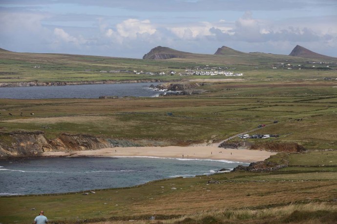
Ireland has lots of islands.  One compilation I found listed 255.  I’ve visited many and indeed written about them and absolutely love the different character of each, whether inhabited or not.  The other day I visited an island at the eastern end of Galway Bay, which I had never even heard of till then.  That’s Tawin Island just a few kilometres from Oranmore.

tawin-3772

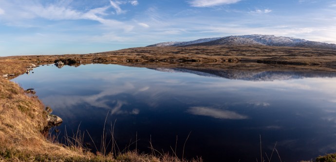
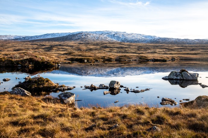
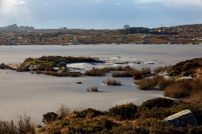
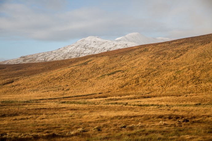
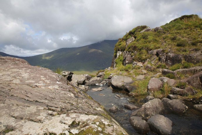
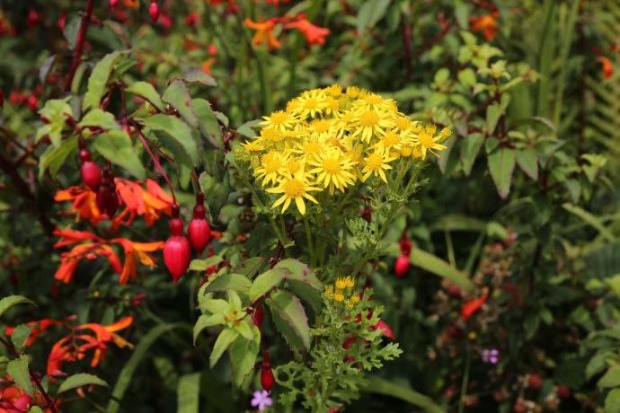
A typical view on Tarwin Island

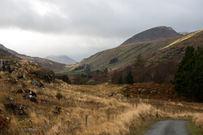
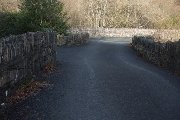
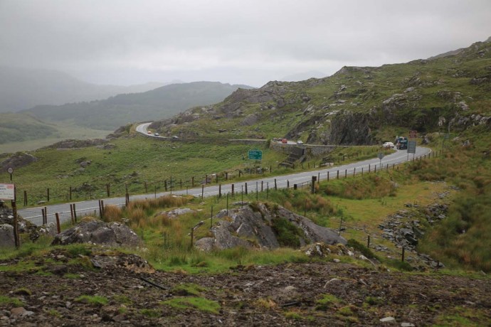
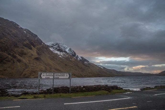
The island is reached by heading west from the village of Maree.  The approach road skirts the bay and then traverses a connecting bridge at Ballymanagh onto East Tawin.  Then another bridge cum causeway to Tawin itself.   

tawin-3940

The bridge to East Tawin

tawin-3820

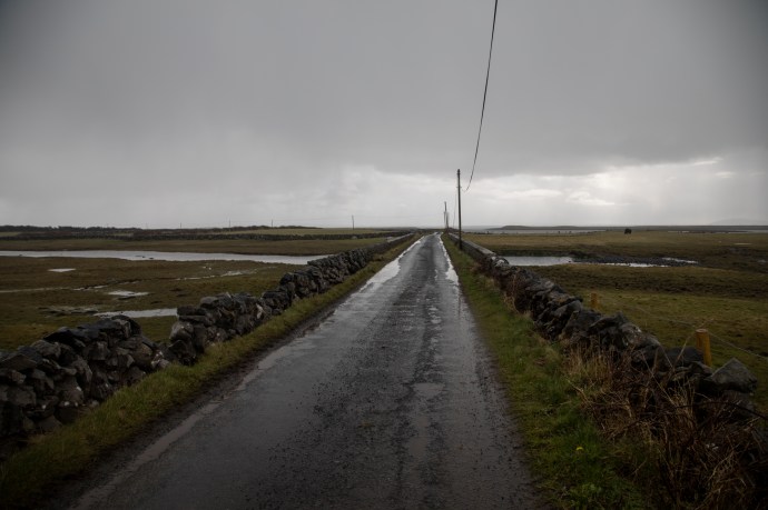
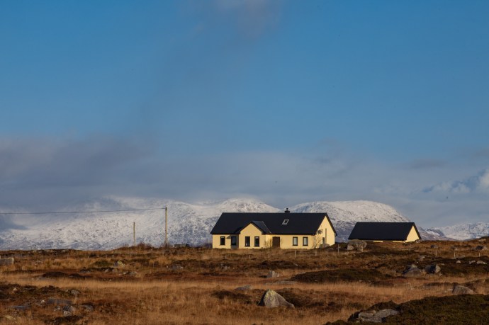
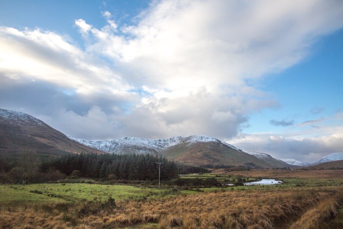
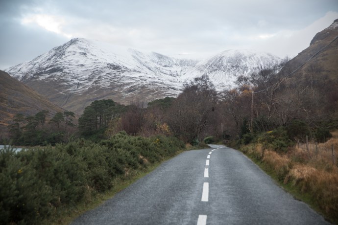
The road to Tawin Island

The road narrows to one lane and you do feel you are entering a forgotten world.  At the end of the road is a small settlement and then a cattle grid, beyond which the road disintegrates into a goat track, and just a short distance later disappears entirely under flooded fields.

tawin-3649

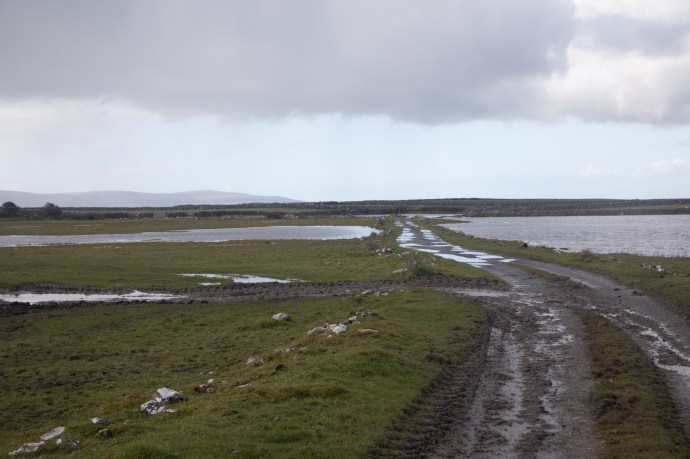
The end of the road.

tawin-3658

Flooded road.  The geese love it.

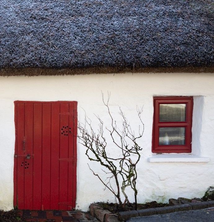
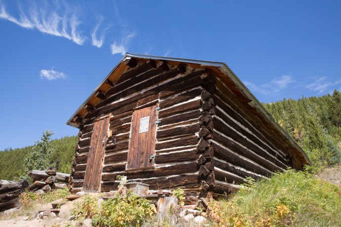
I parked up outside the National School.  It is a simple one room building with a red door and a leadlight window characteristic of the time.  There are two windows, one facing north and another to the west with great views over the bay and to Galway city but both placed high enough above the ground so that children at their desks could not be distracted.

tawin-3644

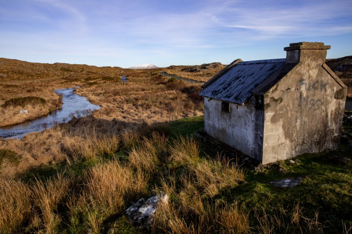
The Tawin National School. Built 1905

This simple school building and Tawin Island however tell quite a story, linked to events in Ireland’s Republican history and to two giant men of the Struggle of 1916.  It is  worth retelling.

The tiny school was erected in 1905.  This is recorded in the plaque above the door. Before that there was another building which had operated as a school room.  But in 1903 that was closed by the authorities.  The local people had rebelled against the exclusive use of English, requesting that all lessons be in Irish.  In response the school was simply closed with the teacher withdrawn and the building quickly falling into disrepair.  The parents were then told it would not reopen until they paid for the repairs.

The following year the noted nationalist Sir Roger Casement, who was later to be hanged for his involvement in the Rising of 1916,  discovered their plight and became a fierce  advocate of the brave attempts of the islanders to ensure their 30 children did not lose their Irish.  The Tawin cause became central to Casement’s articulation of the formal espousal of Irish, the Gaelic movement and the cause of the Gaeltacht.  He obtained the support of the Gaelic League, which had been working feverishly to preserve the Irish languange and culture since 1895.  They helped raise the sum of £80 (of which Casement himself contributed £20) needed to build a new school.  This was opened in 1905, and the children now had a bilingual schoolmaster and again Irish was spoken in the homes of Tawin.

The building was also used by the Gaelic League for an annual Summer School, which leads to the next significant connection to the events of 1916,  Between 1911 and 1913 Robert de Valera became Driector of the the Summer School. De Valera of course was a commander during the Easter Rising and became head of the Irish government for over 20 years and also its President.  In 1912, during a visit by Casement to check progress of the school he had promoted, he met De Valera for the first time.  What transpired at the meeting is not recorded but it cannot be a coincidence that four years later they were both leading figures in the Rising.

The school remained open until 1992.  It is now incorporated into a residence and used as a holiday home but its integrity remains intact.

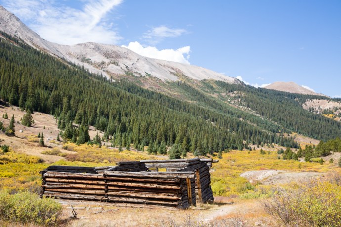
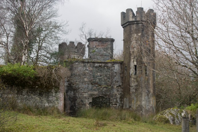
A short distance from the school is an ivy-covered ruin, which caught my attention.  I was told by the local landowner who happened to be wandering past, that this was known as the Teacher’s House.  It is in a sad state now but was clearly a fine home two- story home befitting a school mistress.  I met another local out walking and enjoying the intermittent sunshine. She told me she was a student in the school during the 1960s.  The teacher then was a Miss Fennessy and my informant told me what a memorable and  great privilege it was to be invited up to her house. Miss Fennessy never married and remained the teacher until the school closed in 1992.

tawin-3680

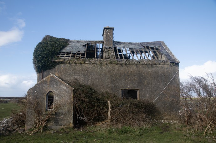
The Teacher’s House on Tarwin Island

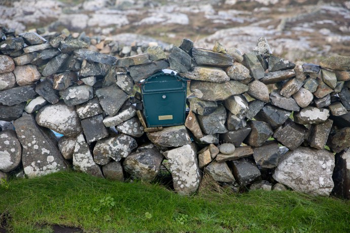
Not far from the school are perhaps a dozen houses line up along the road.  The ‘village’ has no facilities and indeed never did.  No post office but a green post box from George V remains built into a wall, with an Out of Service sign giving us a tangible link to the past.

tawin-3815

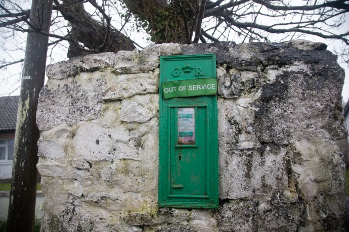
The old post box on Tarwin Island

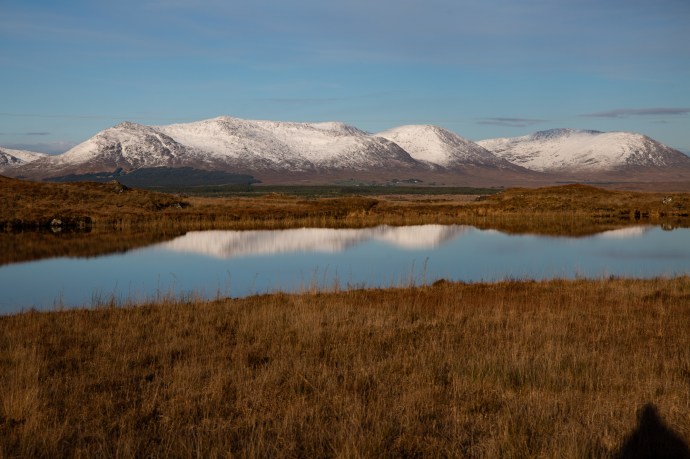
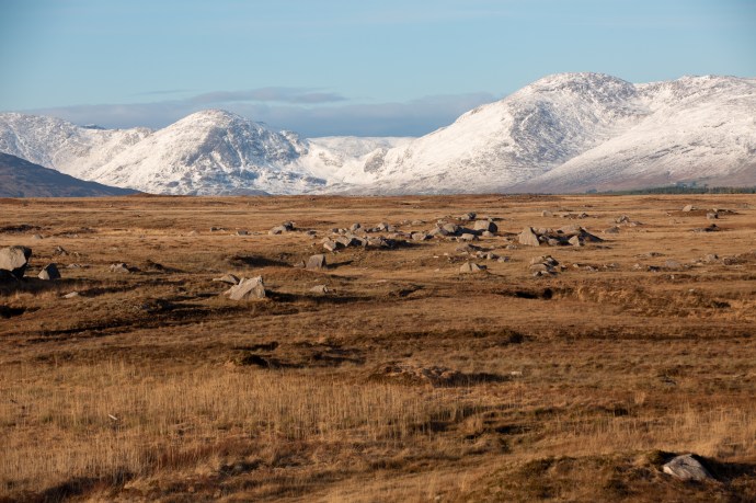
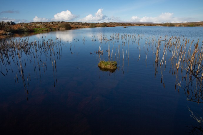
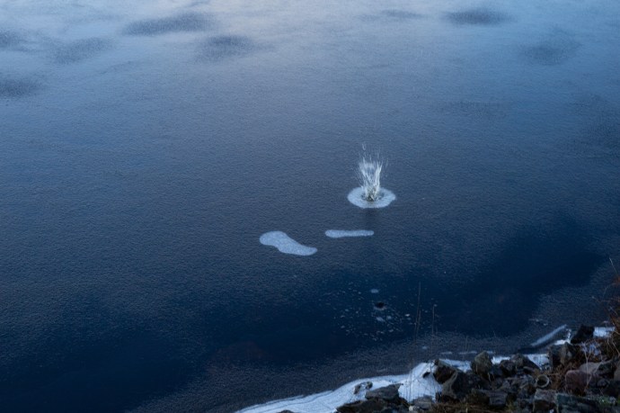
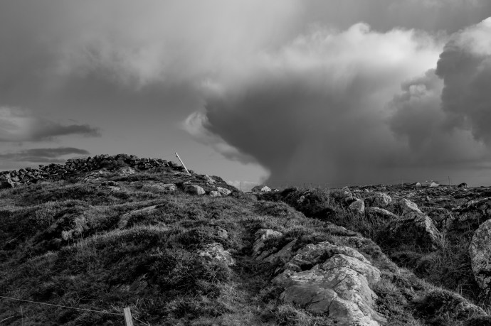
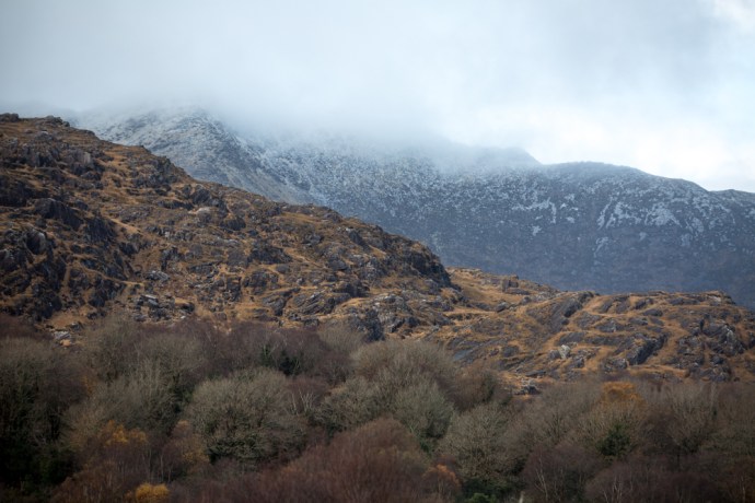
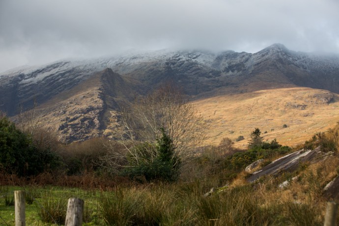
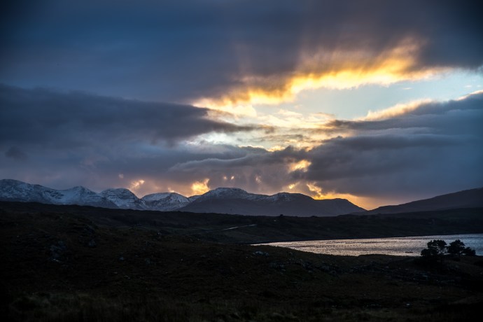
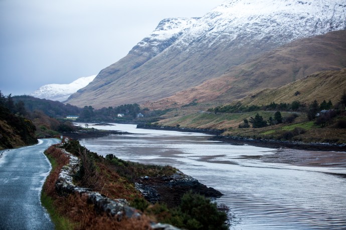
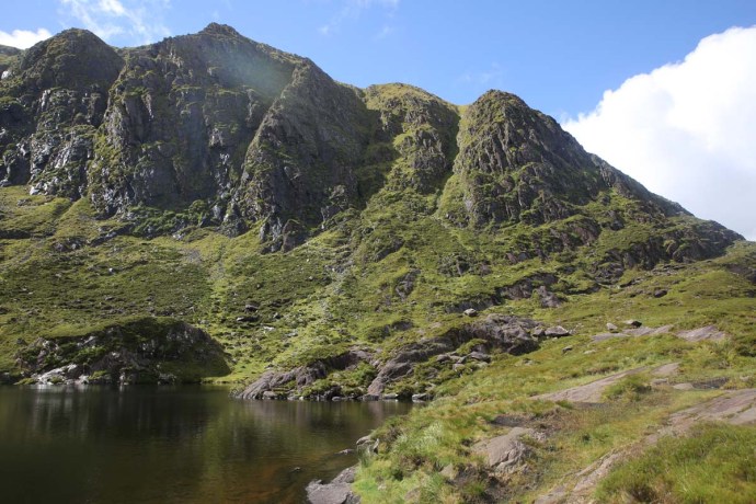
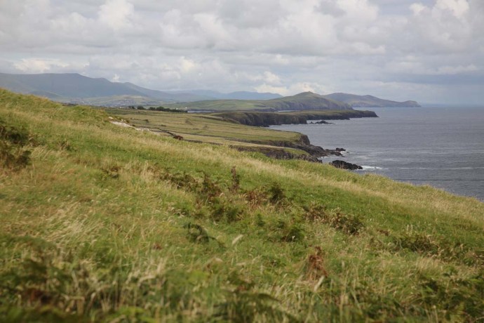
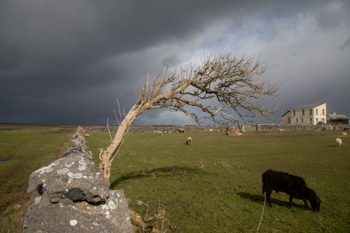
The island, at first glance, doen’t appear to have that much to offer.  It is low lying and treeless, and after a couple of very high tides and weeks of rain was sodden, so not really suitable for exploring.  But its quiet remoteness gives it a  unique ambience. Watching the storms gather over the Burren hills and sweep across the bay and then the dazzling sparkle when the sun returned made for an ever changing light show that provided some great  challenges  and opportunities for the camera.

tawin-3859

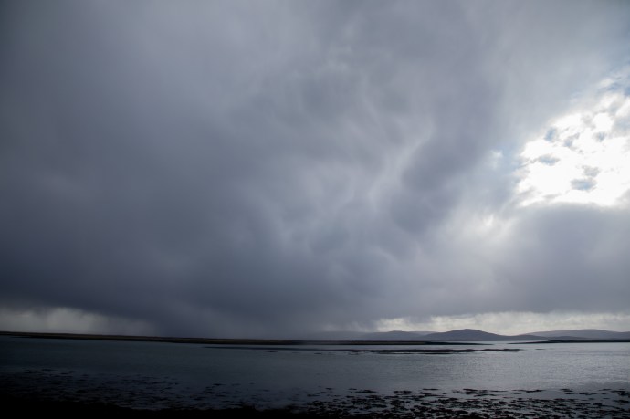
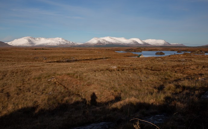
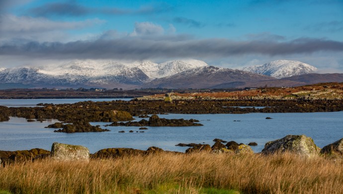
Storms sweep in across the bay with the Burren hills in the distance

tawin-3889

Darkness and light over Galway Bay.

I was surprised at how many people I met out and about (it was Sunday I suppose).  One local man I chatted to for quite a while (from an acceptable distance of course), pointed out a bob of seals on the rocks in the distance. I never would have noticed them and even with my big lens they were hard to spot. [By the way, there are 11 different collective nouns for seals, including bunch, crash, harem, knob, plump, pod and rookery but I’ve gone with ‘bob’ for some reason I can’t quite explain].

tawin-3885

A bob of seals gather on the shore

The island is also home to large flocks (gaggles?) of Light Bellied Brent Geese.  These migratory birds winter almost exclusively in Ireland, heading off to Iceland in April and then spending the summer in Arctic Canada. They were hard to sneak up on.

tawin-3907

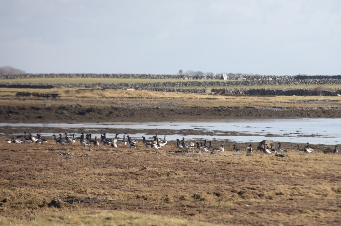
Light Bellied Brent Geese wintering on Tawin Island

Anyway that’s Tawin.  I was surprised by what I found there and it proves to me yet again that anywhere in Ireland can provide rich rewards if you dig just a little and search out the back stories that are never that far away.

tawin-3929

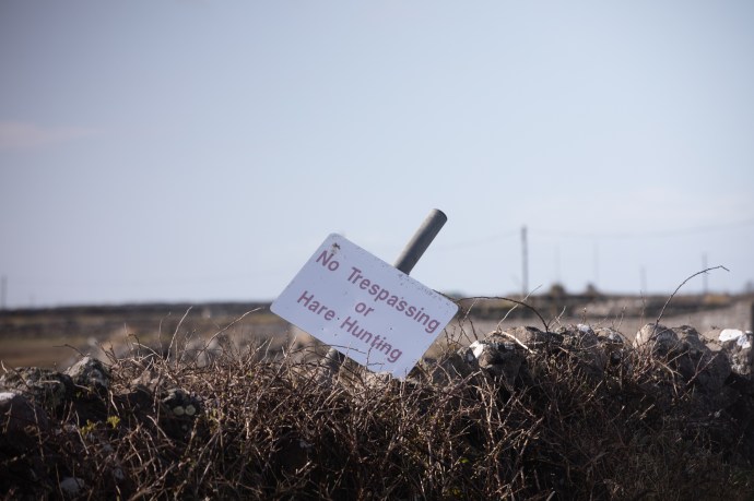
A safe refuge for hares.

Categories: My Journey, Real Ireland | Tags: , , , , , , , , , , , , , , , , , , , | 8 Comments

Connemara. Beautiful.

I visited Connemara at the beginning of February 2019 after an extensive snowall and having mentioned this to a friend, and how beautiful it was, I was surprised at her response.  “What did I mean by beautiful? Was it just the snow?”

I hadn’t really thought about it; it just was.  I could have just quoted the Oxford definition – ‘pleasing the senses or mind aesthetically’ but that would have been too glib. For millenia philosophers and poets have struggled with the notion of beauty so who am I to think I can explain it, but I felt obliged to respond and to try to put my thoughts into words.

So what did I mean by beautiful?

I just love snow so of course that was part of it but it was a lot, lot more.  I’ve been to Connemara many times and each time it has presented a different face.  And each time I have loved it, but it is notorious for its bleak, drab weather; rain and fog has been the norm in my experience.  Never, for me, have the Gods conspired to produce such sheer perfection as this paraticular weekend.  A world that defies description and conditions attuned to capture every nuance of the landscape.  The mountains of Connemara, the Twelve Bens, have a sublime beauty at any time, but when covered in snow they are dizzyingly so.  And this was no ordinary snow.  Locals I talked to said it’s like this perhaps every ten years.  The purest white.  But what was so special was that the weather, the light and the landscape were in perfect harmony.  That’s what I mean by beautiful.

Let me explain a bit more.

On the Friday I travelled from Oughterard through Maam Cross to Letterfrack.  Taking in Lough Inagh and Kylemore Abbey. A continually moving image of the bluest of lakes, snow-covered rocky mountains, treeless bogs with tussocky grass, or rubble-strewn fields of boulder granite and cascading streams.  All illuminated by the low winter sun, with not a trace of haze, giving an extraordinary light, and enabling capture in my photos of every detail against an endless, azure, cloudless sky.  It was cold; the temperature hardly getting above 0°C, but around every corner I had to stop the car, rug up and get just a bit closer.

taster-8083-2

Levallinee, Connemara, Co Galway.

Lough Inagh-

Lough Inagh, Connemara

Lough Inagh-8163

A morning stroll

Lough Inagh-8172

Lough Inagh

Lough Inagh-8239

Monarch of the Glen

Lough Inagh-8241

Happy sheep

Lough Inagh-8463

May the road rise to meet you.

Lough Inagh-8539

Is this really Ireland?

Lough Inagh-8573

The bridge between ice and water.

Lough Inagh-8578

Sometimes the view is better when you turn around.

Lough Inagh-8653

A Connemara winterscape.

And then there was the beautiful Lough Kylemore and Kylemore Abbey.

kyleomore-8256kyleomore-kyleomore--2kyleomore-8336kyleomore-8390

Later that day I headed back east on a little travelled road that takes you across the middle of Connemara from Garroman to Inver.  The locals call it ‘The Bog Road’.  A tundra-like land of grassy plains, granite tors, lakes and bulrushes, turf cutting and the mighty Twelve Bens Range ever-present to the north.  A different beautiful.

Bog Road--2

Lough Avally iced over. A reflective scene

Bog Road-8673

Lough Nacoogarrow near Garroman

Bog Road-8698

The legacy of the turf cutter

Bog Road-8780

Cottage on the Owengowla River.

Bog Road-8826

Lougharnillam and the Owengowla River

Bog Road-8836

One Twelfth of the Bens

Bog Road-8844

Bog, lake, river and mountain. One of the prettiest views in Ireland?

Bog Road-8888

Another view of Lougharnillam and the Twelve Bens

Bog Road-8920

Lough Avally near Derryrush. Walking on thin ice.

Bog Road-8966

Winter colour.

Bog Road-8984

Where the plain meets the mountain

As the end of this extraordinary day approached and I took a little time to reflect at Inver on the southern shore of Connemara and watch the sun light up the clouds and the sea. Beautiful.

Bog Road-9053Bog Road-9074

Never far from the music I stayed with some friends at nearby Camus.  There is nothing on this planet sweeter than the sound of two fiddles.  More beautiful. Thanks Bridge.

That should have been enough but I was ready for another course of Connemara’s extraordinary visual degustation. Predicted showers saw me resist a return visit to the mountains and, following Bridge’s advice, I headed to the coast for a taste of what she calls the ‘real’ Connemara.  With unfamiliar names like Annaghvaan, Lettermore, Gorumna, Lettermullen, Furnace and Crappagh I travelled this string of rugged, unforgiving rocky islands, linked by causeways; so wild it was left out of the Wild Atlantic Way. I just loved it. Met Éireann was spot on though. Storms rolled in from the north bringing snow, sleet and hail and then just as quickly disappeared over Galway Bay.  The stunning landscape with its sculpted coastline and quiet inlets, ice covered mirror-blue loughs, stone walls, thick bogs, neat cottages and rocky fields creates a frowzled, disorderly wildness. Framed always by the serenity of the snowy mountains to the north. The interplay of black clouds, dappled sunshine and an extraordinary pallete of rich colours made for vistas that would have defied the painter. Truly beautiful.

ring-9206

The Ring near Camus

View north from Camus Hill.  Storm rollin in

View north from Camus Hill. A storm rolling in

The Twelve Bens completely blacked out.

A Connemara scene. The Twelve Bens completely shrouded in black cloud.

One minute before the snow and rain hit.. South of Camus

One minute before the snow and rain hit.. South of Camus

A Connemara cottage.  snow

A Connemara cottage under a light dusting of snow

Swans fishing through the ice.  Carrowmore West

Swans fishing through the ice. Carrowmore West

The storm has passed

The storm has passed.

Snow on ice. lake at Carrowroe West.

Snow settles on the ice over this lake at Carrowroe West.

Near Carrowroe West

Home sweet home. Near Carrowmore West.

Looking from Lettermore to Annaghvaan

Looking across the estuary from Lettermore to Annaghvaan

The estuary at Lettermore

The estuary at Lettermore

A cottage near The Hooker Bar on Annaghvaan Island

A cottage near The Hooker Bar on Annaghvaan Island

Cottage on teh island of Furnace.

Cottage, walls and a boreen on the island of Furnace.

Last post-2

A small iced lake at Derrynea, near Carraroe. Completely frozen over at 3:30 pm still.

Last post-0083

Lough Awilla on the island of Gorumna. [sounds like a kingdom in Game of Thrones] The ice is thawing. Twelve Bens in the distance.

Lough Awalia, Gorumna Island.  Bulrushes in ice,.

Lough Awalia, Gorumna Island. Bulrushes poke throught the ice.

Reflections on the ice. Loch Awalia,.  Handful of stones.

Reflections on the ice. Loch Awalia,. The handful of stones I threw rest on top of the ice.

Breaking the ice.

Breaking the ice.

Last post-9575

A Connemara granite wall incorporates existing granite boulders.

Last post-9677

The island of Lettermullen. Glowing in the afternoon sun

Lettermullen from Crappagh

Lettermullen from Crappagh as the rain sweeps by

Last post-9738

White cottages occupy the hills between the bogs. Lettermullen.

Last post-9801

A study in dark and light. Lettermullen.

Last post-9838

Connemara walls take everything in their stride.

Last post-9849

A thundercloud develops over the hills of Connemara

Last post-9962

…..and letterboxes.

golf-0312

The prettiest golf course in Ireland? Connemara Isles Golf Club on Annaghvaan Island.

golf-0332

The view from the Third Tee at Connemara Isles Golf Club

rainbow-

As I sorted through my images from those two days, I felt so grateful that I was able to be there, and to experience this release from the endless drabness of the Irish winter.  I got more images in those two days than a photographer should reasonably expect in a year.

That’s what I meant by beautiful.

Categories: My Journey, Wild Ireland | Tags: , , , , , , , , , , , , , , | Leave a comment

The Colorado Rockies 4. Independence – a Ghost Town.

Independence ghost town

In my last blog on my road trip through the Colorado Rockies, I talked about Independence Pass and its close connection with the discovery of gold. Gold in this part of Colorado was discovered on 4th July 1879 at Roaring Fork River about four miles from the top of the Independence Pass and a town soon sprung upon the banks of the river and in the shadow of Mt Independence. It started as a tent city and one year later there were 300 people living in the camp.  The following year a single company, Farwell Mining Company, had acquired the leading mines such as Independence No 1, 2 and 3, Last Dollar, Legal Tender, Mammoth, Mount Hope, Champion, Sheba, Friday, and Dolly Varden.

IG3C1227-Pano-2

The ghost town of Independence at the foot of Mt Independence in the valley of the Roaring Fork River

Various competing interests battled over the name of the town.  During its short life it was variously known as Belden, Chipeta, Sidney, Farwell, Sparkhill and in its fading days optimistically Mammoth City and Mount Hope.  Ironically though and for obvious reasons, it was widely known as Independence though there was never a post office of that name.

By summer of 1881 there were 500 people and many permanent buildings including grocery stores, boarding houses and three saloons. It reached its peak in 1882 when there were 90 buildings containing 40 businesses and a population of 1,500.

As with most mining booms, the bust followed quickly when the gold ran out and by 1888 there were only 100 citizens eking out an existence at an elevation of nearly 11,000 feet and under a blanket of snow from October to the end of May.  The worst storm in Colorado’s history hit in 1899 and those residents still there were completely cut off for months. Running out of food, they dismantled their houses to make skis and 75 residents skied their way to Aspen. Only one resident remained after this. Jack Williams was caretaker of the stamper battery and treatment plant.  In 1912 Jack finally left and that was the end of the town of Belden-Independence-Chipeta-Sidney-Farewell-Sparkhill-Mammoth City-Mount Hope.

IG3C1276

A restored miner’s cabin now used as a summer residence.

IG3C1279IG3C1289

Incredibly a number of buildings have survived to varying degrees in this spectacular location. Some remain relatively intact and have been restored and some are piles of timber or just depressions in the ground. Ted Ackerman’s Hotel was one of five during its hey-day. Little remains of this establishment where miners could find a room for $2 a day.

IG3C1239

Ruins of Ted Ackerman’s Hotel

A general store stands proud, restored in the 1980s and a remarkable testament to the courage of these men (and a few women) and the lure of gold.

IG3C1261

Restored general store

As a geologist with a strong interest in the company history and social history of gold mining in my home country I have seen many Australian ‘ghost towns’ from the gold rush days. They were much more transient and rarely does any structure survive as here. Australians built with hessian and stone and corrugated iron, rather than timber, which is so abundant here, and material was transported to the next town following abandonment.  You’d have to say that heat was more of a problem than cold generally.  Its hard not to be impressed though by the simplicity of construction of the log cabin and its durability.  140 years later the v-notch joints still hold the structures together.


Just downstream from the town is the timber framework of a large stamper battery and on the slopes above there is a bit more mine infrastructure, the head of a mine shaft and a patch of Aspen covering what was obviously a spoil dump.  I would love to have had time to explore more.

IG3C1319

Remains of a  large stamper battery.  The treatment plant would have been on the flat area below.

IG3C1316

An old mine site.  The mound in the distance was the head of a shaft and the patch of aspen covers a spoil dump.

Preservation of these sites is essential.  They are one of the few tangible links to a hugely important part of the development of countries such as USA and Australia.  As in Australia, mining was responsible for opening up large tracts of the country and for the beginnings of many towns, some gone like Independence, some still surviving like Aspen, Leadville or Cañon City.  I’ll come back to this in a later blog.

Categories: America | Tags: , , , , , , , , , , , , , , , , , | 2 Comments

The Colorado Rockies 2. Hanging Lake and the Spouting Rock.

Hanging Lake

This is the second of a series of blogs on the Rocky Mountains of Colorado.  I visited for a week in mid September 2018.  This spectacular part of the world comprises rugged mountain ranges that tower over the Mile High City of Denver.  Today I will talk about a difficult-to-get-to gem  in the hills above the Colorado River.

If you drive east from Glenwood Springs along Interstate I-70 towards Denver you pass into the incredible Glenwood Canyon. Twelve miles of precipitous sandstone walls loom beyond 1,000 feet above the Colorado River.  Nestled in these cliffs is Hanging Lake.  A short spur off the Highway takes you to the river where you need to arrive early if you want a park. There is a level concrete bike path that runs along the Colorado River and accesses the trail head, which follows the charmingly named tributary, Dead Horse Creek.

IG3C2535

Concrete path leads to the start of the Hanging Lake trail.

You get a temporary respite with the incredible beauty of the steep hills reflected in the calm river waters but make no mistake, this is the toughest hike I have done in a long long time.

IG3C2614

Calm reflection I

IG3C2578

Calm reflection II

The trail climbs relentlessly for more than 300m over the relatively short distance of 2 km. You traverse rough steps or traipse over boulder covered slopes and scree or over exposed tree roots; you have to carefully place every step to be sure of your foothold. I do not recall any downward sections. Every step is up.  The trail crosses the creek a few times on wooden bridges and you get delightful views of the mountain stream cascading over moss covered rocks and logs.

IG3C2496

Near the head of the Hanging Lake Trail. Picking your way over boulder slopes.

IG3C2006

A mountain stream I

IG3C2450

A mountain stream II

When you think you can’t go on, it gets steeper. The worst is right at the end where giant steps are cut into the rock and you are grateful for the sturdy railing that provides some sort of barrier to the steep drop on your right. But then you are there. The trail guide says to allow one hour. It took me two.

At an elevation of 7,200 feet (2,200m – that’s roughly the height of Mt Kosciusko, Australia’s highest mountain!) you reach Hanging Lake and all that strenuous effort is soon forgotten. Fed by a bridal veil falls, it was created by a fault with its waters dammed by travertine deposits created from the underlying limestone. Only 1.5 acres in area, the crystal clear turquoise, blue and aquamarine coloured waters reflect the verdant growth that drapes the cliffs and over which the water trickles.  Autumn colours and fallen logs enhance and add texture to this exquisite scene.

IG3C2152

Hanging Lake I

IG3C2228

Hanging Lake II

IG3C2249

Hanging Lake.  Bathed in autumn colours.

IG3C2083

Bridal veil falls over brown and white travertine

Travertine is formed from the re-precipitation of dissolved limestone which contributes the carbonates that give the water its unique colours. You can see small trout darting about in this mountain pool. The thin air, the high cliffs and the still waters (and a little exhaustion) create a calm contemplative quietude which infects all that make it here. But nature has one more little surprise.

IG3C2141

Mountain trout and travertine through clear waters

A further short climb takes you to the Spouting Rock. An impressive waterfall feeds the creek above the lake and dramatically spouts from a crack in the face of the cliff. You can easily walk behind the falls into a cave eroded into the limestone. Many miss this little gem and walk right on past the turn off.

IG3C2346

Spouting Rock I

Spouting Rock I

IG3C2389

Spouting Rock II

Time to return down the same path. Any thought that the homeward journey would be easier soon dissipates. The descent is treacherous. A wooden pole, thoughtfully left by a previous hiker was an essential aid in negotiating the rocky stretches. I took my time. Another two hours before I was at the bottom. Plenty of time to chat with and provide sage advice and support to the many climbers who pass you on their way up.

Well that’s Hanging Lake. For me it was Hang-in-there Lake. So glad I did.

Categories: America | Tags: , , , , , , , , , , , , , , , , , , , , , | Leave a comment

The Colorado Rockies 1. Twin Lakes. A Classic Photo Opportunity.

Twin Lakes

This is the first of a series of blogs on the Rocky Mountains of Colorado.  I visited for a week in mid September 2018.  This spectacular part of the world comprises rugged mountain ranges that tower over the Mile High City of Denver.  There is much to see.  It is a photographer’s paradise.  My early plans had me on an extensive road trip that would take me to the four corners but I soon realised how impractical that was, so my travels on this occasion concentrated on the area west of Denver to Glenwood Springs, south to Cañon City and north to Estes Park.  First up is my visit to the iconic Twin Lakes.

I had read about this location and its reputation for getting those classic Colorado photos if conditions are favourable. It is a half hour drive from Leadville in the Central Rockies  and on the way up the Independence Pass, which I’ll talk about in an upcoming blog. It is a well known fishing, camping and hiking spot and there are, as the name suggests, two lakes are connected by a channel. If there is no wind and the sun is shining, the location provides countless photographic opportunities for symmetrical reflection of the distant mountains in the still waters of the lake. Luckily, such were the conditions on the day I visited. And to top it off I had blue skies and autumn colours and a cooperative fisherman in the mix.  Here are a few of my favourites,

Quintessential Colorado.

IG3C0913IG3C0946IG3C0964IG3C0966IG3C0978

IG3C0895

Fall colors.  Twin Lakes

IG3C1052

A mountain stream that flows into Twin Lakes

Categories: America | Tags: , , , , , , , , , , , , , , | 1 Comment

Oysters and Trad Music. And sunshine. Sound like Ireland?

May Day weekend in Ireland is one of the busiest music weekends of the year. There is too much choice and if you live in the west you probably think of going to the Cuckoo Fleadh at Kinvara or the festival at Louisburgh. I am sure the Carrigaholt Oyster and Traditional Weekend does not come into your consideration. Well it should.

To be honest I didn’t even know it existed until I prepared the listing of Festivals, which you can find elsewhere on this blog (A Feast of Festivals) but I decided to eschew the larger festivals and the jam packed sessions and head south to this tiny village.

Carrigaholt is not a name that immediately springs to mind and, in fact, I suspect that many, even Clare, people only have a vague notion of where it is, tucked away in the very south west of the county.  Many visitors come to nearby Loop Head but most, indeed including myself, seem to miss Carrigaholt.

I was attracted by the mention of oysters among other things.  Just love fresh oysters.  Sunday arrived with a clear blue sky and a positively balmy 15 degrees so guess where I went.

Carrigaholt is located on the shores of the Shannon Estuary but is a struggling village, like many in the west of Ireland. Population of the village itself is down to 40 and I am told that of that there are only two children. There are four pubs, a small shop inside one of them, a restaurant with brilliant food and a gift shop. But not much else. Oh, and there is Carrigaholt Castle, one of the most elegant tower houses in Clare, which sits on the water’s edge, and a stunning coastal drive towards Kilbaha with some beautifully exposed geology as well.

IG3C4618

The imposing entrance gate to the Carrigaholt Castle

IG3C4676

Another view of Carrigaholt Castle ruin.  One of the most beautiful in Clare.

IG3C4816

West of Carrigaholt on the Coast Road.  Pink Thrift in the foreground and Loop Head in the distance.

IG3C4825

Gently folded strata.  Looking across to Loop Head

IG3C4840

Stunning scenery on the Coast Road from Carrigaholt

Yet for this weekend the streets were jammed and the pubs crowded. Little local festivals like this are the heartbeat of the traditional scene and mean so much to these isolated villages and I love them. I found myself as possibly the only person in town who had traveled there specifically and who didn’t have some connection to the village. Most were either locals, former residents or family visitors. But I was welcomed fulsomely; like joining a family party as the long lost cousin from Australia.

The weather helped of course. Everything was out on the street. An early so-called Junior Session was the first event of the day. ‘Junior’ is the wrong word. The session was led by members of the Maguire family from Wicklow and the music was anything but kid’s stuff. I was stopped in my tracks by Aiofe Maguire doing a concertina solo that showed a truly phenomenal mastery of the instrument. Playing with her were sister Emma on fiddle and Sean, still only 11, wowing all with his fiery bodhran playing. I had another chance to see them later in the day at the Long Dock.

IG3C4705

The ‘Junior Session’.  Some were more interested in other things

IG3C4697

Aoife and Sean Maguire on the street at  Carrigaholt

IG3C4998

The Maguires perform in front of the Long Dock

IG3C5008

The Maguires

IG3C5017

Robbie Walsh with Emma Maguire

The afternoon and evening was filled with sessions at all four pubs. Mainly local musicians from the district, including members of another talented family from west Clare, the Brownes, with some sensational sean nos dancing in the street from Colm Browne.

IG3C4852

In my element.  Thanks Pat Keating for the photo.

IG3C4861

Sean nos dancing on the street from Colm Browne

IG3C4952

Colm Browne with grandfather Tommy Browne.  A musical dynasty continues

I watched a bodhran workshop on the street led by the renowned Robbie Walsh and his Bodhran Buzz. I had to fight mightily the temptation to grab one and have a go but I resisted.

IG3C4900

Joining in the Bodhran Buzz

IG3C4909

Wherever you can find a seat

And later I joined Clare musicians Geraldine and Eamonn Cotter and their extended family for a marvelous couple of hours of tunes and songs.

IG3C5095

The Cotter family plus

Everyone was clearly enjoying themselves in their own way but for some ice cream was the order of the day.

IG3C5036

Totally absorbed.  A family day out.

IG3C4883

I scream and you scream.

IG3C5158

Let out of the Convent for the day or a very Irish Hen’s Party?  Your call.

IG3C5188

Paparazzi.  Can’t escape.

 The party continued at Keane’s Pub well into the night but after 9 hours of playing I made a quiet exit and left them to it.

IG3C5163IG3C5167

Oh and by the way I got my free plate of delicious local oysters!

IG3C4846

Fiddling with oysters

Categories: Festivals, My Journey, Real Ireland | Tags: , , , , , , , , , , , , , , , , , , , , , , , , , | 3 Comments

As I was Going over the Cork and Kerry Mountains. Part 2. The Gap of Dunloe. December 2017

As I was Going over the Cork and Kerry Mountains……

Recently I posted on the spectacular Killarney National Park.  Though the blog only saw the light of day in December it related to a trip completed in June.

Now six months later I had the notion to revisit these mountains.  Storm Caroline had dumped snow all over Ireland so I wanted to see the National Park covered in white.  In this regard I was disappointed.  It seemed the show was restricted to the north and the very highest mountains,.  So I didn’t linger along the road from Killarney to Moll’s Gap, the road I covered in my previous blog (Part 1).  It certainly put on a different face.   Firstly hardly a tourist.  I was the only car at the Ladies View.  Indeed I was almost the only car on the road.  No buses and this time my brakes worked.

Funny how you miss things.  But last time I didn’t see the ruins of the castellated Musgrave Barracks of the Royal Irish Constabulary right on the edge of the road.  The lush green forests I talked about last time were not so welcoming with the now leafless trees.  There was still in many places the carpet of mosses covering the land, that impressed me so much in June.  Sometimes as if a green billiard cloth had been draped over the rocks

I decided to explore the Black Valley and the Gap of Dunloe which runs up the western side of the National Park and maybe head into the higher mountains.  Good decision but unrealistic timewise.  It was bitterly cold and and walking was not particularly inviting but it was truly spectacular even from the roadside and I just kept stopping so I ultimately ran out of light.  Just past Moll’s Gap on the inland road to Sneem (Not the Ring of Kerry) you see a small single lane road to the right.  No sign of any indication where it actually went.  But as it seemed to be the only way to head into the mountains and with no Google, I took it.  The road crosses the broad glacial valley framed to the north with the snow capped ranges of the MacGillycuddy Reeks before heading back east and then cutting sharply back up to the north and over the ridge towards the Gap of Dunloe.

IG3C0260

Killarney Lakes.  view across Muckross Lake

IG3C0271

Killarney National Park.  Ruins of Musgrave Barracks

IG3C0281

Killarney National Park.  Sharing the road.

IG3C0296

Killarney National Park.  A green tablecloth.

IG3C0306

Killarney National Park.  Bare hills and bare trees.

IG3C0325

Ladies View car park

IG3C0333

View from the car park – (December)

IG3C5718

View from the car park (June)

IG3C0345

Killarney Lakes.  View of Looscaunagh Lough


IG3C0349

Heading up to Moll’s Gap

IG3C0352IG3C0363

IG3C0377

Moll’s Gap

This next series of photos were taken on the Black Valley Road.  Beautiful interplay of light.

IG3C0418IG3C0432IG3C0436IG3C0443IG3C0452IG3C0468IG3C0469

IG3C0487

This bridge heading up to the Gap of Dunloe had two passing bays due to inability to see what’s coming!

IG3C0499IG3C0515IG3C0530

This is my kind of country.  Wild, rocky, desolate and seemingly nothing living here except sheep with identifying patches of pink and purple.  The Gap itself is a very impressive break in the sandstone hills caused by a glacial breach.   It has been a famed tourist route since Victorian times. Also easy to see why the area is so popular with rock climbers. We follow along the valley of the River Loe and pass a string of lakes crossed by a number of single arch stone bridges.   The entrance to the largest of the lakes is guarded by by two giant boulders through which the road passes.  This locality known as The Pike seems little changed since the 19th century.

Just the occasional car today but I can well imagine the chaos on this one lane road with the summer tourist traffic, cars, vans, bikes, walkers and pony traps.

Go in Winter!

IG3C0542

The Gap of Dunloe looking north

IG3C0561-Pano

Another view of the Gap

IG3C0632IG3C0670IG3C0677IG3C0752

IG3C0850

The Pike December 2017

Pike-Killarney

The Pike 1888


Categories: My Journey, Wild Ireland | Tags: , , , , , , , , , , , , , , , , , , , | Leave a comment

As I was Going over the Cork and Kerry Mountains. Part 1. June 2017. Killarney National Park

As I was Going over the Cork and Kerry Mountains.

Well I didn’t meet Captain Farrell, but I did discover a glorious land of misty mountains, lakes, cascading rivers and verdant mossy forests.  ‘Discover’ is the wrong word, I know, because I had to share it with half of Germany, so I guess the world had already ‘discovered’ it.  Indeed the road I took is from Kenmare to Killarney, two tourist hotspots and on the famous Ring of Kerry.

It was mid June and I was returning from a festival in West Cork;  I had spent the night in Kenmare. As cloud and rain set in I was in two minds to go the ‘scenic’ route or just head straight home to Clare.   Luckily I was talked into going over the mountain but my hopes were not high.  As it turned out my brakes were playing up and when I limped back to Ennis my garage told me that I had done the whole trip with no front discs.  I wondered what that noise of metal on metal was.

So on to Moll’s Gap and then beyond; the rain held off though and occasionally the clouds would part and a startling landscape would be revealed.

IG3C5390

Heading up to Moll’s Gap

IG3C5397

Heading down from Moll’s Gap

I pulled into a lay-by not far from Moll’s Gap to let the stream of buses pass and the cloud lifted long enough to get a glimpse of the valley view. But it quickly closed back in.

IG3C5402

Mist in the valley

Before I decided to head off again, I crossed the road for a pee. I know this is too much information, but, in seeking a bit of privacy, I wandered just 20 metres off the road and I found myself in the middle of a ferny  fairyland (I think I even found a fairy residence!). Moss-covered trees and boulders. It was primitive and primordial.  Vigorous vines embracing trees and consuming them;  epiphytes sharing their world and mosses making their hosts unrecognizable.   Unlike anything I had seen here in Ireland.  I went back and got my camera and spent the next hour attuning myself to this lush, leafy, sylvan Arcadia.

IG3C5457IG3C5465

IG3C5446

IG3C5540IG3C5570

Hundreds in coaches and cars streamed past headed for the spots marked with brown signs, unaware of what they were missing but no doubt with boxes to tick.

IG3C5586

Having soaked my fill and hopefully capturing a little of the feeling of the place in my photos, I headed on to join the throng at the next brown sign. This was near the ‘Ladies View’. There was room for half a dozen coaches to park.  Sort of.

IG3C5762

Indeed the place was swarmed as dozens disgorged, charged up the hill in the by now ‘soft cloud’, as the Irish call it, pulled out their cameras and recorded the complete white out in front of them.  The perfect selfy with nothing in the background to distract. I too tried to photograph the scenery but found much more interest in those struggling to deal with the reality of touring Ireland.

IG3C5590IG3C5627_1

Heading down the hill a bit to the real ‘Ladies View’, suddenly the cloud lifted enough to see the valley below. I could now see what impressed Queen Victoria’s ladies so much!

IG3C5718


IG3C5739

A lady admiring the view

IG3C5723

But the view is not just for ladies.

Then I heard the skirl of pipes across the valley. Highland pipes not Uillean. I walked back up the hill to where the sound was coming from and found myself back at the coach stop. The crowds were still there but now they had something to see.  And hear.  The highland pipes in their natural environment.  Well almost.  The hills of Killarney are not quite the Scottish Highlands.  Derek said he plays the Uillean pipes too but doesn’t bring them if the weather is bad.   But it was as if the pipes had scared away the clouds and the cameras this time had something to photograph.

IG3C5812IG3C5829

He was very patient with the hordes that wanted a photo record of their moment in the clouds with him.

IG3C5787

It didn’t take long though for another shower to come sweeping in.  Enough this time for the piper to pack up and discreetly retreat along with the bussers.

IG3C5800

The storm approaches 1

IG3C5815

The storm approaches 2

Time to move on.  Further down the mountain I stopped at a lakeside rest. A serene place which the buses had bypassed.  The cloudy, misty atmosphere seemed to add to that wonderful ataraxic feeling.  I wished I had more time.

IG3C5877

Muckross Lake

IG3C5843

Killarney Lakes.  So inviting.

Then I rejoined the multitude at the Torc waterfall. Here again we find ourselves in a stunning forest. Huge trees on steep slopes.  Green and lush.  Chaotic and ordered. It seemed truly ancient and there was this lovely dark light as the sun suddenly had to battle the obstacles of cloud and canopy, in its efforts to break through.

IG3C5986

Tall timber

IG3C5919

Downstream from the waterfall

IG3C5965

Torc Waterfall

IG3C5997IG3C5998IG3C6014

This little taste of the mountain forests and lakes of Killarney national park was a breathtaking tonic. Hugely different to the Ireland I have grown accustomed to – waves, cliffs and buffeting winds are the norm for me in West Clare.  I guess I now understand its popularity.

I will return soon and hopefully the sun will be shining.


Categories: My Journey, Wild Ireland | Tags: , , , , , , , , , , , , , , , , | Leave a comment

Connemara Colours. Winter in the Maumturks.

Sometimes you get lucky.

On a Saturday late in November I made a quick trip to Galway to attend a concert in a friend’s house in the heart of Connemara. Now as readers of this blog will know I love the many moods of Connemara and relished the opportunity to spend a little time there. The weather is not always kind however.  You can expect mist on six out of ten days. But if you spend enough time in this surprising country occasionally you are well rewarded.

I had heard reports of snow but had no real expectations. I was not prepared for what awaited me though as I drove a circuitous route in and out of Galway and Mayo between Lough Corrib and Lough Mask.

Near the village of Cong (famous for its association with the Quiet Man, but I will be quiet on that for the moment),  I saw snow on the ranges to the west.  So of course I headed in that direction along the shore of Lough Mask until I reached the village of Finny.   The white shrouded backdrop above the little yellow church were now within reach.  These are part of the Sléibhte Mhám Toirc (or the Maumturks).  Not so well known as the Twelve Bens, which lie on the other side of the Inagh Valley, they are less rugged but with their brilliant white caps reflecting the sizzling sunlight they were no less spectacular.

As the sun and clouds and rain and mist fought for dominance an amazing winter palette was in full display.  Everything contributed.  The sky, the hills, the snow, lakes and rivers, stone walls, pastures and paddocks.   The snow caps would change from grey to dazzling white and then glow golden orange with the descending sun.  The sky was at once black then blue as the storm passed, the hills were orange, brown, red and green.  The country sparkled.

I was lucky and happy.  To be in such a stunningly beautiful place where a world class vista was around each corner.  And so grateful that I could capture some of those fleeting moments with my Canon.

Words are irrelevant.

IG3C8848IG3C8859IG3C8887IG3C8927IG3C8969IG3C8992IG3C9024IG3C9061IG3C9070IG3C9078-PanoIG3C9100IG3C9122IG3C9181IG3C9213IG3C9232IG3C9248IG3C9255IG3C9269IG3C9275IG3C9310IG3C9336IG3C9347IG3C9366IG3C9381IG3C9401IG3C9408IG3C9427IG3C9433IG3C9462IG3C9514IG3C9529IG3C9555-HDRIG3C9690IG3C9717


Categories: My Journey, Real Ireland | Tags: , , , , , , , , , , , , , , | 2 Comments

Dingleingdinglelingering. Living on the Hedge.

So what’s the word for someone from Dingle? Maybe a Dingleling?  Sorry about that.

And what if someone from Dingle spent a relaxing day touring the Dingle Peninsula? Well that would be Dinglelingdinglelingering wouldn’t it?

Well enough of this silliness.  I am not a Dingleing but I would be quite happy to be.

7th August 2017.  The weather forecast said scattered sunshine and showers. That was like a gold-plated invitation to spend the day outside. So I decided to go Dinglelingering.

The weather forecast however, luckily, was wrong. There was NO rain and lots and lots of sun. So a quick trip around the Peninsula saw me and my very worthy photo assistant for the day, Sophia, from Bavaria, a first time visitor to Ireland, doing a quick tour over Conor Pass to Dingle, Ballyferriter, around the Slea Head Road to Inch and back to Tralee.

The scenery is of course astonishing and a huge contrast to the magical winter wonderland I posted on my blog in March.

Link to dingle-peninsular-the-irish-alps

Here’s a few samples from the most recent visit. Glorious panoramic views from the Conor Pass;  an elevated glacial lake way above the road;  truly spectacular striations on the bare rock caused by glacial action; the coastline along Slea Head, Inch Beach; a busker, lots of tourists.  Tourists yes but thankfully not the stream of buses you get in the Ring of Kerry.  But after all it is August.

Dingle Panorama 2

Dingle Panorama 3

Elevated glacial lake above the waterfall on the Conor Pass

Dingle Panorama 4

View from tht top of the Pass.

IG3C8031

colours in the floor of the lake

IG3C8035

Glacial striations on the edge of the lake, caused by movement of ice.

IG3C8040IG3C8043

IG3C8059

The water exits the lake by this narrow channel.

IG3C8061

IG3C8129

Lakes on the valley floor.


IG3C8334IG3C8361IG3C8368IG3C8422IG3C8430IG3C8467aIG3C8478


IG3C8485

Beehive huts from 2,000 BC

IG3C8518

Detail of a hut wall

IG3C8551

Beehive hut wall and roof.  Corbelled.

IG3C8630

Inch Beach

IG3C8658

Inch Beach

But that’s not what I wanted to talk about in this blog.   I want to focus here on what I think is the highlight of a summer soirée in this part of Ireland.

Living on the Hedge.

I can’t speak for the rest of Ireland but Clare and Kerry are in late July and early August absolutely ablaze with a riot of colour lining the roadside. This is my fourth summer here but I never noticed this intensity of flora before. This year has produced magnificent displays of wild flowers. We had it earlier in the Spring with the Spring Gentian and orchids carpeting the Burren and then the incredible Whitethorn and now this vivid show.

Hedges are a major feature of the Irish roadside if you leave the N’s, particularly if you travel the byways – R’s and L’s. Most of the year you don’t notice them. A drab and featureless tangle of green or in winter, seemingly dead and leafless.  And then the rest of the year, they are vigorous and compete with the tarmac making the roads considerable narrower.   And they can block your unimpeded views of the countryside.  But it’s a different story when they are in flower.

IG3C8284a

IG3C8316

So here in Dingle I decided to have a closer look. This particular boreen is a part of the Cosán na Naomh or Saints Road, an 18km pilgrimage road to the foot of Mt Brandon.  The magnificent backdrop is of the coast around Ballyferriter with the Three Sisters being prominent.

IG3C8270

The hedge is a layered pastel of orange, red, white, yellow and purple.  I was intrigued and wondered how much of this display was endemic.  I knew fuchsia wasn’t. What about the rest?

IG3C8253

So here is a bit of a rundown of the most obvious plants that make up this display. I’m sure I’ve missed heaps as I am not a botanist but it’s what my eyes and camera were drawn to.

Fuchsia.  Fuchsia loves Ireland. I struggled to grow this back home in Australia. Too dry, too hot, too much sunshine.  But here those issues are not a problem. You don’t see the many exotic varieties just the one purple and blue single bell shaped flowers.  Of course the flowers are exquisite and despite its origin in Chile the bush has been so naturalised that it is the Cork county emblem.

IG3C8245

Fuchsia

Wild Angelica. Standing out against the orange and red are the white many rayed umbels of this tall perennial. A native of Ireland

IG3C8286

Wild Angelica

Brambles/Blackberries   One of the pleasures of Ireland is the gathering of blackberries from the roadside. No worries about spraying as in Oz. This time of the year the brambles are flowering and developing berries.  A taste of what’s to come. You have to look hard among the verdant growth but soon they will dominate.  Native to Ireland but a pest in Australia.

IG3C8257

blackberries

IG3C8308

Blackberries

Wild Carrot  A tall erect plant with a cluster of white flowers. Native.


Centaury. Small 5 lobed pinkish red flowers, somewhat overpowered by its neighbours. Native

IG3C8229

Centaury

Tufted Vetch. A splash of purple on long stalked racemes. Not so common here but ver abundant.  Native


IG3C8301

Tufted Vetch

Montbretia.   The most startling plant. Long strap like leaves and multiple flower stems with bright orange funnel like flowers. I love the way this plant is described as a Naturalised Garden Escape.  So definitely not a Native.

IG3C8196

Montbretia

IG3C8312

Montbretia

Meadowsweet   Creamy-white scented flowers. 5 petals. Tall erect plant.  Native

Common Knapweed / Hardhead   Flowers are red-purple on erect stems.  Height to 1m.  Native.

IG3C8247

Common Knapweed

Hawksbeard.  Splashes of yellow among the reds oranges and purples.  Clusters of small yellow flowers with erect buds. Grows to about a metre.  Native and very common.

IG3C8240

Hawksbeard

IG3C8254

Hawksbeard


So, turns out most of the plants are native. But and here’s the big but. The two dominant plants of the roadside are the Fuchsia and the Montbretia and both these are introduced. The hedges without these two plants would be very different and I’m guessing would be dominated by brambles with the other plants struggling to get a foothold.

If you are visiting Ireland in Summer, do take time to stop the car and have a look.

Categories: My Journey, Wild Ireland | Tags: , , , , , , , , , , , , , , , , , , | Leave a comment

Blog at WordPress.com.