Posts Tagged With: Famine

Ireland in Four Days (and Five Years). Day 1. From Tipperary to Hook Head

This is first for me.  For the last five years I have written blogs about my travels, but I have never written a travel blog.  What I mean is that I have talked about places I’ve visited and experienced but have never  written a travel diary as such.  As I prepare to leave Ireland, I am madly trying to see places that I have neglected or counties that I have not explored.  Wexford is the only county I have never visited.  Time to fix that.

Before planning any road trip, I am keen to ensure the best possible light for my photography, so I am an avid consumer of weather apps and unless there are other constraints (such as a music festival) I am lucky enought to be able to pick my time.  The hourly forecasts have become remarkably reliable as a predictor of sunshine, so on this particular Saturday, late in August it looked good for Sunday and Monday.  Next morning, I headed off with the plan of an overnighter to Hook Head.

A quik aside.  Travelling Ireland is in my mind unique.  It is compact and chock full of rich and varied experiences that cover millenia and everything is pretty accessible.  For me though, it’s not just about ticking monuments and sights off a list, it’s about the people you meet on the way, the side roads you take, the discoveries you make and colliding with the unexpected.  I wanted to post this to show those contemplating a visit that you can do so much better than just consulting the Lonely Planet guide book or leaving it in the hands of your tour operator.  And you can do so much more in limited time than anywhere else in the world.  If you can though you have to be flexible.  My planned two day trip to Hook Head ended up being a four day journey that took me through Tipperary, Wexford, Carlow and Wicklow.  In the process I saw pretty much everything that Ireland can offer.

I’m not expecting the average visitor would want to cram as much as this into a visit.  Perhaps you want to linger longer at one place.  I find each stop speaks to me about how long I have  to stay.  You just have to listen.  Some I was there only 15 minutes, others for 4 hours.  In Wicklow on the last afternoon, I walked for 12 km, unable to call it quits.

Most of the places on this visit I have never been to before. You see, even in an Ireland where I have been relentlessly touring for five years you can still do that.  There are constants but nothing is the same.  You never tire of the stunning scenery and the prehistoric or historic legacy that screams at you of conquerors, wars, pestilence, struggle and achievement.  Sure you can go to high profile, developed sites, where you can get a packaged and potted version of Ireland’s history, but for myself I like the Ireland that is hdden or the Ireland I discover by chatting to people on the way,

So, enough talk, do up your seatbelt and lets go.

Sunday morning’s start was later than I hoped, due to a session in Miltown Malbay the previous night.  My destination for the night was Hook Head, about four hours drive.  Plenty of time but nothing was set in stone.   That’s the way I like to travel these days.  I never know where I will end up and around five or six in the evening, I look for an Airbnb or B&B that suits or I just sleep in the car.  I find that travelling to a BB puts an artificial constraint to the day and makes it difficult to be where you want to be for the evening light, or for an early start and the predawn light that the photographer in me craves.

I’ve left Clare behind as I travel through Limerick when just near the village of Pallasgreen close to the Tipperary border, I noticed a brown sign  Very useful these brown signs.  Bob’s Fifth Law of Travel –

Brown sign + Google = discovery.

Kilduff Castle it said.  An evocative ruin of a 1550 Tower House, it was the home of the Hurley family until 1660s, when forced out by Cromwell,  Destroyed in 1688 during the Jacobite war it has been left in ruins ever since.  Access is restricted due to its perilous state.  Something tells me there will be a lot less of it next time I visit.

kilduff-0384

Kilduff Castle

kilduff-0420

Kilduff Castle.  Beyond repair?

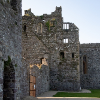
Then it was on to Cahir Castle, Tipperary.  There has been a fort at this location since the 3rd century but the castle that stands today was built in the 12th century by Conor O’Brien on a limestone rock jutting out of the river. Almost growing out of that rock it has been the site of countless attacks and sieges for centuries.

Cahir--3

Cahir Castle.

The powerful Anglo-Norman family, the Butlers, came into the possession of the castle in 1375 .  It was thought to be impregnable but, it was subsequently captured three times in its history: twice without a shot being fired.  It fell to Devereux, Earl of Essex, in 1599 after it had been battered for three days with artillery; it surrendered without a fight to Inchiquin in 1647 and again to Cromwell in 1650.  That man again!

Through all this though the Butlers managed to retain control until 1961, the last Lord Cahir died, and the castle reverted to the State.

It has looked the way it looks now since 1599 and is remarkably well preserved retaining its impressive keep tower, its original portcullis gate and winch mechanism and much of its defensive structure such as machiolations and canon.  I even spotted a garderobe chute (tipping its contents straight into the river).

The forecast of sunshine for the afternoon was spot on and the River Suir was sparkling. The ducks and geese were having as much fun as the visiting Dutch or Greeks.  To my mind, as with many of the ‘touristy’ reconstructed or restored castles it is a bit sterile and looks for all the world like a film set, which, not surprisingly, it has been for such films as Excalibur, Barry Lyndon and Tristan and Iseult.  And recently it was the location for a new film, ’The Green Knight’, a fantasy re-telling of the story of Sir Gawain who embarks upon a quest to confront the titular Green Knight. There is no denying the stunning views from every vantage point though.

Cahir-0745

Caher Castle and the geese and ducks on the River SuirEnter a caption

Cahir-

The Banquet Room, Cahir Castle

Cahir--2

View over the town of Cahir from the CastleEnter a caption

A short distance away, but in a parallel world, is the chocolate-box pretty of the Swiss House.  Not Swiss but given that name by the locals due to its idiosyncratic architectural style known as ‘cottage orné’ which resembled in their mind a Swiss chalet.  It was built in 1810 by the same Butlers, owners of the castle, as a rustic getaway.

swiss-0789

The Swiss Cottage at Cahir Castle

The style was meant to reflect the disorder in nature and blend in, so the roof isn’t level, windows are of different sizes and external oak timbers are meant to resemble roots.  A verandah surrounds it and makes it look bigger than it is.  The patterns in the trellis work change constantly as you move around and the house never looks the same from any angle. The iron fence of intertwining branches dates from 1850.  A Yew tree adjacent to the house is believed to be 1,000 years old making it one of the oldest in Ireland..  The cottage is now owned by the State and managed by OPW.  No time for a tour inside, but nevertheless a charming and very non-Irish looking diversion.

It was time to head on through Tipperary towards my destination of Wexford.  But one surprising deviation first.  My road took me through Carrick-on-Suir.  Some context here before I go on.  This is one of the most passionate of the hurling places in Ireland.  The county is renowned for its excellence in this most Irish of sports.   The weekend before, Tipp had won the All Ireland for the 27th time. The celebrations were still going on on the street.  I stopped at a place, which I later learned was named Sean Tracy Park.  [The name is in honour of Tipperary man Seán Treacy, one of the leaders of the IRA who was killed in October 1920, in Dublin, in a shootout.  His name is revered in West Tipperary and associated with hurling.]

It was festooned with bunting and flags and numerous placards of hurlers in a coordinated display of blue and yellow.  The bright sunshine had brought people onto the street, everywhere talking hurling and reliving the glory.  As I clicked away I heard a voice. “Are we gonna be on News of the World?”.  I had to disappoint him that it was only the News of Australia.  He told me that following their Senior win they had just won the Under 20s and that they were going for the Trifecta, with the Ladies playing the next weekend.

I learnt a lot that afternoon.  Of the passion for a uniquely Irish game and of a corner of the world where there was a real community spirit. In a world where many of us live our lives in reclusive isolation in front of a TV screen or on a hand held screen this was a refreshing flashback to a community existence where fences between houses don’t exist. I recalled vague memories of growing up in Sydney in the fifties, where life was lived outside, the street was your front yard and there were endless games of cricket.

I knew Tipperary was one of the Big Three in hurling.  In fact they won the very first All Ireland in 1887 and have won another 26 since including this year’s.  Preeminence in hurling is seen as a simple fact of life in Tipperary.  Michael Cusack, the founder of the GAA, once said   “Tipperary was the benchmark by which every other county would be judged.”  Looking at the street display I asked my friend from earlier, “Is all of Tipp like this”.  “Ah no he said.  “Carrick on Suir is special.”  As if to confirm this, I later found a reference to an article  from the Tipperary Advocate  of 1887 decrying the violence  in the game.  It reported “disgraceful scenes” in Clonmel when a game against Carrick developed into a brawl and ending in a bout of stone-throwing. The Gardai were called but it was a sense of continuing bitterness that Carrick men were blamed with no arrests of anyone from Clonmel.  It was a much more peaceful scene on this sunny Sunday 132 years later.  I wished him luck for the Trifecta and resumed my journey.

But I couldn’t leave Carrick on Suir without visiting Ormond Castle. Another of Butler’s many properties.  This one was a fortified Tudor Manor House (Ireland’s only such building) dating from 1560s.  What I found really interesting though is how this elegant building integrated and incorporated an earlier fortified castle dating from the 14th century and and not one but two Tower Houses of different ages.  Here I wished I’d had more time to look inside at the splendour of Thomas Butler’s house, built, it is said. to impress Queen Elizabeth I (for whom he had a bit of a thing).  Sadly she never came to visit.

osmond-0859

Front view of Ormond Manor House

osmond-

Rear viewo Ormond House taken from the 14th Century castle and showing the two tower houses.

osmond-0871

The 16th century Manor House abuts against one ot the earlier Tower Houses.

Leavng Carrick on Suir, to get to Wexford you must travel along the River Suir in Kilkenny until it meets the Barrow (the second longest river in Ireland) and then follow that north to its first crossing at New Ross.  On the way at Granagh, you are confronted by an impressive bridge over the Suir .  Just before the bridge is yet another castle, Castle Granagh, also known by the perhaps less threatening name, Granny Castle.  Another strategically placed defensive site on a bend of the Suir just west of Waterford, there was a Celtic fort built at this spot as long ago as the 1st century.  This one is a typical Norman castle with a courtyard and towers in each corner.  The large keep tower may have been added in the 15th century.  Originally built by the Power family, when they fell out of favour it was granted to, yes, the Butlers, in 1375. Until, yet again, in 1650 taken by Cromwell and destroyed.  History definitely keeps repeating itself around here.

Granny-

Castle Granagh

Three intrepid (or should I say foolish) lads managed to get inside one of the corner towers.  A perilous exercise and not for the faint hearted.  I am happy to report that they got out ok.

I grabbed one more look at the view that juxtaposed a bold architectural statement of the 21st century bridge with a castle that combined elements of the 13th, 14th, 15th and 17th centuries, before I was back on the road to Wexford.

Granny-0951

Granagh Castle and the bridge over the River Suir

It was 4.30 pm when I got to the historic riverside port town of New Ross, with its the three-masted tall ship, The Dunboy Famine Ship, dominating its skyline.  I had to pay a visit, though I hadn’t intended to stop. There I discovered yet another Interpretive Centre, Restaurant, Cafe and Museum complex, and another request for €9.  The Dunboy is actually a replica of a ship that was genuinely used in the 1840s and it is open to the public.  Resigned to parting with my €9, I thought I would have a look.

Dunboy--2

The Dunboy Famine Ship and the River Barrow at New Ross

“Yes Sir, we do have a tour starting at 4.45”.  I looked up at the prominently displayed clock above the desk. It says 4:50.

“So I have missed the tour?”  keeping in mind though that I might be saved by the well-known Irish skill at timekeeping.

“Yes Sir. It didn’t run. There were no takers”.  For the first time I came across a tour that ran on time but didn’t, if you get my drift.

“So I can’t get on and have a look?” I said disappointedly

“Oh yes. if you want to do it on your own you can, you just can’t go on a tour,”

I smiled. I’d never actually said I wanted to go on a tour.

I still had to fork out my €9 but the upshot was that I was given a laminated script of the tour (it’s even called a ‘script’) and I headed on board.  I had the boat to myself.  I had limited expectations, but I have to say I found it a thought provoking and surprisingly moving experience.  The boat is a replica of the vessels that used to carry desperate folk escaping Ireland in the 1840s.  These boats were not designed for transporting people.  They were opportunistically used by traders engaged in shipping timber and other goods from Canada and the US to Ireland.  The return journey would take passengers instead of going back empty.  

It is difficult for us to conceive of the situation at that time.  Stop for a minute and think on this. Ireland, with a population of 9 million was desperate. The US had a population (including slaves) of 18 million.  As a result of the famine, 1 million people died and 2 million left in the space of 3 to 4 years.  On some ships up to half the passengers died during the voyage. As an afterthought, Ireland now has 4 million and the US, 320 million.

The Dunboy carried as many as 300 on each trip on makeshift temporary bunks. Minimal rations were provided.  You were expected to bring your own food.  Imagine that; leaving famine-ravaged Ireland and you had to bring enough food for you and your family for 6 to 10 weeks.  You had one hour a day to cook for yourselves in an open fire on deck.  With twenty others at a time.  That was the only light you saw. The rest of the time you were in your cabin in your bunk.  Speaking of the bunks.  They were 6’ by 6’ double bunks.  Each person had an allocation of 6’ by 18”, which meant there was room for four adults.  Children had half that.  You were expected to share with complete strangers. There were no toilets either.  Just a bucket and you shared that.  Cholera and typhoid were rife and there was no washing possible; most didn’t have a change of clothes. All this was preferable to staying at home.  At least there was hope.

Dunboy-

Sleeping bunks in Steerage class

Dunboy-1012

The bunks are 6′ by 6′ and accommodate four adults.  This is where passengers lived for 23 hours each day.

Dunboy-1014

The crew had individual bunks in the foc’sle

Dunboy-1025

The Captain’s cabin at the back of the ship.

Dunboy-1051

On deck cooking facility and toilet bucket

This crystallised the sense I got when I walked part of the Famine Road in the Burren or visited a famine graveyard on Achill Island.  Putting flesh on the bones to use a very inappropriate metaphor. Being alone on the ship gave me time to absorb and ponder on those brave souls who made that perilous journey to a country that welcomed them, if they survived the trip, with the promise of a new life.  A different America today that turns victims of injustice away.

The captain, who, by all accounts was humane and caring, fared a little better in the Saloon at the back of the ship.  There were four cabins here, accommodating the senior crew and two passenger cabins and the crew had individual bunks in the foc’sle.

I loved the safety notice thoughtfully provided in the script, which I returned with thanks to the desk.  “For safety reasons please don’t fall in the river!” it said.

“Where are you from?” said the chatty man at the desk as I returned the script

“Australia”.

“How long are you here?”

“I’m heading back in a couple of weeks”, I said, skipping the bit about having been here five years. “Thankfully I’m travelling by plane and not ship!” I quipped.  I don’t think he got it.

A stander-by (if that’s a word) engaged me in conversation, recognising my accent.  He introduced himself;  John from Melbourne, but currently living in London, had arrived in Ireland three days earlier with no return plans; to soak up Ireland, to write and just see what happens. That sounded very familiar, so we ended up having a coffee in a local café.  He too was a musician and was staying in the house of another Australian musician friend, a member of a well-known Aussie rock band.   There you go.  I’ve always said that music is the thread that binds Ireland and binds us to Ireland.

He was interested in my story and we chatted for over an hour, before I had to take my leave.  An invitation to a meal and an offer of accommodation followed, so we made arrangements to meet up the next day at his cottage in Carlow. These serendipitous meetings happen all the time in Ireland; in this case a snippet of an overheard conversation changed my travel plans.

It had been a perfect blue afternoon and I was looking forward to a spectacular sunset, but was starting to worry that I would be too late for it.  Still I had to visit the ruined Dunbrody Abbey on the way.  My hopes plummeted [insert scream here] when I saw that it was another visitor centre, this time with a Café, a Maze and a Pitch-and-Put centre and that access to the abbey included all these fringe benefits. The ruin of Dunbrody Castle sits adjacent to the facility.  This castle built just prior to the 1640 rebellion was never actually finished and is now used as a craft shop.

Dunbrody-1078

Dunbrody Castle.  Now a craft shop.

But all that was closed and with it access to the Abbey which was  couple of hundred metres across the road.    Thankfully you could walk around it though and that was what me and my camera did.
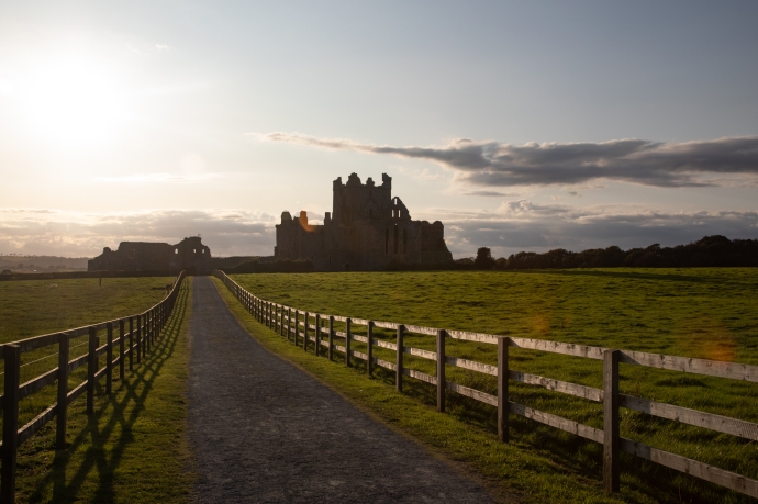
Dunbrody-1250

Dunbrody Abbey

It is a Cistercian Abbey dating from 1170, which prospered until the suppression of  the monasteries in 1536.  The ruin was left to the State in 1911.  I would have liked to have gone inside, apparently it has one of the longest naves in the country.   The monks here in the 14th century were pretty feisty, and it appears were often in dispute with their fellow Cistercians at nearby but much grander Tintern Abbey.  I will be seeing that tomorow.  But even from the outside I was having fun exploring the photographic possibilities that happen when evining light and a ruined abbey combine.  Here are a few of the photos I took that I post without comment.

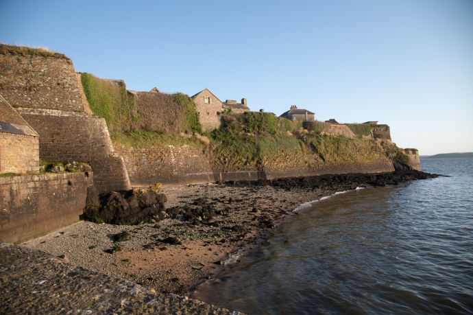
Just a couple of miles further south is the seaside village of Duncrannon.  Protected since the 5th century by a Fort of some description, and even before that by a Promontory Fort that sits on the headland above the Quay.  The only way to see it is with a tour and it was way too late for that so  I had to be satisfied with viewing it from the wharf.  And Duncrannon Fort is what is known as a Star Fort, built in that shape to maximise the coverage and angles for canons.  Built in 1587 by Queen Elizabeth I to protect against the Spanish Armada, it saw much more local action during the Irish Confederate Wars of 1645 and then withstood an attack from Oliver Cromwell in 1649.  A lighthouse was built there in 1774.  During the 1798 Rebellion the United Irishmen failed to capture it and it became a safe house for fleeing loyalists and a prison and site of execution for rebels.  The song the Croppy Boy tells one such story.  Staying in the control of the British Army it was burnt down in 1922.  Now it is a museum.  It looked truly formidable sitting high on the cliffs above the ocean.

Duncrannon-

Duncrannon Fort from the water

Duncrannon-1260

Duncrannon Fort another view

Duncrannon-1254

Entrance to Duncrannon Fort

It was now after 7pm with less than an hour to sunrise and finally within reach of my goal.  But I couldn’t resist one more stop.  The village of Templetown, which may have been a village once but is now just a roadside bar and restaurant (but a popular one it would seem).  Across the road is a the Templetown Church ruin.    This was the base for the Knights Templars, a military religious order founded in Jerusalem to protect the Holy Land, who set up here in 1172, giving the name to the locality.  The Templars however disbanded in 1307 and their lands were given to their great rivals, another military order, the Knights Hospitallers.  They built this church and its adjacent fortified tower.  It is in wonderful condition, just missing its roof, and is surrounded by a small graveyard.  It looked spectacular and glowed golden against a vivid blue evening sky. I’ll have reason to talk about these fellas again.
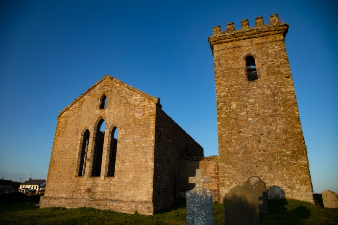
Templars-1314

Templetown Church

Templars-1319

Templetown Church and graveyard

Templars-1328

Templetown Church

Templars-1306

Graveyard at Templetown Church

Paradoxically, with light running out, the next stop was definitely Hook Head Lighthouse.  I could see it in the distance and at the first opportunity I pulled off the road to photograph it.  The lighthouse is not the prettiest in Ireland, with its chunky disproportionate base, but it is iconic and it is the oldest and is spectacularly located (I guess most of them are).

Hook 2-1335

A distant view of Hook Head Lighthouse

It was built by William Marshall, who had a few strings in his bow, so to speak.  He was Strongbow’s successor (get it?) as Lord of Leinster, and had built a port at New Ross, which was 30 km up the river.  Told you I’d come back to the Templars; well Marshall was also a Knights Templar (he was known as the Greatest Knight).  The light was erected at the beginning of the 13th century and it was the monks at Templetown who became the first keepers.  They looked after the lighthouse tower until 1641 when dedicated lighthouse keepers took over until it was automated in 1996.  It is the oldest operating lighthouse in the world.

Hook 2-1357

Hook Lighthouse and the old Keepers’ cottages, now a visitor centre.

Hook 2-

A view from the other side with the sun setting behind Hook Head lighthouse

Hook 2-1369

The lads are off for a fish.

That’s something to ponder on – a guiding light for 800 years. I can’t leave though without mentioning the  expression ‘by hook or by crook’.  One theory (and it is only one of a number) is that the expression came from Oliver Cromwell who had to make the decision whether they would sail up the Barrow on the Wexford side (by Hook) or by Crooke (a village on the Waterford side).  Only problem is there is a reference to the expression in a Middle English tract dated 1387, nearly 300 years before Cromwell. Wherever the expression came from I got there by hook or by crook and I became immediately hooked on the place.

As darkness descended I looked at the collection of campervans parked on the clifftop at the base of the lighthouse, with just a hint of envy.  I searched for a spot to park up, claiming my spot right on the cliff edge next to an old limekiln and looking across to Passage East in Waterford on the other side of the Barrow.  I wouldn’t say I had the best night’s sleep but was well satisfied with an exhausting but rewarding day of travel.

Hook 2-1495

The view from my five star accommodation at Hook Head.

And as a bonus from my vantage point in the back of the car,  I watched the rising of the crescent moon and photographed the Milky Way, managing to catch a couple of shooting stars.  Where else would you want to be.

Hook Head sky night-1586

The Rising of the Moon

Hook Head sky night-1657

The Milky Way.  There are two shooting stars if you look closely

Well that’s Day 1 of this four day journey.  It’s long I know and thank you for sticking with me to the end.  Stay tuned for Day 2 which will take me north through Waterford towards Carlow.

Categories: My Journey, Real Ireland | Tags: , , , , , , , , , , , , , , , , , , , , , , , , , , , , , , | Leave a comment

An Ancient Coast and 5,000 years of Irish history. Maghery in Beautiful Donegal.

One of the things I love about touring in Ireland is that you find so much to enjoy in the most unheralded and remote corner of of the country.  You don’t need to join the throngs of visitors kissing stones, ticking boxes and visiting interpretive centres to enjoy the ‘real’ Ireland.

Take the village of Maghery in the the area know as The Rosses near Dungloe in west Donegal.

What drew me there was a sunny Donegal Saturdayin late autumn and a vague knowledge of some sea arches at nearby Crohy Point, a spot favoured by photographers.

IG3C3538

Clohy Sea Arches

But I found far more.

Yes there was the Bristi Stack and the Clohy Sea Arches. Unique land forms such as these are found dotted up and down the Irish coastline. It was easy enough to find the location along a scary single lane cliff road. And I mean scary; you have no choice but to rely on the other driver to be doing the right thing.

The Clohy Sea Arches are marked on GoogleMaps but not on the ground. Clearly they don’t want people stopping. There is space for two cars to park on the verge and you can’t actually see the rock formations from the road. Feeling that sense of welcome provided by a locked farm gate you climb it and follow a track that leads toward the coast and down the hill where you get your first look at the unusual triangular arch.

IG3C3600-Pano

Panoramic view of Clohy Sea Arches

IG3C3616

The Bristi Sea Stack

Nestled in a small bay it is accompanied by a number of pinnacles which are the remains of similar collapsed arches. There is another quite different arch attached to the mainland at the other end of the bay where the rocks are dragged into near vertical by a fault which has since eroded out.

IG3C3590

Natural bridge formed by erosion of fault fill material

The Bristi stack was first climbed by professional sea stack climber Iain Miller in 2011. If you are contemplating it you need ropes, a dinghy to get there, amazing skill and a whole lot of heart.  Not for me but have a look at this video on climbing Bristi Sea Stack

Bristi-Stack

That’s Iain Miller stands on Bristi Sea Stack.  Unknown photographer. Unknown date

For more sedate pleasures I drove back to the village. Past the 1804 Signal Tower, like many others that dot dozens of remote headlands and islands along the west coast of Ireland. Built to give warning of an impending invasion by Napoleon.  This one looks to be in excellent condition. I wasn’t up to the hill walk to get there this day. Thanks be to long lenses.

IG3C3507

View in the vicinity of Maghery.  Napoleonic signal tower.

IG3C3638

Napoleonic signal tower

The village itself lies adjacent to a beautiful wide sandy strand. This Saturday it was empty except for the local equestrian group practicing their show jumping in this idyllic location. Happy horses indeed.

IG3C3988

Maghery nestled in the bay

IG3C3813

Practicing show jumping on the beach at Maghery


Hand painted signs on slate placed by the roadside led me to other points of interest. There is an impressive stone circle just north of the village.  Again you are left to your own devices; there is no marker on the ground and no directions as to how to get there.  Twenty metres in diameter and a bit overgrown but some diligent searching found this 4-5,000 year old monument. These circles are very rare in west Donegal, I believe.

IG3C4049-Pano

Termon Stone Circle

From here you get a sense of that Donegal wildness as you look to the north east across Dungloe Bay towards Mt Errigal 23 km away on the horizon.

IG3C4012

View across Dungloe Bay to Mt Errigal

Nearby is Termon House built in late 18th century and once owned by the local clergy sits on its own glorious beach. It is available as a luxury holiday rental.

IG3C4006

Adjacent to the house are some impressive walls built as work relief for those affected by the famine of 1847.  Hence ‘Famine Walls’.  Apparently the government refused to support the then landowner who ended up footing the £1,500 cost of paying his labourers 1d a day to build the wall. Beautifully constructed though they remain standing 170 years later.

IG3C4068

The afternoon was closing in and I could hear  the ringing sounds of twenty fiddles filling my head with mazurkas and schottisches so it was time to return to Glenties.  I was well satisfied with this little village that delivered a slice of Donegal’s wild coastal scenery and its human history of over 5,000 years.


Categories: Real Ireland, Wild Ireland | Tags: , , , , , , , , , , , , , , , , , , , , , , , , , , , , | Leave a comment

Dursey. An island at the end of Ireland.

Dursey Island lies at the end of the Beara Peninsula in West Cork. It has been inhabited since antiquity and though it lies only 200 m from the mainland it has always been one of the most remote and inhospitable places to live in in the whole country.

IG3C3006

Dursey Island looking towards the mainland.

It had a tortured early existence and was the site of one of the most horrific events in Irish history.  Following the Battle of Kinsale and the defeat of Donal Cam O’Sullivan at Dunboy in early 1602, the English moved to clean up the last of the rebels.  Many of the O’Sullivan Clan’s non-combatants had been sent to  Dursey to keep them out of harm’s way.  An English force attacked the small garrison guarding the island. They butchered the entire population of the island, women, children and the garrison. Three hundred people executed on the cliffs and their bodies (some were still alive) cast into the sea.  O’Sullivan survivors from the whole of the Beara Peninsula, about 1,000 of them, then marched 550 km north to seek shelter from the O’Rourkes of Leitrim, but that’s another story.

As with the rest of the west coast of Ireland, Dursey suffered during the famine with a 30% reduction in its population in the 1840s.  Its subsequent and continuing depopulation reflects that of many other Irish islands but its survival displays the resilience and strength of its people. In 1860 the three villages of Ballynacallagh, Kilmichael and Tilickafinna,  a population of around 240 eked out a lonely life on the treeless but well pastured island.  By 1969 this number was down to 53. A feature of the island now is the large number of abandoned houses from these times.  This eloquently tell the story of a disappearing population, but they also give the island its remarkable character.

IG3C2842

Abandoned village

Up until 1970 the only way to get on and off the island was by boat across the channel.  A channel that could become so treacherous with storms and a tidal surge  that for a month and a half each year the island was completely cut off.  Considering that there was no electricity, TV, doctor, priest, food supplies and no hall or pub, life must have been very bleak indeed.   After much agitation from islanders the Government agreed to build a cable car to provide a lifeline and, while that did save it from the same fate as the Blaskets, which were abandoned in 1953, it did not stop the population drain until, by 2011, there were only three permanent residents.

IG3C2411

Treacherous tides and surges made this channel very dangerous to cross.  Not these days.

IG3C2448

Approaching the island

IG3C2435

Anticipation. A picture window.

But the cable car opened the island to the tourist.  6.5 km in length, there is much of interest.

To walk the island takes at least 4 hours but I spent over 6 hours ambling and rambling, getting lost and finding myself again.  Just absorbing the ambiance and grateful for the glorious sunshine and the warm breeze that accompanied me. It is glorious to walk either along the sometimes paved road (which despite the alarming speed sign is almost devoid of vehicles;  I saw only one) or across the hills but best to stay on the marked paths unlike me.

IG3C2470

There is a marked walking trail across the hills.  Looking across to the mainland.

IG3C2486

If you leave the path walking through thick vegetation and across stone walls can be a challenge.

IG3C2790

I can never understand Irish speed limits.  100 kph!?

IG3C2880

Looking from the western tip of the island back towards the mainland.  A signal tower stands on the highest point.

On your walk you will come across the remains  of St Mary’s Abbey, a Napoleonic signal tower, historic ruins, spectacular views, rocky cliffs, birds galore, native orchids and your best chance  in Ireland to see dolphins and whales.

IG3C3170

St Mary’s Abbey

IG3C2623

Cliffs on the southern side of the island

IG3C2647

Dolphins

IG3C2727

I tracked this pod of dolphins for over half an hour down the coast

IG3C2928

Native orchids are common

At the western end of the island are three small islands.  Well, rocks really.  They are known as Calf Rock, Cow Rock and yes, you guessed it, Bull Rock.

IG3C2799

Looking west across Dursey to the imposing Bull Rock, two miles off shore

IG3C2889

Cow Rock and Bull Rock

A lighthouse was established on  Calf Rock in 1866.

Less than three years later a storm damaged the lighthouse.  This led to another tragic event in the saga of Dursey.  The Keeper, on Dursey, thought he saw distress flags and six boatmen were dispatched.  Those on the island were safe however, on the the return trip, the boat capsized and all six were lost

On 27 November 1881 in another  violent storm the the tower and lantern just snapped off above the steel base and fell into the sea. No one was hurt but it took two weeks to extract the four men stranded on the island. You can still see the base of the tower to this day.

IG3C2897

Calf Rock with the remains of the steel base of the light tower. Wrecked in 1881

To replace this lighthouse one was built on nearby Bull Rock, work commencing in  1882.  The light didn’t open until 1888.  It is worth pondering the challenge of constructing this on an island of precipitous cliffs measuring 230 m by 160 m and rising to 90 m above sea level.

The station consisted of an octagonal lighthouse tower, dwellings for the Keepers, and an oil-gas works.   This was a massive undertaking and the optic was the biggest in Ireland.

IG3C2915

Bull Rock with its lighthouse.  You can also see a gull colony and the entrance to a natural tunnel that goes right through the island.

The light still stands proudly today though it was automated in 1991. The island is swarming with gulls.  Also noteworthy is a natural tunnel that goes right through the island.  You can see the eastern entrance in the picture above.

That’s Dursey.   Take everything you think you’ll need because there are no supplies on the island and not even a toilet. And it won’t always be mild and sunny as it was for me; go prepared for bleak and wild.

But don’t miss it.

IG3C3225


Categories: My Journey, Real Ireland, Wild Ireland | Tags: , , , , , , , , , , , , , , , , , , , , , , , | Leave a comment

Strokestown Park House. A Living Museum.

I love when I visit a place for one reason (usually music) and discover something totally unexpected. Such was the case with Strokestown in Co Roscommon. I had no reason to expect anything other than long days and nights in one or many of the quaint pubs playing music and sampling the odd Jamesons.

It turns out Strokestown, a planned town, has a pivotal and fascinating history. In the centre of the town is Strokestown Park House, the ancestral home of the Mahon family.


IG3C6230

Strokestown Park House

You can’t help but notice the wide avenue that leads to the narrow gate to the grounds.  Aside from O’Connell Street in Dublin, it is the widest street in Ireland. One gets the impression that lined as it is with imposing buildings and Georgian terraces it was meant to create an aura of wealth and prosperity befitting the status of the British landowner; so as they drove the carriage down the avenue his friends would be suitably impressed.  The true state  of the people hidden in the side streets.

IG3C6279

The gateway to Strokestown House in the distance.

IG3C6283

Public buildings.  There’s room to park a bus rear to kerb.

But the family and the name Strokestown has a darker side.  It is now mostly remembered for its connection to the Famine, evictions and land clearances.  That story is told in the Famine Museum attached to the house (which is itself now a museum)  and is an extraordinary one.

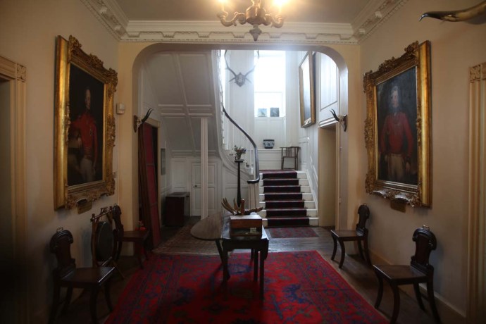
The house is a time capsule. The Georgian Palladian style of its architecture reflects the obsession with symmetry at the time and the desire to make the house look bigger than it was. The two wings were largely cosmetic with stables and storage and services. All the living areas were in the main two story house.

IG3C6238

Georgian Palladian architecture.  The central building is the main residence.  To the left are the kitchen and storerooms and to the right the stables.

Built in 1660 the original owner, Captain Nicholas Mahon, was given lands as reward for his exploits with the forces of Cromwell in taking Ireland. The family did well and by the 1840s had an estate of 11,000 acres. An arranged marriage to another prominent British family, the Pakenhams, led to a combined land holding of 30,000 acres spread through Roscommon,.

During the 1700s and into the 1800s Strokestown prospered.  However in the1840s when the potato blight and the consequent famine struck hard in Roscommon, the then owner Denis Mahon implemented a programme of large scale evictions.

In one year alone (1847) he evicted 3,000 people. Though the excuse for the land clearance was the inability of the Irish tenants to pay rent it seemed to be part of a grander scheme.  Immediate steps were taken to advertise the land thus made available in places like Scotland, where presumably Protestant tenants would be more reliable. The clearances were accomplished largely by “assisted emigration” in particular to Canada. As many as 50% of the passengers died amid extraordinary cruelty on these Famine ships mostly through cholera and typhoid and this prompted outrage.  It climaxed in the murder of Denis Mahon at the end of 1847.  The culprits, presumed to be disaffected tenants weren’t identified, but it led to swift retribution against any family that might have had a remote connection as a conspirator.   Much material that relates to this period is on display in the Museum.  In particular there are many original letters and documents which illustrate the plight of the people and the heartlessness of the landlords.


IG3C5256a

A list of tenants recommended for relief work, 1846.  The notes in blue provide comments as to whether the person had made an effort to pay their rent.  They were favoured.

IG3C5258a

A petition from Kilbeg tenants to the owners requesting whether they will be given assisted immigration.  Tenants were keen to go to foreign lands but many never made it.

IG3C5262a

A Notice to Quit on Widow Mary Campbell requesting her to vacate the premises.

IG3C5263a

A Civil Bill used where rent was over twelve months in arrears.  The tenants’ annual rent was £11 5s and their arrears were £16.  They were to appear in court to be evicted.

IG3C5270a

A receipt for £2 to Margaret Brice on surrendering her house, land and manure upon eviction.  Note signed with her mark, an x

Following the joining with the Pakenhams their money enabled the family to survive and prosper into the twentieth century. The last remaining resident however  was Olive Pakenham-Mahon who lived in the house until 1981.

She decided in 1979 to move to a nursing home and sold the house and lands to local businessman Jim Callelly.  He just wanted the land but one day he visited the basement of his newly acquired house and discovered a treasure trove of historical documents that spelt out in intimate detail the story of the house and the evictions. This prompted him to retain the house, restore it and set up a museum based on this archive. And thank God he did.

The house now is furnished exactly as Olive left it. Many of the original furniture and artefacts remain but a lot were sold off to enable her to survive. Olive lived in one room by the end (the Drawing Room) and the rest of the house was essentially abandoned.

IG3C5857

The Drawing Room

Visitors are now able to tour the house. What I enjoyed is that lived-in feel. Peeling wallpaper, organised clutter. Pictures exactly where she had left them. Monogramed personal items lying around.  A toy room with original toys used by her children.  A nursery with original clothes hanging behind the door.  A classroom.  A massive and elegant dining room.

IG3C5842

Entrance foyer

IG3C5927

The Master’s bedroom

IG3C5993

The Lady’s bedroom

IG3C5966

The Nursery

IG3C5957

The schoolroom

IG3C5999

The toyroom

IG3C6059

The Dining Room


There is an amazing kitchen with original stoves, furniture and kitchenware. Our guide related the story that Olive had decided the kitchen was too large and wanted it demolished and a smaller modern kitchen built.  The architect was very reticent and came up with a scheme with false walls and ceilings and modern appliances.  The original kitchen was preserved behind these walls.  Jim Callelly had heard a rumor of this and dismantled it to reveal a treasure frozen in time.  Everything was in place and untouched.


IG3C6115

The old Kitchen with its massive range

IG3C6114

IG3C6102

Beautiful original cast iron cooking range

IG3C6085

IG3C6076

Original Strokestown jug


The library is also impressive. A chippendale bookcase said to be one of the best in Ireland. A pecctacular Grandfather clock. Beautiful globes. Certaily a life style very different to that outside these walls.  A classic retreat for the males in the house as was the custom.


IG3C5904

The Library


IG3C5870

Original 17th Century wallpaper lines the walls of the Library


IG3C5901

Rare Irish Chippendale bookcase in the Library


Many magnificent paintings adorn the walls.  One is of  an ancestral relative, General Pakenham who led the British Army in the Famous Battle of New Orleans. We all remember the history as told by Johnny Horton in his 1959 song

In 1814 we took a little trip
Along with Colonel Jackson down the mighty Mississip.
We took a little bacon and we took a little beans
And caught the British running in the town on New Orleans……..

We fired our guns and the British kept a comin’ …..

You know the rest.  The poor General did not survive but was regarded as a bit of a hero back home.


IG3C5844

Portrait of General Edward Packenham hanging in the Foyer


Unfortunately as was the case with many Anglo-Irish families when they came upon hard times many paintings and treasures had to be sold.  We are reminded of this when we see the faded areas of the original 17th century wallpaper where these paintings used to hang.


IG3C6033

Walls of the Dining Room showing faded areas outlining where original pictures hung.


One such painting was a priceless portrait by Bernardi Strozzi of the acclaimed Cremona composer Monteverdi.  The portrait was painted in c1630 and was sold by Olive for £2,000.  A somewhat amateurish copy hangs now in the Drawing Room in its placewhile the original was returned to Venice.


An intriguing feature of the house is the Servant’s tunnel.  Entered from behind the stables it heads under the house exiting at the back door of he kitchen.  Built to ensure deliveries and movement of servants took place with no interaction with the house, it is easily accessed today.


IG3C6159

Servants’ tunnel under the house

IG3C6205

Entrance to the tunnel


Adjacent to the house is a restored walled garden. A large walled garden of around 4 acres.  After a ten year restoration it was opened to the public in 1997 and many of the original features of this pleasure garden have been retained.  There is a croquet lawn and a Summer House, a Lawn Tennis court, a beautiful lily pond, impressive herbaceous borders (the longest in Ireland), a formal rose garden, beautiful manicured hedges and a pergola. lawns and wildflower areas.  I loved it.  But as with the Vandeleur Garden in Clare which I wrote about in a previous blog, the cruel history of the famine sits uneasily with the beauty and bucolic pleasures of this garden.


IG3C5494

Herbaceous borders line the walls

IG3C5505

There are formal and informal pathways


IG3C5531

Croquet Lawn and Summer House

IG3C5542

Detail of Summer house with Autumn foliage


IG3C5510

Beautiful ornamental lily pond

IG3C5525

Secluded pathways

IG3C5559

Perfectly manicured hedges

IG3C5554

Numerous hidden spaces lie behind hedges

Another treasure of the estate is the Woodland.  There is a circular walk through this leafy mossy retreat with huge oak and beech trees and thick undergrowth.   It was first planted in the early 1700’s by Thomas Mahon and some of the original trees still exist. During the 1800’s, to increase the pleasure of the shoot, laurels were planted creating a thick undergrowth.  Eventually it took over but it was sensitively restored in 2011.  The fairies have gone a little overboard though and seem to have occupied nearly every tree.

IG3C5333IG3C5429IG3C5376

IG3C5435


IG3C5402

When old chairs become an art installation.


Truly the house, the museum, the garden and the woodland will keep you occupied for four or five hours.  They will be four or five hours well spent.


Categories: My Journey, Real Ireland | Tags: , , , , , , , , , , , , , | 3 Comments

Ruins and Ruined Dreams. An Abandoned House in Roscommon,

I have talked about abandoned houses in the Irish landscape many times. They are so characteristic, they are part of the DNA imprint of the countryside. Ruins appear to date from many times and reflect the struggles of the Irish as they deal with famine, invaders and economic and social dislocation. Naturally the iconic image is of the castle ruin or the grand manor house, but cottages and farm houses are so much more abundant. I often wonder about the stories behind these buildings. Ruined lives and ruined dreams; or did they find a better life somewhere else.

IG3C3144_1

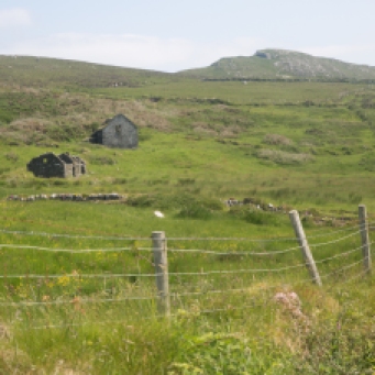
This is one such house. It lies on the edge of the Kilronan Mountain Bog near Ballyfarnon in north Roscommon. A remote place.  It is close to the Arigna coal mine and perhaps the family living here derived its income from there.  The ruin is intact but blackened walls at the entrance suggest maybe some fire damage at some stage. It is not an old house and the front door is missing a panel so curiosity got the better of me. I walked into a time capsule.  IG3C3115_1

The house is a mess. Largely empty with years of accumulated debris covering the floors. Sheep have been regular visitors.   The rooms are spacious and well suited to a family.  The walls are bare save for a small crucifix over the living room door.  The walls were generally neutral colours but through the peeling paint are bright greens and pinks reflecting changing fashions. The kitchen was bright blue with pink trim.  Scrape away the sediment on the floor  and it reveals a very 60s brightly coloured lino in the main living room.  Definitely not to everyone’s taste but an individual statement.   No personal possessions remain.  Nothing that would give us a sense of who lived here.  Items too large to take though have been left behind.  A television, some chairs, a fridge and stove. All now beyond use.

IG3C3117_1IG3C3123_1IG3C3143_1

IG3C3127_1

Stairs lead to a mezzanine level with two rooms, shelves and some decaying mattresses.  Everything is still there in the bathroom, even the shower curtain and taps.

IG3C3129_1IG3C3130_1IG3C3139_1

I got the sense of a comfortable home. There is central heating and fireplaces in every room; there was insulation in the ceilings and to me it would seem they had the trappings of a good life.

What went wrong and when? Where did they end up? Fortunately we can answer as to when?  A newspaper among the papers strewn on the floor dates from July 1997.  My eyes fell on an article with a headline: “Anna Spices up Wimbledon”.  A sixteen year old Anna Kournikova was at the beginning of her rollercoaster ride in the world of tennis while this Roscommon family grappled with a very uncertain future.

IG3C3124_1

My original thought that the breadwinner worked at the Coal Mine makes sense except that it closed in 1990.  Perhaps they struggled on for another 7 years before finally giving up.

We will never know what makes a family walk away and leave their house.  Leave fridges and stoves and furniture.  Leave curtains.   And head somewhere for a better life.  Unfortunately it has been a huge part of the Irish narrative for nearly two hundred years.

No doubt such events happen in other countries but what is different here is the scale of the dispossession and that the evidence remains for decades perhaps even centuries with these dwellings lying empty and untouched; as if interfering with the ruin would somehow be disrespectful.

So many pages of the Irish Story lie open to us in this way.  However the writing is indistinct and many times illegible and impossible to decipher.

These ruins for me are always a time to pause and think.


Categories: My Journey, Real Ireland | Tags: , , , , , , , , , , , | Leave a comment

The Vandeleur Walled Garden, Kilrush. Of Fragrance and Famine.


IG3C0215

The Vandeleur Walled Garden is located near Kilrush in the south western corner of Clare. I visited it in the middle of Spring when it was at its charming best. It is a formal garden space within high walls and is now a place of calm, peace and reflection. Especially reflection.

Historically it was the private garden of the Vandeleurs, who were the largest landowners in the area. It is completely surrounded by enormous stone walls and was located close to the family home, which was destroyed by fire in the 1890s and demolished in the 1970s and is now a car park.  The rectangular design was oriented to catch maximum sun so today Mediterranean plants thrive.

The original garden design was simple and functional as it was mainly used for produce, fruit and supplies for the household. It also included a large greenhouse. All that is gone and the garden lay forgotten for decades. Restoration commenced in 1997 and it was opened in 2000.   It has been redesigned as a recreational space with lawns, an horizontal maze, an hedge maze, plantings of exotics and an arboretum. It is a lovely space. There is a red theme throughout with furniture and installations matching some of the plantings.

IG3C0299

Remnants of the supports for the roof of the greenhouse


IG3C0303

Lawns and plantings cut by gravel paths


IG3C0281

Mediterranean plants thrive.


IG3C0254

Vigorous growth under the high walls


IG3C0234

The Garden has a red theme

IG3C0557

Red theme reflected in plantings.

But despite all this beauty as I stroll around my mind remained troubled.

Near the entrance is a small plaque.  It says “Dedicated to the memory of the people evicted from the Estate of Landlord Hector Stewart Vandeleur. July August 1888”. The effect is somewhat diminished though with the tag “Erected by the Kilrush Tidy Towns committee April 2010”

IG3C0220

Memorial plaque near entrance to Garden

I suspect most people just walk by and give only a passing thought to this hint of the awful history that accompanies the family responsible for this garden. I   wonder further how many people actually are aware of what happened in this place during the 1800s, as their children skip and play on the lawns and chase each other through the hedge maze or as they wander along gravel paths and admire the plantings from all over the world.

IG3C0436

skip and play

IG3C0451

Children take a short cut across the Horizontal Maze

There is no information provided so I too was in the dark. My interest piqued though I explored further a little later.

So who were the The Vandeleurs? Descended from Dutch merchants, they settled in county Clare at Sixmilebridge in the early 17th Century.  In 1712 the Earl of Thomond leased the Kilrush estate to the family who eventually purchased it in 1749,   The lands amounted to almost 20,000 acres spread over a very wide area of West Clare.  John Ormsby Vandeleur played a major role in the development of the town of Kilrush in the early 19th century and built Kilrush House (to which the garden was attached) in 1808. Later the Vandeleurs gave land for the building of the Catholic Church, convent, a fever hospital and, ironically, the workhouse.

The family however is remember more for the large number of evictions that took place in the famine years and then again some forty years later.

As I said the brochures you collect at the entrance make only passing reference to these events with the words that “history must never be repeated”.  But behind this is a painful picture of despair, cruelty and terrible injustice.  I am sure all my readers will be well aware of the Famine. An event that killed one million people and forced another million to flee to other lands. But as I dug deeper the sense of injustice increased and I think it is worth retelling the story at least as it impacts the Vandeleurs.

As the Famine took hold in 1847 and tenants were unable to pay rent mass evictions began. Not just by the Vandeleurs but by landowners all over the country.

County Clare however had the highest level of evictions, relative to its population, of any county in Ireland and Kilrush Poor Law Union had the highest level of mass evictions in Clare. So the Vandeleurs were right in the centre of it.

We are lucky that the records of Captain Kennedy who was the administrator for the Kilrush Union are available and they make extraordinary reading. Captain Kennedy was extremely disturbed by what was going on and though he was diligent in administering the regulations he did what he could to alleviate the plight of those affected and destined for starvation, disease and the workhouse.

A quick word on Kennedy.  He was a good man caught in terrible times.  He later went on to be Governor of Western Australia but he never forgot Kilrush and regularly sent money back there.

In early 1848 he observed in one of his regular Reports.

“I scrutinized a list of 575 families here, and saw each individual; On one estate alone, little short of 200 houses have been ‘tumbled’ within three months, and 120 of this number, I believe, within three weeks! The wretched, houseless, helpless inmates, for the most part an amphibious race of fishermen and farmers, scattering disease, destitution, and dismay in every direction. Their lamentable state of filth, ignorance, destitution, and disease, must be seen to be comprehended.”

In July of that year things were desperate:

“Twenty thousand, or one-fourth of the population, are now in receipt of daily food, either in or out of the workhouse.

“I may state in general terms, that about 900 houses, containing probably 4,000 occupants, have been levelled in this Union since last November. The wretchedness, ignorance, and helplessness of the poor on the western coast of this Union prevent them seeking a shelter elsewhere; and to use their own phrase, they “don’t know where to face;” they linger about the localities for weeks or months, burrowing behind the ditches, under a few broken rafters of their former dwelling, refusing to enter the workhouse till the parents are broken down and the children half starved, when they come into the workhouse to swell the mortality, one by one. It is not an unusual occurrence to see 40 or 50 houses levelled in one day, and orders given that no remaining tenant or occupier should give them even a night’s shelter.

“I have known some ruthless acts committed by drivers and sub-agents, but no doubt according to law, however repulsive to humanity; wretched hovels pulled down, where the inmates were in a helpless state of fever and nakedness, and left by the road side for days.

“As many as 300 souls, creatures of the most helpless class, have been left houseless in one day, and the suffering and misery resulting therefrom attributed to insufficient relief or mal-administration of the law: “

I could go on. In total there were close to 7,000 evictions. The event, of course, changed the nation. It was surely inconceivable that it could happen again. But extraordinarily it did; and the Vandeleurs were in the forefront.

A series of bad harvests plagued the country from 1870. This had led to a movement in the next decade for tenants’ rights and land reform with the foundation by William O’Brien of the National Land League.   The ‘land question’ caused major upheaval in the county and people flocked to Ennis in 1880 to hear Charles Stuart Parnell make his famous “Boycott” speech.

Landleagueposter

Irish Land League poster from the 1880s

By1885, bad weather, poor harvests, falling prices and declining markets had again taken their toll, and thousands of tenants, especially in the western parts of the county, found themselves unable to pay rents.

The National League introduced the Plan of Campaign in 1886. This was adopted by many tenants who got into trouble. Where a landlord refused to lower his rents voluntarily to an acceptable level the tenants were to combine to offer him reduced rents. If he refused to accept these, they were to pay him no rent at all, but instead contribute to an “estate fund”.

Vandeleur’s tenants adopted this strategy, which was summarily rejected and negotiations went nowhere. And after a long stand off the evictions commenced in October 1887. But the main evictions of the Vandeleur tenants were not until July 1888. It was a massive operation. A procession moved from house to house that comprised hundreds of men and was 1¼ mile in length.  It included detachments of police, hussars, government representatives, the landowners, Emergency men, Infantry, cart loads of observers, visitors and a massive battering ram. It is estimated that up to 10,000 people were there on some days.

battering

The Irish Collection

23144955540_e65c53e0ef_hThe mob was resolute in its intent and ruthless in its implementation. Here is a description of the demolition of the house of Michael Cleary, near Moneypoint.

Cleary had strongly barricaded the house and was clearly prepared to resist. First of all cordon of police and soldiers were drawn up about the house, but at some distance. Smoke was coming from the chimney – and the first action taken was to block the chimney with straw. Possession was then demanded and the only reply heard was a laugh from some girls inside. The police were now ordered to fix their bayonets, while the bailiffs got to work with crowbars and hatchets, but to little effect. An attack on the door moved it only slightly and hot water was thrown out. The tripod and battering ram were then brought up – and after a long time eventually made a breach in the wall. A shower of hot water was thrown out through the breach.

Finally, a large section of the wall crashed down to a cheer from the Emergency men. Two girls and their two brothers who were in the house were seized by the police The house was then knocked to the ground.

The eviction of Mathaiass Macgrath from Moyasta a week later received the most attention as he resisted strongly and was brutally beaten. His mother, watching this, collapsed and died that night. The evictions ended two days later.

photographing_evictions_vandeleur

These Vandeleur evictions were on a much smaller scale than those in the Famine years. only 22 houses were destroyed compared to the many thousands previously. However, Because the event was so well documented and photographed and because of the resistance of the tenants it received wide publicity. This was a factor in reaching a settlement which led to the tenants being able to resume their land a year later.

The photographs above and many others were taken by Robert French and are now in the collection of the National Library in Dublin. They were a major factor in changing perceptions. Maybe more would have been done if the public had been better appraised of what was happening during the earlier evictions.

So back to the garden. Earlier I commented that there was no informaton on these events. But I am now in two minds. Perhaps we don’t need an Interpretive Centre to tell us of these terrible events.  Perhaps it is a place for people to enjoy in their own way.   For some just to walk and contemplate and for others to run and play.

And for others it is a place to honour and respect an extraordinary formative time in Irish history. To reflect on inhumanity and injustice. To ponder on the harm man can do to their own. To contemplate and to evince hope for the future.

IG3C0305

Enter a caption


Categories: My Journey, Real Ireland | Tags: , , , , , , , , , , , , , , , , , , , , | 1 Comment

Oliver O’Connell, Man of the Burren and the Track of Tears.

Ireland is a very popular destination with visitors. And for good reasons. I have met so many who have come here for a week and have rushed around to tick Dublin, Dingle, Cliffs of Moher and Galway off their list and happily report back home that they “did Ireland”. Don’t get me wrong most people genuinely enjoy Ireland, in fact love it. What’s not to love? There is of course wonderful scenery, friendly people, ruined castles, trad music, Guinness, bacon and cabbage, sheep on the road. Everything that brings people here. But very few of those short-term visitors would have tapped into the ‘real’ Ireland.  Ireland’s real treasure is its people. It’s through the people of Ireland you discover the Hidden Ireland.

I spent a day recently with one of these people. Oliver O’Connell may be known to some of you. Perhaps if I say he is Blackie O’Connell’s dad that may twig a few responses or the guy who started a session on an Aer Lingis flight last year, the video of which went viral; but really he should be better known as the great-great-great-great-great-great-great-great-great-great grandson of Maurice O’Connell ‘The Transplanted’. I’ll come back to that.

Oliver lives in an extraordinary spot in the middle of the Burren which is the beating heart of County Clare. Ten kilometres  from Corofin. You look out his kitchen window towards Mullaghmore , across a barren, stark tortured, limestone plain and you cannot see a single house. And at night the only light is the faint reflected glow from Galway City way to the north.

ig3c8720

View across the Burren National Park

Oliver is as much part of the Burren as the megalithic tombs and glacial erratics that dot the landscape. He took me for a little walk to show me a favourite spot of his; the so-called Famine Road. A little used part of the Burren Way walking trail.

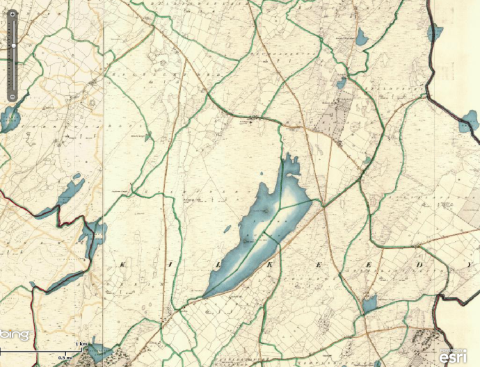
Now I thought I knew what a ‘Famine Road’ was.  The walking tours of The Burren will take you to one and tell you these roadways were built as an assistance scheme to keep people out of the Workhouse.  This may indeed be the case but this one is different as Oliver tells it.  This road was here way before the Famine.  Indeed the 1842 map of Clare shows the route as a road in use and on the exact same line as the satellite image.  So it certainly well predated the Famine.

2016-11-04a

Satellite image of Famine Road.  Shown with red arrow.

2016-11-04-1

1842 Map showing same area as satellite image above.  Famine Road is clearly marked.

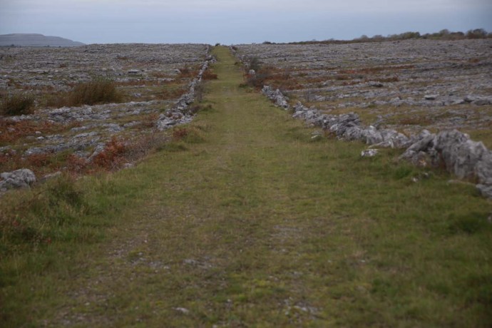
Oliver explained that it is called the ‘Famine Road’ for a very different reason.  The route was used by a number of families attempting to escape the deprivations of those terrible years but many did not survive. They are buried somewhere along the route in unmarked graves. It struck me as unusual that the road fell into disuse even though it would shorten the trip considerable from Corofin to Kinvara.  Oliver thinks the road has been there for perhaps a thousand years.  If this is true then it is a tribute to the engineering capabilities of the early residents.  It is roughly cobbled and raised in places, the summer grasses partly hide it now but its unique stone walls bounding it still stand proud today. They have regularly spaced jagged vertical stones. The road is straight as a die in places  and it traverses the country peacefully and silently.

ig3c8604

The start of the Famine Road near Aughrim.  Part of the Burren Way.

ig3c8716

View to the north along the Famine Road

ig3c8655

Cobbles forming the road base

ig3c8664

Detail of cobbling

2016-11-04-3

Detailed satellite view of portion of the Famine Road

ig3c8710

Jagged rocks standing upright form part of a wall along both edges of the road

So why was it no longer used?

Oliver is a poet. One whose poetry is raw, and highly descriptive.  It is personal and it is heartfelt.  It comes to him quickly almost as a stream of consciousness. He doesn’t massage it and as a result it doesn’t sound the least bit contrived.  In a poem he wrote about this road he describes what he calls the Track of Tears, thus:

Here in this place “bothar na muinne, ait ciunas gan uaigness”.

Where silence screams at you but the spirits of our people radiate a comforting presence as they lie here in peace in their final resting place.

You tread on their footsteps and on their tombstones as you weave your way through sacred structures and vertical stone walls in this land of myth and magic.

(‘bothar na muinne, ait ciunas gan uaigness’ translates to a ‘place of silence without loneliness’)

The silence screams. It quite literally does. Not a bird, no wind, no animals Just the sound of our footsteps and our breathing. It’s as if the Gods with quiet reflectance continue to mourn those who didn’t make it. And it is surrounded with a landscape of harsh but tranquil beauty described so well in Oliver’s poem.

It is perfectly fitting that the road is no longer used and it is tempting to think that this was by design as a memorial to those lost.

I was moved by the story of the road and this window into a distant Ireland.  Distant struggles, yes, but it recalls the many battles endured before and since by the Irish people.

But Oliver has a bigger story to tell.

ig3c8736

Oliver with the O’Connell Family Tree

ig3c8741

Detail of portion of the Family Tree

He has spent fifteen years trying to unravel it and his journey has as many twists and turns as a good detective yarn.

Oliver’s forebears have been in Clare since 1653. He has been able to trace them back continuously to Maurice O’Connell (The Transported) who led 59 members of his family from their home in Kerry, from where they were expelled by Cromwell. Those who survived resettled near Inagh and Liscannor. Clare was then part of Connacht and the expression To Hell or Connaught comes from that time and relates to this exodus. The barren plains of the Burren was the equivalent of being sent to Hell. But survive they did and Blackie’s children represent the fourteenth generation of O’Connell’s to live in Clare. But it’s even more interesting than that.

Oliver has managed to trace Maurice O’Connell’s antecedents back to 1340 when they were a well connected and important family in Kerry and Limerick and even earlier to Connaill Gabhra, “Connaill of the Swift Horses”, King of Munster, in the 1100s. What a fabulous heritage. Nearly a thousand years!

What is unique about this story is that documentation exists continuously since the 1300s. As Oliver explained most Irish families can only go back to the 1820s. Prior to that records were kept by the British only for Protestants and Military. The O’Connell’s have a long hsitory of military service so the story is still there for those with the patience and energy to root it out.

Oliver as well as being a poet and raconteur is a musician and has links to a generation of musicians sadly disappearing fast. He is full of stories all told with zest and enthusiasm, such as how Blackie started on the pipes, but I will leave that for Oliver to tell sometime as he surely will.

ig3c8753

How else would you end a day such as this but with some tunes, So I sat on a chair in the kitchen, a chair that I’m sure that Oliver’s old friend Finbar Furey would have sat on and it just seemed so perfectly logical that the fiddle and the box together would shatter that Burren silence.

Oliver has invited me back to see this place in a different mood. When the frosts arrive.

Keep me away.

ig3c8649_1

Categories: My Journey, Real Ireland, Wild Ireland | Tags: , , , , , , , , , , , , | 11 Comments

Blog at WordPress.com.