Posts Tagged With: Colorado

The Colorado Rockies 7. America’s Mountain. Pike’s Peak.

Pikes Peak

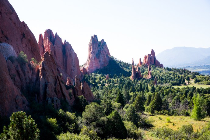
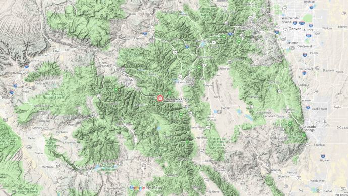
There are 54 peaks in the Colorado Rockies that are over 14,000 ft (4,267m). Keep in mind that the highest mountain in Australia is 7,228 ft!) There are however only two that you can drive up. Pikes Peak is one of these.  At 14,115 ft it is still only the 53rd highest mountain in North America. Nevertheless it dominates the landscape of this part of the Front Range. If you have read my last post on the Garden of the Gods you would have seen it in the distance in many of the photos.

It is also known somewhat cheesily as ‘America’s Mountain’, In 1893, Katherine Lee Bates wrote the song “America the Beautiful” after having admired the view from the top of Pikes Peak.

IG3C0650-Pano

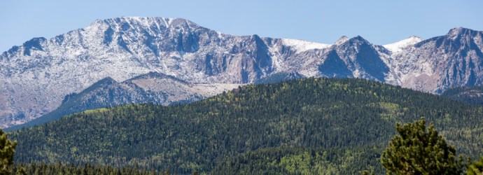
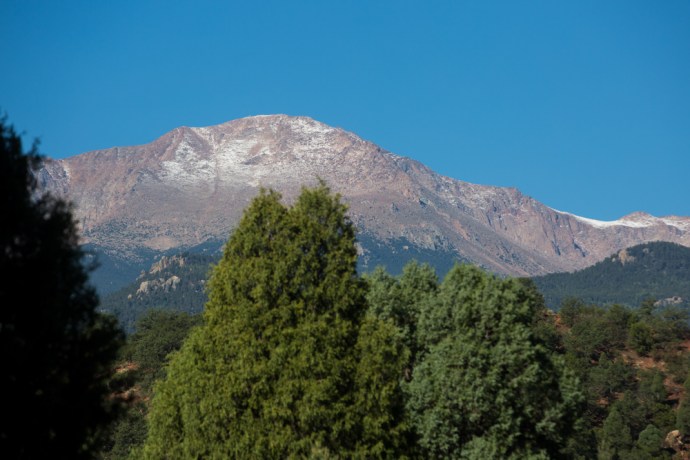
The snow dusted Pikes Peak towering over the forest on the climb up the mountain

A 19 mile long toll road takes you off the US24 allowing you to drive to the top. Well not quite to the top this time. They were doing extensive rebuilding of the facilities so the last three miles were in a shuttle bus.  I loved the way you were given the choice to join the bus earlier if you were uncomfortable with the drive. And if you are not used to mountain roads, well it is scary. You shouldn’t underestimate the drive.  It requires a lot of concentration.  It is two lane but there are a lot of switchbacks, steep grades and with no barriers preventing drops of thousands of feet to the valley floor. And for some reason they seem to drive on the wrong side of the road.

IG3C0881

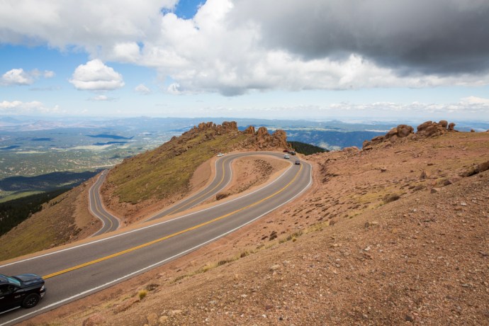
Hairpin bends on the way up the mountain.

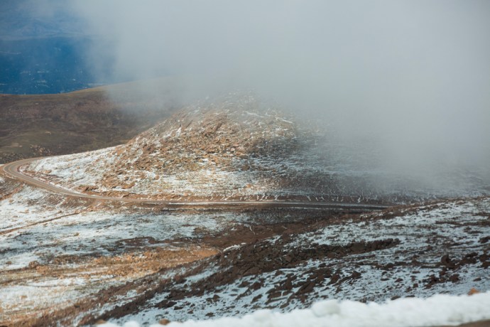
The driver of your shuttle will probably point out the spot at Devil’s Playground, where Jeremy Foley went over the edge during the 2012 Pikes Peak Hill Climb (incredibly he and his navigator survived).

IG3C0870

The Devil’s Playground.  Near the top of the mountain.  The bollards are where rally driver Jeremy Foley left the road in 2012.  He survived unharmed.

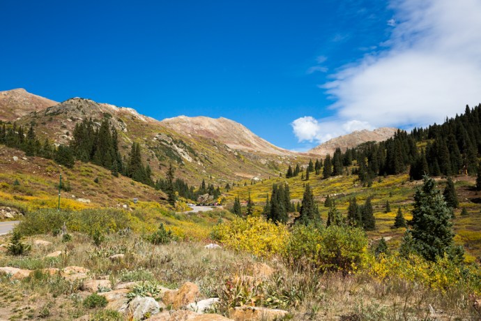
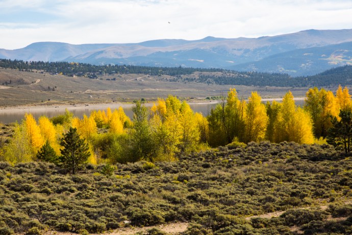
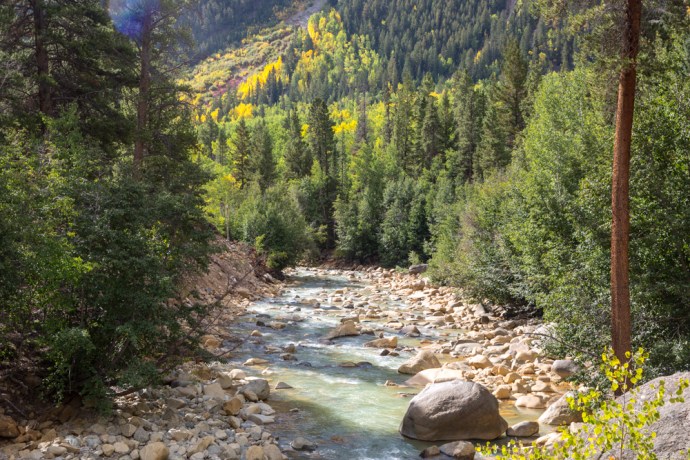
The $15 toll will take you on an awesomely beautiful journey through different worlds with ever-changing landscapes. Firstly pine and fir forests and the calm waters of the fishing paradise, Crystal Lake.

IG3C0653

A view of the Peak through the forest

IG3C0611

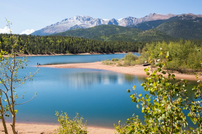
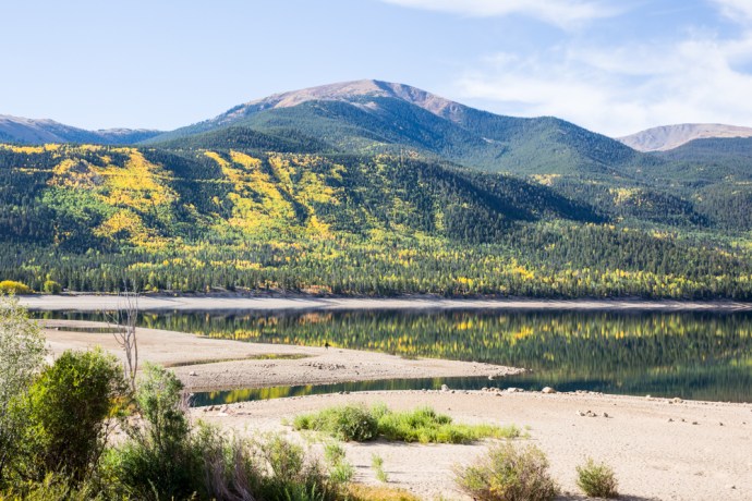
Crystal Lake.  A reservoir for Colorado Springs.

IG3C0624

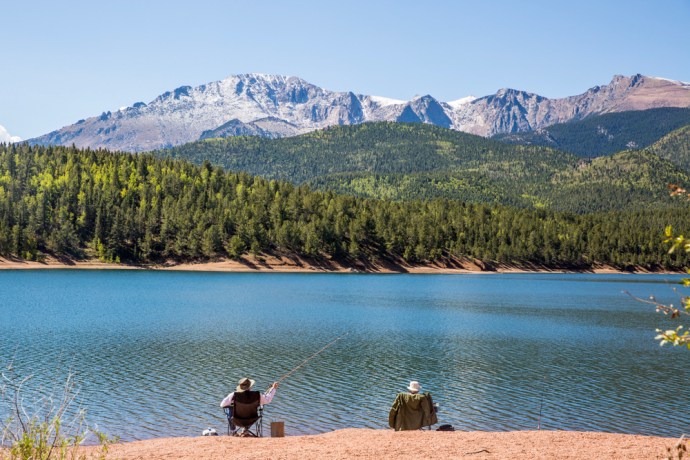
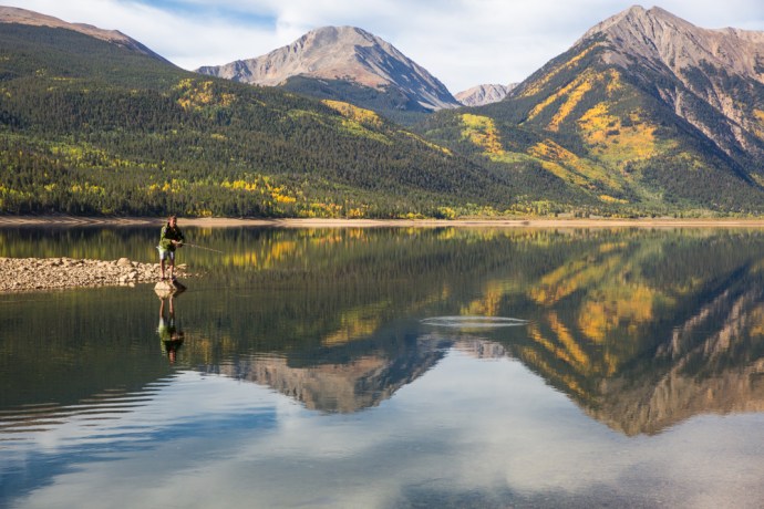
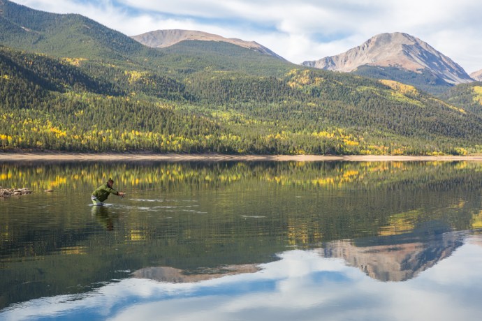
An idyllic fishing spot

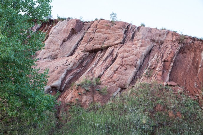
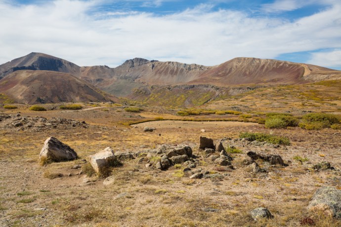
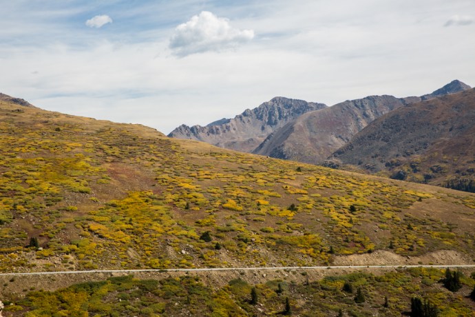
Then through aspen groves just starting to turn and spruce forests and over the tree line to the wildness of the alpine zone and tundra with piles of bare burnt red-brown granite boulders.

IG3C0688

Leaving the Bus Station in the Shuttle near the 16 Mile point

IG3C0695

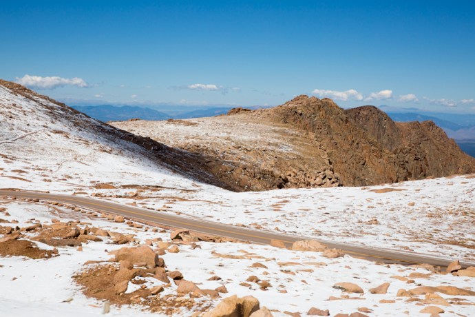
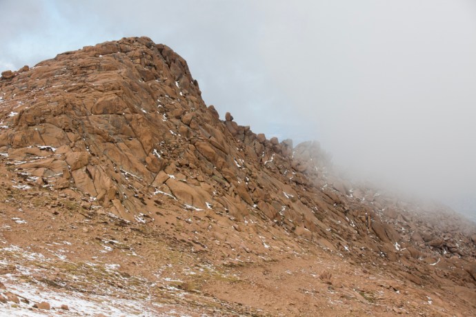
Above the tree line.  Alpine tundra and granite

IG3C0708

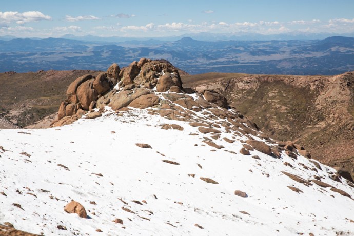
Granite tors covered with the previous night’s snowfall

IG3C0723IG3C0735IG3C0739

And the photo gods were hard at work as we had a snowfall the night before and plenty of blue sky and as we climbed the mountain some low cloud to add texture and interest to the images. I was in heaven.

IG3C0857IG3C0851IG3C0834IG3C0786

It was a tad cold at the top and I have to say not being used to altitude sickness, I felt all the classic symptoms, fatigue, breathlessness and headache. (same symptoms as after an all night trad session! just kidding).   None of this detracted from the thrill of being at the top of the world. At least this little part of it.

IG3C0791

The Summit

IG3C0800-Pano

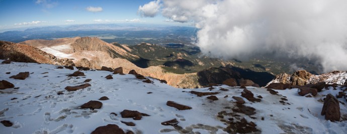
The view from the Summit

That malady disappeared pretty quickly once the oxygen levels returned to normal on the descent. And anyway there were enough distractions as the descent gives another perspective as you slowly edge down the mountain in first or second gear.  In the distance was the Cripple Creek and Victor mines one of the largest gold mines in America.

IG3C0824

A view to the south towards the Cripple Creek and Victor Gold Mines
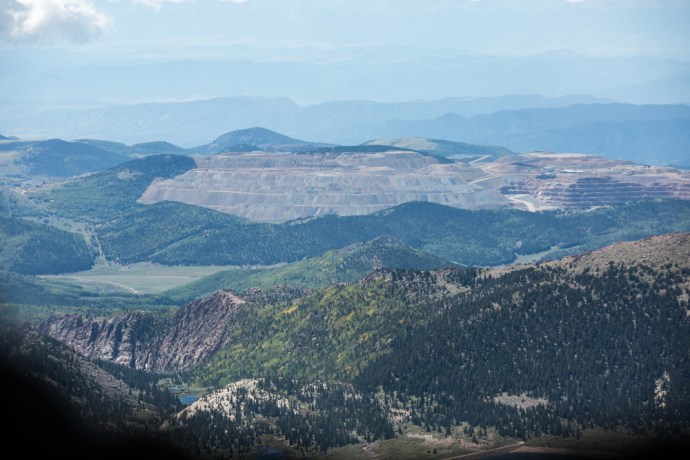
IG3C0833

Cripple Creek Mine

I was relieved and very satisfied to reach the bottom after a remarkable drive.  Well worth the $15 toll.  America the Beautiful.

Categories: America, My Journey | Tags: , , , , , , , , , , , , , , , , , , , | Leave a comment

The Colorado Rockies 6. The Garden of the Gods.

Garden of the Gods

IG3C0104

The main entrance to the park with Pike’s Peak in the distance.

The Garden of the Gods.  What an evocative name.

A geological and scenic marvel, this public park and National Monument lies on the edge of the Front Range of the Colorado Rockies surrounded by the communities of Colorado Springs and Manitou Springs.  Indeed it is so much part of the community that the rock formations and houses coexist in many places.

IG3C8084

IG3C7968

Houses nestle among rock formations of the Garden of the Gods

Jagged irregular spires of red and white sandstone, some reaching 300 feet high, tower over the forest creating a fantastical landscape. The whole thing framed by a snow capped mountain range containing one of the highest peaks in Colorado.  The first Europeans to see this terrain proclaimed it as “a fit place for the Gods to assemble. We will call it the Garden of the Gods.”  The name stuck.

IG3C0040-Pano

Sunrise

IG3C0539

Jagged spires make for a fantastical vista mimicking the pines.

IG3C7922

Mt Cheyenne range glows at sunrise.  Taken from the front yard of my Airbnb overlooking Colorado Springs.

IG3C9977

North Gateway rock with Pike’s Peak

Of course as you can see from these images it is an incredibly beautiful place but the rocks tell a fascinating geological story that spans a billion years, with almost every geological period represented.  Stick with me.  The story begins with 1 billion year old Pikes Peak granite  intruding into the older 1.7b year old gneiss of the so-called Ancestral Rockies .

IG3C0529

Pike’s Peak looms over the Garden of the Gods Park.  A dusting from a snowfall the previous night. The mountin is comprised of the 1 billion year old Pikes Peak Granite.

These mountains wore down progressively and around 250-300 million years ago the resulting sediment fed into a giant sea that ultimately became a  huge sandy desert. Great dunes of red sand accumulated to create the thick sedimentary rock formations known by geologists as ‘red beds’.

25 million yeas later these then flat lying sediments were covered with a great inland sea until the Jurassic, around 150 million years ago, when the climate changed again creating a rich tropical forest grazed by dinosaurs.  About 65 million years ago an intense period of mountain building began; the orogenic upheaval that built the present day Rockies.  Colossal forces created massive fault lines which stood the sediments upright.

IG3C7938

Red sandstones stood on their end by geological tectonism.  A flat lying reverse thrust fault is visible also in this cutting.

Erosion and then glaciation has selectively removed the softer rocks and left the landscape that we see today – a giant  sculpture in sandstone, conglomerate and limestone.

IG3C9880

Pike’s Peak glows as it catches the first rays of the rising sun

IG3C8059

View from the Red Rock Open Space at the Garden of the Gods.

IG3C0278

Differential erosion in the vertical exposed rocks create these stark contrasting outcrops.  Kissing Camels in the distance and White Rock.

The only way to really appreciate this place is to walk through it and around it, to become part of it, taking it in from different angles and in different light.  I was up at sunrise one day when it glowed in the dawn light.  The reds are redder against the bluest of skies.  There are miles of trails to explore and there are many rewards along the way.  Unique formations have names that reflect their morphology.  Kissing Camels, The Sentinel, Cathedral Rock, White Rock.  There are natural holes, arches and the precarious Balanced Rock.

IG3C0400IG3C0332IG3C0130IG3C0454

IG3C0520

Cathedral Rock

IG3C8025

A natural hole

IG3C8040

A natural rock arch

Of course the rock formations are its most obvious and spectacular feature but it is also a mighty challenge to the most technical of rock climbers.  Unfortunately I saw evidence that this activity is not always sympathetic to the natural and geological values of the area.  For example at the Sentinel is an excellent  example of ancient ripple marks insensitively defaced by a drill hole for for a climber’s foothold.

IG3C0324

A rare exposure of ripple marks defaced by rdrill holes.

It is also a haven for wildlife.  I saw deer and a variety of birds, including what appeared to be hawks nesting high on a pinnacle.

The special nature of the place was recognised by the early landowners, most notable among them Charles Perkins, whose family, on his death in 1909, gave their land to the City on condition that it would be a free public park.  That promise has been honored for over a hundred years.

We should be grateful for the foresight of these people, who recognised something that needed to be preserved and shared so that today it is one of the most visited parks, and one of the most loved, in America today.

IG3C0077

Categories: America | Tags: , , , , , , , , , , , , , , , , | 2 Comments

The Colorado Rockies 5. Fossils at Florissant, a Petrified Forest and the Singer family.

florissant

Take Highway 24 west from Colorado Springs. You pass the majestic Pikes Peak (look out for an upcoming blog on this) on your left and after about 50 km you’ll see a turn off to the Florissant Fossil Beds. That sounded interesting so I took it of course. I soon discovered that this place of which I knew nothing (though I should have) is legendary in the annals of American geology and palaeontology.

Within its shales and mudstones is an extraordinarily abundant assemblage of mainly insects and plants dating to the Eocene Period (34 million years old). A combination of unique circumstances has led to a level of preservation normally unheard of for insect and plant fossils.

It’s worth briefly explaining. A lake environment surrounded by redwood forest is determined as the depositional environment here.  A nearby volcano generated volcanic ash which interacted with tiny creatures known as diatoms living in the lake. This caused regular diatom blooms as well as insect and plant die-offs. Dying diatoms would fall to the bottom of the lake and preserve with unrivaled detail the fossils in the finely layered mud and ash. But that’s not all. The volcano also contributed to the formation of some of the finest petrified stumps you will ever see. I’ll come back to that.

You can’t see the fossil beds. They are off limits but there is an excellent display in the museum on site. Invertebrates dominate with over 1,500 species of spiders and insects alone having been identified. Not possible to photograph them properly in their glass cases, so here are a few images from the published scientific record to give you some idea of the quality and depth of the material.

What most people go to Florissant for though is the petrified forest and this you can see.  I’ve always been fascinated by petrified wood. I had a specimen as a young child and I used to count the rings and look under the lens at the cell structure preserved in stone and I would marvel.  Who knows it may have been responsible for firing an interest that saw me spend a lifetime in geology.

IG3C9325

A large petrified stump near the entrance to the park

The Big  Stump.230 feet tall 750 yrs old when covered by volcanic mud

The famous ‘Big Stump’

IG3C9335

The celebrated Trio of redwood stumps

The petrified trees here are among the largest surviving in the world. They have been identified as similar to modern sequoias.  They were killed by a giant lahar (volcanic mud flow) from that volcano we were talking about earlier, flowing through the forest and cutting off the oxygen to the roots. Circulating water containing a lot of silica then percolated through, replacing the organic material in a process known as permineralisation.  The trees were as tall as 60 metres and up to 700 years old when they died.

But I always look for the story behind the story. There is quite a saga here with the discovery, development and preservation of this national treasure; not least because it was owned by an entrepreneurial family, the Singers. I felt personally obliged to investigate this connection further.

But let’s start a little before this, back in the mid 1870s.  Charlotte Hill and husband Adam, acquired and built a homestead near Florissant in 1874 under the Homestead Act. This remarkable woman discovered the fossil beds and collected hundreds of specimens which she brought to the attention of the scientific community. Included in her collection were dozens of previously unrecognised species. Most famous is the spectacular Persephone Butterfly (illustrated above). This led to scientific expeditions but also alerted the world and brought tourists and collectors. Charlotte facilitated this as a guide and joined the many who became collectors and traders in fossils. The Florissant beds were heavily exploited during this time and immense damage done. Thousands of specimens were lost. There was even an attempt to saw up the Big Stump and transport it west; you can still see evidence of this today.

IG3C9433

Saw blades lodged in the “Big Stump’.  An attempt to slice up the tree for specimens.

Then came the railway and thousands of tourists and the pressure only grew.  OK now back to the Singers.  Hill sold her land and homestead and it was eventually bought by the Singer family who set up a tourist attraction around the ‘Big Stump’ Another adjacent landowner opened a second Forest Park with the main attraction being a trio of stumps. They became bitter rivals.

As early as 1915 it had been proposed as a National Park. Some of the owners supported this but the Government was not keen After many false starts, it took 50 years and some torrid court battles for this to become a reality with Singers and the other landowners eventually selling to the Government in the 1960s and the park opening in 1969.

I visited a log cabin nearby. This was the original homestead built by Charlotte and Adam Hill in 1874 and which became the family home of my namesakes, the Singers in the 1920s.  A comfortable cottage giving us a revealing insight into homestead life in the mid west. The walls are lined with layers of newspaper and wallpaper covering many decades. Near the roof line you can see exactly how thick this layering became. Outside the elegant cabin has v-joints and caulking to keep out the icy winds. A central stove heats the whole house.  There is a small kitchen and living areas downstairs and a large bedroom and more sleeping accommodation within the roof upstairs.

It felt just a little bit weird walking through this house that may have been lived in by distant relatives.

The homestead is part of the Fossil Park and well preserved and can be visited if someone happens to be around to unlock it for you.

IG3C9685

The homestead built by Charlotte Hill and later the Singer family home.

IG3C9718

Inside the Hill homestead

IG3C9723

IG3C9772

Roof shingles on the Charlotte Hill homestead

The geologist in me wanted to see the fossils in situ but of course that was impossible; but seeing those massive petrified trunks was remarkable enough and the Colorado Rockies delivered yet another amazing experience.

And finding another group of Singers with links into the geological world! Now I wonder if any of them played the fiddle .

Categories: America, My Journey | Tags: , , , , , , , , , , , , , , , , , | 1 Comment

The Colorado Rockies 4. Independence – a Ghost Town.

Independence ghost town

In my last blog on my road trip through the Colorado Rockies, I talked about Independence Pass and its close connection with the discovery of gold. Gold in this part of Colorado was discovered on 4th July 1879 at Roaring Fork River about four miles from the top of the Independence Pass and a town soon sprung upon the banks of the river and in the shadow of Mt Independence. It started as a tent city and one year later there were 300 people living in the camp.  The following year a single company, Farwell Mining Company, had acquired the leading mines such as Independence No 1, 2 and 3, Last Dollar, Legal Tender, Mammoth, Mount Hope, Champion, Sheba, Friday, and Dolly Varden.

IG3C1227-Pano-2

The ghost town of Independence at the foot of Mt Independence in the valley of the Roaring Fork River

Various competing interests battled over the name of the town.  During its short life it was variously known as Belden, Chipeta, Sidney, Farwell, Sparkhill and in its fading days optimistically Mammoth City and Mount Hope.  Ironically though and for obvious reasons, it was widely known as Independence though there was never a post office of that name.

By summer of 1881 there were 500 people and many permanent buildings including grocery stores, boarding houses and three saloons. It reached its peak in 1882 when there were 90 buildings containing 40 businesses and a population of 1,500.

As with most mining booms, the bust followed quickly when the gold ran out and by 1888 there were only 100 citizens eking out an existence at an elevation of nearly 11,000 feet and under a blanket of snow from October to the end of May.  The worst storm in Colorado’s history hit in 1899 and those residents still there were completely cut off for months. Running out of food, they dismantled their houses to make skis and 75 residents skied their way to Aspen. Only one resident remained after this. Jack Williams was caretaker of the stamper battery and treatment plant.  In 1912 Jack finally left and that was the end of the town of Belden-Independence-Chipeta-Sidney-Farewell-Sparkhill-Mammoth City-Mount Hope.

IG3C1276

A restored miner’s cabin now used as a summer residence.

IG3C1279IG3C1289

Incredibly a number of buildings have survived to varying degrees in this spectacular location. Some remain relatively intact and have been restored and some are piles of timber or just depressions in the ground. Ted Ackerman’s Hotel was one of five during its hey-day. Little remains of this establishment where miners could find a room for $2 a day.

IG3C1239

Ruins of Ted Ackerman’s Hotel

A general store stands proud, restored in the 1980s and a remarkable testament to the courage of these men (and a few women) and the lure of gold.

IG3C1261

Restored general store

As a geologist with a strong interest in the company history and social history of gold mining in my home country I have seen many Australian ‘ghost towns’ from the gold rush days. They were much more transient and rarely does any structure survive as here. Australians built with hessian and stone and corrugated iron, rather than timber, which is so abundant here, and material was transported to the next town following abandonment.  You’d have to say that heat was more of a problem than cold generally.  Its hard not to be impressed though by the simplicity of construction of the log cabin and its durability.  140 years later the v-notch joints still hold the structures together.


Just downstream from the town is the timber framework of a large stamper battery and on the slopes above there is a bit more mine infrastructure, the head of a mine shaft and a patch of Aspen covering what was obviously a spoil dump.  I would love to have had time to explore more.

IG3C1319

Remains of a  large stamper battery.  The treatment plant would have been on the flat area below.

IG3C1316

An old mine site.  The mound in the distance was the head of a shaft and the patch of aspen covers a spoil dump.

Preservation of these sites is essential.  They are one of the few tangible links to a hugely important part of the development of countries such as USA and Australia.  As in Australia, mining was responsible for opening up large tracts of the country and for the beginnings of many towns, some gone like Independence, some still surviving like Aspen, Leadville or Cañon City.  I’ll come back to this in a later blog.

Categories: America | Tags: , , , , , , , , , , , , , , , , , | 2 Comments

The Colorado Rockies 3. Independence Pass.

Independence Pass

This is the third in a series of blogs on the Colorado Rockies following my visit during September 2018.  In an earlier blog I looked at Twin Lakes.  If you continue driving west from here along Highway 82 towards Aspen you cross the Independence Pass.  That’s where we will go today.

Independence Pass is the highest paved crossing of the Continental Divide in the USA.  The Divide runs like a spine through North and South America from the Beering Straits to the Straits of Magellan and marks the hydrological divide between rivers that drain into the Atlantic to the east and the Pacific to the west.  Independence Pass reaches an elevation of 12,095 feet (3,687m) in the Sawatch Range.  It is closed for much of the year, from October, due to extreme snowfalls.  But this September day, clear blue skies greeted me and not a trace of snow.

IG3C1128

An incredible drive up, switchbacks snake through forests of pine, spruce, fir and aspen and past lakes surrounded by soaring peaks many reaching as high as 14,000 feet (14ers as they call them in Colorado), luckily with a few pull-offs to admire and photograph the views.

IG3C1081

A typical Colorado mountain scene on the way up Independence Pass

IG3C1066

A huge switchback takes you from the valley floor to the top.

Near the top though there is a dramatic change as you enter the treeless alpine tundra environment of open grassland, low shrubbery, bare exposed rock and ephemeral pools.

IG3C1147

Wild landscape at the top of Independence Pass

IG3C1150

This ephemeral lake has dried up during the summer

IG3C1194

The car park under an ‘exploding hill’ at the top of Independence Pass

IG3C1190

arctic tundra

Everywhere you look you see the results of glacial action, the land being smoothed out during the last ice age about 12,000 years ago.  The rocks of course are much older and comprise gneiss dating back 1,700 million years and younger intrusive granites.

The Pass has an interesting history.  Spotted by Zebulon Pike in 1806, during his mapping of the southern boundary of the Louisiana Purchase, it wasn’t fully surveyed until 1873.  It was the limit of European settlement at the time.  West, the land was reserved for the Ute people and travel was prohibited but prospectors defied this and on July 4th 1879 discovered gold 4 miles from the pass on the Roaring Fork River, at a place which naturally became known as Independence.  Eventually the mountain, lake and pass itself were given that name.  Independence started a massive gold and silver rush and is now a fascinating ghost town.  I will have more to say in an upcoming blog.

The original path over the pass was suitable only for horses but as Independence became a more permanent settlement, in 1881 the pass was improved so that stagecoaches could cross. A toll was charged and this paid for a team of men who shoveled snow through the winter to keep the road open.  They were successful at doing this for five years but on occasions sleighs had to be used. A typical voyage over the pass required 10–25 hours and five changes of horses. A new road was built in 1927 and the current paved road in 1967.  I took a little time to ponder the different obstacles and tribulations that the prospectors of Colorado had to deal with, compared with those in the Australian gold rushes.  all incredibly hardy folk.

From the viewpoint at the top which looks east you can see a number of peaks including from left to right 1 Casco Peak (13,908 ft, which hides the highest mountain in Colorado, Mt Elbert at 14,433 ft),  2 Lackawanna Peak (13,661 ft). 3 Rinker Peak  (13,783 ft), 4 La Plata (14,343 ft), 5 Star Mountain (12,941 ft) and 6 Ouray Peak (12,947 ft).

IG3C1170-Pano2

View looking east from Independence Pass showing major peaks.

An awesome feeling standing at the top of the world.  Imagine the scene before me draped in snow.  I didn’t want to leave, but when I did the view from the western side on the way down towards Aspen was just as good.

IG3C1212

Over the pass and down the western side.  A classic glacial valley.

IG3C1209

Heading back beneath the tree line towards Aspen


Categories: America | Tags: , , , , , , , , , , , , , , , , , , , , , , , , , , , | Leave a comment

The Colorado Rockies 2. Hanging Lake and the Spouting Rock.

Hanging Lake

This is the second of a series of blogs on the Rocky Mountains of Colorado.  I visited for a week in mid September 2018.  This spectacular part of the world comprises rugged mountain ranges that tower over the Mile High City of Denver.  Today I will talk about a difficult-to-get-to gem  in the hills above the Colorado River.

If you drive east from Glenwood Springs along Interstate I-70 towards Denver you pass into the incredible Glenwood Canyon. Twelve miles of precipitous sandstone walls loom beyond 1,000 feet above the Colorado River.  Nestled in these cliffs is Hanging Lake.  A short spur off the Highway takes you to the river where you need to arrive early if you want a park. There is a level concrete bike path that runs along the Colorado River and accesses the trail head, which follows the charmingly named tributary, Dead Horse Creek.

IG3C2535

Concrete path leads to the start of the Hanging Lake trail.

You get a temporary respite with the incredible beauty of the steep hills reflected in the calm river waters but make no mistake, this is the toughest hike I have done in a long long time.

IG3C2614

Calm reflection I

IG3C2578

Calm reflection II

The trail climbs relentlessly for more than 300m over the relatively short distance of 2 km. You traverse rough steps or traipse over boulder covered slopes and scree or over exposed tree roots; you have to carefully place every step to be sure of your foothold. I do not recall any downward sections. Every step is up.  The trail crosses the creek a few times on wooden bridges and you get delightful views of the mountain stream cascading over moss covered rocks and logs.

IG3C2496

Near the head of the Hanging Lake Trail. Picking your way over boulder slopes.

IG3C2006

A mountain stream I

IG3C2450

A mountain stream II

When you think you can’t go on, it gets steeper. The worst is right at the end where giant steps are cut into the rock and you are grateful for the sturdy railing that provides some sort of barrier to the steep drop on your right. But then you are there. The trail guide says to allow one hour. It took me two.

At an elevation of 7,200 feet (2,200m – that’s roughly the height of Mt Kosciusko, Australia’s highest mountain!) you reach Hanging Lake and all that strenuous effort is soon forgotten. Fed by a bridal veil falls, it was created by a fault with its waters dammed by travertine deposits created from the underlying limestone. Only 1.5 acres in area, the crystal clear turquoise, blue and aquamarine coloured waters reflect the verdant growth that drapes the cliffs and over which the water trickles.  Autumn colours and fallen logs enhance and add texture to this exquisite scene.

IG3C2152

Hanging Lake I

IG3C2228

Hanging Lake II

IG3C2249

Hanging Lake.  Bathed in autumn colours.

IG3C2083

Bridal veil falls over brown and white travertine

Travertine is formed from the re-precipitation of dissolved limestone which contributes the carbonates that give the water its unique colours. You can see small trout darting about in this mountain pool. The thin air, the high cliffs and the still waters (and a little exhaustion) create a calm contemplative quietude which infects all that make it here. But nature has one more little surprise.

IG3C2141

Mountain trout and travertine through clear waters

A further short climb takes you to the Spouting Rock. An impressive waterfall feeds the creek above the lake and dramatically spouts from a crack in the face of the cliff. You can easily walk behind the falls into a cave eroded into the limestone. Many miss this little gem and walk right on past the turn off.

IG3C2346

Spouting Rock I

Spouting Rock I

IG3C2389

Spouting Rock II

Time to return down the same path. Any thought that the homeward journey would be easier soon dissipates. The descent is treacherous. A wooden pole, thoughtfully left by a previous hiker was an essential aid in negotiating the rocky stretches. I took my time. Another two hours before I was at the bottom. Plenty of time to chat with and provide sage advice and support to the many climbers who pass you on their way up.

Well that’s Hanging Lake. For me it was Hang-in-there Lake. So glad I did.

Categories: America | Tags: , , , , , , , , , , , , , , , , , , , , , | Leave a comment

The Colorado Rockies 1. Twin Lakes. A Classic Photo Opportunity.

Twin Lakes

This is the first of a series of blogs on the Rocky Mountains of Colorado.  I visited for a week in mid September 2018.  This spectacular part of the world comprises rugged mountain ranges that tower over the Mile High City of Denver.  There is much to see.  It is a photographer’s paradise.  My early plans had me on an extensive road trip that would take me to the four corners but I soon realised how impractical that was, so my travels on this occasion concentrated on the area west of Denver to Glenwood Springs, south to Cañon City and north to Estes Park.  First up is my visit to the iconic Twin Lakes.

I had read about this location and its reputation for getting those classic Colorado photos if conditions are favourable. It is a half hour drive from Leadville in the Central Rockies  and on the way up the Independence Pass, which I’ll talk about in an upcoming blog. It is a well known fishing, camping and hiking spot and there are, as the name suggests, two lakes are connected by a channel. If there is no wind and the sun is shining, the location provides countless photographic opportunities for symmetrical reflection of the distant mountains in the still waters of the lake. Luckily, such were the conditions on the day I visited. And to top it off I had blue skies and autumn colours and a cooperative fisherman in the mix.  Here are a few of my favourites,

Quintessential Colorado.

IG3C0913IG3C0946IG3C0964IG3C0966IG3C0978

IG3C0895

Fall colors.  Twin Lakes

IG3C1052

A mountain stream that flows into Twin Lakes

Categories: America | Tags: , , , , , , , , , , , , , , | 1 Comment

Blog at WordPress.com.