Posts Tagged With: snow

Connemara. Beautiful.

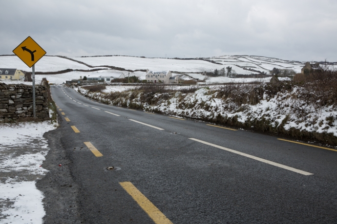
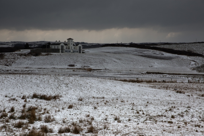
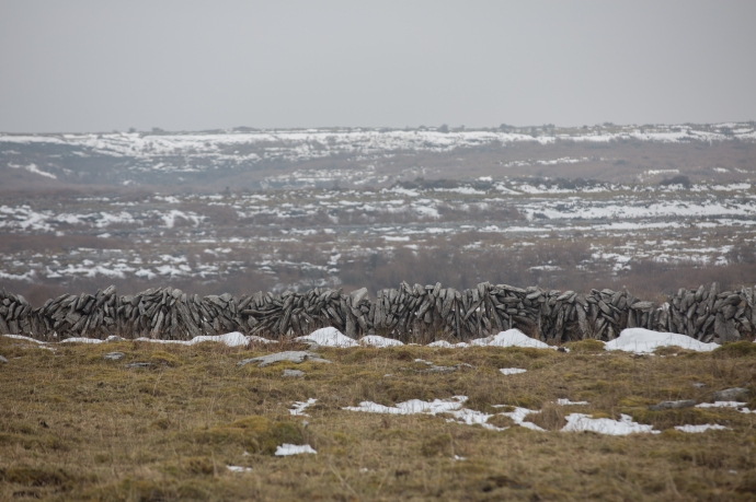
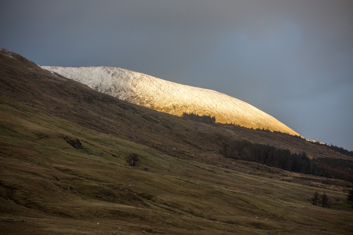
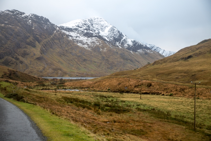
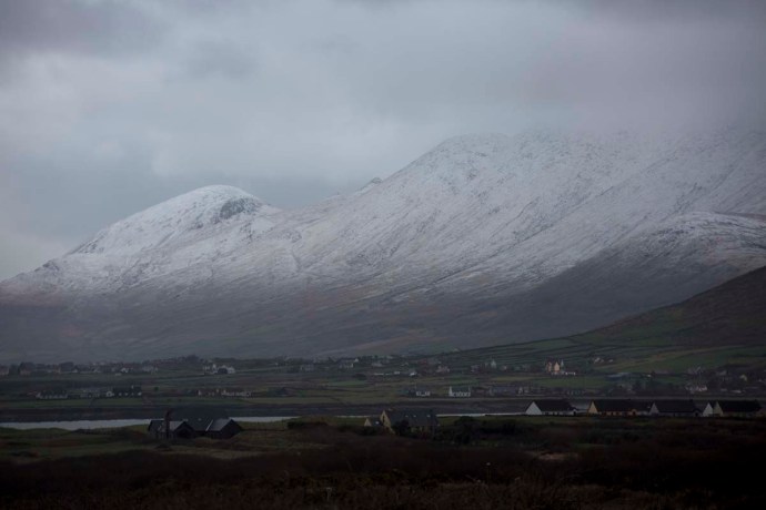
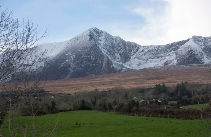
I visited Connemara at the beginning of February 2019 after an extensive snowall and having mentioned this to a friend, and how beautiful it was, I was surprised at her response.  “What did I mean by beautiful? Was it just the snow?”

I hadn’t really thought about it; it just was.  I could have just quoted the Oxford definition – ‘pleasing the senses or mind aesthetically’ but that would have been too glib. For millenia philosophers and poets have struggled with the notion of beauty so who am I to think I can explain it, but I felt obliged to respond and to try to put my thoughts into words.

So what did I mean by beautiful?

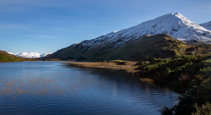
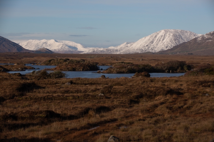
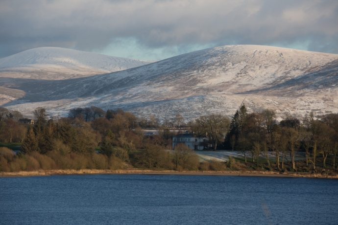
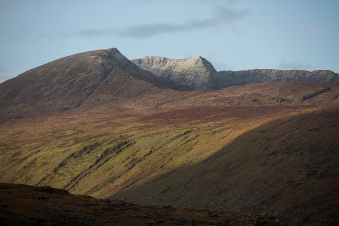
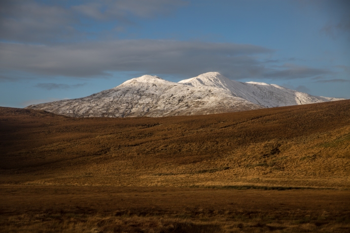
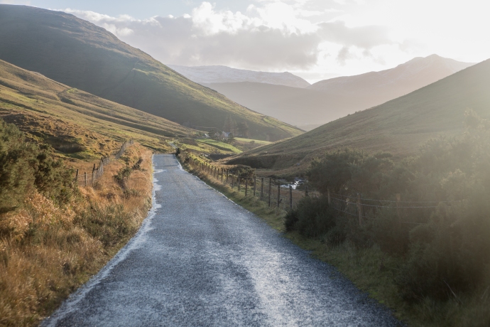
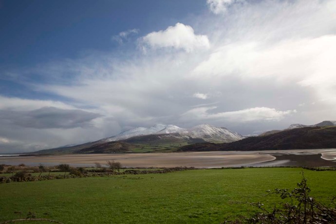
I just love snow so of course that was part of it but it was a lot, lot more.  I’ve been to Connemara many times and each time it has presented a different face.  And each time I have loved it, but it is notorious for its bleak, drab weather; rain and fog has been the norm in my experience.  Never, for me, have the Gods conspired to produce such sheer perfection as this paraticular weekend.  A world that defies description and conditions attuned to capture every nuance of the landscape.  The mountains of Connemara, the Twelve Bens, have a sublime beauty at any time, but when covered in snow they are dizzyingly so.  And this was no ordinary snow.  Locals I talked to said it’s like this perhaps every ten years.  The purest white.  But what was so special was that the weather, the light and the landscape were in perfect harmony.  That’s what I mean by beautiful.

Let me explain a bit more.

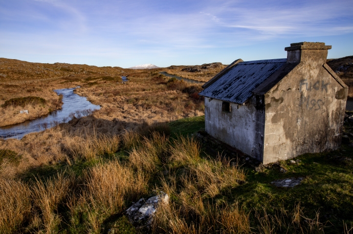
On the Friday I travelled from Oughterard through Maam Cross to Letterfrack.  Taking in Lough Inagh and Kylemore Abbey. A continually moving image of the bluest of lakes, snow-covered rocky mountains, treeless bogs with tussocky grass, or rubble-strewn fields of boulder granite and cascading streams.  All illuminated by the low winter sun, with not a trace of haze, giving an extraordinary light, and enabling capture in my photos of every detail against an endless, azure, cloudless sky.  It was cold; the temperature hardly getting above 0°C, but around every corner I had to stop the car, rug up and get just a bit closer.

taster-8083-2

Levallinee, Connemara, Co Galway.

Lough Inagh-

Lough Inagh, Connemara

Lough Inagh-8163

A morning stroll

Lough Inagh-8172

Lough Inagh

Lough Inagh-8239

Monarch of the Glen

Lough Inagh-8241

Happy sheep

Lough Inagh-8463

May the road rise to meet you.

Lough Inagh-8539

Is this really Ireland?

Lough Inagh-8573

The bridge between ice and water.

Lough Inagh-8578

Sometimes the view is better when you turn around.

Lough Inagh-8653

A Connemara winterscape.

And then there was the beautiful Lough Kylemore and Kylemore Abbey.

kyleomore-8256kyleomore-kyleomore--2kyleomore-8336kyleomore-8390

Later that day I headed back east on a little travelled road that takes you across the middle of Connemara from Garroman to Inver.  The locals call it ‘The Bog Road’.  A tundra-like land of grassy plains, granite tors, lakes and bulrushes, turf cutting and the mighty Twelve Bens Range ever-present to the north.  A different beautiful.

Bog Road--2

Lough Avally iced over. A reflective scene

Bog Road-8673

Lough Nacoogarrow near Garroman

Bog Road-8698

The legacy of the turf cutter

Bog Road-8780

Cottage on the Owengowla River.

Bog Road-8826

Lougharnillam and the Owengowla River

Bog Road-8836

One Twelfth of the Bens

Bog Road-8844

Bog, lake, river and mountain. One of the prettiest views in Ireland?

Bog Road-8888

Another view of Lougharnillam and the Twelve Bens

Bog Road-8920

Lough Avally near Derryrush. Walking on thin ice.

Bog Road-8966

Winter colour.

Bog Road-8984

Where the plain meets the mountain

As the end of this extraordinary day approached and I took a little time to reflect at Inver on the southern shore of Connemara and watch the sun light up the clouds and the sea. Beautiful.

Bog Road-9053Bog Road-9074

Never far from the music I stayed with some friends at nearby Camus.  There is nothing on this planet sweeter than the sound of two fiddles.  More beautiful. Thanks Bridge.

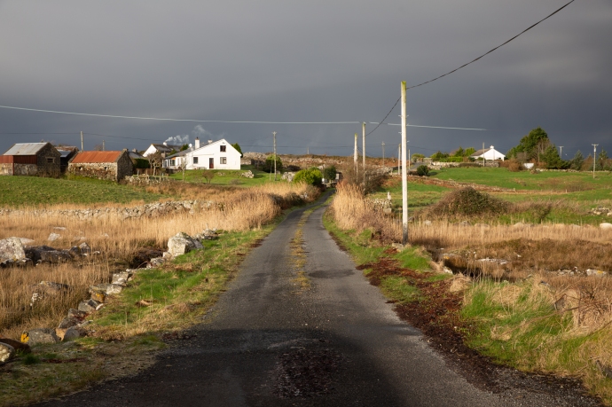
That should have been enough but I was ready for another course of Connemara’s extraordinary visual degustation. Predicted showers saw me resist a return visit to the mountains and, following Bridge’s advice, I headed to the coast for a taste of what she calls the ‘real’ Connemara.  With unfamiliar names like Annaghvaan, Lettermore, Gorumna, Lettermullen, Furnace and Crappagh I travelled this string of rugged, unforgiving rocky islands, linked by causeways; so wild it was left out of the Wild Atlantic Way. I just loved it. Met Éireann was spot on though. Storms rolled in from the north bringing snow, sleet and hail and then just as quickly disappeared over Galway Bay.  The stunning landscape with its sculpted coastline and quiet inlets, ice covered mirror-blue loughs, stone walls, thick bogs, neat cottages and rocky fields creates a frowzled, disorderly wildness. Framed always by the serenity of the snowy mountains to the north. The interplay of black clouds, dappled sunshine and an extraordinary pallete of rich colours made for vistas that would have defied the painter. Truly beautiful.

ring-9206

The Ring near Camus

View north from Camus Hill.  Storm rollin in

View north from Camus Hill. A storm rolling in

The Twelve Bens completely blacked out.

A Connemara scene. The Twelve Bens completely shrouded in black cloud.

One minute before the snow and rain hit.. South of Camus

One minute before the snow and rain hit.. South of Camus

A Connemara cottage.  snow

A Connemara cottage under a light dusting of snow

Swans fishing through the ice.  Carrowmore West

Swans fishing through the ice. Carrowmore West

The storm has passed

The storm has passed.

Snow on ice. lake at Carrowroe West.

Snow settles on the ice over this lake at Carrowroe West.

Near Carrowroe West

Home sweet home. Near Carrowmore West.

Looking from Lettermore to Annaghvaan

Looking across the estuary from Lettermore to Annaghvaan

The estuary at Lettermore

The estuary at Lettermore

A cottage near The Hooker Bar on Annaghvaan Island

A cottage near The Hooker Bar on Annaghvaan Island

Cottage on teh island of Furnace.

Cottage, walls and a boreen on the island of Furnace.

Last post-2

A small iced lake at Derrynea, near Carraroe. Completely frozen over at 3:30 pm still.

Last post-0083

Lough Awilla on the island of Gorumna. [sounds like a kingdom in Game of Thrones] The ice is thawing. Twelve Bens in the distance.

Lough Awalia, Gorumna Island.  Bulrushes in ice,.

Lough Awalia, Gorumna Island. Bulrushes poke throught the ice.

Reflections on the ice. Loch Awalia,.  Handful of stones.

Reflections on the ice. Loch Awalia,. The handful of stones I threw rest on top of the ice.

Breaking the ice.

Breaking the ice.

Last post-9575

A Connemara granite wall incorporates existing granite boulders.

Last post-9677

The island of Lettermullen. Glowing in the afternoon sun

Lettermullen from Crappagh

Lettermullen from Crappagh as the rain sweeps by

Last post-9738

White cottages occupy the hills between the bogs. Lettermullen.

Last post-9801

A study in dark and light. Lettermullen.

Last post-9838

Connemara walls take everything in their stride.

Last post-9849

A thundercloud develops over the hills of Connemara

Last post-9962

…..and letterboxes.

golf-0312

The prettiest golf course in Ireland? Connemara Isles Golf Club on Annaghvaan Island.

golf-0332

The view from the Third Tee at Connemara Isles Golf Club

rainbow-

As I sorted through my images from those two days, I felt so grateful that I was able to be there, and to experience this release from the endless drabness of the Irish winter.  I got more images in those two days than a photographer should reasonably expect in a year.

That’s what I meant by beautiful.

Categories: My Journey, Wild Ireland | Tags: , , , , , , , , , , , , , , | Leave a comment

The Colorado Rockies 7. America’s Mountain. Pike’s Peak.

Pikes Peak

There are 54 peaks in the Colorado Rockies that are over 14,000 ft (4,267m). Keep in mind that the highest mountain in Australia is 7,228 ft!) There are however only two that you can drive up. Pikes Peak is one of these.  At 14,115 ft it is still only the 53rd highest mountain in North America. Nevertheless it dominates the landscape of this part of the Front Range. If you have read my last post on the Garden of the Gods you would have seen it in the distance in many of the photos.

It is also known somewhat cheesily as ‘America’s Mountain’, In 1893, Katherine Lee Bates wrote the song “America the Beautiful” after having admired the view from the top of Pikes Peak.

IG3C0650-Pano

The snow dusted Pikes Peak towering over the forest on the climb up the mountain

A 19 mile long toll road takes you off the US24 allowing you to drive to the top. Well not quite to the top this time. They were doing extensive rebuilding of the facilities so the last three miles were in a shuttle bus.  I loved the way you were given the choice to join the bus earlier if you were uncomfortable with the drive. And if you are not used to mountain roads, well it is scary. You shouldn’t underestimate the drive.  It requires a lot of concentration.  It is two lane but there are a lot of switchbacks, steep grades and with no barriers preventing drops of thousands of feet to the valley floor. And for some reason they seem to drive on the wrong side of the road.

IG3C0881

Hairpin bends on the way up the mountain.

The driver of your shuttle will probably point out the spot at Devil’s Playground, where Jeremy Foley went over the edge during the 2012 Pikes Peak Hill Climb (incredibly he and his navigator survived).

IG3C0870

The Devil’s Playground.  Near the top of the mountain.  The bollards are where rally driver Jeremy Foley left the road in 2012.  He survived unharmed.

The $15 toll will take you on an awesomely beautiful journey through different worlds with ever-changing landscapes. Firstly pine and fir forests and the calm waters of the fishing paradise, Crystal Lake.

IG3C0653

A view of the Peak through the forest

IG3C0611

Crystal Lake.  A reservoir for Colorado Springs.

IG3C0624

An idyllic fishing spot

Then through aspen groves just starting to turn and spruce forests and over the tree line to the wildness of the alpine zone and tundra with piles of bare burnt red-brown granite boulders.

IG3C0688

Leaving the Bus Station in the Shuttle near the 16 Mile point

IG3C0695

Above the tree line.  Alpine tundra and granite

IG3C0708

Granite tors covered with the previous night’s snowfall

IG3C0723IG3C0735IG3C0739

And the photo gods were hard at work as we had a snowfall the night before and plenty of blue sky and as we climbed the mountain some low cloud to add texture and interest to the images. I was in heaven.

IG3C0857IG3C0851IG3C0834IG3C0786

It was a tad cold at the top and I have to say not being used to altitude sickness, I felt all the classic symptoms, fatigue, breathlessness and headache. (same symptoms as after an all night trad session! just kidding).   None of this detracted from the thrill of being at the top of the world. At least this little part of it.

IG3C0791

The Summit

IG3C0800-Pano

The view from the Summit

That malady disappeared pretty quickly once the oxygen levels returned to normal on the descent. And anyway there were enough distractions as the descent gives another perspective as you slowly edge down the mountain in first or second gear.  In the distance was the Cripple Creek and Victor mines one of the largest gold mines in America.

IG3C0824

A view to the south towards the Cripple Creek and Victor Gold Mines

IG3C0833

Cripple Creek Mine

I was relieved and very satisfied to reach the bottom after a remarkable drive.  Well worth the $15 toll.  America the Beautiful.

Categories: America, My Journey | Tags: , , , , , , , , , , , , , , , , , , , | Leave a comment

Glengarriff, West Cork. A Blissful Elysium.

IG3C9137-2

Glengarriff sits on the upper reaches of Bantry Bay in West Cork. I was lucky enough to spend five wonderful days there last week at a Fiddle Retreat and was able to closely observe the various moods of this sublime waterway. I never actually visited the village of Glenngarriff itself, as my accommodation was tucked away on its own private estate behind the golf course; so private and so quiet that in the time I was there encountered not another soul. other than my fellow residents.

Join me on a walk through this blissful elysium.

IG3C9187

Glengarriff waters I

IG3C9120

Glengarriff waters II

IG3C9119

Glengarriff waters III

Bantry Bay is a drowned river valley (like Sydney Harbour), and its quiet, still protected waters are dotted with steep sided rocky islands sometimes capped with remnant, thick sub-tropical vegetation.

IG3C0033

A perched forest I

IG3C0098

A perched forest II

The surrounding forest of magnificent oaks birches and conifers has (where the rhododendron hasn’t taken over) a primeval under-story of forest detritus draped with mosses, lichens and ferns, in places forming a vivid green carpet.  There is a bubbling stream of crystal clear water that snakes its way down the steep slope into the Bay, cascading over the smoothed rocks and falling into occasional, inviting, pellucid pools.

IG3C9935

Moving water

IG3C9865

Still water

IG3C9834

Forest green I

IG3C9818

Forest green II

IG3C9839

Forest green III

Azaleas and camellias add colour.  This is only March and the rhododendrons can’t be far away from joining in.

IG3C9972

Lush sub tropical gardens with flax, azaleas and camelias.

You regularly sight seals cavorting on the shore.

IG3C8241

A cavorting seal I

IG3C8247

A cavorting seal II

The scene was ever-changing. One moment bathed in brilliant sunshine, then heavy cloud.  Frigid weather brought some light flurries of snow flakes drifting to the ground but not settling and then blue skies brought out the singing birds.  A Great Tit in an oak tree near the house harmonising with the sweet sounds of the fiddle coming from inside.

IG3C0080

Sunshine one moment

IG3C0277

Snow the next

IG3C0102-2

The sun brings out the birds.  The Great Tit.

Another wonderful hidden gem in beautiful West Cork.

Categories: My Journey, Wild Ireland | Tags: , , , , , , , , , , , , , , , , | 1 Comment

The Big Freeze. March 2018. My Story.

What an extraordinary event.

Gotta say I’m not used to snow.  Not used to the feeling of flakes on your face or the biting wind or the stunning beauty when the sun comes out.  Or the slushy wetness that soaks through your boots and trousers and gets tramped through the house.  Or digging the snow from your front door. Or being stuck in your house. Or the vicissitudes of stupidly taking a remote boreen just as a snow shower starts.  I’ll come back to that last one later.

The snow came from that annoyingly named freak weather condition known as ‘The Beast from the East’ which blasted frigid air across continental Europe and over Ireland. It arrived in West Clare on a Wednesday, the last day of February 2018. But it turned out that that was just an entree to a full three course meal which came Thursday and Friday and continued to Sunday.

But first this ‘Beast’. Where did it come from? And why was it so devastating? As a geologist I make a pretty poor meteorologist but those that do know about these things said the whole thing was triggered by a periodic event called “sudden stratospheric warming”. This involved a huge rise in air temperature of around 50ºC in an area about 30 km above the Arctic (the stratosphere).  The origin of this actually goes back to severe cyclones in January in the Pacific disturbing global weather patterns. A true ripple effect. Anyway, this warming weakened the jet stream and forced cold air from western Russia towards Ireland.  Temperatures on the ground in the Arctic were 20ºC above normal, while Europe experienced lows of -15ºC in many places.  And then to complicate it there was Storm Emma which headed north from Portugal.  When it hit the cold air, blizzards, gales and snow were the result.

Where I could, I tried to record the event with my camera and words. Here is a personal account of how it all unfolded around my little part of West Clare.

Wednesday 28th February 2018

We knew it was coming. Temperatures had been way below normal for days and the web was alive with warnings.  Yet I had no idea exactly what was in store. Just two weeks earlier I was chasing all over Ireland to Louth and Armagh and Kerry and Wicklow and Connemara because of snowfalls there. Now it was here in my front yard.  It was snowing when I awoke and it continued to snow.  I was excited enough to venture out around 9am.  The snow wasn’t heavy; just a few centimetres so I figured there would be no real problems except that is that the weather accompanying this snow was truly living up to the appellation that is the ‘Wild Atlantic Way’.  I headed to Spanish Point Beach, braving snow showers and bitter wind.  I’ve seen this beach battered with giant waves, covered in froth and foam and perfectly still with nary a ripple. Never though with white snow meeting the yellow sand. It was not comfortable as mini blizzards would sweep in between the sunshine. Nevertheless I was totally entranced and happy.  The showers faded during the day and though the temperature hardly went above zero, the snow melted by the late afternoon and the streets of Miltown Malbay returned to relative normality. This turned out to be a temporary reprieve.

IG3C3178

Snowstorm on Spanish Point Beach. Wednesday 28 February 2018

IG3C3177

Spanish Point Beach, Wednesday 28 February 2018

IG3C3219

Bell Bridge House Hotel.  Wednesday 28 February 2018

IG3C3253

Mouth of the Anagh River.  Looking across to Caherush.  Wednesday 28 February 2018

IG3C3259

Bridge over the Anagh River.  Wednesday 28 February 2018

IG3C3274

Spanish Point Beach. The sun shone briefly.  Wednesday 28 February 2018

IG3C3296

Spanish Point Beach.  Looking from the Armada Hotel.  Wednesday 28 February 2018

IG3C3348

The Clogher Road.  Looking towards my cottage.  Wednesday 28 February 2018

IG3C3371

Caherush.  Low tide. Wednesday 28 February 2018

IG3C3377

Mutton Island.  Wednesday 28 February 2018

IG3C3398

Caherush looking towards Quilty.  Wednesday 28 February 2018

IG3C3231

Miltown Malbay  Wednesday 28 February 2018

IG3C3236

Miltown Malbay.  Wednesday 28 February 2018

Thursday 1st March 2018

I woke up reluctantly poking my head above the sheets with the temperature hovering at -4ºC.  A quick look out the window showed a complete white-out. It was a stunning sight. I love how you don’t know it’s happened during the night. So quiet unlike a rain storm pelting on the slate roof and rattling the windows.

The rocks and cliffs of the bay at Caherush were covered with a thick white carpet and it was still snowing with some vigour.  Around 9am it brightened and it stopped snowing.  I rugged up and took a walk up the Clogher Road.  I was joined by the neighbour’s dog, Valdo.  Briefly. This was much too exciting;  he had better things to do and left me to my meandering. The sun broke through the clouds and its rays made the hills gleam.  My neighbour Michael Talty, stopped his car for a chat. He was heading to Kilrush for some tractor parts. A farmer doesn’t stop for a bit of snow.  So of course I didn’t refuse the invitation to join him. I think he quickly regretted it as I had him stop at Quilty where the snow, the water and the sand united to create a magic world. Mutton Island sat like an iceberg off the coast. I had to photograph them.

As we left Quilty and headed south, there was only a light dusting over the fields. This part of West Clare had escaped the heavy falls that we had experienced. Business done, followed by an hearty breakfast in Kilrush we headed back north to Caherush.

We were passing O’Looney’s lovely pub just a few kilometres from Quilty at Molosky. Stop! I exclaimed as I caught a sight, out of the corner of my eye, of the falls at the Annageerah River. They were frozen! Michael waited patiently as I clambered over a gate and headed across a slushy snowy field to photograph the incredible sight of ice sheets draping the rocks and icicles clinging to wherever they could; where normally water flows. So lucky to see it.

Back home to the Clogher Road which by now was starting to thaw.  It was 2 pm and still -1ºC. The temperature never got to zero during the whole day

Encouraged by the condition of the roads on our journey, I cleared the snow from the car and headed north through Spanish Point along the coast towards Lahinch. The air was clean and crisp and the sun was making a good fist of doing its daily job but the thick cloud resisted. Nevertheless the bucolic landscape had become a patchwork of white fields and the coastline was now the White Cliffs of Clare. The views coming into Lahinch were unfamiliar but truly jaw-droppng. Though thick here across Liscannor Bay the fields were green. The snowfalls were obviously quite patchy.

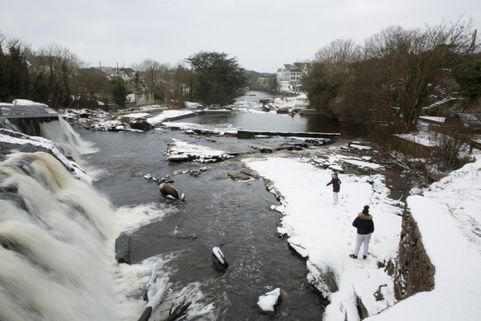
I continued to Ennistymon. I wanted to see the Falls here.  Would they be frozen?  Well no they weren’t and they were quite subdued, as we hadn’t had a lot of rain for a week or so but they were framed with snow on every exposed rock with icicles hanging from branches and protected crags. The Falls Hotel looked like an alpine resort

A few flurries of snow were appearing now. I love that word ‘flurries’. Not one you get to use very often. Time to head home. Why didn’t I just stick to the main road? It had been treated with salt and grit and was perfectly clear. I was lulled I think into a false sense of safety. So with the help of Google, I took a back route to Miltown Malbay, it wasn’t long before I got into serious trouble. It was only a small hill. A narrow single lane boreen. With a hedge on the left and a ditch on the right. I knew I had to use a high gear and travel at a decent clip but I lost traction very quickly and found myself half way up the hill and going nowhere. Under the snow was a layer of ice. With wheels spinning I couldn’t go forward. With no brakes, reversing was pretty scary. I honestly don’t know how I got out of that. Reversing back down the hill and using the gears to slow down, the wheels went wherever they wanted.  One minute I slid into the hedge. Straightening up then I would head towards the ditch. It was probably only 200m of reversing first down the hill then back up another but it took forever until I came to a farm gate. The drama still wasn’t over as it took many goes slipping and sliding all over before I edged the nose of the car into that refuge and was able to turn around and drive home. To my warm fire and a few relieving tunes and a glass of the small.

That was some day but the wires (as we used to call it before the wireless world took over) were full of dire warnings of another storm. Emma was arriving and would collide with the Beast and batter us with wind and massive snowfalls. Code Red all over the country.  Bread and milk had disappeared from the shops. This really was serious.

IG3C3484-Pano

Panoramic view of Caherush bay.  Thursday 1 March 2018

IG3C3462

Caherush Bay at low tide in the snow.  Thursday 1 March 2018

IG3C3459

My cottage on the shore. Thursday 1 March 2018

IG3C3496

More snow.  Thursday 1 March 2018

IG3C3504

Caherush Bay Thursday 1 March 2018

IG3C3546

Mutton Island.  Thursday 1 March 2018

IG3C3547

Sugar Island and Quilty. Thursday 1 March 2018

IG3C3590

The sun breaks through. Thursday 1 March 2018

IG3C3624

Joined on my walk by Valdo.  Thursday 1 March 2018

IG3C3627

Joy.  Thursday 1 March 2018

IG3C3628

Looking down the Clogher Road.  Thursday 1 March 2018

IG3C3664

Driving into Quilty.  Thursday 1 March 2018

IG3C3667

The Quilty Shore I.  Thursday 1 March 2018

IG3C3672

The Quilty Shore II.  Thursday 1 March 2018

IG3C3675

Quilty Shore III.  With Mutton Island in the distance.  Thursday 1 March 2018

IG3C3716

Breakfast at Kilrush.  Thursday 1 March 2018

IG3C3739

The snow falls again at Annagreenagh Falls, near Quilty.  Thursday 1 March 2018

IG3C3758

Annageeragh Falls.  Thursday 1 March 2018

IG3C3764

Annageerah Falls.  Thursday 1 March 2018

IG3C3818

View towards Cliffs of Moher from Spanish Point.  Thursday 1 March 2018

IG3C3828

Near Spanish Point.  Thursday 1 March 2018
IG3C3877

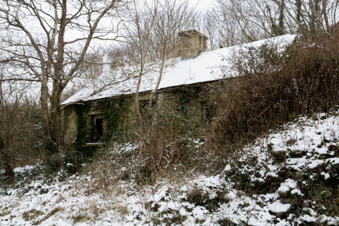
Near Lahinch.  Thursday 1 March 2018

IG3C3890

Lahinch. Thursday 1 March 2018

IG3C3899

Moy House.  Lahinch, Thursday 1 March 2018

IG3C3909

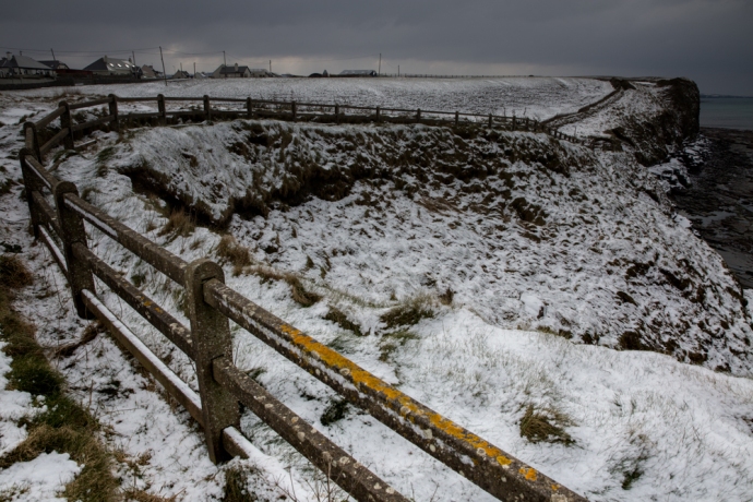
Cliffs south of Lahinch.  Thursday 1 March 2018
IG3C3920

Fenceline and cliffs.  Lahinch. Thursday 1 March 2018

IG3C3945

Lahinch. Thursday 1 March 2018

IG3C4008

The Falls at Ennistymon. Thursday 1 March 2018

IG3C4048

Falls at Ennistymon.Thursday 1 March 2018
IG3C4142

Looking towards the Falls Hotel on the Inagh River at Ennstymon.Thursday 1 March 2018

IG3C4199

Icicles I .  Ennistymon.  Thursday 1 March 2018

IG3C4225

Icicles II.  Ennistymon.  Thursday 1 March 2018

IG3C4352

Icicles III.  Ennistymon.Thursday 1 March 2018

IG3C4248

Icicles IV.  Ennistymon.Thursday 1 March 2018

IG3C4110

Icicles V.  Ready to drop.Thursday 1 March 2018

IG3C4377

Frozen grass on the menu today. Lahinch. Thursday 1 March 2018

Friday.  2nd March 2018

It would reek havoc they said.  And they were right about that! Friday morning saw a thick cover of snow over everything with drifts up to a metre. We, in Clare though,  seemed to get off rather lightly. The east and the south of the country were lashed with ferocious snowstorms. Back here in Clare, snow piled up against my door, just like in those movies set in countries where they have real winters.  It was obvious I was going nowhere today, so I settled in with a warm fire to wait it out. Even if I wanted drive anywhere the Clogher Road was not going to cooperate. It continued to snow all day. I ventured out in the late afternoon as the snow eased. The tide had come in and the ocean was tranquil with the bay in front of my house looking surreal with its brilliant white ‘beach’ all the way down to the high tide mark. The car remained in a drift and I went nowhere. No thoughts of a session and in any case most pubs were shut. Marooned. Like millions of others across the Once Green Isle.  Who knows how much fell? I heard a figure of 40cm but I would say much more in some places.  At least it had stopped.

IG3C4451

My cottage.  Marooned.  Friday 2 March 2018

IG3C4467

Going nowhere.  Friday 2 March 2018

IG3C4490

The Clogher Road.  Friday 2 March 2018

IG3C4530-Pano

Caherush Bay at high tide.  A surreal calmness.  Friday 2 March 2018
IG3C4401

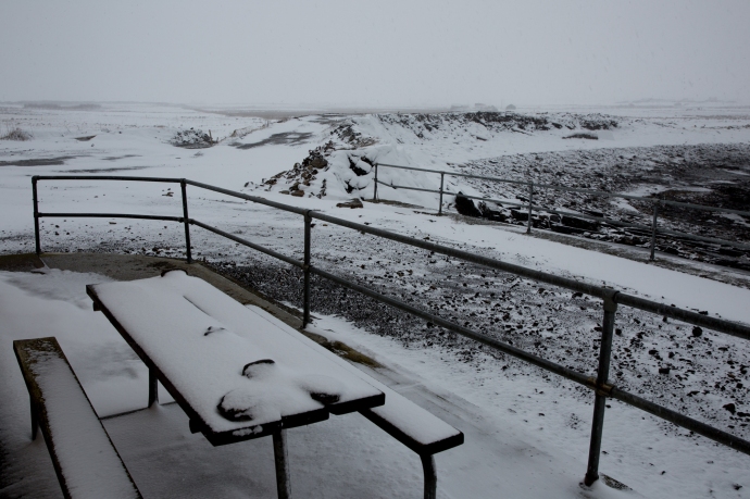
My front patio.  Friday 2 March 2018

IG3C4406

The ‘beach’ at Caherush.  At my front door.  Low Tide.Friday 2 March 2018

IG3C4435

Caherush. Friday 2 March 2018

IG3C4499

The ‘beach’ at Caherush.  At my front door.  High Tide. Friday 2 March 2018

IG3C4515

The Clogher Road.  Friday 2 March 2018

Saturday. 3rd March 2018

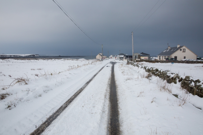
More snow overnight but by the morning all was quiet. Temperatures were up now with a maximum of 2ºC for the day. A veritable heat wave. I was still going nowhere. The predicted rain didn’t arrive but by the afternoon I decided the snow on the roads had started to melt sufficiently to venture out again. Roads had a lot of snow in massive drifts, sometimes two metres high, and in many places were down to one lane. Those roads that were treated were passable but venture off the main roads at your peril. I’d learnt my lesson.  Most residents who live up narrow lanes were were still stuck.  My route again took me to Lahinch and Ennistymon.  The snow was still thick and extensive but the melt had started.  Lahinch golf course was more whites than greens and it was easy to become blaze about the stunning beauty all around.  Snow was still everywhere in Ennistymon, Lahinch and Miltown but the ploughs had been through and it was now more of a hazard to pedestrians.  Businesses were starting to reopen.  Life goes on.
IG3C4576

The Clogher Road is now passable. Saturday 3rd March, 2018

IG3C4599

Welcome to Quilty Holiday Cottages.  Saturday 3rd March, 2018

IG3C4631

The Bell Bridge Hotel and beyond.  Spanish Point.  Saturday 3rd March, 2018

IG3C4644

Caherush.  Saturday 3rd March, 2018

IG3C4651

Behind the Strand.  Clogher Road.  Saturday 3rd March, 2018

IG3C4658-Pano

Panoramic view of Surf City Lahinch.  Saturday 3rd March, 2018

IG3C4667

Ennistymon. Saturday 3rd March, 2018

IG3C4725

Blake’s Corner. Ennistymon.  Saturday 3rd March, 2018

IG3C4752

The Inagh River and Ennistymon.   Saturday 3rd March, 2018

IG3C4767

The old Railway Bridge over the Inagh River,  Ennistymon.  Saturday 3rd March, 2018

IG3C4789

Lahinch. Saturday 3rd March, 2018

IG3C4810

Snow dunes, Lahinch.  Saturday 3rd March, 2018

IG3C4827

Lahinch Castle.  Saturday 3rd March, 2018
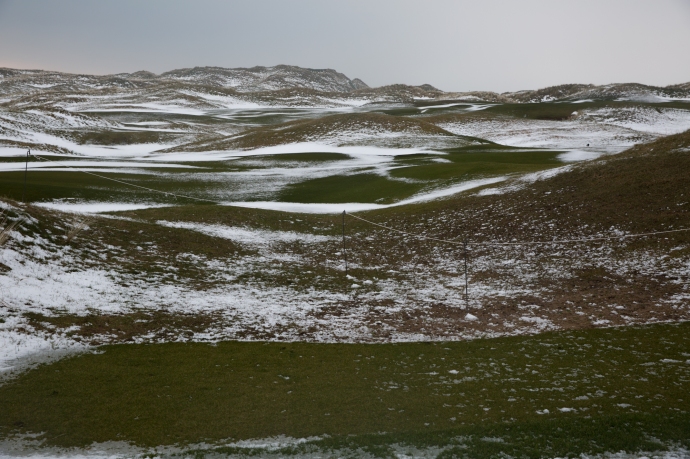
IG3C4843

The Golf Course at Lahinch..  Saturday 3rd March, 2018

IG3C4871

Lahinch  Saturday 3rd March, 2018

IG3C4875

Another view of the Castle.  Lahinch.  Saturday 3rd March, 2018

IG3C4883

The estuary at Lahinch. Saturday 3rd March, 2018

IG3C4892

Snowy hills above Lahinch Golf Course.  Saturday 3rd March, 2018

IG3C4921

Miltown Malbay.  Saturday 3rd March, 2018

Sunday.  4th March 2018

No snow last night and finally the real thaw started. It still only got to 2ºC maximum all day but the lure of a music session at lunch time in Ennis was too much for me to resist. The Clogher Road was mostly clear now. Mikey Talty was, like many, shoveling snow off the road in front of his house. I stopped for a chat.  Mikey had been living here for over 80 years. “Have you ever seen anything like this before?” I asked. “Aah yes” he said. “When I lived in the States”. 

Grinning I went on my way. Ireland does get heavy snow every few years. But not so often in these low lying coastal areas such as West Clare. The road to Ennis goes over Slieve Callan and the snow was thick in the hills and again there were drifts, metres high, meaning it was a slow trip. The music at Cruises Pub in Ennis was fantastic, with a huge crowd, desperate for a circuit breaker from the travails of the last few days. I returned about 5pm and it was still felt more like a journey through the alps rather than rural Ireland. I wasn’t ready to go home and called in at Hillery’s, for the regular Sunday evening session.  Life goes on.

IG3C4935

Mikey Talty, resident on the Clogher Road for 82 years clears away snow.  Sunday, 4th March, 2018

IG3C4937

Snow drifts on the road to Inagh.  Sunday, 4th March, 2018

IG3C4947

Heavy cover of snow remains.  Sunday, 4th March, 2018

IG3C4961

Even the windmills stopped turning.  Sunday, 4th March, 2018

IG3C4966

Lonely cottage at the food to Slieve Callan.  Sunday, 4th March, 2018

IG3C5172

Switzerland? or Ireland?  Sunday, 4th March, 2018

IG3C5183

The boreens were starting to clear.  Sunday, 4th March, 2018

IG3C5207

Looking forward, looking back.  Mt Callan.  Sunday, 4th March, 2018

IG3C5100

Enjoying the craic at Cruises Pub in Ennis.  Sunday, 4th March, 2018

IG3C5229

The snow melts in the fields on the Clogher Road.  Sunday, 4th March, 2018

IG3C5232

Caherush.  The rocky bay is returning to normal  Sunday, 4th March, 2018

IG3C5237

Almost gone.  Sunday, 4th March, 2018

Monday, 5th March 2018.  

It wasn’t quite over yet. Still the predicted rain never arrived and most of the snow on the lower ground had retreated but I knew it was still lying in the uplands.  Maybe the Burren would be worth a visit.  I wanted to see it.   Temperature was still around 2ºC in the morning as I set out but by the end of the day it had risen to 5ºC.  So I drove to Poulnabroun and then to Ballyvaughan and back through Carran.   It took all day.  It was cloudy and misty so not ideal but walking in the stillness of a snowy Burren was something truly special.  So quiet with hardly a soul on the road and those that were seemed to be heading somewhere else. A privilege to see it like this. I encountered a few busloads of tourists and they like me were the lucky ones.   The dolmen at Poulnabourn was looking resplendent and I viewed the wonderful stone walls literally in a different light as they stood out framed by the whiteness of the snow and the sky.  See if you agree with me.  The hills actually had a lot more snow than was apparent from a distance with the clints and grykes retaining the snow where it had melted elsewhere.  The Turlough at Carran, a wondrous geological feature  had plenty of water, though much of it appeared to be covered with ice. I imagine a couple of day earlier you might have been able to walk across it. By the way turlough, along with drumlin and esker are the only three words of Irish origin that I know that are  used worldwide as geological terms.  Thick snow was still on some of the Lanes but the snow ploughs were out and about so I imagined most would be passable.

The event that had dominated Irish lives, closed schools, airports highways and even pubs, isolated people for days and created timeless memories was over.

And that seems a good place to end this story.

IG3C5243

Plenty of snow on the way to the Burren.  Monday, 5th March 2018.  

IG3C5261

Poulnabroun Dolmen.  Monday, 5th March 2018.

IG3C5282

Poulnabroun Dolmen.  Monday, 5th March 2018.

IG3C5316

Near Poulnabroun Dolmen.  Monday, 5th March 2018.

IG3C5351

Burren scene.     Monday, 5th March 2018.

IG3C5378

Burren.  Monday, 5th March 2018.

IG3C5388

Burren.  Monday, 5th March 2018.

IG3C5419

Burren.  Monday, 5th March 2018.

IG3C5462

The tourists still come.  Monday, 5th March 2018.

IG3C5518

Burren. Monday, 5th March 2018.

IG3C5568

On the way to Carron. Monday, 5th March 2018.

IG3C5580

Still heavy snowdrifts.  Monday, 5th March 2018.

IG3C5589-Pano

Carran Turlough.Monday, 5th March 2018.

IG3C5599

The Turlough. Much of it is still frozen.  Monday, 5th March 2018.

Here are some pictures of those wonderful stone walls:

Tuesday 6th March 2018

I thought I had finished this blog but it was much brighter this morning and by the afternoon the sun was returning.  The temperature soared up to 7ºC.  Out my kitchen window the paddocks were pretty much free of snow.  Not Mt Callan.  It looked glorious (despite those windmills) with patches of sun glistening off it.  I had to go up and take a closer look.  There was plenty of snow so, sorry, a few more pictures.

Almost a week.  A week I won’t forget.

IG3C5625

Mt Callan.  The view from my kitchen window. Tuesday 6th March 2018
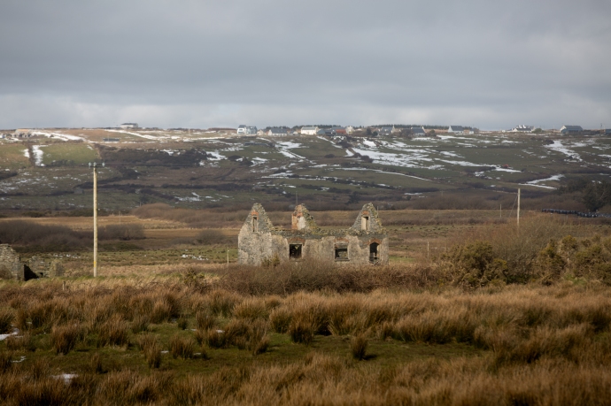
IG3C5639

Ruined cottage.  Road to Mt Callan.  Tuesday 6th March 2018

IG3C5642

Behind Miltown Malbay.  Tuesday 6th March 2018

IG3C5644

Mt Callan. Tuesday 6th March 2018

IG3C5656

The Summit.  As close as I could get.  Tuesday 6th March 2018

IG3C5679

Abandoned barn.  Mt Callan. Tuesday 6th March 2018

IG3C5693

The roof of the world.  Tuesday 6th March 2018
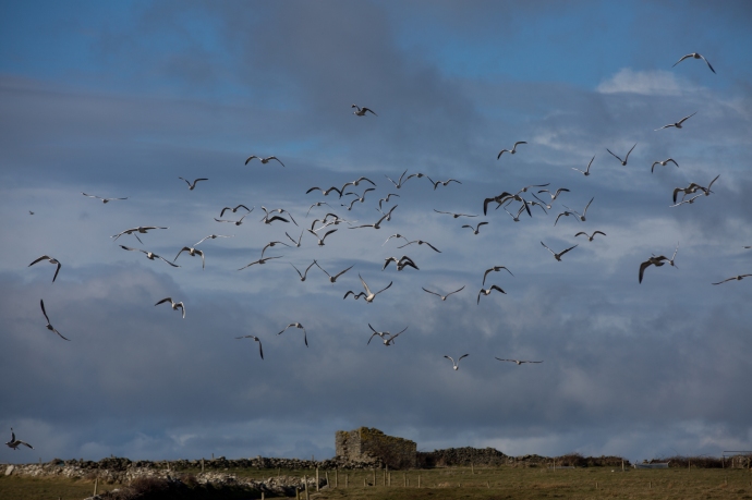
IG3C5717

Situation normal.  The gulls have returned to Caherush.

IG3C5708

A bird’s eye view.  Tuesday 6th March 2018

Categories: Real Ireland, Wild Ireland | Tags: , , , , , , , , , , , , , , , , , , , , , , , , , , , , , , , , , , , , , , , , , | 6 Comments

One Day. Six Counties. A Winter Tour through East Ireland

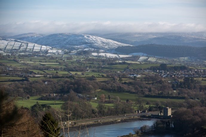
It’s a long drive from West Clare, my base in Ireland, to Carlingford in County Louth.  In fact it is across the country from one coast to the other.  So when you get there you want to maximise the time. Early in February a small festival known as Feile na Tana is organised by renowned fiddler Zoe Conway and she manages to attract some of the finest traditional musicians in the country.   I posted on this festival on my blog a couple of years ago (here) and nothing much has really changed.  Centered on instrument workshops the focus of the festival is on reaching out to the young and to try and restore and invigorate a once strong musical heritage on the edge of Ulster. The other thing I love about coming to Louth, the smallest county in Ireland, is that it and the neighbouring counties of Armagh and Down has unrivaled beauty and such unique landscapes, geology, ancient archaeology and recent history.   I relished the chance to explore this while playing music at the same time.

I was blessed on a number of accounts this time.  The weather was relatively fine (let me translate: ‘it didn’t rain’) and I found a marvelous place to stay through AirBnB.  Eve, another expatriate drawn to leave her life in the US behind and put down roots in Ireland, was the perfect host.  With views toward the Mountains of Mourne and in the shadow of Slieve Foy, I could come and go, I could practice the fiddle or settle down by the fire. And then she was instrumental in convincing me to stay an extra couple of days to experience the coming snow.  Thanks Eve.  I was well rewarded for that decision.

And that’s what I want to talk about in this blog.

IG3C1568

Looking from Louth across to the Mountains of Mourne

IG3C1572

Slieve Foy near Carlingford

IG3C1626

Carlingford nestled at the foot of the Cooley Hills

Coming from the Land of the Midday Sun (I’ve just renewed my Poetic Licence!) I have little experience with snow.  Except that I love it and the spectacular images that may result if the light is right. This lack of experience however led to some interesting learnings about coping with ice and snow on the road

In West Clare when it rains or hails you certainly know about it. The sound of the rain on the slate can be deafening. Here if it snows at night you sleep through the silence. The flakes drift to the ground steadily and quietly building up anywhere where gravity is only mildly resisted.  This is what happened on the Monday night. After an unusually undisturbed night snuggled up with the thoughtfully provided electric blanket (surprisingly unusual in an Irish BnB),  I looked out the window in the morning, with no great expectation, but was dazzled by brilliant blue sky and a sparkling carpet of fresh white powder. And remember I was at sea level.

I had a loose plan. I would take the ferry across the Carlingford Lough to County Down and explore the Mountains of Mourne, which I could see from the window of my second story bedroom.

IG3C1593-Pano

Looking across the Lough from Greenore towards the Mountains of Mourne

IG3C1666

View across the Carlingford Lough to the town of Warrenpoint

IG3C1670

Another view across the Carlingford Lough to the town of Warrenpoint

However the best laid plans. The ferry was closed for ‘adverse’ weather conditions. Hardly surprising really with a strong wind now making life difficult and whipping up the waters of the Lough. In Ireland you always have to have a Plan B, so I drove north towards  Slieve Gullion.   Lucky really as in retrospect driving through County Down would have been treacherous.

My vague plan was to revisit some spots on the Ring of Gullion but really I was dictated by which roads were passable.  I had earlier spent a couple of days exploring this stunning area of South Armagh .  A blog on this is on the way.  I was curious to see what this ancient world looked like under a white blanket.  My route took me through Carlingford to Omeath and up to Flagstaff Hill. Mistake. There were stunning views on the way up.   But.

IG3C1638

The Cooley Hills between Carlingford and Omeagh

IG3C1657

Rock and Ice

IG3C1696

View across the Newry River to County Down on the way up to Flagstaff Hill.  The tower house on the River is the Narrows Keep and the site of the most deadly attack in the Troubles, by the Provisional IRA in 1979, which killed 16 British paratroopers.  

My car struggled to deal with the icy hill and only after some hair raising moments did I make it to a relatively ice-less part of the road to pause.  Up ahead the road continued to climb with even more ice and snow.  What did they say about discretion and valour?  So I did an 11 point turn and gingerly pointed the car back down the hill.

IG3C1705

IG3C1718

Flagstaff Hill is actually in County Armagh.  But are they miles or kilometres?

Having got this far though I decided to walk to the top of the hill.  So glad I did.  I actually didn’t realise that this was Flagstaff Hill which I will talk about in another blog but the snow certainly added another dimension.  Flagstaff Hill is actually in Northern Ireland.    There are no border signs so you don’t actually know.  In fact the only way you know you have passed into another countyr is that the road signs and Google Maps switch to miles.  Honestly I can’t conceive of an hard border here.

The fine white powder transformed the green rolling hills of the elevated Cooley range into an Alpine wonderland. The biting wind and an outside temperature of 1 degree though did nothing to dampen spirits.  I actually didn’t want to leave but I was worried about how the car would handle the trip back down the mountain.

IG3C1755

View down Carlingford Lough from Flagstaff Hill

IG3C1790

View across to the Mountains of Mourne from Flagstaff Hill in Armagh

IG3C1784

Flagstaff Hill

It was nerve wracking I have to say.   Slipping and sliding with shuddering and totally ineffectual brakes I edged back down the hill to Omeath and then on to Slieve Gullion by a more circuitous and less treacherous route.

Naively I had expected to be able to drive to the Summit but luckily the road was closed because I might have been tempted to give it a go.

Thwarted again, I made my way west to a castle I had visited a couple of days earlier (Castle Roche).   Only a light dusting of patchy snow remained at this lower level but this is one of the most imposing ruins in Ireland and the patches of snow added to the mystical quality of the fortification.  I will have more to say about it in my upcoming blog on the Ring of Gullion.

IG3C1818

Castle Roche

IG3C1932

Fields surrounding the Castle

Suddenly the blue skies weren’t blue anymore and snow showers would sweep across the fields.  Not enough to settle and they were only intermittent but they reminded me how quickly the weather could change.

IG3C2010

A dark sky looms over a bucolic winter scene

IG3C2037

Moments later snow sweeps in 

IG3C2061

By now it was approaching 2 pm and  as I had to be back in Clare I reluctantly headed south.

But my adventure was not over.  Driving down the M1 towards Dublin the snow continued to blanket the cuttings along the motorway. Skirting Dublin on the M50 and then south west on the M7,  I could see plenty of snow in the distance and I just couldn’t bring myself to speed past it.

IG3C2169

Snowy hills around Kilteel in Co Kildare

IG3C2177

A rural scene in County Kildare

So so I left the Motorway at Rathcoole in County Dublin and headed east, I had never been here and had no idea where I was going. I love that.  The only thing on my mind was to get closer to those white hills.  My confused route took me through the west of  Dublin to Kildare and then crossing into the edge of Wicklow.   If anything the snow was heavier here than further north and there were unrivaled picture postcard views of snowy villages and of winter landscapes revealed around every corner.  The ranges in the distance I later discovered were the Wicklow Hills.

IG3C2118

Kilteel, Co Kildare

IG3C2134

A snow covered barn in Kilteel, Co Kildare

IG3C2192

The charming village of Rathmore, Co Kildare

IG3C2220

Great weather for sheep.  Co Wicklow.

IG3C2240

Abandoned farm buildings, Co Wicklow

IG3C2271-Pano

Co Wicklow

IG3C2303

Co Wicklow

IG3C2312

Co Wicklow

IG3C2314-Pano

Something was drawing me on but common sense intervened.  As the bright blue sky turned orange with the disappearing sun, and darkness descended, I headed back to the Motorway.  Continuing to Limerick, as if to tease me in the fading light, drifts of snow reflecting in my headlights, continued to tantalise .

A marvelous day and indeed a rare day and I think I took full advantage.  I manged to experience and observe snow-draped winter terrains under largely blue skies across Six Counties – Louth, Down, Armagh, Dublin  Kildare and Wicklow.

Special.

Categories: My Journey, Real Ireland, Wild Ireland | Tags: , , , , , , , , , , , , , , , , , , , , , , | Leave a comment

As I was Going over the Cork and Kerry Mountains. Part 2. The Gap of Dunloe. December 2017

As I was Going over the Cork and Kerry Mountains……

Recently I posted on the spectacular Killarney National Park.  Though the blog only saw the light of day in December it related to a trip completed in June.

Now six months later I had the notion to revisit these mountains.  Storm Caroline had dumped snow all over Ireland so I wanted to see the National Park covered in white.  In this regard I was disappointed.  It seemed the show was restricted to the north and the very highest mountains,.  So I didn’t linger along the road from Killarney to Moll’s Gap, the road I covered in my previous blog (Part 1).  It certainly put on a different face.   Firstly hardly a tourist.  I was the only car at the Ladies View.  Indeed I was almost the only car on the road.  No buses and this time my brakes worked.

Funny how you miss things.  But last time I didn’t see the ruins of the castellated Musgrave Barracks of the Royal Irish Constabulary right on the edge of the road.  The lush green forests I talked about last time were not so welcoming with the now leafless trees.  There was still in many places the carpet of mosses covering the land, that impressed me so much in June.  Sometimes as if a green billiard cloth had been draped over the rocks

I decided to explore the Black Valley and the Gap of Dunloe which runs up the western side of the National Park and maybe head into the higher mountains.  Good decision but unrealistic timewise.  It was bitterly cold and and walking was not particularly inviting but it was truly spectacular even from the roadside and I just kept stopping so I ultimately ran out of light.  Just past Moll’s Gap on the inland road to Sneem (Not the Ring of Kerry) you see a small single lane road to the right.  No sign of any indication where it actually went.  But as it seemed to be the only way to head into the mountains and with no Google, I took it.  The road crosses the broad glacial valley framed to the north with the snow capped ranges of the MacGillycuddy Reeks before heading back east and then cutting sharply back up to the north and over the ridge towards the Gap of Dunloe.

IG3C0260

Killarney Lakes.  view across Muckross Lake

IG3C0271

Killarney National Park.  Ruins of Musgrave Barracks

IG3C0281

Killarney National Park.  Sharing the road.

IG3C0296

Killarney National Park.  A green tablecloth.

IG3C0306

Killarney National Park.  Bare hills and bare trees.

IG3C0325

Ladies View car park

IG3C0333

View from the car park – (December)

IG3C5718

View from the car park (June)

IG3C0345

Killarney Lakes.  View of Looscaunagh Lough


IG3C0349

Heading up to Moll’s Gap

IG3C0352IG3C0363

IG3C0377

Moll’s Gap

This next series of photos were taken on the Black Valley Road.  Beautiful interplay of light.

IG3C0418IG3C0432IG3C0436IG3C0443IG3C0452IG3C0468IG3C0469

IG3C0487

This bridge heading up to the Gap of Dunloe had two passing bays due to inability to see what’s coming!

IG3C0499IG3C0515IG3C0530

This is my kind of country.  Wild, rocky, desolate and seemingly nothing living here except sheep with identifying patches of pink and purple.  The Gap itself is a very impressive break in the sandstone hills caused by a glacial breach.   It has been a famed tourist route since Victorian times. Also easy to see why the area is so popular with rock climbers. We follow along the valley of the River Loe and pass a string of lakes crossed by a number of single arch stone bridges.   The entrance to the largest of the lakes is guarded by by two giant boulders through which the road passes.  This locality known as The Pike seems little changed since the 19th century.

Just the occasional car today but I can well imagine the chaos on this one lane road with the summer tourist traffic, cars, vans, bikes, walkers and pony traps.

Go in Winter!

IG3C0542

The Gap of Dunloe looking north

IG3C0561-Pano

Another view of the Gap

IG3C0632IG3C0670IG3C0677IG3C0752

IG3C0850

The Pike December 2017

Pike-Killarney

The Pike 1888


Categories: My Journey, Wild Ireland | Tags: , , , , , , , , , , , , , , , , , , , | Leave a comment

Connemara Colours. Winter in the Maumturks.

Sometimes you get lucky.

On a Saturday late in November I made a quick trip to Galway to attend a concert in a friend’s house in the heart of Connemara. Now as readers of this blog will know I love the many moods of Connemara and relished the opportunity to spend a little time there. The weather is not always kind however.  You can expect mist on six out of ten days. But if you spend enough time in this surprising country occasionally you are well rewarded.

I had heard reports of snow but had no real expectations. I was not prepared for what awaited me though as I drove a circuitous route in and out of Galway and Mayo between Lough Corrib and Lough Mask.

Near the village of Cong (famous for its association with the Quiet Man, but I will be quiet on that for the moment),  I saw snow on the ranges to the west.  So of course I headed in that direction along the shore of Lough Mask until I reached the village of Finny.   The white shrouded backdrop above the little yellow church were now within reach.  These are part of the Sléibhte Mhám Toirc (or the Maumturks).  Not so well known as the Twelve Bens, which lie on the other side of the Inagh Valley, they are less rugged but with their brilliant white caps reflecting the sizzling sunlight they were no less spectacular.

As the sun and clouds and rain and mist fought for dominance an amazing winter palette was in full display.  Everything contributed.  The sky, the hills, the snow, lakes and rivers, stone walls, pastures and paddocks.   The snow caps would change from grey to dazzling white and then glow golden orange with the descending sun.  The sky was at once black then blue as the storm passed, the hills were orange, brown, red and green.  The country sparkled.

I was lucky and happy.  To be in such a stunningly beautiful place where a world class vista was around each corner.  And so grateful that I could capture some of those fleeting moments with my Canon.

Words are irrelevant.

IG3C8848IG3C8859IG3C8887IG3C8927IG3C8969IG3C8992IG3C9024IG3C9061IG3C9070IG3C9078-PanoIG3C9100IG3C9122IG3C9181IG3C9213IG3C9232IG3C9248IG3C9255IG3C9269IG3C9275IG3C9310IG3C9336IG3C9347IG3C9366IG3C9381IG3C9401IG3C9408IG3C9427IG3C9433IG3C9462IG3C9514IG3C9529IG3C9555-HDRIG3C9690IG3C9717


Categories: My Journey, Real Ireland | Tags: , , , , , , , , , , , , , , | 2 Comments

Dingle Peninsula. The Irish Alps

I have blogged about Dingle quite a few times and posted many photos. Even the name has a delightful ringle to it.  So what else could I possibly say about it?  But. There’s the thing about Ireland. There are always surprises and you can go back time after time and each time it’s like you’re there for the first time.

It was the end of February and my annual pilgrimage to Ballyferriter was completed (I have written about this Festival in previous years and it delivered yet again). It was time to go home. I’d been up that night until 4am playing tunes with wonderful people whose friendship is renewed every year.  That’s what’s great about Festivals.  It’s not just the music.

Anyway, during my short time in bed I lay awake listening to the wind lashing and the hail thrashing. A wild night.  Next morning it was calm and there were patches of sun, so I decided to head around the Slea Road back to Dingle, one of my favourite drives. I’d had Aidan Connolly in the cd player all weekend so it was time for a change. I stopped to retrieve a new CD and something made me look back towards Mt Brandon. I was stunned by the view. Completely shrouded in snow with Ballyferriter nestled at the bottom. This is what I saw.

kerry2_154

Mt Brandon, the third highest mountain in Ireland looms over Ballyerriter.

A quick change of plans and I headed the other way making the instant decision to return via Conor Pass.

Perhaps a little foolhardy but the weather looked ok and I doubted I would get another opportunity like this. It turned out to be an inspired decision. As I got closer to the pass the patchwork of paddocks gave way to a carpet of white.  The weather came and went in waves as I headed up the hill.   I was greeted at the top by another snowfall. But also enough sun to revel in the alpine glory. I was in the heart of the Kingdom and I had been granted admission to the Palace. I was lost for words and I really can’t describe the feeling I had immersed in this wilderness.

On this occasion I will let the camera talk. And talk it will. Loudly. Driving over the top and down Conor Pass, there were surprises with every turn in the road . I headed to the villages of Cloghane and Brandon and out to Brandon Point and then returned along the coast to Aughacasla. All the time snow clad ranges framed the views.

Please enjoy these photos of an Ireland rarely seen.

kerry2_157

The green fields of Kerry on the road up the Conor Pass, from Dingle, turned progressively whiter,

kerry2_160

and whiter,

kerry2_159

and whiter,

kerry2_167

and whiter.

dingle-4

The view from the top.

kerry2_172

Heading down the mountain

kerry2_2

Corrie lakes in the glacial valley

kerry2_10

The start of the steep bit! Or the end if you’re coming down.

kerry2_13

kerry2_14

And then…..

kerry2_18

It started to snow.

kerry2_26

It’s not easy to photograph snow.

kerry2_30

At the bottom of the pass is this view towards Mt Brandon.

dingle-1

And the light kept changing.

kerry2_34

This is still Ireland.

kerry2_38

The Irish Alps

kerry2_41

Slieveanea from the base of the Pass

kerry2_51

Approaching Cloghane

kerry2_55

A view of Mt Brandon near Cloghane

kerry2_56

Cloghane with Mt Brandon.

kerry2_57

Mt Brandon looms above Cloghane Church

kerry2_61

Mt Brandon

kerry2_66

The sun shone

kerry2_69

The road from Cloghane to Brandon

kerry2_70

looking across the bay to Beenoskee

kerry2_72

And then it was raining

kerry2_75

Fenced in

kerry2_78

The mountain disappears in the mist

kerry2_85

View from the pier at Brandon

kerry2_86

The pier at Brandon

kerry2_89

kerry2_90

Another view across the bay towards Beenoskee

kerry2_92

Incongruity.  Surfers in the bay.

kerry2_100

Colours.

kerry2_105

The village of Brandon

kerry2_109

kerry2_115

Cappagh Strand near Brandon village

kerry2_116

View across Brandon Bay and Cappagh Strand

kerry2_126

Cappagh Strand

kerry2_131

View from Cappagh Strand back towards Mt Brandon

kerry2_139

The village of Cloghane

kerry2_142

Cloghane or have I been teleported to Switzerland?

kerry2_147

The hills are alive with the sound of……

kerry2_150

A last view of Mt Brandon.

Categories: My Journey, Wild Ireland | Tags: , , , , , , , , , , , , , , , , , | 1 Comment

Winter in Ireland !

They said I wouldn’t survive the winter.

Well it’s approaching the end of January and I am still here. But I have to say that these last few weeks I have really felt what it is that everyone has warned me about. The realisation hit as I stood on the cliffs of Sleave League in southwest Donegal trying to stand up straight enough to take a photograph, wrapped in multiple layers but still feeling that wind cut through to the bone. It was a brisk 4˚C at midday but with the wind chill it was sub-zero. It was numbingly cold but the photos I took that day look deceptively pretty, with blue skies and gorgeous colours reflecting the sun off the cliffs. The camera never lies but it doesn’t always tell the full story.

And then the other day the maximum on the mercury back home in Clare was 1˚C. It was snowing across the county, indeed all over the west, but not here at Caherush on the sea.

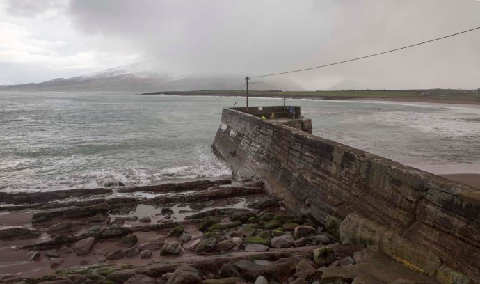
I stand outside my front door. The wind here is relentless and constant. This day you can hardly stand up as it whips the usually calm waters of the bay into a seething boiling maelstrom and further out past Mutton Island, massive waves roll in through a sea of foam and whipped up spray I can see the spray drive high over Mutton Island covering its castle as waves crash in from the west. Some intrepid gulls fight the elements to carry on with their continuous search for sustenance seemingly just hanging in the air almost enjoying the challenge as they feast on the abundant feed whipped up by the furious waters. And a handful of ducks continue to forage on the shoreline despite being buffeted hither and thither. And on the land, cattle turn their backs to the wind to provide some protection. There is no rain at the moment, in fact patches of blue appear through the clouds to tantalise and at least give an impression of warmth soon dispelled by the reality closer to the ground. I don’t stay out there long. Valdo, the farmer’s border collie runs up, stone in mouth, inviting me to play, seemingly oblivious to the unfriendliness of the elements. No walk along the shore today Valdo, that’s just a distant memory. Back inside though the house is cosy, the fire goes all day and if I’m not warm enough I sometimes turn the central heating on also. I play music. I write. I read. I watch the odd movie. And when I get bored I play some more music. My day really begins at 9pm when I head out to look for tunes, an increasingly difficult challenge.

So I am still here. My adopted countrymen can’t understand this. They see the endless blue skies of a Summer Bay Utopia and a bikini-barbecue lifestyle to match and wonder why I would want to come here. They all have relatives in Perth who will never come home. And they all want to join them there in the warmth. So why don’t I feel the same way. Don’t get me wrong I love Australia (well when it is not being stuffed up by uncaring governments!) but I have had decades of it and the Australian summer holds no attraction for me anymore. Yes, day after day of blue skies, but it comes with often unbearable heat (depending where you are, and I spent a lot of my time there in 40 plus temperatures in the desert), the threat of fires, not sleeping at night, hot westerly winds. It all makes you actually crave some ‘weather’. That craving for weather is certainly satisfied here. In recent days I have seen it at its rawest – driven through a snow storm, been pelted by hailstorms, 130kph winds and 30m waves. But seriously this wild winter is a small price to pay to live in this glorious country and be surrounded by music every day. I feel blessed.

So if I go home it definitely won’t be because of the weather.

Here are some photos that say winter and Ireland to me…….

the wild Atlantic.  Spanish Point Co Clare

the wild Atlantic. Spanish Point Co Clare

Spanish Point

Spanish Point

Stating the obvious.  White Strand near Spanish Point, Co Clare

Stating the obvious. White Strand near Spanish Point, Co Clare

Cattle turn their backs to the wind.  Spanish Point, Co Clare

Cattle turn their backs to the wind. Spanish Point, Co Clare

Caherush, Co Clare

Caherush, Co Clare

wind blown foam,  Spanish Point Beach.  Co Clare

wind blown foam, Spanish Point Beach. Co Clare

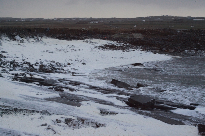
Spanish Point Beach.  Covered in foam.

Spanish Point Beach. Covered in foam.

Wild Atlantic.  Spanish Point.  Co Clare

Wild Atlantic. Spanish Point. Co Clare

Sleave League, Co Donegal

Sleave League, Co Donegal

Ice.  Gweedore, Co Donegal

Ice. Gweedore, Co Donegal

Fanore Beach, Co Clare

Fanore Beach, Co Clare

Caherush Bay during a gale.

Caherush Bay during a gale.

Caherush Bay. Co Clare.

Caherush Bay. Co Clare.

Ice crystals on the windscreen.  Sixmilebridge. Co Clare

Ice crystals on the windscreen. Sixmilebridge. Co Clare

Ice on the road.  Mount Callan, Co Clare.

Ice on the road. Mount Callan, Co Clare.

Categories: Wild Ireland | Tags: , , , , , , , , , , , | 2 Comments

Blog at WordPress.com.