Posts Tagged With: view

The Colorado Rockies 4. Independence – a Ghost Town.

Independence ghost town

In my last blog on my road trip through the Colorado Rockies, I talked about Independence Pass and its close connection with the discovery of gold. Gold in this part of Colorado was discovered on 4th July 1879 at Roaring Fork River about four miles from the top of the Independence Pass and a town soon sprung upon the banks of the river and in the shadow of Mt Independence. It started as a tent city and one year later there were 300 people living in the camp.  The following year a single company, Farwell Mining Company, had acquired the leading mines such as Independence No 1, 2 and 3, Last Dollar, Legal Tender, Mammoth, Mount Hope, Champion, Sheba, Friday, and Dolly Varden.

IG3C1227-Pano-2

The ghost town of Independence at the foot of Mt Independence in the valley of the Roaring Fork River

Various competing interests battled over the name of the town.  During its short life it was variously known as Belden, Chipeta, Sidney, Farwell, Sparkhill and in its fading days optimistically Mammoth City and Mount Hope.  Ironically though and for obvious reasons, it was widely known as Independence though there was never a post office of that name.

By summer of 1881 there were 500 people and many permanent buildings including grocery stores, boarding houses and three saloons. It reached its peak in 1882 when there were 90 buildings containing 40 businesses and a population of 1,500.

As with most mining booms, the bust followed quickly when the gold ran out and by 1888 there were only 100 citizens eking out an existence at an elevation of nearly 11,000 feet and under a blanket of snow from October to the end of May.  The worst storm in Colorado’s history hit in 1899 and those residents still there were completely cut off for months. Running out of food, they dismantled their houses to make skis and 75 residents skied their way to Aspen. Only one resident remained after this. Jack Williams was caretaker of the stamper battery and treatment plant.  In 1912 Jack finally left and that was the end of the town of Belden-Independence-Chipeta-Sidney-Farewell-Sparkhill-Mammoth City-Mount Hope.

IG3C1276

A restored miner’s cabin now used as a summer residence.

IG3C1279IG3C1289

Incredibly a number of buildings have survived to varying degrees in this spectacular location. Some remain relatively intact and have been restored and some are piles of timber or just depressions in the ground. Ted Ackerman’s Hotel was one of five during its hey-day. Little remains of this establishment where miners could find a room for $2 a day.

IG3C1239

Ruins of Ted Ackerman’s Hotel

A general store stands proud, restored in the 1980s and a remarkable testament to the courage of these men (and a few women) and the lure of gold.

IG3C1261

Restored general store

As a geologist with a strong interest in the company history and social history of gold mining in my home country I have seen many Australian ‘ghost towns’ from the gold rush days. They were much more transient and rarely does any structure survive as here. Australians built with hessian and stone and corrugated iron, rather than timber, which is so abundant here, and material was transported to the next town following abandonment.  You’d have to say that heat was more of a problem than cold generally.  Its hard not to be impressed though by the simplicity of construction of the log cabin and its durability.  140 years later the v-notch joints still hold the structures together.


Just downstream from the town is the timber framework of a large stamper battery and on the slopes above there is a bit more mine infrastructure, the head of a mine shaft and a patch of Aspen covering what was obviously a spoil dump.  I would love to have had time to explore more.

IG3C1319

Remains of a  large stamper battery.  The treatment plant would have been on the flat area below.

IG3C1316

An old mine site.  The mound in the distance was the head of a shaft and the patch of aspen covers a spoil dump.

Preservation of these sites is essential.  They are one of the few tangible links to a hugely important part of the development of countries such as USA and Australia.  As in Australia, mining was responsible for opening up large tracts of the country and for the beginnings of many towns, some gone like Independence, some still surviving like Aspen, Leadville or Cañon City.  I’ll come back to this in a later blog.

Categories: America | Tags: , , , , , , , , , , , , , , , , , | 2 Comments

More than just Hot Air. My First Balloon Flight.

Invitations like this don’t come around very often. Certainly not for me and certainly not in Ireland.  Friends, Jeanne and Natasha from Albuquerque in New Mexico (in fact you can read about how we met here) were visiting again, this time for the The Irish National Hot Air Balloon Championships in County Offaly.  Held annually since 1971, this is the longest running national ballooning event in the world and the biggest in Ireland.  Invitation only, up to 40 balloons from around the world, fly each year in what promised to be an incredible spectacle. It was held over the week of September 24 to 28th.

Canon EOS 5D Mark III1466

Jeanne Page and Natasha Coffing.  My hosts.

There was a chance I could crew.   Who wouldn’t want to be part of that?  But I ummed and ahed.  I was still recovering from three weeks in the US.  On Tuesday it was still just a thought. By Wednesday I had the kind offer of a bed from a musician friend at her magnificent BnB in Kinnitty, Ardmore Country House.  House. That sealed it  for me.  A night or two in quite possibly one of the best BnB’s in Ireland and some fiddle tunes was the extra incentive I needed.

Canon EOS 5D Mark III607

Ardmore Country House BnB in Kinnitty.  My home for the duration.

It was only a couple of hours drive and in dull weather I arrived at the launching place, which was the dramatic gardens surrounding Birr Caste and Demesne. Preparations were well underway for the late afternoon flight.  I couldn’t find my friends from Albuquerque so I watched with great interest the activities feverishly underway, as crews readied their balloons.

Balloons were being unfurled, baskets were being loaded, flames were being thrown and one by one the giant multicoloured bubbles stood upright and drifted slowly into the hazy evening.  I started to put some pieces of the jigsaw together but I really had little idea of what I was watching.  As the last balloon drifted over the castle I came to the realization that my friends were in the air and  that they probably had to land somewhere.  So I asked someone, who seemed to know, who said they were heading to Kinnitty, about 10 km to the east.  Well, turned out she didn’t actually have much more of an idea than me, or perhaps the wind didn’t cooperate but, in my haste to get to Kinnitty, I failed to notice they were actually heading northeast  rather than east.

I caught up later that evening with Jeanne and Natasha at Dempsey’s Bar in the charming village of Cadamstown, 10 minutes north of Kinnitty where a regular  trad session was being held. The word had got out and the pub was crammed with musicians and with ballooning people. They were lucky. It was  terrific music led by local box and banjo legends, the Kinsella brothers, and at least twenty other musicians with a high energy mix of tunes and songs. Jeanne and Natasha had bought their harps with them from the States and treated us to some lovely duets.

Canon EOS 5D Mark III687

Traditional music session in Cadamstown.  Natasha and Jeanne join in on their harps.

In among the tunes we discussed the possibility of a flight the next morning.  My education in ballooning continued. A decision on whether flying was possible would be made at the Pilots’ Briefing at 6:30 am.  Weather conditions, in particular wind speed and direction, were the primary factors. Then the teams will move to the launch site and each pilot will make the decision as to whether they will fly.  I couldn’t be guaranteed a spot in the basket but if that didn’t happen I could join the chase crew. They are charged with following the balloon to be there wherever it lands, get permission from the local farmer and collect and transport the crew and the balloon back to Birr. It looked promising.

So next morning I was there. The wind was good and the weather  was fine and the decision was a Go.  There was a problem though. Patchy thick fog had descended and there were worries about visibility.  So the crews made their way to the site for individual pilots to make their own call. It had been a cold night and frost was still covering the ground, the wetness soaking through my waterproof  boots to my toes.

A few set up and started inflating their balloons but most pilots waited. The mist had created an eerie atmosphere and while the delay was disappointing it was a hugely appealing light and plenty of opportunities for the photographer in me to experiment.

Canon EOS 5D Mark III1364

Birr Castle rises from the mist

Canon EOS 5D Mark III1329

Waiting in the frost and mist for the sun to rise

Canon EOS 5D Mark III1340

Autumn reflections

Canon EOS 5D Mark III1505

The sun bursts through the fog

Canon EOS 5D Mark III1503a

A magical misty morning.  More like a Monet painting.

Canon EOS 5D Mark III1354a

Island in the mist

As the sun rose the feeling was that the fog would burn away and a few started to take to the air. Our pilot Steve Coffing (who just happened to be Natasha’s uncle), though remained cautious. It seemed obvious but the primary requirement was that you need to see the ground.  There was still doubt about whether the fog had lifted sufficiently to give this required visibility. We waited.

Most balloons were now in the sky, but then the fog came back in and a number of the last to lift off returned to the ground.  Finally Steve decided when it became clear that we had run out of time and called off the morning flight.  I was actually not particularly upset as I felt happy that despite my frozen fingers, I had captured some great images. I’ll leave it to you to judge.

Canon EOS 5D Mark III1545Canon EOS 5D Mark III1496Canon EOS 5D Mark III1425Canon EOS 5D Mark III1408Canon EOS 5D Mark III1387Canon EOS 5D Mark III1380

We adjourned for breakfast at a local cafe. Steve was confident the weather would be good in the evening and renewed my invitation to fly.  He suggested  I be at the afternoon briefing at 4.30 pm.

Once the fog lifted it turned into a cracker of a day.  Perfect to explore the nearby Sieve Bloom. These low mountains straddle Offaly and Laois and are a wonderful mix of thick forests of spruce and pine, ancient oak and beech forests, open bog land, lakes and mountain streams cascading through mossy glens. It is a hiker’s’ paradise, so that’s what I did.  But my mind was elsewhere.

On tenterhooks I attended the 4.30 pm briefing.  It was a Go decision for the evening flight. But things had changed a little and the balloon that I had planned to fly in was needed for a check flight to maintain the owner’s licence.  Steve managed to get a piloting spot on another balloon but I was told that balloon was full.  Then fate stepped in.  Nikki and Dylan, an Aussie couple I had met the previous night at the session in Cadamstown, came to my rescue. Friends of the owner of the balloon Steve was flying. they had already flown a couple of times earlier in the week. To my eternal gratitude they gave up their spot and it was Up Up and Away [Oh dear, I never thought I could be so cheesy as to use that line!]

I now joined the readying of the balloon for flight. Like me, most of my readers will not have flown in a balloon before. Well I became an instant expert. The physics is simple really. The nylon or dacron ‘envelope’ is filled with air using a large fan and this is heated until the balloon is upright.  A basket is suspended underneath which carries up to four passengers, the pilot and a heat source. The heat source is an open flame fueled by propane, carried in tanks on the basket. The heated air reduces the density of the air inside the envelope compared with the colder air outside causing it to rise. The skill of the pilot comes in knowing how much heat to apply to make it rise or fall. Rapid descent can be achieved by opening the vent at the top with a rope causing the hot air to escape quickly.  There is limited ability to change direction and reading the wind, which can change dramatically at different heights, is part of the skill of flying.

Simple really. A great achievement though for the Montgolfier brothers who built the first manned balloon in 1783. Love the way when they were testing it for manned flight, they proposed that convicted prisoners should be used for the first pilots. Dispensable.

So I watched the preparations with keen interest. The equipment is actually quite compact and is carried in a customized trailer.

IG3C1801

Basket being removed from trailer

First the basket is prepared. The burner is then mounted over the four corners of the basket and the legs wrapped with a protective insulation.

IG3C1812

Burner being mounted over basket

IG3C1823

legs wrapped in insulating material

IG3C1837

Burner is tested.

The propane is connected to the burner and the burner tested. The balloon is then unwrapped and laid out next to the basket which is now on its side. Inflation begins with a large fan. As the balloon expands the burner is turned on sporadically to heat the air. This process takes only a few minutes and when the balloon is full and the pilot is ready the heating is increased which pulls the basket to vertical.

IG3C1843

Balloon is unwrapped and laid out.  Everyone pitches in.

IG3C1866

Balloon is filled with air


IG3C1894

Vent flap is secured

Canon EOS 5D Mark III1453

Fan used to fill balloon

IG3C1918

Air is heated once filled

IG3C1930

Heating continues until balloon stands vertically

IT is now ready for take off. Passengers board. Joining Steve and myself was John Kelly, a local publican, with a deep knowledge of the surrounding landscape. We had a briefing. There were only a few simple rules. Keep an eye out for other balloons and livestock and power lines and communicate this with the pilot.  And oh, Don’t get out of the basket. My total agreement with that one.  I was definitely ‘crew’ now.  We were ready to go.

There was a roar from the burner shooting flames into the balloon above and we rose effortlessly.  There was no real sensation of take off. The ground just seemed to move away from us. In between the bursts of noise of the burner it was deathly quiet. Just this wonderful relaxing calm.

Canon EOS 5D Mark III513

Lift off

Most balloons were ahead of us but as we rose, I could see them spread out before us. Some stayed low. Others were thousands of feet above us.  Birr Castle and its magnificent grounds disappeared from view.  Steve took us up to 2,000 ft just to show us what it felt like. Sometimes balloons go to 5,000 ft particularly if they have passengers who are sky diving.   Oh my god. The thought of throwing yourself off this little basket from this height totally freaked me out.  Fair play to those who can happily do this and actually much prefer it to jumping from a light plane as they have no forward velocity.

IG3C1940

Leaving Birr Castle I

IG3C1952

Leaving Birr Castle II

IG3C1943

Leaving Birr Castle III

IG3C1963

Who knows where we will end up?

IG3C1972

Balloons fill the sky

IG3C1988

At all levels

IG3C2003

The balloon ‘Twister’ flying low.  This was the balloon I was originally to fly in.

IG3C2013IG3C2037

IG3C2063

Bliss.

IG3C2151

Our pilot Steve holding all the ropes

IG3C2153

Soaring above the swans

IG3C2168

Magic evening light

IG3C2180

The evening sun casts our balloon shadow on the glowing trees

IG3C2205

Looking for a landing spot


We drifted effortlessly with only occasional use of the burner for minor adjustments to our flight while I just breathed in the late evening light and dealt with the challenge of capturing the feeling as best I could with the camera.  It wasn’t a point and shoot exercise. I found I needed to make constant adjustments to the exposure to compensate for how much sky there was or where the sun was. I was learning quickly. We were up there for nearly an hour. One wonderful hour.  I know I would do a better job next time.

We made preparations to land. Steve was in constant radio contact with the ground support team. He had to consider a lot in deciding where to land. An open field with no trees, no power lines, no livestock, not under cultivation, not a bog and easy access. Lots to consider. Once he has decided the ground crew tries to determine the owner and seeks permission Normally the pilot would wait for clearance. In this case the landowner was thrilled we were landing in her paddock.

You have to admire the skill of the descent. It was controlled and steady with Steve adjusting both the horizontal ground speed and the descent speed. He jokingly told stories of a tradition in some places of leaf grabbing as pilots scrape the tops of trees.

But not this time. We touched the ground bounced a couple of times, dragged a little and then stopped . Remaining vertical all the time. A quick exit and the retrieval crew including Nikki and Dylan, who were waiting a short distance away stepped in to manage the deflation and unhooking of the basket.

IG3C2276

Safe landing

IG3C2266

Dylan and the chase crew was there to meet us

IG3C2270

Pilot Steve Coffing and my fellow passenger John Kelly pose for the family album.

IG3C2287

Nikki at the end of her tether

There was a celebratory atmosphere with the crew participating equally in the thrill that us virgin flyers so obviously had had. Of course once the balloon was packed and loaded there was just one thing to do. A few quiet ales and some songs (I had my guitar in the car) back in John Kelly’s pub in Birr. Perfect end to the day.

I had an amazing three days. So many people to thank for making this all possible. Jeanne Page and Natasha Coffing for thinking of me, Christina Byrne for sharing her house and her music, Steve Coffing for piloting with skill and aplomb and for making us feel comfortable and relaxed, Nikki and Dylan for giving up their spot in the basket and for making me a little homesick for a Home Among the Gum Trees, the owners  Graeme and Judy Scaife for sharing their balloon with so many people in and outside of the ballooning community, to my fellow passenger John Kelly for helping me understand the landscape we were flying over and to Shane Page for sharing some tips for photographing balloons.  The organizers need to be complimented also for there effortless coordination of a lovely relaxed few days of ‘competition’.

I think I might do that again.

Balloons come in all shapes and colours

Balloons come in all shapes and colours

IG3C1909

Categories: My Journey, Real Ireland | Tags: , , , , , , , , , , , , , , | 1 Comment

The Colorado Rockies 1. Twin Lakes. A Classic Photo Opportunity.

Twin Lakes

This is the first of a series of blogs on the Rocky Mountains of Colorado.  I visited for a week in mid September 2018.  This spectacular part of the world comprises rugged mountain ranges that tower over the Mile High City of Denver.  There is much to see.  It is a photographer’s paradise.  My early plans had me on an extensive road trip that would take me to the four corners but I soon realised how impractical that was, so my travels on this occasion concentrated on the area west of Denver to Glenwood Springs, south to Cañon City and north to Estes Park.  First up is my visit to the iconic Twin Lakes.

I had read about this location and its reputation for getting those classic Colorado photos if conditions are favourable. It is a half hour drive from Leadville in the Central Rockies  and on the way up the Independence Pass, which I’ll talk about in an upcoming blog. It is a well known fishing, camping and hiking spot and there are, as the name suggests, two lakes are connected by a channel. If there is no wind and the sun is shining, the location provides countless photographic opportunities for symmetrical reflection of the distant mountains in the still waters of the lake. Luckily, such were the conditions on the day I visited. And to top it off I had blue skies and autumn colours and a cooperative fisherman in the mix.  Here are a few of my favourites,

Quintessential Colorado.

IG3C0913IG3C0946IG3C0964IG3C0966IG3C0978

IG3C0895

Fall colors.  Twin Lakes

IG3C1052

A mountain stream that flows into Twin Lakes

Categories: America | Tags: , , , , , , , , , , , , , , | 1 Comment

Oh no! Not more pictures of the Cliffs of Moher.

With all this fabulous weather in West Clare recently I decided to take the cruise from Doolin to visit the cliffs. I’ve been to the Cliffs of Moher many times but never before have I seen them from the water.  I checked the forecast. Fine for the next couple of days.  Brilliant.  So I booked the late boat for the following day as I dreamed of perfect photos lit by the late evening glow.

The morning dawns and I open the window to the bay at Caherush shrouded in thick fog. I wasn’t worried and smugly congratulated myself at my foresight in booking the late boat. The fog will lift of course by midday and there will be blue skies. My optimism was rewarded as it did lift and by mid afternoon some blue sky appeared. A perfect plan?

So I drive the 40 minutes to Doolin.  Around Lahinch the fog starts to roll back in, getting heavier as I drive across the bog and down the hill to Doolin until by the time I reach the Pier visibility is just a few tens of metres. My heart sunk.  Visions returned of a trip to Jungfrau in the Swiss Alps many years ago.  Up the cog railway in a total wipeout.  I saw nothing of the roof of the world.

We set off nevertheless with, in my case, no real expectation.  So much for all those dramatic photos I was going to take of walls of rock framed by skies of blue.

But for fleeting moments as we approached closer the fog would shift and you would get glimpses of green through the grey.  You got a real sense of the powerful presence of these cliffs though you never saw them in their totality and could only imagine how high they actually were.  The changing  views were tantalising and somehow seductive.  As the boat rocked and shifted, the angles changed and I snapped away but with no real hope of capturing this feeling.

I’ve stopped looking for explanations of the Irish version of the way of the world.  An hour later the fog lifted. But never was the expression ‘go with the flow’ more apposite. Taking advantage of the extended daylight in June I spent the remaining hours exploring the rocky coast north of Doolin, in total thrall of the wonderful rock garden that is the Burren in spring.  I forgot about the the Cliffs.

But when I got home that evening (early next morning I should say, after tunes in Doolin and Ennistymon) and looked at the photos and I was surprised and happy at what I had captured.  I still have a lot to learn about photography but I think the images say just as much or perhaps more than if we were seeing every minute and vivid detail.  Sometimes showing just a little reveals a lot.

Turns out that fog was a lucky break.

IG3C6009

IG3C6032IG3C6135IG3C6154IG3C6049IG3C6012IG3C6182IG3C5917

Categories: My Journey, Wild Ireland | Tags: , , , , , , , , , , | Leave a comment

Glengarriff, West Cork. A Blissful Elysium.

IG3C9137-2

Glengarriff sits on the upper reaches of Bantry Bay in West Cork. I was lucky enough to spend five wonderful days there last week at a Fiddle Retreat and was able to closely observe the various moods of this sublime waterway. I never actually visited the village of Glenngarriff itself, as my accommodation was tucked away on its own private estate behind the golf course; so private and so quiet that in the time I was there encountered not another soul. other than my fellow residents.

Join me on a walk through this blissful elysium.

IG3C9187

Glengarriff waters I

IG3C9120

Glengarriff waters II

IG3C9119

Glengarriff waters III

Bantry Bay is a drowned river valley (like Sydney Harbour), and its quiet, still protected waters are dotted with steep sided rocky islands sometimes capped with remnant, thick sub-tropical vegetation.

IG3C0033

A perched forest I

IG3C0098

A perched forest II

The surrounding forest of magnificent oaks birches and conifers has (where the rhododendron hasn’t taken over) a primeval under-story of forest detritus draped with mosses, lichens and ferns, in places forming a vivid green carpet.  There is a bubbling stream of crystal clear water that snakes its way down the steep slope into the Bay, cascading over the smoothed rocks and falling into occasional, inviting, pellucid pools.

IG3C9935

Moving water

IG3C9865

Still water

IG3C9834

Forest green I

IG3C9818

Forest green II

IG3C9839

Forest green III

Azaleas and camellias add colour.  This is only March and the rhododendrons can’t be far away from joining in.

IG3C9972

Lush sub tropical gardens with flax, azaleas and camelias.

You regularly sight seals cavorting on the shore.

IG3C8241

A cavorting seal I

IG3C8247

A cavorting seal II

The scene was ever-changing. One moment bathed in brilliant sunshine, then heavy cloud.  Frigid weather brought some light flurries of snow flakes drifting to the ground but not settling and then blue skies brought out the singing birds.  A Great Tit in an oak tree near the house harmonising with the sweet sounds of the fiddle coming from inside.

IG3C0080

Sunshine one moment

IG3C0277

Snow the next

IG3C0102-2

The sun brings out the birds.  The Great Tit.

Another wonderful hidden gem in beautiful West Cork.

Categories: My Journey, Wild Ireland | Tags: , , , , , , , , , , , , , , , , | 1 Comment

Connemara Colours. Winter in the Maumturks.

Sometimes you get lucky.

On a Saturday late in November I made a quick trip to Galway to attend a concert in a friend’s house in the heart of Connemara. Now as readers of this blog will know I love the many moods of Connemara and relished the opportunity to spend a little time there. The weather is not always kind however.  You can expect mist on six out of ten days. But if you spend enough time in this surprising country occasionally you are well rewarded.

I had heard reports of snow but had no real expectations. I was not prepared for what awaited me though as I drove a circuitous route in and out of Galway and Mayo between Lough Corrib and Lough Mask.

Near the village of Cong (famous for its association with the Quiet Man, but I will be quiet on that for the moment),  I saw snow on the ranges to the west.  So of course I headed in that direction along the shore of Lough Mask until I reached the village of Finny.   The white shrouded backdrop above the little yellow church were now within reach.  These are part of the Sléibhte Mhám Toirc (or the Maumturks).  Not so well known as the Twelve Bens, which lie on the other side of the Inagh Valley, they are less rugged but with their brilliant white caps reflecting the sizzling sunlight they were no less spectacular.

As the sun and clouds and rain and mist fought for dominance an amazing winter palette was in full display.  Everything contributed.  The sky, the hills, the snow, lakes and rivers, stone walls, pastures and paddocks.   The snow caps would change from grey to dazzling white and then glow golden orange with the descending sun.  The sky was at once black then blue as the storm passed, the hills were orange, brown, red and green.  The country sparkled.

I was lucky and happy.  To be in such a stunningly beautiful place where a world class vista was around each corner.  And so grateful that I could capture some of those fleeting moments with my Canon.

Words are irrelevant.

IG3C8848IG3C8859IG3C8887IG3C8927IG3C8969IG3C8992IG3C9024IG3C9061IG3C9070IG3C9078-PanoIG3C9100IG3C9122IG3C9181IG3C9213IG3C9232IG3C9248IG3C9255IG3C9269IG3C9275IG3C9310IG3C9336IG3C9347IG3C9366IG3C9381IG3C9401IG3C9408IG3C9427IG3C9433IG3C9462IG3C9514IG3C9529IG3C9555-HDRIG3C9690IG3C9717


Categories: My Journey, Real Ireland | Tags: , , , , , , , , , , , , , , | 2 Comments

The Flaggy Shore and Aughinish. Make the time.

IG3C7889

Just a short distance off the N67 which tracks the northern coast of Clare as part of the Wild Atlantic Way is the Flaggy Shore. This is the perfect spot to see the Burren meet the Bay, in this case Galway Bay.  A sweeping stony shoreline with a backdrop of the bare purple hills and the lush green fields beneath.

IG3C7648IG3C7663IG3C7852


IG3C7746IG3C7717

Look north across the bay, now calm and peaceful and you see the villages of Galway clinging to the coast and beyond this the misty silhouette of Connemara and the Twelve Pins.


IG3C8056

Cliffs of Aughinish in the foreground and the Twelve Pins on the horizon


The place has a permanent spot in Ireland’s psyche thanks to one of Seamus Heaney’s most celebrated poems, Postscript.

And some time make the time to drive out west
Into County Clare, along the Flaggy Shore,
In September or October, when the wind
And the light are working off each other ……

Heaney in describing how the poem came to him said:   “I had this quick sidelong glimpse of something flying past; before I knew where I was, I went after it”.

He has said it beautifully of course so I won’t try and improve on those words.  All I can do is attempt to give that feeling in pictures…

IG3C7920IG3C7909IG3C7905

There is no beach, as such, at Flaggy Shore. Just boulders, pebbles and rocky outcrops. But a walk on the strand will well reward. You can stroll along the roadway or explore the limestone platform in the littoral zone.

IG3C7697

This is the best place in the whole of Clare to observe the coral fossils that make up such a large part of the 350 million year old layers. Huge colonies of branching corals (fasciculate lithostrotionids) are sliced at various angles revealing themselves from all perspectives.  Their true branching form can be seen often in section on the rock face. Sometimes the colonies seem completely intact and measure over a metre across. If you have been to the Great Barrier Reef in Queensland it is easy to imagine the warm shallow sea that was once home to these corals and the teeming life that surrounded them.


IG3C7585

Planar sectional view through a coral colony

IG3C7656

Large fossil coral colonies on the rock platform

IG3C7655

Excellent view of coral colony showing branching and dendritic form. About a metre across.


If you look hard you will see long straight grooves etched into the rock. These are called striations and are caused by the movement of a glacier which smoothed this landscape around 10,000 years ago. Rocks trapped in the ice were dragged along the bottom scouring these cracks. We are able to measure the direction of movement of the ice sheet using this evidence.


IG3C7588

Glacial striations on the rock platform at Flaggy Shore


If you like watching sea birds, you are in the right place.  As well as gulls, this time of the year starlings gather in flocks and search for food on the sea shore. These murmurations can number thousands of birds and when performing their acrobatic gyrations they make one of the truly spectacular sights in nature. They swoop and soar and flit and glide in perfect concert. It’s only when you freeze this motion with the camera that you see how perfectly aligned is the movement of each individual bird. I could watch them for hours.


IG3C7822a

Starlings I

IG3C7793

Starlings II

IG3C7857_1

Eyes left

IG3C7858a

Eyes right


Aughinish Island, just a few hundred metres across the calm water, is comprised of glacial deposits left behind by the retreating ice as the continent warmed. The Island was originally part of the mainland but a devastating tsunami caused by an earthquake in Portugal in 1755 separated it. The British built a causeway in 1811 to service the troops manning the Martello Tower (built to protect Ireland from Napoleon). It is still the only access to the Island.  The one lane causeway actually connects Aughinsh to County Galway which paradoxically means the fifty residents on the island and the occasional vistor who stumbles on this place must travel through Galway to get access to this part of Clare.


IG3C7934

The causeway built to access Auginish

IG3C7947

Peace I

IG3C7950

Peace II

IG3C7984

Peace III


For the ‘tourist’ looking for a quick fix there is not much to take you to Aughinish.  But it is a place to walk and breathe.  Where the quiet ambience is tangible.  It has a feeling of calm so unusual for the Atlantic Coast.  You will be unlikely to meet anyone except a farmer attending to his boggy field or another collecting seaweed blown in by Hurricane Ophelia.  But you will get stunning views across the inlet and if you are lucky enough to see the sun disappear behind Black Head you may not want to leave.


IG3C8005

Looking across the inlet from Aughinish to the village of Ballyvelaghan

IG3C7988

A Martello Tower built in 1811 to defend the Irish coast from the French.

IG3C8011

Lengthening shadows

IG3C8014

Evening serenity I

IG3C8036

Evening serenity II

IG3C8064

The shoreline on Aughinish.  The softest most comfortable grass you will ever find.

IG3C8079

Vivid red growth on the tidal flats

IG3C8094

The high tide mark left by Hurricane Ophelia which exploded the previous day. 

IG3C8231

Collecting seaweed


IG3C8053

Life on Aughinish


As usual I will let my camera have the last word.

IG3C7981

IG3C8293IG3C8310

Categories: My Journey, Real Ireland, Wild Ireland | Tags: , , , , , , , , , , , , , , , , , , , , , , , , , , , , , , , | Leave a comment

Route 1 from San Francisco to Los Angeles. Almost.

I know those who follow this blog probably do so because they are interested in my posts on Ireland.  Well I recently had a holiday in the States so I have a few other stories to tell. So I will get back to Ireland but in the meantime I will talk a bit about my visits to San Francisco and then later New York.

I had just spent some time discovering San Francisco.  My plan was to drive south from there to Los Angeles on Highway 1.  Legendary names like Monterey, Big Sur and San Simeon were on the itinerary and I had given myself three days. What I wasn’t really aware of was that this actually wasn’t now possible due to a landslide and storm damage near Big Sur last year and consequent closing of the iconic bridge there amid worries as to its stability.   But as I headed off I didn’t know this.

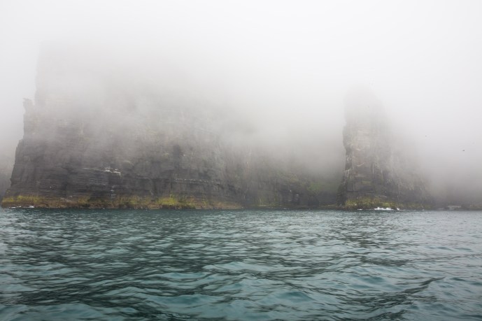
Leaving San Francisco shrouded in its usual summer fog was not exactly what I would have hoped for but you don’t need crystal clear blue skies to enjoy this place.

IG3C7460

Goodbye to San Francisco with the Golden Gate Bridge shrouded in mist.

The geologist in me wanted to find the San Andreas Fault.  This was my first challenge.   The city behind, I followed Freeway 280 and Highway 35 as they traced the line of  the Fault. The fault itself though lay to the west of the highway and was defined by a linear river and lake system known as Crystal Springs and San Andreas Lake. So there wasn’t a lot to see.

IG3C7555

San Andreas Lake, south of San Francisco.  The lake fills the valley which marks the path of the San Andreas Fault.

There were a couple of spots where the rocks in the road cuttings showed strong evidence of shearing and slickensides and where extreme measures were taken to support the crumbling rock in road cuttings.  I assume these are due to splay faulting from the San Andreas.

I looked for a spot where I could cross the fault line on the way to Highway 1 But at the probable location there was nothing to see from the massive bridge over the lake.

I didn’t realise the fault line was so inland.  Next time I will do more research.  Oh well. I headed back to Highway 1 through the rugged hills of the Miramontes Ridge to the coast at Half Moon Bay. Nowhere to stop and take photos on the way!

Half Moon Bay is a pretty spot where you can partake of gourmet food, taste olive oil, visit boutiques or craft shops if that’s your wont.  Or do as I did and have an organic salad and listen to some accoustic music in the garden of San Benito Cafe. That was a pleasant surprise.

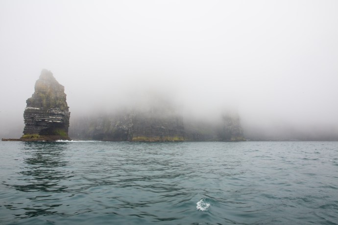
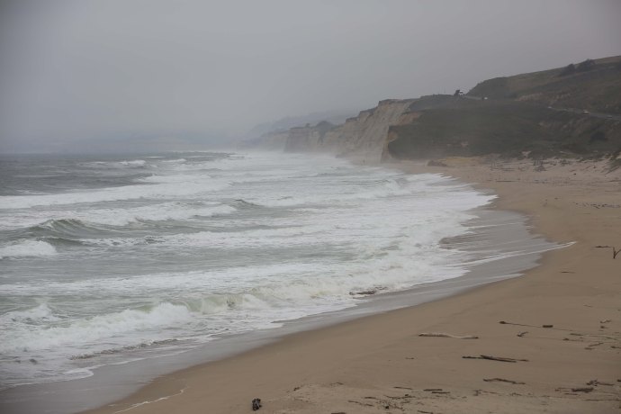
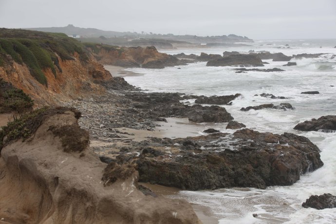
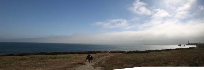
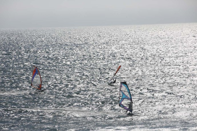
Now I was really on Highway 1 so I headed south. I took every opportunity to get off the freeway onto the coast and there were plenty of places to stop and walk down the cliffs to deserted beaches.  At San Gregorio Beach, at Pescadero Beach and then the lighthuse at Pigeon Point Bluffs. And one of the best windsurfing and sail boarding locations in California at Waddell Creek.

On the way there were rugged cliffs, and jagged coasts, banks of fog rolling in with blue sky behind, a lighthouse silhouetted in the mist, pods of pelicans, marsh and bogland with a congregation of egrets, a phallanx of wind surfers and sail boarders taking advantage of a favourable breeze, hardy flora, solitary birds of prey and all the time the Pacific Ocean on my right.

IG3C7678

Coastal scene at San Gregorio Beach

IG3C7702

The coast near Pescadero Beach
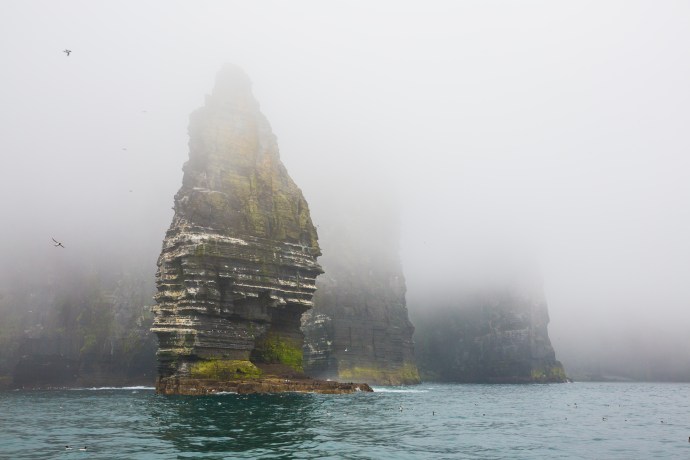
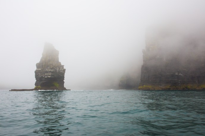
IG3C7723

Pigeon Point Bluffs

Panorama Highway 1 1

A bank of fog rolls in over Pigeon Point

IG3C7882

Egrets at home in the Pescadero Marsh

IG3C7909a

An egret takes flight.

IG3C7771

Man takes flight.  At Waddell Creek.

IG3C7798a

Waddell Creek Beach

IG3C7819

Waddell Creek Beach

IG3C7930

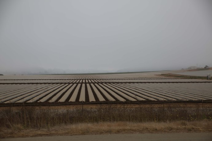
The food bowl of America.  Growing Vegetables near Monterey

I had intended to visit the boardwalk at Santa Cruz but the crowds and the chaos turned me off.  After all it was just a collection of carousels and rides though the fact it had been there since 1907 was of interest to me.  So I continued on and finished the day in fading light in a classic American motel in the town of Marina, just north of Monterey.

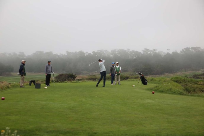
The next day I wanted to take the 17 mile Drive around Pebble Beach south of Monterey.  Renowned for its wildlife and for its scenic beauty I was a tad surprised when I was asked to pay $10 but the fine print on the ticket says I could have my money back if I played a round of golf.  Yeah sure. Read on.

IG3C7942

The Monterey entrance to the 17-mile drive.

Once you drive in the gate the first image you have is of the lush greens of a luxury course where it meets the Pacific Ocean.  There are indeed eight golf courses on the peninsula. Including two that are regularly rated in the top 10 in the world.  Pebble Beach which is open to the public and costs $525 a round (but you get your $10 back) and Cypress Point (which is NOT open to the public and is the most exclusive in the world with only 250 members!).  Non members just cannot play there and members include zillionaires such as Bill Gates but shamefully if your rich but black you can’t be a member.

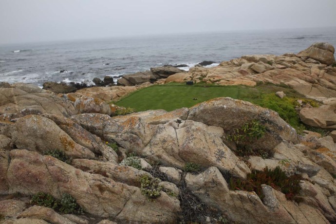
Many of the courses hug the coast and reach inland to the marshes and forests.  Indeed there are greens and tees located within the beachside rocks dunes and cliffs.  Huge granite boulders and cypress pines are a feature.  Challenging would be one word to describe many of the holes.  The famous Par 3 hole 16 at Cypress Point requires a 230 yard drive over the swirling ocean to reach the tee.

IG3C7958IG3C8013

IG3C8066

A glance down to the shore reveals a young seal seemingly unperturbed about being alone.  Just basking.   Lines of pelicans soar overhead making their way north and the rocks are covered with cormorants and gulls including the elegant California Gull with the red dot on the beak and the distinctive grey plumage of the Heermann’s Gull (The head turns white when they are breeding.


IG3C8000a

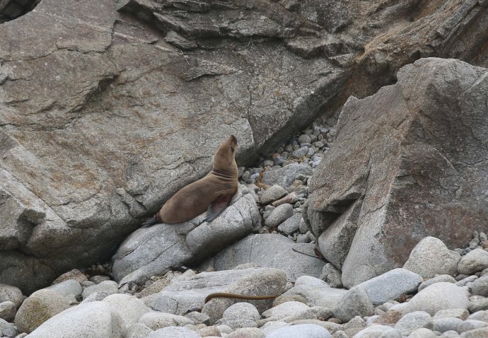
A young seal basks on the rocks


IG3C8090

A pod of pelicans and a lonely cypress.

IG3C8084a

Pelicans in flight

IG3C8112

California Gull

IG3C8223

Adult non breeding Heermann’s Gull

Look hard and you will see the perfectly camouflaged Californian Squirrel.  This is a ground squirrel unlike his tree based cousin perhaps more familiar to those on the east coast or London for that matter.  Darting about in and around the rocks and then standing up like a prairie dog.  Motionless.  Certainly they are cute but they are still considered a pest as they were in 1918 when children were enlisted to poison the rodents which were then apparently threatening the war effort against the Germans (see the squirrel army dressed in Kaiser -type hats in the poster below).

IG3C8133

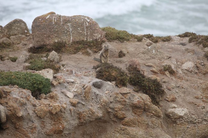
California Ground Squirrel

IG3C8217

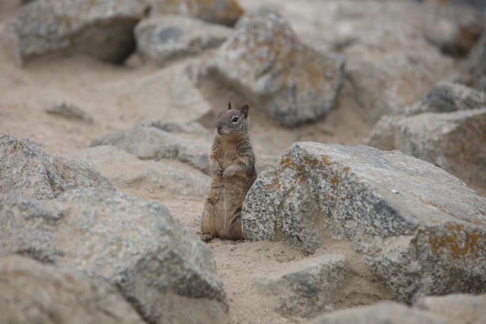
Squirrel on its back legs


image

Poster from 1918 encouraging children to kill squirrels.  The poison of choice was strychnine.

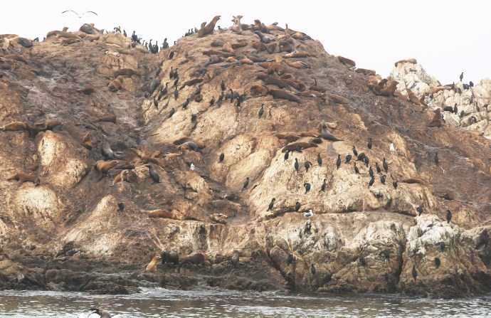
I mentioned spotting a seal.  Well nothing really prepares you for Bird Rock Island.  I could hear the barking before I saw them.  It lies just off the coast about half way around the drive.  It is literally covered with sea lions and seals.  The sea lions are spread all over the rocks hanging precariously, with some occupying the summit.  Their climbing skills are remarkable.  The rock is shared with cormorants and gulls and the surrounding water is their playground.  The barking is incessant as is the cavorting.  Beats Sea World.

IG3C8455

Bird Rock from the mainland


IG3C8453a

IG3C8627a

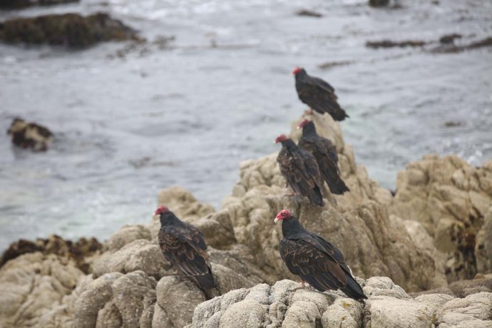
Just nearby was a ‘venue’ of vultures resting on the shore (trust me; It’s a ‘kettle’ if they’re flying and a ‘wake’ if they’re eating!).  At first in my naïveté I thought they were Condors.  But good old Google and no they are Turkey Vultures or that very American appellation Turkey Buzzards.  They are impressive birds and beautiful in flight.  They do have a bad rap though because of course they are carrion eaters and hey, they are not exactly pretty.  The featherless head is said to enable them to burrow into carcasses more easily.

IG3C8813IG3C8753a

IG3C8765a

Just off the coast of Bird Rock lies Carmel Canyon an offshoot of the 10,000 ft deep Monterey Canyon.  During summer cold water wells up from the Canyon and this brings nutrients and feed and is responsible for the rich marine life.  The area was declared a sanctuary in 1992.  This time of the year there is also a variety of coastal flora.  Some familiar some not.  There is what we call ‘pigface’ a perfectly adapted succulent which actually comes from South Africa and heaps of others I have no idea the names of.

IG3C8841IG3C8836

IG3C7667_1

IG3C7673

Pigface.

But in truth the most distinctive vegetation is the Monterey Cypress.  They occur in forests or as single or groups.  They are native to the peninsula but have been cultivated widely around the world.  Often bare of leaves except for a canopy they can have twisted trunks and branches or even grow horizontally as they cope with the harsh conditions.

IG3C8985

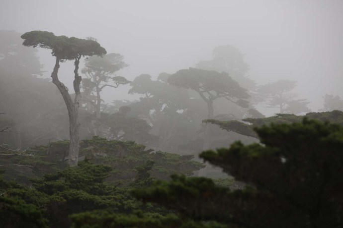
A Cypress Forest.  Monterey,  The trees love the cooler summers and the constant fog.

IG3C8052

Near Pebble Beach.  Survivors.

IG3C9015

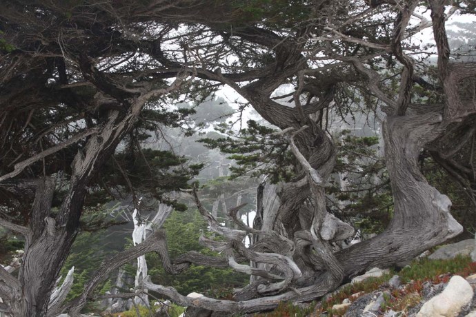
Monterey Cypress.  The road map of a hard journey.

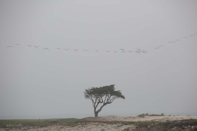
But the area is synonymous with one particular tree.  The Lone Cypress.  It is located between the Pebble Beach and Cypress Point Golf courses and sits exposed to the elements on a granite outcrop as it has for maybe 250 years.  Held up now by wires.  it is seen as a symbol of rugged individualism and struggle.  It is much photographed but on this day my efforts fall way short, due to fog and haze.
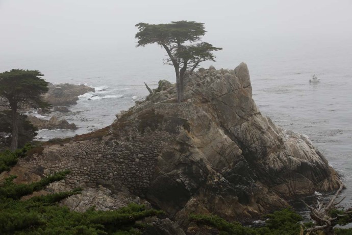
IG3C8950

The Lone Cypress

My final stop was at Cypress Point.  The actual point not the golf course.  Of course it is covered with pines but of interest here were some sea otters.  Unfortunately I only caught occasional glimpses as there were a bit reclusive.  And really hard to photograph but they are recognisable.

IG3C8929

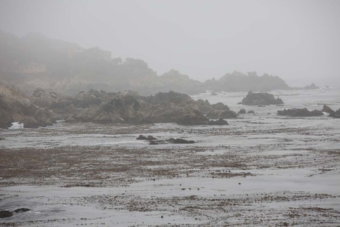
The coast at Cypress Point

IG3C8908a

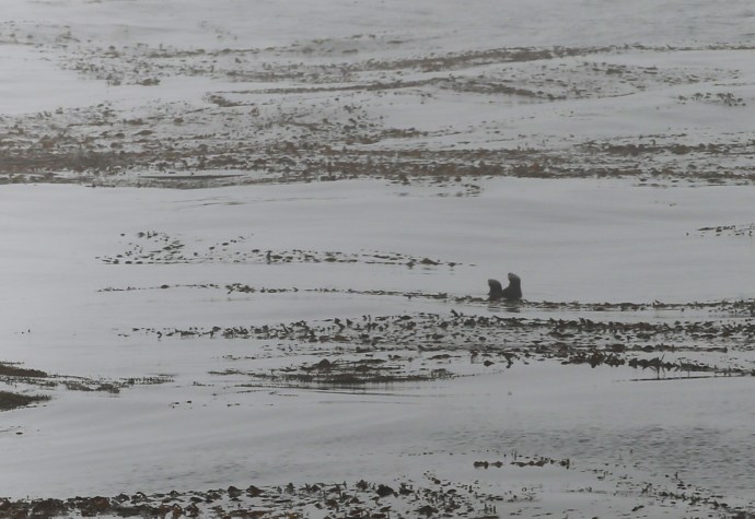
Two sea otters at play.  Point Cypress

The Peninsula is a place where conflicting needs seem to coexist.  Luxury homes sit beside extraordinary natural beauty, impressive wildlife and millions of visitors.  Golf and bird watchers inhabit the same space.  It all seemed to be pretty well managed.


IG3C8873

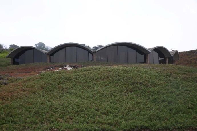
Innovative architecture.  Pebble Beach

IG3C8881

Grand houses grand view


I spent much of the day here but it was time to move on.  Big Sur was my next destination but I needed gas (as they say over here).  The helpful man at the gas station told me that I was wasting my time as the road had been closed over a year.  So Plan B.  Leave the coast, head inland through Carmel Valley across the hills, and join HIghway 101. Just keep that in mind if you want to drive Highway 1.  You can’t.

Heading inland I took local roads.  It was a very different landscape.  The fog soon lifted.  to reveal steep hills, sometimes forested sometimes bare and sometimes covered with yellow grasses.  IG3C9042IG3C9031

IG3C9082

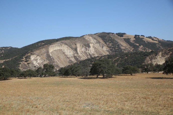
Carmel Valley itself is a wine growing area and lies in a wide flood plain surrounded by a mountain range. I can’t comment on the wine but the view was special
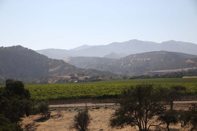
 

IG3C9074

Carmel Valley

IG3C9073


The second night was spent in King City, A not very remarkable motel in a not very remarkable place.  That left just a short (?) few hours drive left to Los Angeles for the next day.

I stuck to the inland road so my dream of completing Highway 1 was not to be.  But this was my first dose of real US Freeway traffic.  There was one section near Santa Barbara where it took nearly two hours to travel 10 miles  There seems to be an inverse rule that the wider the freeway and the more lanes, the slower it will be.  Still the cd was blaring out Irish tunes and this is the American Dream isn’t it. The road trip?  Crawling along the Freeway.

Ahh no; really there was a lot to see.

The Salinas River Valley is home to the very large San Ardo’s Oilfield.  The Miocene sands here are rich in oil bearing sediments and oil wells with ‘nodding donkey’ pumps are as far as the eye can see.  It is surprising how the simple beam pump used in the mining industry for centuries is still in use as the main method of extraction.
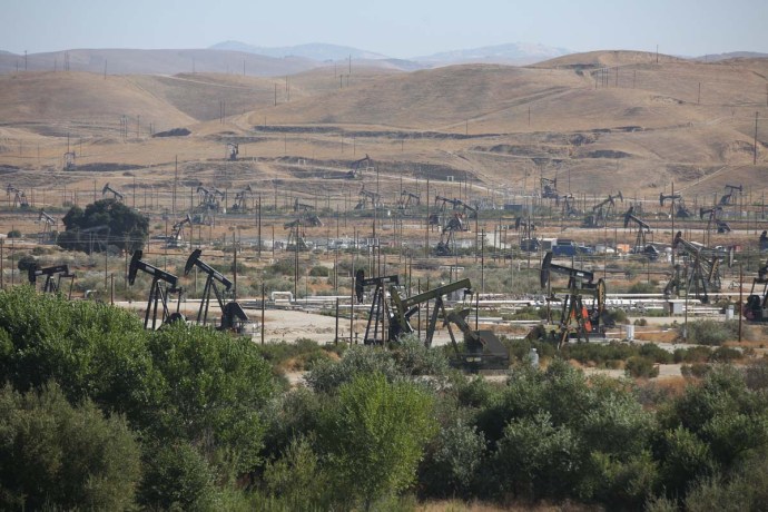
 

IG3C9105

San Ardo oilfield

IG3C9111

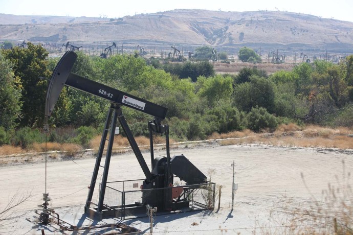
A bean pump at San Ardo


IG3C9142

San Ardo oilfield


It’s not generally thought of as a pretty sight but for the geologist in me it’s like looking through a window into a decaying technology extracting a dying product.  Already in many parts of California the acres of nodding donkeys have been replaced by acres of solar panels and windmills.

The drive along Highway 101 takes you in large part through the earliest settled parts of California.  The original settlers (ie invaders) were the Spanish and they set up a string of Missions between 1769 and 1833.  They were set up by the Fransiscans to evangelise the native Americans.  There were 21 of these Missions and they formed the basis of the colony of New Spain known as Alta California and part of the Spanish Empire.  They heavily disrupted native Californian life by forcing them to live in settlements, introduced ranching, fruits, vegetables, horses and technology but left a lasting legacy in terms of modern California with the cities of Los Angeles, San Diego, San Jose, and San Francisco developing around missions.

Mexico achieved its independence from Spain in 1821 and took Alta California with it and in 1849 ceded it to the United States as a result of losing the Mexican war.  Ironic actually as gold was discovered in California that same year.

 I visited one of these missions at San Miguel.  Built in 1797 close to a Salinas Indian village the aim was to convert these natives to Christianity.  It is still largely in original condition and though not run now as a mission is used for regular church services. You can tour through the building which includes many notable featurs such as a collonade of 12 arches all different sizes and shapes, a plaza with a fountain, a courtyard, an alley through the buildings to allow sheep to enter, original furnishings and art work, a beautifully decorated church and an adjoioning cemetery with the interred remains of 2,250 native Americans.


IG3C9183

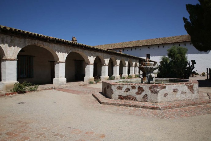
Plaza and fountain San Miguel Mission


IG3C9170

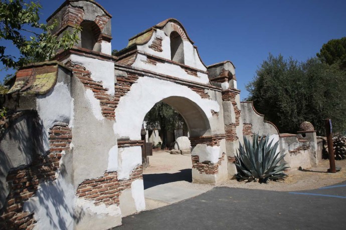
Main gate to the Mission

IG3C9199

Collonade with 12 arches


These buildings are held in high regard and their preservation a priority as they are  a treasured part of Californian history.

The missions were accessed by a road known as the El Camino Real (The Royal Road) going from San Diego to north of San Francisco.  Much of it was just a goat track but in places it was marked by carved crosses in trees.  As you would imagine most haven’t survived but one was discovered near San Miguel and is on display here.  Today Highway 101 pretty much follows the old route and it is marked by bells on poles. Tradition has it however that the padres spread mustard seed along the route creating a golden highway helping the pilgrims to find their way.

So I’d certainly recommend the journey.  Check whether Highway 1 is open and be prepared to travel other routes.  Get off the freeways and take your time.  It’s always rewarding.  But that’s the great thing about travel.  There’s always something else to discover somewhere else.  It just might not be what you expect.
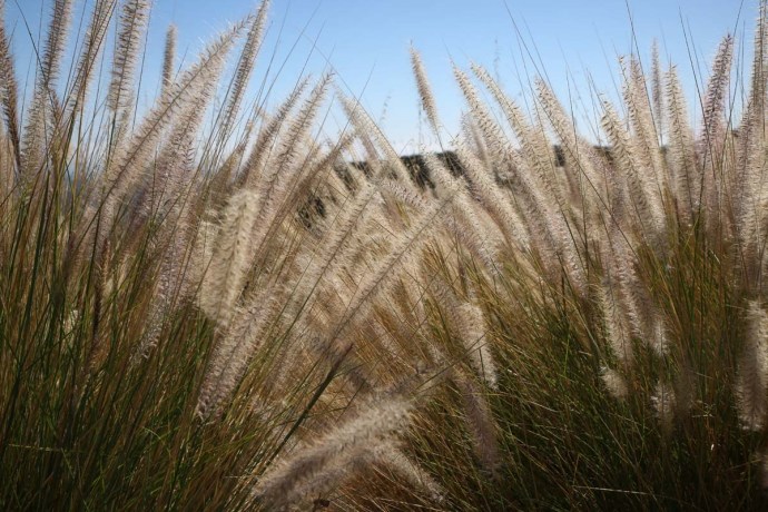
IG3C9362


IG3C9386

California grass.


Categories: America, My Journey | Tags: , , , , , , , , , , , , , , , , , , , , , , , , , , , , , , , , , | Leave a comment

Dingle Peninsula. The Irish Alps

I have blogged about Dingle quite a few times and posted many photos. Even the name has a delightful ringle to it.  So what else could I possibly say about it?  But. There’s the thing about Ireland. There are always surprises and you can go back time after time and each time it’s like you’re there for the first time.

It was the end of February and my annual pilgrimage to Ballyferriter was completed (I have written about this Festival in previous years and it delivered yet again). It was time to go home. I’d been up that night until 4am playing tunes with wonderful people whose friendship is renewed every year.  That’s what’s great about Festivals.  It’s not just the music.

Anyway, during my short time in bed I lay awake listening to the wind lashing and the hail thrashing. A wild night.  Next morning it was calm and there were patches of sun, so I decided to head around the Slea Road back to Dingle, one of my favourite drives. I’d had Aidan Connolly in the cd player all weekend so it was time for a change. I stopped to retrieve a new CD and something made me look back towards Mt Brandon. I was stunned by the view. Completely shrouded in snow with Ballyferriter nestled at the bottom. This is what I saw.

kerry2_154

Mt Brandon, the third highest mountain in Ireland looms over Ballyerriter.

A quick change of plans and I headed the other way making the instant decision to return via Conor Pass.

Perhaps a little foolhardy but the weather looked ok and I doubted I would get another opportunity like this. It turned out to be an inspired decision. As I got closer to the pass the patchwork of paddocks gave way to a carpet of white.  The weather came and went in waves as I headed up the hill.   I was greeted at the top by another snowfall. But also enough sun to revel in the alpine glory. I was in the heart of the Kingdom and I had been granted admission to the Palace. I was lost for words and I really can’t describe the feeling I had immersed in this wilderness.

On this occasion I will let the camera talk. And talk it will. Loudly. Driving over the top and down Conor Pass, there were surprises with every turn in the road . I headed to the villages of Cloghane and Brandon and out to Brandon Point and then returned along the coast to Aughacasla. All the time snow clad ranges framed the views.

Please enjoy these photos of an Ireland rarely seen.

kerry2_157

The green fields of Kerry on the road up the Conor Pass, from Dingle, turned progressively whiter,

kerry2_160

and whiter,

kerry2_159

and whiter,

kerry2_167

and whiter.

dingle-4

The view from the top.

kerry2_172

Heading down the mountain

kerry2_2

Corrie lakes in the glacial valley

kerry2_10

The start of the steep bit! Or the end if you’re coming down.

kerry2_13

kerry2_14

And then…..

kerry2_18

It started to snow.

kerry2_26

It’s not easy to photograph snow.

kerry2_30

At the bottom of the pass is this view towards Mt Brandon.

dingle-1

And the light kept changing.

kerry2_34

This is still Ireland.

kerry2_38

The Irish Alps

kerry2_41

Slieveanea from the base of the Pass

kerry2_51

Approaching Cloghane

kerry2_55

A view of Mt Brandon near Cloghane

kerry2_56

Cloghane with Mt Brandon.

kerry2_57

Mt Brandon looms above Cloghane Church

kerry2_61

Mt Brandon

kerry2_66

The sun shone

kerry2_69

The road from Cloghane to Brandon

kerry2_70

looking across the bay to Beenoskee

kerry2_72

And then it was raining

kerry2_75

Fenced in

kerry2_78

The mountain disappears in the mist

kerry2_85

View from the pier at Brandon

kerry2_86

The pier at Brandon

kerry2_89

kerry2_90

Another view across the bay towards Beenoskee

kerry2_92

Incongruity.  Surfers in the bay.

kerry2_100

Colours.

kerry2_105

The village of Brandon

kerry2_109

kerry2_115

Cappagh Strand near Brandon village

kerry2_116

View across Brandon Bay and Cappagh Strand

kerry2_126

Cappagh Strand

kerry2_131

View from Cappagh Strand back towards Mt Brandon

kerry2_139

The village of Cloghane

kerry2_142

Cloghane or have I been teleported to Switzerland?

kerry2_147

The hills are alive with the sound of……

kerry2_150

A last view of Mt Brandon.

Categories: My Journey, Wild Ireland | Tags: , , , , , , , , , , , , , , , , , | 1 Comment

Blog at WordPress.com.