Posts Tagged With: Quilty

Mutton Island. A Clare Treasure.

This is my longest blog to date.  It is also one I have had the most pleasure writing.  It is about a special place.  Never visited by tourists and only by a handful of locals.  A place where little vignettes of a vanished Ireland can be glimpsed, where nature has done its wonderful work and where you can find peace in solitude.  I hope you find the time to read it and that I can give you a little of this feeling in these words and pictures.  


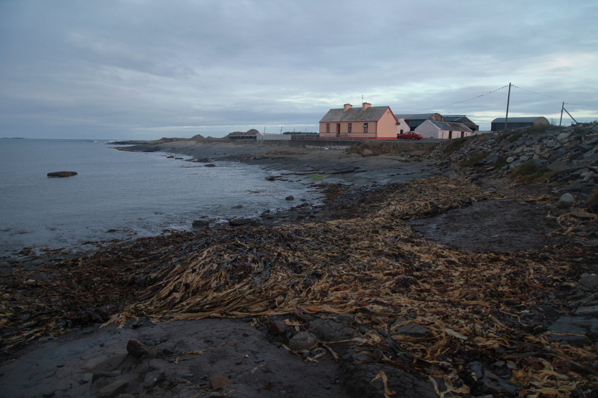
I live on the edge. Of Ireland, that is.

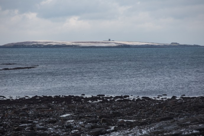
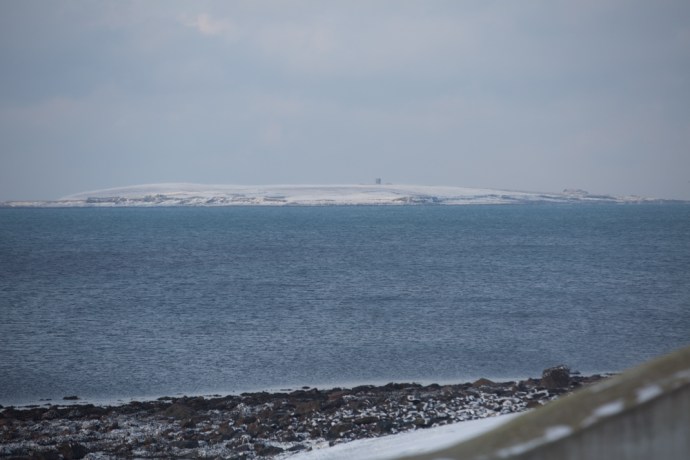
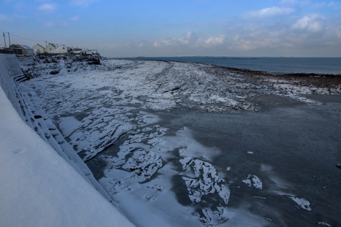
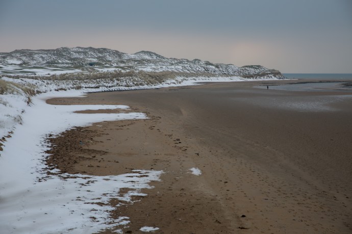
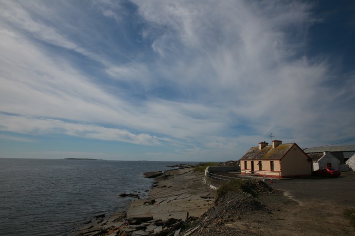
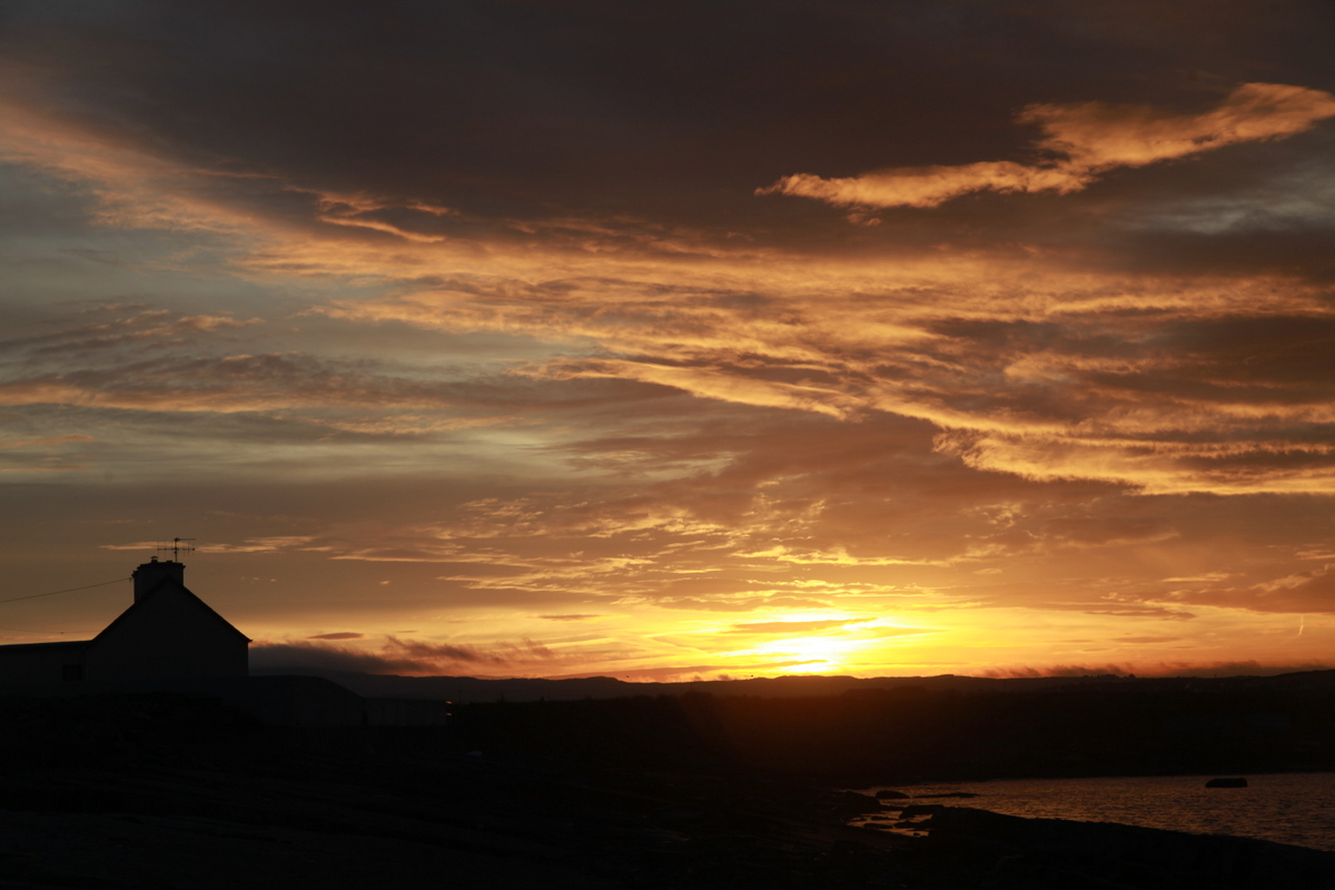
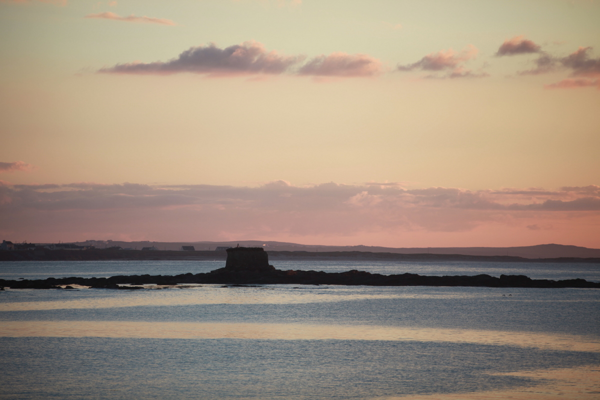
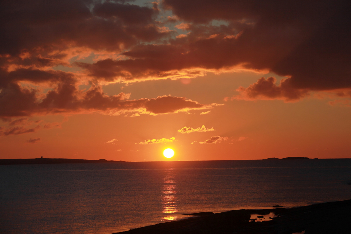
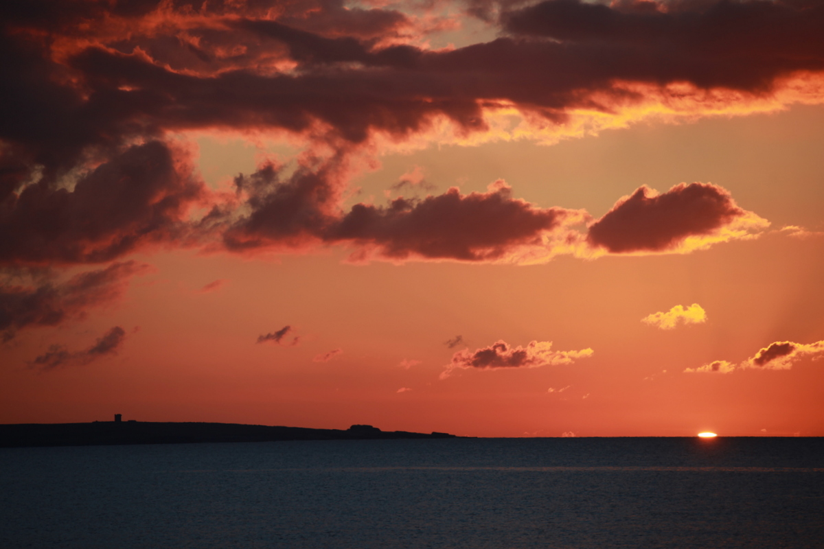
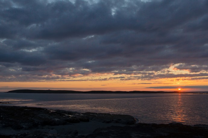
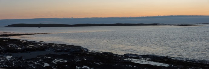
Every morning I pull the curtains and look out my window across Caherush bay. The first thing I see is Mutton Island. It’s the image that begins every day. Sometimes the cloud or mist or the spray from wild waves hides it and sometimes it is like a green jewel floating on a blue calm. I’ve seen it covered in snow and I’ve seen it bathed in the glow of a West Clare sunset.  But in four years I’d never been there.

IG3C8074-HDR

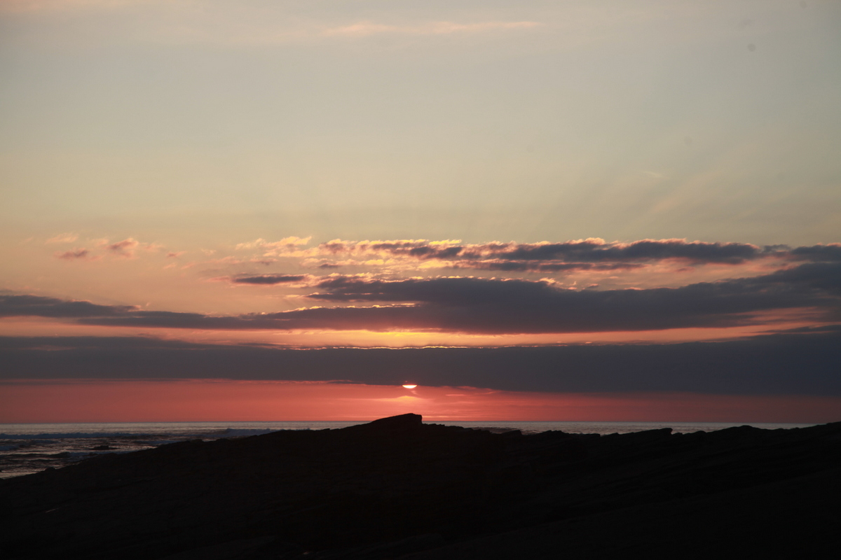
Sunset over Mutton Island viewed from Seafield Beach at Quilty.

IG3C3546

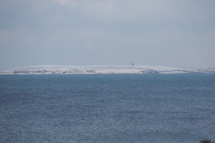
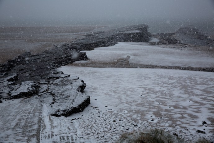
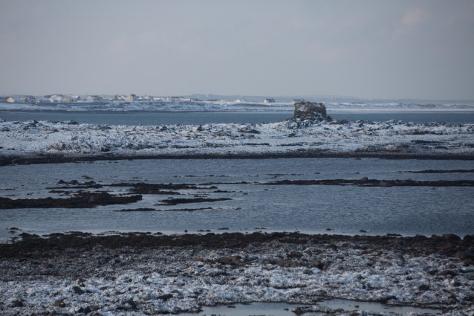
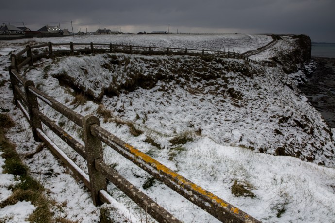
Mutton Island during the ‘Beast from the East’ in March 2018. Covered in thick snow.

The island of 185 acres is shrouded in myth and mystery. It’s inaccessibility gives these stories weight.

There is no obvious way to get there for those of us who don’t own a boat or a kayak, but I decided one July Tuesday in the midst of an extraordinary spell of hot, fine weather to try and get there.

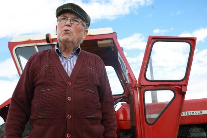
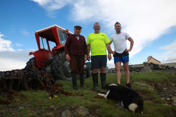
My inquiries led me to Anthony Murrihy, a Quilty fisherman, and so 10am Wednesday saw me waiting at the Seafield Pier to be ferried across. Well, after two weeks of blue skies, this morning arrived with low cloud covering Quilty and the island. Mmmm. That’s Ireland. Still there was no rain and it was just a bit cooler than it had been which in the end I was grateful for.

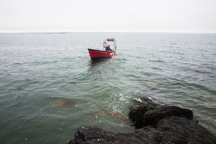
As the little red boat pulled away from the Quilty shore, it somehow seemed appropriate that the island should be shrouded in mist. Why would it give up its secrets so easily?

IG3C4150

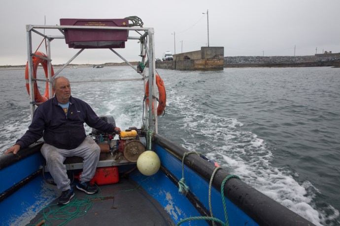
Anthony Murrihy, Quilty fisherman.  Leaving Seafield Pier.

In my travels around Ireland, I’ve visited many islands: Tory, Inis Oir, Inis Mor, Cape Clear, Sherkin, Valentia, Achill, Aranmore, Dursey, Scattery, Skellig Michael, Garinish. Most are ‘tourist’ experiences. Ferry terminals, interpretive centres, maps and paths, signs with arrows and glossy brochures.  All were wonderful experiences of course, but nothing is like Mutton Island.

So it was just me, Anthony and a little red dinghy heading across the flat Atlantic.  There is no actual landing point on the island and as Anthony tried to hold the boat against a rock with a gaff (made from a paint roller, a broom handle and some duck tape), I gingerly stepped ashore clinging to my camera bag and my egg mayo sandwich.

IG3C4190

The landing spot.  I had to step ashore off the boat onto that rock……

Then it was just me. Anthony and the little red dinghy disappeared back to the inhabited part of Ireland.

It was the strangest feeling watching the tiny speck disappear into the distance. I just stood there for some time, quite dumbstruck.  I really can’t describe it.  A sense of excitement, of respectful awe, and at the same time a creeping solitude. It is so rare to actually be alone and isolated in this ‘civilised’ world. But here I was the only human being on this little slice of the planet. At least for the next few hours.

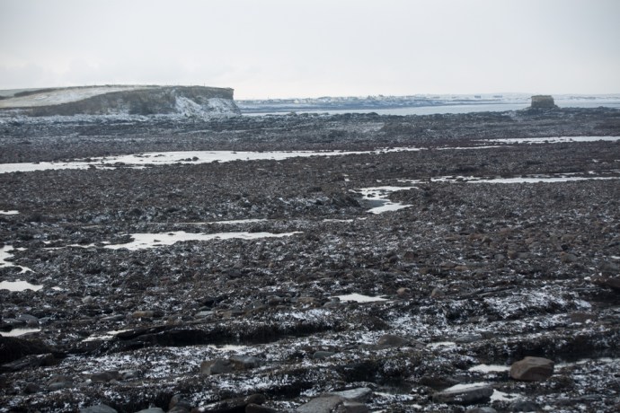
The island is elongate east-west fattening to the west. The boat dropped me near the eastern end so it seemed logical to start there and circumnavigate the island. This was my kind of exploration. It reminded me of my early days of geology fieldwork. No preconceptions, only a vague idea what I would find and no guide book to follow.  I think now that’s what attracted me originally to exploration geology. Here was an empty, abandoned world. Everything you see is a surprise, no paved path to follow, no interpretive centres or explanatory signs. Just raw nature, landscape, geology, wildlife and archaeology and only your eyes and feet to unravel it.

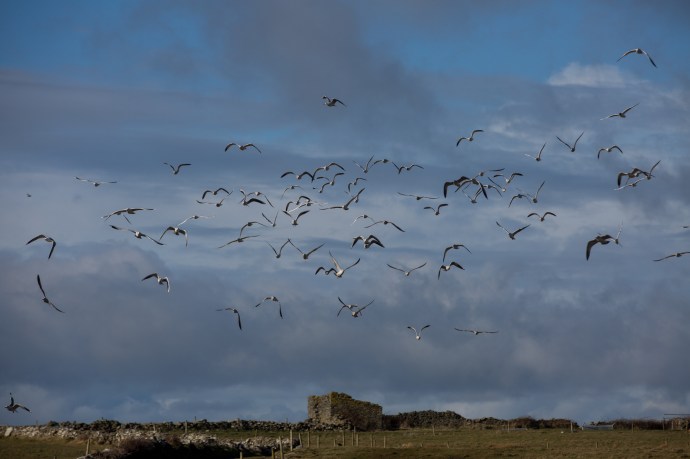
My first surprise was that it wasn’t the quiet idyll I expected. Because I wasn’t truly alone. The screeching and squawking of gulls and the persistent piping of oyster catchers was overpowering at times. They were telling me in no uncertain way that I was an intruder. Why would they welcome me? This was their world. One gull took a particular exception to me. I was repeatedly dive bombed. Heading straight for my head and only pulling on the joy stick at the last minute to clear me by inches. This was only a taster though. A more Hitchcock-like experience awaited me on the other side of the island.

IG3C4391

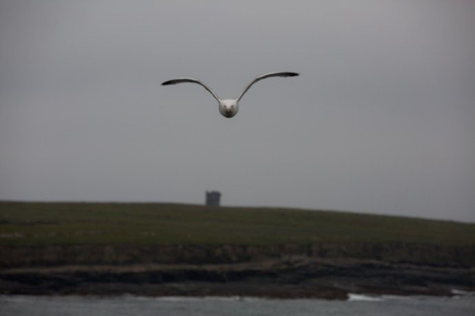
Being dive bombed by a gull.

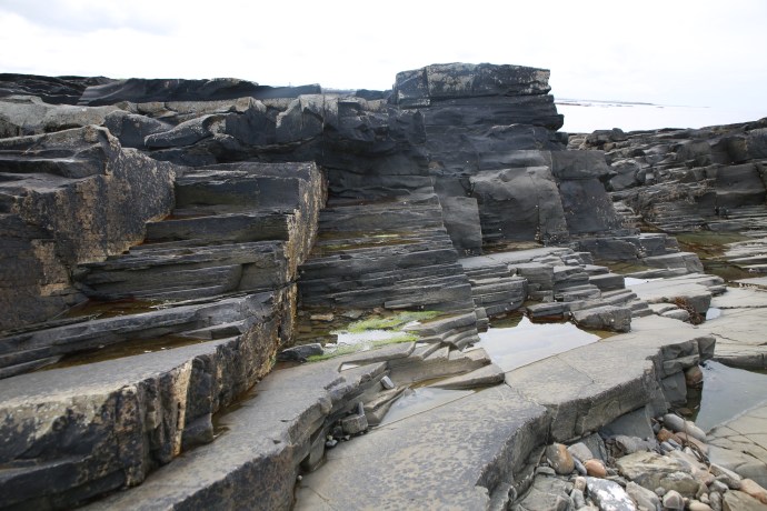
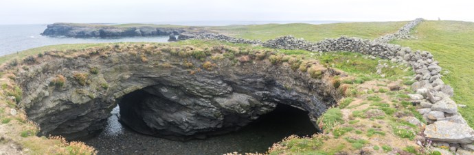
It only took a few strides from the rocky beach though until I realised this was a much more varied landscape than I had imagined. The rolling green slopes that you see from the mainland were there, yes, but hidden from view there were rugged cliffs. Sheer drops and a deeply incised coastline, caves, sea arches, channels and stacks revealing a wildness that was breathtaking.

IG3C4444

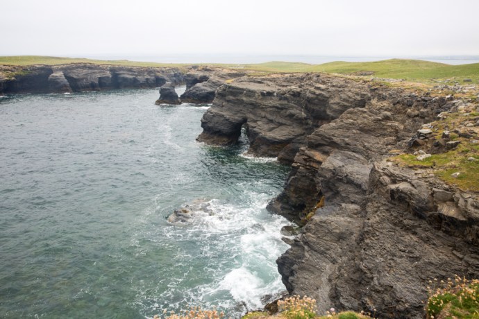
The beautiful incised coast at the north eastern end of the island.

IG3C4338

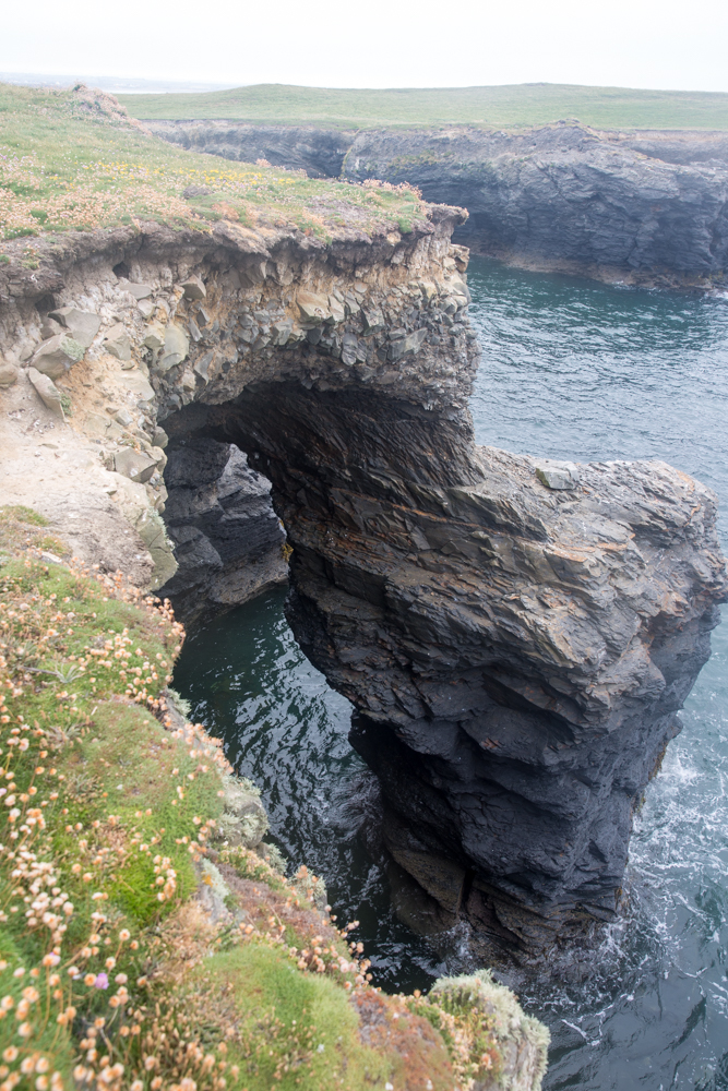
A natural arch on the northern coast

IG3C5467

The sculpted coast exposed at low tide.

IG3C4382

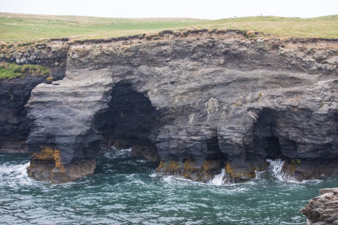
Caves and Arches I.  High tide

IG3C5481

Caves and Arches II.  Low tide.

The rocks are all sandstones and shales, as on the mainland, faulted and folded by a disruptive tectonic event nearly 300 million years ago. This alternation of soft and hard layering and extensive faulting has provided many opportunities for selective erosion creating these awesome geological features.

IG3C5436

This cave is formed at a fault boundary where soft shale is in contact with hard sandstone

IG3C5456

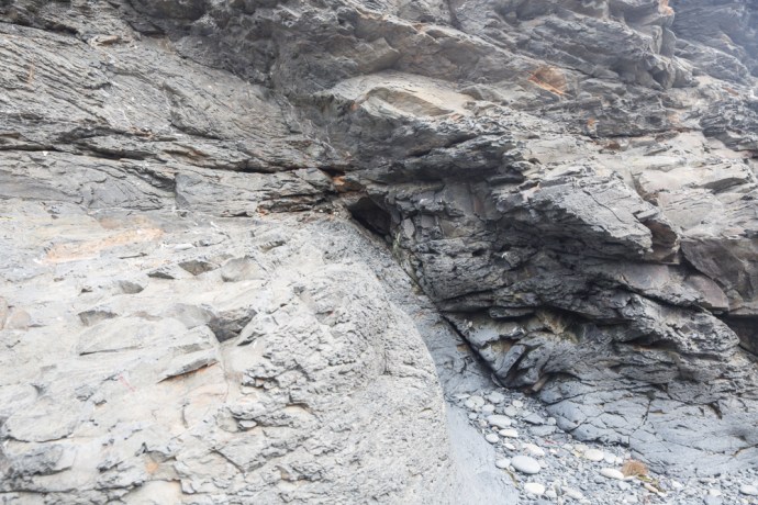
A cave in the early stage of development.  Erosion is taking place along a fault and under a sandstone cap.  Come back in a few hundred years and this will be a cave.

Sometimes the roof collapses forming what are known as stacks. There is particularly impressive roof collapse which has formed a cave (known as Poul Tabach, a reference to the contraband dealings that went on there),  It has created a giant sink hole with two entrances one open to the sea.

IG3C4454-Pano

A collapsed cave and arch.  Poul Tabach.  Walled off by the early settlers to stop livestock disappearing down the hole.  Said to have been used by smugglers.

On the western side of the island there are many similar caves and arches.  I found a number of natural bridges across steep narrow chasms right at the north western tip – in one case a double bridge, something I had never seen before.

IG3C4731

Arches and bridges over a steep natural chasm.  The bridge in the middle distance is actually a double arch.

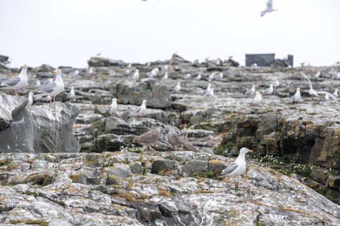
As I walked west the sky became thick with those gulls again. I was approaching their breeding grounds. I felt a bit like a cross between David Attenborough and an extra in The Birds, as I skirted around the edge trying as much as possible not to disturb them but at the same time wanting to observe close up this rare experience.

IG3C4642

Gull colony with the cliffs of the north west tip of the island in the distance.

IG3C4806

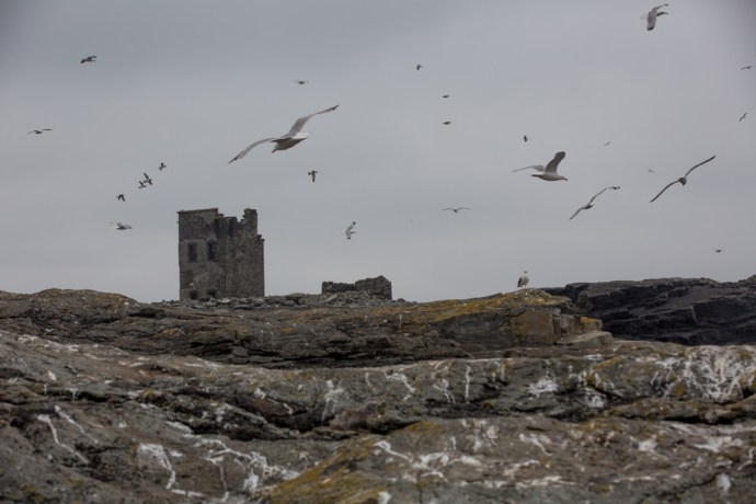
Gulls take to the air over the Napoleonic Tower

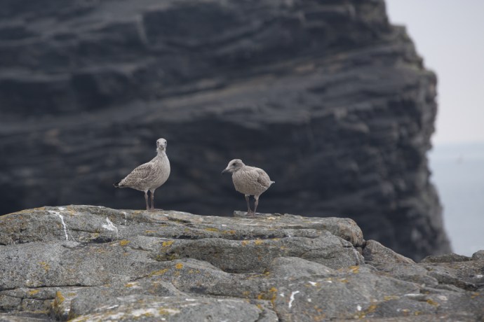
To my untrained eye there seemed to be two species of gull sharing the same nesting sites. I later identified them as Herring Gulls and Lesser Black-backed Gulls.

IG3C4697

Herring Gulls and their chicks

IG3C4911

A Lesser Black-backed Gull in flight

There were two distinct colonies with thousands in each. One was on exposed rocks with nests on little remnant vegetated patches or just on the bare rock and the other, some distance away with extensive burrows in a field. The dowdy chicks still unable to fly and with their distinctive grey, brown and cream down, scampered across the rocks or hid in their burrows abandoned momentarily by their parents to try and distract me. The more confident ones standing on the cliff edge dreaming of the day they would fly.

IG3C5236

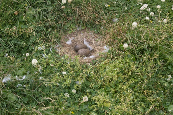
Gull eggs.  Here they are in a nest but often they are laid on the bare rock.

IG3C4813

Two Herring Gull chicks.  Ready for their first flight?

IG3C4280

Herring gull chick taking refuge in a burrow

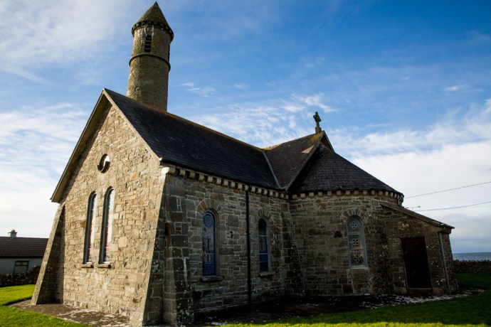
I was endlessly fascinated watching this seething mass but there was more to see. Not far away was the tell tale silhouette of a Napoleonic signal tower, so I headed there.

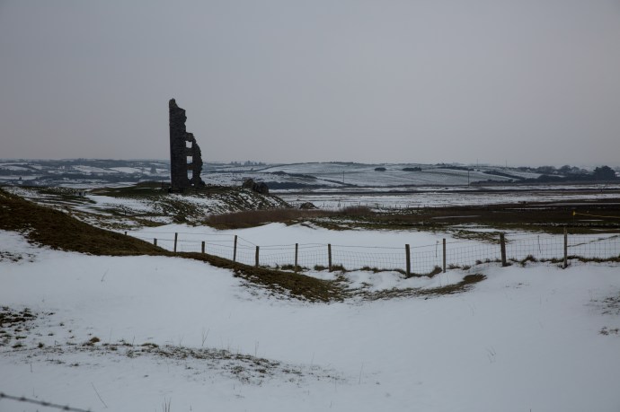
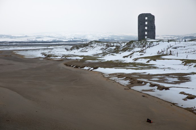
Bearing a superficial resemblance to a Tower House, many call these structures ‘castles’. They are not. They are a part of a network of towers built between 1804 and 1806 as a response to the threat of invasion by the French. There were around 80 towers built along the west and south coast from Malin Head all the way to Dublin. Each cost £3,000 to build.

The idea was that they were within sight of each other (theoretically! Irish weather not withstanding) and in this way a message could be transmitted using flags and black balls on a tall wooden mast.  Following Napoleon’s defeat at Waterloo in 1815, the towers fell into disuse. Though solidly constructed many are now crumbling ruins. This one though has many typical architectural features preserved and seems to have been one of the better built ones.

IG3C4762

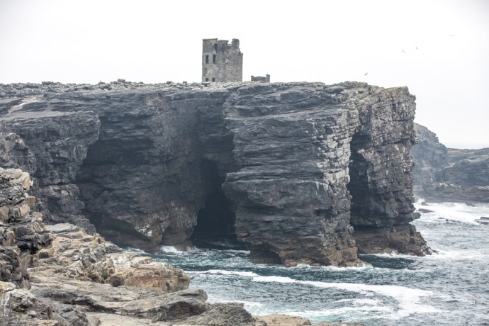
Sea cliffs with caves and bridges and the Napoleonic Tower

IG3C5125

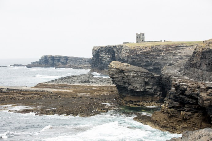
The western coast of the Island

It is a handsome building with solid mortared stone walls built of local shale and sandstone but with window surrounds of cut and dressed limestone. Other highlights such as the fire places, the elegant window surrounds and the observation platform buttresses were also of this limestone. Some features were also constructed of red brick. The walls were rendered in a cement with a lot of shell grit  The walls were covered inside and out with a mortar of the same material, though only a little remains.   The external walls were covered with overlapping slate tiles of which only those on the north-east wall have partially survived. The limestone, bricks and mortar would have been imported to the island. Internally you can see remnants of  timber lintels and floor joists.  Again presumably imported onto the island. There are many names and dates scratched into the mortar with elegant script and though largely illegible now, most seem to date from the 1800s.

IG3C4940

Napoleonic Watch Tower

The whole is surrounded by a very solid wall in similar style to the tower and a stone out building. It is perched on the top of a cliff on the highest point on the island and in sight of the Hag’s Head tower to the north and Loop Head (tower now gone) to the south.

IG3C5027

Entrance gate and wall surrounding the tower.

These towers are a reminder of the fear that would have engulfed Britain and its colonies at the time and the incredible effort that nations would go to to protect their borders. It is truly remarkable to think that 80 of these towers were built in a two year period in some of the remotest places you could imagine.

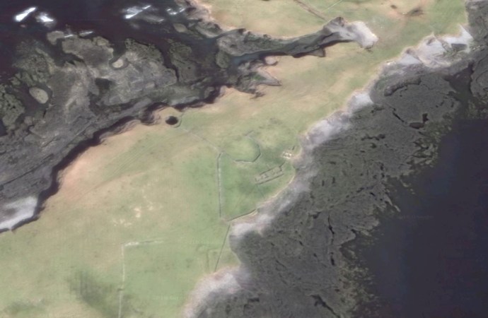
My day was rapidly coming to an end. To get back to the pick up point I had to cross a wide expanse of meadow and in places, bog. But first I headed out to the headland at the southern end of the island.  Something drew me there. I think it was the cormorants at the point but on the way I pondered a rubbly ridge of stone on the landward side of the headland.  Later I discovered this is believed to be the site of an ancient Promontory Fort possibly Bronze Age.  You can clearly see this rocky ridge on the google image.

IG3C5179

Rocky rubble possibly representing the wall of a promontory fort at the southern tip of the island

Mutton island prom fort

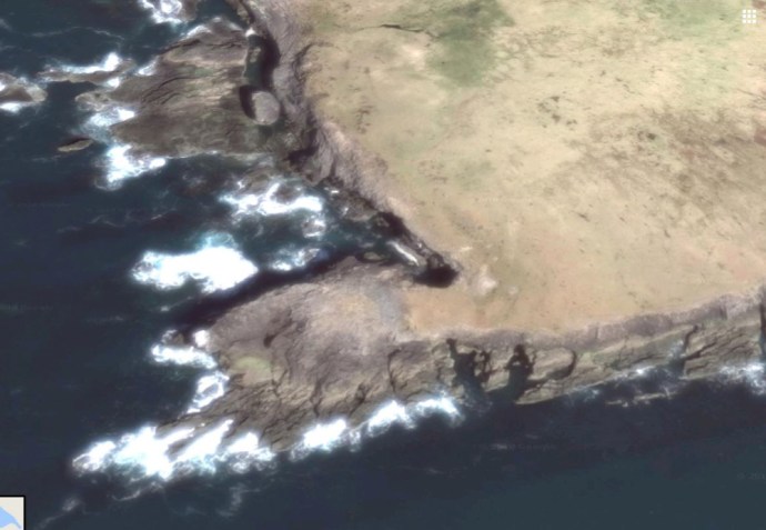
Google image of the promontory fort  You can see the break where the rubble in the photo above is.

No one really knows what these were used for.  But they may have been some sort of lookout. This would suggested habitation before the time of Christianity.  St Senan was said to have built a monastery here before going to Scattery.  So we are confident it was lived on in the 7th century.  Records suggest four monks had an oratory here.  It is common for oratories to have a circular wall and there is such a wall at the eastern side of the island.  Was this the site of the oratory, long since gone?

mutton island circle wall

Google image showing part of  a circular wall which may have been the site of St Senan’s oratory.  The hole to the north of this is Poul Tabach.

IG3C4459

The circular wall and much later ruined cottages.

It would seem the island is getting smaller as Samuel Lewis in his 1837 book on Clare gives it an area of 210 acres, down now to 185 acres. Historically however it may have been much, much bigger. The island is referred to in The Annals of the Four Masters, (a compilation of Irish history up to 1616) as Fitha Island which included the now separate islands of Mutton Island, Inismattle and Roanshee. This source states that Fitha was connected to the mainland until in 804AD “the sea swelled so high that it burst its boundaries, overflowing a large tract of country and drowning over 1,000 persons.” This is now presumed to have been a tidal wave and it is speculated that it may have been responsible for separating the islands from the mainland. Geologically, this would be pretty unlikely if the connection was of sandstones and shales, however it is plausible, given the extensive glacial deposits still on the island, that if these unconsolidated sediments were the connection with the mainland, then such an event may well have removed some of these deposits.  As storm events today still do.

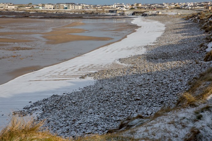
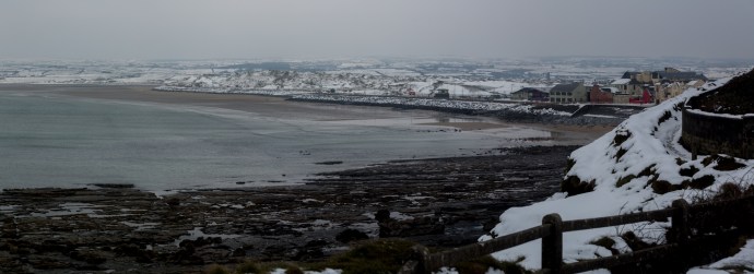
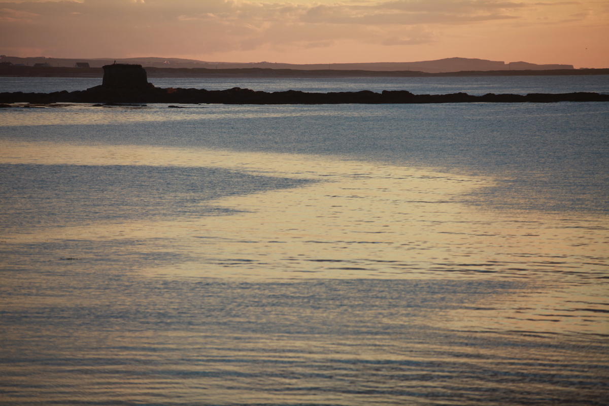
In fact the water between Mutton island and Quilty is very shallow. Anthony, my ferryman, told me that they used to walk cattle across on very low Spring tides. As we returned on the boat he showed me the ‘road’ that lies at the ocean bottom visible in the clear water just couple of metres below.  In these very low tides water will reach your knees suitable for cattle.  A couple of days later I visited the Seafield shore to see whether I could find it. Sure enough there is a ramp of sorts visible at low tide and in the photo below you can see the trace of the submerged roadway, highlighted in the evening light.  It turns out it is in fact clearly visible also on the google satellite image.

IG3C7629-Pano

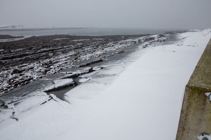
View from Quilty to Mutton Island.  The ramp to the left is the start of the ‘roadway’ and you can see its trace continuing to the eastern end of the island. You can also see it in the first photo of this blog.

Mutton island road

A google image showing the shadow of the roadway at the eastern end.

The island would have had many stories to tell. A ship, the Sao Marcos, from the Spanish Armada, is said to have run aground in 1588 with sailors buried on the island, and it was used extensively by smugglers in later years who took advantage of its many caves. During the days of the Sinn Fein courts, which operated outside the British justice system, it was used as a detention camp.

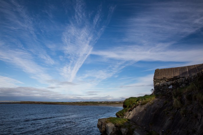
Further evidence of habitation is in the ruins of some cottages on the south eastern side of the island. It is believed that up to a dozen families lived here in the 19th century, the population peaking in the 1920s.  They fished, harvested seaweed, grew potatoes and vegetables, and as the island’s name suggests kept livestock.  ‘Mutton Island’ is said to derive from the quality of the meat, flavored by the lush grasses and herbs that the sheep dined on.

IG3C5355

Ruins of the village on the island.  A home now for the starlings

People lived on the island seasonally until late in the 20th century.  One resident led a hermit-like existence there until the mid 50s, living summer and winter for four years.  Quite remarkable when you think about it.

As I walked around I saw signs of more recent human activity however. Some fencing. Lobster pots, the remains of a motor vehicle? I had heard a report that one of the residents of the island had built a raft and freighted a Ford Anglia to the island.  Was this it?

IG3C5424

Is this the the wreck of the Ford Anglia?

Mutton island is an island of mystery.  I have talked about the archaeological heritage but what about this?  I found yhis unique figure in the thick grass around the Napoleonic Tower.  Made from the red bricks used in the tower construction.  Is it the oldest example of an iconographic emoticon?  Predating the digital age by two centuries?

IG3C5052

Archaeological heritage?  An early emoji.

And then there’s this.  A crop circle?

IG3C5319

A crop circle?

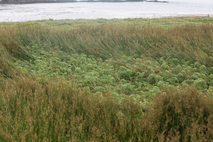
There is a wide variety of vegetation.  No trees.  That’s a given, but grasslands, bogland and in places thick growth of thistles and cow parsley that comes up to your chest. Not easy to walk through especially given the hidden rabbit holes!

IG3C4490

Fields thick with cow parsley.

IG3C5284

Bog cotton

For now the island is populated by rabbits, rats, seals and reportedly goats (though I didn’t see any, so that population may have died out). Doesn’t sound appealing but all the land mammals were introduced from the mainland and are happy in this people-less place.  Even less appealing perhaps were the colonies of midges.  But, you know, they weren’t interested in me in the least.  They were quite happy to dine out on the sweet nectar of the cow parlsey flower.

IG3C5369

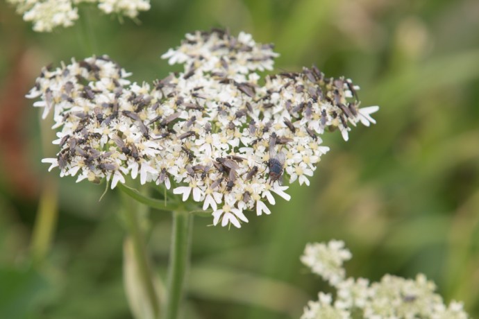
Midges on a cow parlsey flower head.  That’s a normal fly for scale.

The island is privately owned and changed hands many times of late.  At one time it was owned by the DuPont corporation who thought that it would make a perfect terminal for shipping the oil that was discovered west of Aran Islands.  Luckily that plan fell through!  An American bought it then and he had grand plans but couldn’t get permission for a pier.

It is a bird sanctuary now and this gives it protection, to some degree, from such avaricious planning decisions, so hopefully it will be there to be enjoyed by those willing to take the trouble and time to get there and who respect its cultural value to Ireland.

This is as it should be.

Around 5 pm Anthony returned in that little red boat, this time finding a shallow beach to pick me up.  Reluctantly I re boarded, but the memory of that special place will be permanently etched.  Images that will return every time I pull the curtains of my bedroom window to let in the morning light and stare across at that proud rock.

IG3C5516

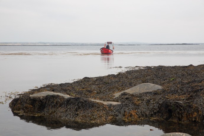
The ferryman returns to collect me

IG3C7972

An excellent four part radio series about Mutton Island was made by Raidió Corca Baisicinn in 2016   It’s worth listening to.  You can find it at http://rcb.ie/mutton-island/


Categories: My Journey, Real Ireland, Wild Ireland | Tags: , , , , , , , , , , , , , , , , , , , , , , , , | 1 Comment

The Big Freeze. March 2018. My Story.

What an extraordinary event.

Gotta say I’m not used to snow.  Not used to the feeling of flakes on your face or the biting wind or the stunning beauty when the sun comes out.  Or the slushy wetness that soaks through your boots and trousers and gets tramped through the house.  Or digging the snow from your front door. Or being stuck in your house. Or the vicissitudes of stupidly taking a remote boreen just as a snow shower starts.  I’ll come back to that last one later.

The snow came from that annoyingly named freak weather condition known as ‘The Beast from the East’ which blasted frigid air across continental Europe and over Ireland. It arrived in West Clare on a Wednesday, the last day of February 2018. But it turned out that that was just an entree to a full three course meal which came Thursday and Friday and continued to Sunday.

But first this ‘Beast’. Where did it come from? And why was it so devastating? As a geologist I make a pretty poor meteorologist but those that do know about these things said the whole thing was triggered by a periodic event called “sudden stratospheric warming”. This involved a huge rise in air temperature of around 50ºC in an area about 30 km above the Arctic (the stratosphere).  The origin of this actually goes back to severe cyclones in January in the Pacific disturbing global weather patterns. A true ripple effect. Anyway, this warming weakened the jet stream and forced cold air from western Russia towards Ireland.  Temperatures on the ground in the Arctic were 20ºC above normal, while Europe experienced lows of -15ºC in many places.  And then to complicate it there was Storm Emma which headed north from Portugal.  When it hit the cold air, blizzards, gales and snow were the result.

Where I could, I tried to record the event with my camera and words. Here is a personal account of how it all unfolded around my little part of West Clare.

Wednesday 28th February 2018

We knew it was coming. Temperatures had been way below normal for days and the web was alive with warnings.  Yet I had no idea exactly what was in store. Just two weeks earlier I was chasing all over Ireland to Louth and Armagh and Kerry and Wicklow and Connemara because of snowfalls there. Now it was here in my front yard.  It was snowing when I awoke and it continued to snow.  I was excited enough to venture out around 9am.  The snow wasn’t heavy; just a few centimetres so I figured there would be no real problems except that is that the weather accompanying this snow was truly living up to the appellation that is the ‘Wild Atlantic Way’.  I headed to Spanish Point Beach, braving snow showers and bitter wind.  I’ve seen this beach battered with giant waves, covered in froth and foam and perfectly still with nary a ripple. Never though with white snow meeting the yellow sand. It was not comfortable as mini blizzards would sweep in between the sunshine. Nevertheless I was totally entranced and happy.  The showers faded during the day and though the temperature hardly went above zero, the snow melted by the late afternoon and the streets of Miltown Malbay returned to relative normality. This turned out to be a temporary reprieve.

IG3C3178

Snowstorm on Spanish Point Beach. Wednesday 28 February 2018

IG3C3177

Spanish Point Beach, Wednesday 28 February 2018

IG3C3219

Bell Bridge House Hotel.  Wednesday 28 February 2018

IG3C3253

Mouth of the Anagh River.  Looking across to Caherush.  Wednesday 28 February 2018

IG3C3259

Bridge over the Anagh River.  Wednesday 28 February 2018

IG3C3274

Spanish Point Beach. The sun shone briefly.  Wednesday 28 February 2018

IG3C3296

Spanish Point Beach.  Looking from the Armada Hotel.  Wednesday 28 February 2018

IG3C3348

The Clogher Road.  Looking towards my cottage.  Wednesday 28 February 2018

IG3C3371

Caherush.  Low tide. Wednesday 28 February 2018

IG3C3377

Mutton Island.  Wednesday 28 February 2018

IG3C3398

Caherush looking towards Quilty.  Wednesday 28 February 2018

IG3C3231

Miltown Malbay  Wednesday 28 February 2018

IG3C3236

Miltown Malbay.  Wednesday 28 February 2018

Thursday 1st March 2018

I woke up reluctantly poking my head above the sheets with the temperature hovering at -4ºC.  A quick look out the window showed a complete white-out. It was a stunning sight. I love how you don’t know it’s happened during the night. So quiet unlike a rain storm pelting on the slate roof and rattling the windows.

The rocks and cliffs of the bay at Caherush were covered with a thick white carpet and it was still snowing with some vigour.  Around 9am it brightened and it stopped snowing.  I rugged up and took a walk up the Clogher Road.  I was joined by the neighbour’s dog, Valdo.  Briefly. This was much too exciting;  he had better things to do and left me to my meandering. The sun broke through the clouds and its rays made the hills gleam.  My neighbour Michael Talty, stopped his car for a chat. He was heading to Kilrush for some tractor parts. A farmer doesn’t stop for a bit of snow.  So of course I didn’t refuse the invitation to join him. I think he quickly regretted it as I had him stop at Quilty where the snow, the water and the sand united to create a magic world. Mutton Island sat like an iceberg off the coast. I had to photograph them.

As we left Quilty and headed south, there was only a light dusting over the fields. This part of West Clare had escaped the heavy falls that we had experienced. Business done, followed by an hearty breakfast in Kilrush we headed back north to Caherush.

We were passing O’Looney’s lovely pub just a few kilometres from Quilty at Molosky. Stop! I exclaimed as I caught a sight, out of the corner of my eye, of the falls at the Annageerah River. They were frozen! Michael waited patiently as I clambered over a gate and headed across a slushy snowy field to photograph the incredible sight of ice sheets draping the rocks and icicles clinging to wherever they could; where normally water flows. So lucky to see it.

Back home to the Clogher Road which by now was starting to thaw.  It was 2 pm and still -1ºC. The temperature never got to zero during the whole day

Encouraged by the condition of the roads on our journey, I cleared the snow from the car and headed north through Spanish Point along the coast towards Lahinch. The air was clean and crisp and the sun was making a good fist of doing its daily job but the thick cloud resisted. Nevertheless the bucolic landscape had become a patchwork of white fields and the coastline was now the White Cliffs of Clare. The views coming into Lahinch were unfamiliar but truly jaw-droppng. Though thick here across Liscannor Bay the fields were green. The snowfalls were obviously quite patchy.

I continued to Ennistymon. I wanted to see the Falls here.  Would they be frozen?  Well no they weren’t and they were quite subdued, as we hadn’t had a lot of rain for a week or so but they were framed with snow on every exposed rock with icicles hanging from branches and protected crags. The Falls Hotel looked like an alpine resort

A few flurries of snow were appearing now. I love that word ‘flurries’. Not one you get to use very often. Time to head home. Why didn’t I just stick to the main road? It had been treated with salt and grit and was perfectly clear. I was lulled I think into a false sense of safety. So with the help of Google, I took a back route to Miltown Malbay, it wasn’t long before I got into serious trouble. It was only a small hill. A narrow single lane boreen. With a hedge on the left and a ditch on the right. I knew I had to use a high gear and travel at a decent clip but I lost traction very quickly and found myself half way up the hill and going nowhere. Under the snow was a layer of ice. With wheels spinning I couldn’t go forward. With no brakes, reversing was pretty scary. I honestly don’t know how I got out of that. Reversing back down the hill and using the gears to slow down, the wheels went wherever they wanted.  One minute I slid into the hedge. Straightening up then I would head towards the ditch. It was probably only 200m of reversing first down the hill then back up another but it took forever until I came to a farm gate. The drama still wasn’t over as it took many goes slipping and sliding all over before I edged the nose of the car into that refuge and was able to turn around and drive home. To my warm fire and a few relieving tunes and a glass of the small.

That was some day but the wires (as we used to call it before the wireless world took over) were full of dire warnings of another storm. Emma was arriving and would collide with the Beast and batter us with wind and massive snowfalls. Code Red all over the country.  Bread and milk had disappeared from the shops. This really was serious.

IG3C3484-Pano

Panoramic view of Caherush bay.  Thursday 1 March 2018

IG3C3462

Caherush Bay at low tide in the snow.  Thursday 1 March 2018

IG3C3459

My cottage on the shore. Thursday 1 March 2018

IG3C3496

More snow.  Thursday 1 March 2018

IG3C3504

Caherush Bay Thursday 1 March 2018

IG3C3546

Mutton Island.  Thursday 1 March 2018

IG3C3547

Sugar Island and Quilty. Thursday 1 March 2018

IG3C3590

The sun breaks through. Thursday 1 March 2018

IG3C3624

Joined on my walk by Valdo.  Thursday 1 March 2018

IG3C3627

Joy.  Thursday 1 March 2018

IG3C3628

Looking down the Clogher Road.  Thursday 1 March 2018

IG3C3664

Driving into Quilty.  Thursday 1 March 2018

IG3C3667

The Quilty Shore I.  Thursday 1 March 2018

IG3C3672

The Quilty Shore II.  Thursday 1 March 2018

IG3C3675

Quilty Shore III.  With Mutton Island in the distance.  Thursday 1 March 2018

IG3C3716

Breakfast at Kilrush.  Thursday 1 March 2018

IG3C3739

The snow falls again at Annagreenagh Falls, near Quilty.  Thursday 1 March 2018

IG3C3758

Annageeragh Falls.  Thursday 1 March 2018

IG3C3764

Annageerah Falls.  Thursday 1 March 2018

IG3C3818

View towards Cliffs of Moher from Spanish Point.  Thursday 1 March 2018

IG3C3828

Near Spanish Point.  Thursday 1 March 2018

IG3C3877

Near Lahinch.  Thursday 1 March 2018

IG3C3890

Lahinch. Thursday 1 March 2018

IG3C3899

Moy House.  Lahinch, Thursday 1 March 2018

IG3C3909

Cliffs south of Lahinch.  Thursday 1 March 2018

IG3C3920

Fenceline and cliffs.  Lahinch. Thursday 1 March 2018

IG3C3945

Lahinch. Thursday 1 March 2018

IG3C4008

The Falls at Ennistymon. Thursday 1 March 2018

IG3C4048

Falls at Ennistymon.Thursday 1 March 2018

IG3C4142

Looking towards the Falls Hotel on the Inagh River at Ennstymon.Thursday 1 March 2018

IG3C4199

Icicles I .  Ennistymon.  Thursday 1 March 2018

IG3C4225

Icicles II.  Ennistymon.  Thursday 1 March 2018

IG3C4352

Icicles III.  Ennistymon.Thursday 1 March 2018

IG3C4248

Icicles IV.  Ennistymon.Thursday 1 March 2018

IG3C4110

Icicles V.  Ready to drop.Thursday 1 March 2018

IG3C4377

Frozen grass on the menu today. Lahinch. Thursday 1 March 2018

Friday.  2nd March 2018

It would reek havoc they said.  And they were right about that! Friday morning saw a thick cover of snow over everything with drifts up to a metre. We, in Clare though,  seemed to get off rather lightly. The east and the south of the country were lashed with ferocious snowstorms. Back here in Clare, snow piled up against my door, just like in those movies set in countries where they have real winters.  It was obvious I was going nowhere today, so I settled in with a warm fire to wait it out. Even if I wanted drive anywhere the Clogher Road was not going to cooperate. It continued to snow all day. I ventured out in the late afternoon as the snow eased. The tide had come in and the ocean was tranquil with the bay in front of my house looking surreal with its brilliant white ‘beach’ all the way down to the high tide mark. The car remained in a drift and I went nowhere. No thoughts of a session and in any case most pubs were shut. Marooned. Like millions of others across the Once Green Isle.  Who knows how much fell? I heard a figure of 40cm but I would say much more in some places.  At least it had stopped.

IG3C4451

My cottage.  Marooned.  Friday 2 March 2018

IG3C4467

Going nowhere.  Friday 2 March 2018

IG3C4490

The Clogher Road.  Friday 2 March 2018

IG3C4530-Pano

Caherush Bay at high tide.  A surreal calmness.  Friday 2 March 2018

IG3C4401

My front patio.  Friday 2 March 2018

IG3C4406

The ‘beach’ at Caherush.  At my front door.  Low Tide.Friday 2 March 2018

IG3C4435

Caherush. Friday 2 March 2018

IG3C4499

The ‘beach’ at Caherush.  At my front door.  High Tide. Friday 2 March 2018

IG3C4515

The Clogher Road.  Friday 2 March 2018

Saturday. 3rd March 2018

More snow overnight but by the morning all was quiet. Temperatures were up now with a maximum of 2ºC for the day. A veritable heat wave. I was still going nowhere. The predicted rain didn’t arrive but by the afternoon I decided the snow on the roads had started to melt sufficiently to venture out again. Roads had a lot of snow in massive drifts, sometimes two metres high, and in many places were down to one lane. Those roads that were treated were passable but venture off the main roads at your peril. I’d learnt my lesson.  Most residents who live up narrow lanes were were still stuck.  My route again took me to Lahinch and Ennistymon.  The snow was still thick and extensive but the melt had started.  Lahinch golf course was more whites than greens and it was easy to become blaze about the stunning beauty all around.  Snow was still everywhere in Ennistymon, Lahinch and Miltown but the ploughs had been through and it was now more of a hazard to pedestrians.  Businesses were starting to reopen.  Life goes on.

IG3C4576

The Clogher Road is now passable. Saturday 3rd March, 2018

IG3C4599

Welcome to Quilty Holiday Cottages.  Saturday 3rd March, 2018

IG3C4631

The Bell Bridge Hotel and beyond.  Spanish Point.  Saturday 3rd March, 2018

IG3C4644

Caherush.  Saturday 3rd March, 2018

IG3C4651

Behind the Strand.  Clogher Road.  Saturday 3rd March, 2018

IG3C4658-Pano

Panoramic view of Surf City Lahinch.  Saturday 3rd March, 2018

IG3C4667

Ennistymon. Saturday 3rd March, 2018

IG3C4725

Blake’s Corner. Ennistymon.  Saturday 3rd March, 2018

IG3C4752

The Inagh River and Ennistymon.   Saturday 3rd March, 2018

IG3C4767

The old Railway Bridge over the Inagh River,  Ennistymon.  Saturday 3rd March, 2018

IG3C4789

Lahinch. Saturday 3rd March, 2018

IG3C4810

Snow dunes, Lahinch.  Saturday 3rd March, 2018

IG3C4827

Lahinch Castle.  Saturday 3rd March, 2018

IG3C4843

The Golf Course at Lahinch..  Saturday 3rd March, 2018

IG3C4871

Lahinch  Saturday 3rd March, 2018

IG3C4875

Another view of the Castle.  Lahinch.  Saturday 3rd March, 2018

IG3C4883

The estuary at Lahinch. Saturday 3rd March, 2018

IG3C4892

Snowy hills above Lahinch Golf Course.  Saturday 3rd March, 2018

IG3C4921

Miltown Malbay.  Saturday 3rd March, 2018

Sunday.  4th March 2018

No snow last night and finally the real thaw started. It still only got to 2ºC maximum all day but the lure of a music session at lunch time in Ennis was too much for me to resist. The Clogher Road was mostly clear now. Mikey Talty was, like many, shoveling snow off the road in front of his house. I stopped for a chat.  Mikey had been living here for over 80 years. “Have you ever seen anything like this before?” I asked. “Aah yes” he said. “When I lived in the States”. 

Grinning I went on my way. Ireland does get heavy snow every few years. But not so often in these low lying coastal areas such as West Clare. The road to Ennis goes over Slieve Callan and the snow was thick in the hills and again there were drifts, metres high, meaning it was a slow trip. The music at Cruises Pub in Ennis was fantastic, with a huge crowd, desperate for a circuit breaker from the travails of the last few days. I returned about 5pm and it was still felt more like a journey through the alps rather than rural Ireland. I wasn’t ready to go home and called in at Hillery’s, for the regular Sunday evening session.  Life goes on.

IG3C4935

Mikey Talty, resident on the Clogher Road for 82 years clears away snow.  Sunday, 4th March, 2018

IG3C4937

Snow drifts on the road to Inagh.  Sunday, 4th March, 2018

IG3C4947

Heavy cover of snow remains.  Sunday, 4th March, 2018

IG3C4961

Even the windmills stopped turning.  Sunday, 4th March, 2018

IG3C4966

Lonely cottage at the food to Slieve Callan.  Sunday, 4th March, 2018

IG3C5172

Switzerland? or Ireland?  Sunday, 4th March, 2018

IG3C5183

The boreens were starting to clear.  Sunday, 4th March, 2018

IG3C5207

Looking forward, looking back.  Mt Callan.  Sunday, 4th March, 2018

IG3C5100

Enjoying the craic at Cruises Pub in Ennis.  Sunday, 4th March, 2018

IG3C5229

The snow melts in the fields on the Clogher Road.  Sunday, 4th March, 2018

IG3C5232

Caherush.  The rocky bay is returning to normal  Sunday, 4th March, 2018

IG3C5237

Almost gone.  Sunday, 4th March, 2018

Monday, 5th March 2018.  

It wasn’t quite over yet. Still the predicted rain never arrived and most of the snow on the lower ground had retreated but I knew it was still lying in the uplands.  Maybe the Burren would be worth a visit.  I wanted to see it.   Temperature was still around 2ºC in the morning as I set out but by the end of the day it had risen to 5ºC.  So I drove to Poulnabroun and then to Ballyvaughan and back through Carran.   It took all day.  It was cloudy and misty so not ideal but walking in the stillness of a snowy Burren was something truly special.  So quiet with hardly a soul on the road and those that were seemed to be heading somewhere else. A privilege to see it like this. I encountered a few busloads of tourists and they like me were the lucky ones.   The dolmen at Poulnabourn was looking resplendent and I viewed the wonderful stone walls literally in a different light as they stood out framed by the whiteness of the snow and the sky.  See if you agree with me.  The hills actually had a lot more snow than was apparent from a distance with the clints and grykes retaining the snow where it had melted elsewhere.  The Turlough at Carran, a wondrous geological feature  had plenty of water, though much of it appeared to be covered with ice. I imagine a couple of day earlier you might have been able to walk across it. By the way turlough, along with drumlin and esker are the only three words of Irish origin that I know that are  used worldwide as geological terms.  Thick snow was still on some of the Lanes but the snow ploughs were out and about so I imagined most would be passable.

The event that had dominated Irish lives, closed schools, airports highways and even pubs, isolated people for days and created timeless memories was over.

And that seems a good place to end this story.

IG3C5243

Plenty of snow on the way to the Burren.  Monday, 5th March 2018.  

IG3C5261

Poulnabroun Dolmen.  Monday, 5th March 2018.

IG3C5282

Poulnabroun Dolmen.  Monday, 5th March 2018.

IG3C5316

Near Poulnabroun Dolmen.  Monday, 5th March 2018.

IG3C5351

Burren scene.     Monday, 5th March 2018.

IG3C5378

Burren.  Monday, 5th March 2018.

IG3C5388

Burren.  Monday, 5th March 2018.

IG3C5419

Burren.  Monday, 5th March 2018.

IG3C5462

The tourists still come.  Monday, 5th March 2018.

IG3C5518

Burren. Monday, 5th March 2018.

IG3C5568

On the way to Carron. Monday, 5th March 2018.

IG3C5580

Still heavy snowdrifts.  Monday, 5th March 2018.

IG3C5589-Pano

Carran Turlough.Monday, 5th March 2018.

IG3C5599

The Turlough. Much of it is still frozen.  Monday, 5th March 2018.

Here are some pictures of those wonderful stone walls:

Tuesday 6th March 2018

I thought I had finished this blog but it was much brighter this morning and by the afternoon the sun was returning.  The temperature soared up to 7ºC.  Out my kitchen window the paddocks were pretty much free of snow.  Not Mt Callan.  It looked glorious (despite those windmills) with patches of sun glistening off it.  I had to go up and take a closer look.  There was plenty of snow so, sorry, a few more pictures.

Almost a week.  A week I won’t forget.

IG3C5625

Mt Callan.  The view from my kitchen window. Tuesday 6th March 2018

IG3C5639

Ruined cottage.  Road to Mt Callan.  Tuesday 6th March 2018

IG3C5642

Behind Miltown Malbay.  Tuesday 6th March 2018

IG3C5644

Mt Callan. Tuesday 6th March 2018

IG3C5656

The Summit.  As close as I could get.  Tuesday 6th March 2018

IG3C5679

Abandoned barn.  Mt Callan. Tuesday 6th March 2018

IG3C5693

The roof of the world.  Tuesday 6th March 2018

IG3C5717

Situation normal.  The gulls have returned to Caherush.

IG3C5708

A bird’s eye view.  Tuesday 6th March 2018

Categories: Real Ireland, Wild Ireland | Tags: , , , , , , , , , , , , , , , , , , , , , , , , , , , , , , , , , , , , , , , , , | 6 Comments

Quilty. On the Edge of Ireland.

IG3C1507

I’ve lived in West Clare for over three years now.  My local village is Quilty.  It occurred to me the other day that I have travelled all over Ireland discovering beauty in places known and unknown but I have never photographed this tiny fishing village in my back yard.

So the other day on a fine day in early November I went for a walk around Quilty.  Quilty truly is on the edge of Ireland and inextricably linked with the sea.  Quaint fisherman’s cottages perched on the cliff above what can be a very stormy Atlantic.  And the Our Lady Star of the Sea Church and its imposing tower is a constant reminder of the heroic rescue of the crew of the Leon XIII in 1907. The stuff of legends.

Here is a collection of images taken that day.  It doesn’t need my words so I will let this photo essay speak for itself.  IG3C1467


IG3C1470IG3C1484IG3C1495

IG3C1501IG3C1594IG3C1538IG3C1556

IG3C1472IG3C1603IG3C1623IG3C1679

Categories: My Journey, Real Ireland | Tags: , , , , , , , , , , , , , , , | 2 Comments

All is not what it seems. A little story from the Wild Atlantic Way on the west coast of Clare.

I live in a remarkable spot and I have written of it and photographed it many times. Point Caherush lies between Quilty and Spanish Point along the spectacular west coast of Clare.  Indeed it was spectacular before it became part of the Wild Atlantic Way but now of course it is legitimately spectacular because it has a label with the word ‘wild’ in it. Anyway I live at the end of a one kilometre long boreen known locally as the Clogher Road. My front door looks out over Quilty and Mutton Island. Here’s a reminder.

ig3c5962

My little cottage nestled on the rocks at Pt Caherush


The rocks at my feet though are similar to the rest of the West Clare coastline from Loop Head to Doolin, and comprise shallowly dipping interbedded sandstones and shales.  For the whole time I have lived here I assumed that I was living at the edge of a wilderness (that’s the ‘wild’ in Wild Atlantic Way!). A thin strip of pristine land beyond the rolling green that is everywhere so heavily moulded by man.  I surmised, somewhat romantically, that only the hand of the sea had sculpted the shore. Despite this I was troubled by some observations I could not explain. Perfectly circular holes in the rock sometimes with radial joint patterns around them were disturbingly reminiscent of what I had seen in open cut mines. This made no sense. There was nothing to mine in these barren sandstones.

But I didn’t think of the sandstone itself.

ig3c6883

Perfectly circular holes and radial joint patterns on the rock platform at Point Caherush


One day I was chatting to Mikey Talty, a resident of this place all his long life. I have written about that day in a previous blog, when three generations of the Talty family were harvesting kelp from the bay. Mikey is full of wonderful stories but he really got my attention when he mentioned working as a young man in the 1950s at a massive quarry operation on the Point. He showed me where the crushing plant was and described how truckloads of rock were carted away to build roads as far away as Kilrush and Kilkee. This mining it would seem had changed the shape of the headland and much of the protection of the bay was lost.

ig3c6799

Mikey Talty talks about Caherush in his youth.


With this new knowledge I now see the evidence everywhere in my wanderings. Of course the drill holes were for the explosives, some still showing their perfect shape and probably unexploded, and others with radial shatter patterns showing they did their job. There are rock exposures that are not natural and there is angular rubble strewn, that has yet to be smoothed out by the ocean.

ig3c6873

Blasted face at limit of quarrying

ig3c6913

Quarried rock face and blasted rubble


It is hard now to understand the thinking that would have led to the locating of a quarry here when there would have been plenty of locations away from the coast. I would like to think that in ‘modern’ Ireland it would be impossible to conceive of permission being obtained today for mining on the seashore. Perhaps planning approval wasn’t needed then and certainly priorities would have been different.

I can find nothing in the literature about this operation and maybe the memory of it is only now with those who lived or worked here. But the record will stay in the rocks for hundreds of years and I am sure it will confuse and intrigue future generations of geologists and non-geologists, who wander around Point Caherush, as it did me.

Categories: My Journey, Real Ireland, Wild Ireland | Tags: , , , , , , , , , , , , , , , , , , , , | Leave a comment

Where the ocean kisses Ireland and the waves caress its shore : of seaweed and báirnachs.

Where the ocean kisses Ireland and the waves caress its shore
The feeling it came over me to stay forever more

These words are from a Saw Doctor’s song, The Green and Red of Mayo. OK, they are about Mayo but they could just as easily have been written about Clare. Or about my house which is right there on the rocks; where the ocean kisses Ireland.

IG3C5962

At the moment it is a hive of activity. Seaweed harvesting is in full swing and there are regulars who visit the shore to collect winkles or báirnach (limpets) or drop in a line hoping for a pollock or mackerel.

Gerard Talty runs the seaweed farm and his pasture is right at my front lawn. He has developed a thriving business exporting at least a dozen products made from seaweed collected at Caherush and nearby and processed right here on the Clogher Road. Talk about coals to Newcastle, Japan is one of his biggest customers.

One bright day recently I went out to chat to the guys. There were three generations of Talty’s working the weed. Ger, his father Mikey and son Evan. That in itself is pretty unique.  Currently they are harvesting the kelp. Laminaria.  Ger is a great advocate for seaweed and he extolled the many properties of this particular variety of kelp. It eats cellulite; you can bathe in it; it is rich in magnesium; it has a chemical make-up that is closest to human blood. It is chock full of chlorophyll. Or you can cook any number of delicious things with it. There’s carrageen and dillisk and sea lettuce and all the rest too but today it was about kelp. Something I didn’t know about kelp was that the fifth taste, umami, was recognised in kelp in 1908 though it was nearly a hundred years later before it was given credence as a distinct taste alongside bitter, sweet, salty and sour.  This came with the discovery of umami taste receptors in the tongue and the stomach.IG3C6789IG3C6853IG3C6754IG3C6771IG3C6836

Seaweed farming has a long history in West Ireland. A poem, probably dating from the twelfth century, describes monks harvesting dillisk from the rocks and distributing it to the poor as one of their daily duties. It was used as a food and a medicine, as chewing tobacco, ingested to eliminate worms, and was recommended as a remedy for ‘women’s longing’ whatever that was.  Seaweed manure was particularly important in areas with poor soil, and conflicts were fought over seaweed rights and access.

10550110_1169256223085081_1466736678709842427_o

Ireland’s tradition of kelp harvesting dates back to the seventeenth century. It was burnt in stone kilns, the ruins of which are still visible in places. The ash that remained was used for glazing pottery and for making glass and soap and then later to produce iodine. This latter discovery kept the tradition alive until World War II. Now the tradition is continued by people like the Taltys.

I spoke to Ger’s dad Mikey. A resident on the Clogher Road for 79 years. And still driving the 1969 Massey Ferguson to harvest the weed. He remembers when the tractor replaced the horse and cart. I’ve seen him doing any number of farm chores, including driving the excavator onto the beach to clear drains or transporting silage and of course helping with the seaweed harvest.

IG3C6799IG3C6823

We had just a few minutes before an errant shower interfered with the dialogue but there is nothing Mikey doesn’t know about this bay. He told me the best way to cook báirnach or where I can find evidence of them eating báirnach in the 11th century in the middens of a castle around the point.  And more surprisingly how Point Caherush was a major quarrying operation back in the 50s. This was intriguing and prompted me to investigate further. I will blog on this another time.

So with the tractor loaded and the threat of imminent rain, the operation concluded for the day. Ger told me that this kelp was the best for seaweed baths. Slippery; and hot water brings out the beneficial nutrients. “That’s what you get down at Trump’s” he said, referring to the Donald Trump owned resort at Doonbeg, ten km away.IG3C6867

I think I might go and take a bath.

Categories: My Journey, Uncategorized | Tags: , , , , , , , , , , | Leave a comment

St Stephens Day and the Wren Boys

In Ireland no one seems to talk about Boxing Day – It’s St Stephens Day. But when I ask who St Stephen was, it’s like asking an Irish trad musician the name of the tune they just played. I just get a blank look.

So I did some research. Stephen was in fact a Greek-speaking Hellenistic Jew who died around 34 AD and was the first martyr of Christianity. He was accused of blasphemy and stoned to death.  Thanks Wikipedia.

In Ireland though the day is also known as Lá an Dreoilín, meaning the Day of the Wren, an apparent reference to legends linking the wren to episodes in the life of Jesus. People (mainly kids) dress up in old clothes, wear straw hats and travel from door to door with fake wrens (previously real wrens were killed) and they dance, sing and play music.

It is also used by charitable organisations to raise funds so when Michael Talty asked me if I wanted to join the Wren Boys from the local Kilmurry-Ibrickane GAA I jumped at the chance. It meant getting up at 6.30, the morning after Christmas, which I had spent with friends in Connemara, and driving back to Quilty to be there at 10.00.  Not easy.

The weather was not good. Cold and the threat of rain. A number of musicians and dancers had congregated in the GAA clubrooms and we were split into two teams of three musicians and four dancers. The idea was to go door to door to every home in the Parish, do a quick half set and solicit donations. First we had to agree on a tune (I won’t mind if I don’t hear Sally Gardens again!) and a speed, so after a quick run through with Pat on flute and Gerard on whistle and my fiddle tucked under my coat we piled into a windowless van and hit the streets.

We stopped outside every house (except those that the locals knew to be unoccupied) and knocked on the door. Without ceremony we would launch into Sally Gardens, the dancers would do their thing and we would be off again. People were very generous; I saw the odd 50 drop into the tin. Many made a donation and out of sympathy for us in the cold waved us on without playing. And cold it was. Squalls of drizzly rain swept in as the temperature seemed to continue to drop during the day. Eventually I resorted to playing in gloves and after a bit of practice, made a decent fist of it. I would tuck my fiddle under my coat when not playing and managed to keep it out of the elements. The bow however was another story. Ever tried to play with a wet bow?

Occasionally we were invited inside and that was special, as tables and chairs were pushed aside and if you briefly closed your eyes you could imagine you were transported back fifty years to a kitchen ceili. Occasionally we were also offered beer or cider. In one house we were treated to slices made by Amish girls in traditional headgear and costumes. There must have been a dozen of them. The things you find in West Clare.

There was a welcome break at Cooney’s Pub in Quilty, who put on soup and sandwiches, and then it was back out in the afternoon continuing what was a very long and challenging day until darkness descended finishing on my own street, the Clogher Road. Very fitting.

Despite the privations I had a ball and enjoyed the whole experience – a window into an Ireland that foreigners would likely not see. Thanks Michael and all my fellow dancers and musicians who accepted me and made me feel part of the community. For the record we raised 2,200 euros.


IMG_4021 IMG_4040 IMG_4049 IMG_4051 IMG_4065 IMG_4069 IMG_4072 IMG_4075 IMG_4121 IMG_4150 IMG_4196 IMG_4201 IMG_4206 IMG_4210 IMG_4214 IMG_4272 IMG_4277 IMG_4314 IMG_4364 IMG_4421 IMG_4468 IMG_4622


Categories: Stories, Trad Irish Music | Tags: , , , , , , , , , , , , , , , , , , | 3 Comments

Christmas Concert Mullagh

I was part of an extraordinary event last night.

I had never heard of Marty Morrissey but around these parts he seems to be a god. I’m talking here about the Parish of Kilmurry-Ibrickane in West Clare. A mouthful but it is my adopted home community. It comprises the villages of Quilty, Mullagh and Coore. Kilmurry-Ibrickane is a famous name in the world of GAA (that’s Gaelic Football for my Aussie followers) and Marty is its leading advocate. He is a well-known sports commentator for RTE and a passionate advocate of the local community. To this end he organised this concert as a fund raiser. Through his many contacts he gathered together a who’s-who of Irish music with a strong focus on local talent. And there is plenty of that.

When I first heard of the concert I tried to get a ticket but it sold out in four days. One of the organisers, Michael Talty offered me a spare ticket which I gleefully accepted. It wasn’t cheap but I was intrigued by the concept.

It was a wet and dismal night, though not cold there was a gusty wind blowing off the Atlantic. But then again that describes most nights these days in this part of West Clare. I arrived into Mullagh to an army of men in hi-vis yellow and waving red or green wands directing me to the GAA oval where I was told to park and a mini bus ferried me the short distance to the church. I was impressed by the organisation. The St James Church Mullagh was hardly recognisable with a giant marquee erected in front of it. It was 6.00 pm and the tent seemed nearly full already. The concert didn’t start til 7.30 but here was no shortage of hot mulled wine and mince tarts which I eagerly accepted when proffered. There were a few people I recognised from my interactions with the community. And a few who seemed to know me, though I was struggling to recognise them. I was asked by one lady if I was the Parish Priest of Ennis and another who asked me if I was still coming to Christmas Dinner. Do I have some doppelgängers out there?

I was shown to my pew which was already fully occupied but they squeezed up and let me in. The seat was in the far corner about as far from the stage as possible but it had the advantage of being close to the door so I could sneak out if need be. I know that seems unkind, but I was not sure I was going to enjoy this night.

The concert started pretty much on time at 7.30 which was a surprise for Ireland but as it was being streamed live this was understandable. This in itself was pretty impressive, with the concert being seen around the world. I have to say we were then treated to a marvellous and continuous panoply of artists for the next 5½ hours. That’s right! five-and-a-half-hours! Remarkably there were no flat spots and myself and the audience were held in thrall for all that time with the possible exception of the raffle draw. Although with the prize of two return tickets to Australia even that was attention grabbing.

From the opening act which was the Scoil Mhuire Choir, who made a spectacular entrance to the stage holding candles and walking on from three directions before delivering a sparkling and spellbinding performance. And it was only uphill from there. Following a rock star welcome for Marty we had the Kilfenora Ceili Band sounding splendid and looking equally so in their red and black outfits. They were joined by a team of set dancers from the Eugene Donnelan School which lifted the whole performance.

Not all the music was to my personal taste. There was crooning country singer Mike Denver with a medley of Christmas songs, P J Murrihy and his band, local singer from Cree, Karen McInerny, Tommy Flemming, for whom the audience went wild and the penultimate act of the night Phil Coulter who delivered as expected with lovely renditions of his songs Steal Away and Town I Loved So Well.

The highlights of course, for me though, were the trad acts, most of which were local musicians. Musicians from the Brid O’Donoghue Music School from Miltown Malbay gave a beautifully textured performance of slow tunes, jigs and reels ending with two young boys doing sean nos dancing on half barrels. There was exquisite accordion playing from Michael Sexton and he was joined by talented young sean nos dancer Eoin Killen in a superb display of relaxed and confident dancing. A future star. The Donnellan Family from Ballina, Co Mayo were terrific with their energetic playing and again one of their members Carol, did a sensational sean nos brush dance. There was a scratch band of local musicians led by Michael Falsy who had the audience stomping with a rousing rendition of Lark in the Morning, and an absolute standout for me, a gorgeous rendition by Martin and Ronan Burke of the song the Clogher Road. Special, because I live on this road! And I shouldn’t forget the local Kilmurry-Ibrickane Community Choir which included kids to grandparents and did a highly creditable job.

The grand finale which took us past 1 am was provided by the Galway Tenors who started off rather shakily with a crowd pleasing version of Fields of Athenry, an aria accompanied by waving scarves in red and green (provided to the audience in their programmes) and finished with some rousing Christmas carols.

In between the acts were slide shows, videos, old films, documentaries, all speaking of the great community spirit in this Parish and I have to say this spirit shone through all night. The audience of locals lapped it up, picking up on the many in-jokes. The story of the “spirit of Quilty” with the rescue of the sailors from the Leon, the successes of the Kilmurry-Ibrickane GAA team, a film of set dancing in the Quilty pub from 1970s, video greetings, from Australia, NZ and the USA, from the Mullagh and Quilty diaspora, photo albums of parishioners much of it received with enthusiastic clapping or laughter. And a spoof RTE News flash reporting on the traffic jams crippling West Clare as cars head to Mullagh. All great craic.

I have one gripe. Most of the “name” artists used backing tracks. The exceptions to this of course were the trad acts and Phil Coulter who accompanied himself on the piano. For me this is very sad that high-profile acts to do this. When you pay 40 euros for a ticket you expect to see live music. Singing to a backing track for me is no better than karaoke and gives the voice a detached feel and is rarely satisfying. It certainly lacks spontaneity. It may be alright for the X-Factor but not for a live concert. Anyway that’s pretty much my only beef and the rest of the audience didn’t seem to share it clapping excitedly for every number.

Fair play to the organisers they did an absolutely fabulous job.

Merry Christmas to all my followers and please stay tuned for more adventures in 2015.

IMG_3341 IMG_3350 IMG_3367 IMG_3369 IMG_3376 IMG_3389 IMG_3399

Categories: Stories, Trad Irish Music | Tags: , , , , , , , , , , , , , | 2 Comments

Home

Well it has been a month since I have posted and a lot has happened. I have kept telling myself I will catch up when winter arrives but it never did. We have had an amazing warm September and the first couple of weeks of October with more blue skies.  That all camne to an end last week and we have had our first taste of winter.  I am ready for it!

Those of you following me on Facebook will know that I have found a house to rent. I can’t believe where I have ended up. A magic place on the water between Spanish Point and Quilty near Miltown Malbay in west Clare.

My cottage is at the end of a row of houses that stretches along the Clogher Road to Point Caherush. It is situated on the edge of the land where it meets the rocky shore. Surrounded by gravel and a high wall there is no softening green garden but the starkness somehow seems appropriate. Adjacent is an old whitewashed stone shed with a slate roof and behind that are large domed sheds that constitute the operations base for my landlord’s extensive farmland, which stretches beyond in all directions to the sea. Everyone here talks about nothing but the storms last January and the damage done by the high tides, but I am assured by the owner that the new seawall will keep the ocean out.

The house looks directly south across a shallow bay and to the treeless plains and hills that are so characteristic of this part of West Clare. In the distance I can see Quilty and the round tower of its church poking above the horizon. And out beyond the now calm ocean is the uninhabited Mutton Island only accessible by boat. I have a table and benches, like those provided at picnic sites, outside my front door and from here I can see the sun rise over the hills to my left and watch it all the way to where it disappears into the Atlantic Ocean on the right. The last month has provided glorious clear blue skies and amazing sunrises and sunsets. For most of the day the sun streams invitingly into the house filling it with light.

The bay is forever changing moods. At low tide the ocean floor is exposed across its entire width. Rocks and seaweed predominate with pools of water left behind temporarily. It is not what is conventionally regarded as appealing. At high tide the rocks are completely covered and though there is no pristine white sandy beach, just boulders and kelp and various flotsam bordering the calm waters, the scene has a raw beauty that is captivating. There are very few people. Occasionally I will see someone collecting periwinkles or the landlord’s brother collecting and drying seaweed for his business or the occasional walker or a mother pushing a pram but for the most part there are just the sea birds, which provide plenty of movement and interest and there is Valdo, the neighbour’s border collie who spends all day chasing them.

Just a handful of steps and I am on a rock platform that stretches along the northern side of the bay to the end of the point. The rocks dip largely to the south at about 20 degrees and the sandstone and shale layers provide a series of steps which one seems to be forever climbing. At low tide you can walk all the way around the point. At the end of the point the calmness of the bay gives way to breakers which hint at the power that the Atlantic can unleash. For now though it is has been mostly peaceful but I have had a little taste of its power last weekend. There are some spectacular folds in the rock layers and the dip changes from the south to the north and back to the south providing plenty of geological interest. If I walk the other way I walk across the boulders and weed best negotiated at high tide. There is an exposed layer of peat just above the high tide mark. It provides a fascinating insight into the formation of this unique part of the Irish landscape as abundant, partially decomposed trees, branches and roots protrude from the ground. Further round the point towards Quilty is a cliff face formed of jagged, loosely consolidated boulders that appears to be a glacial moraine and the weathering of this cliff contributes to the mix of irregular and rounded boulders seen on the shore.

I am seeing it at its absolute best but I already love this place. It is not the Ireland I expected to live in but I finally have a sense of place and I am so looking forward to spending the next year here.

To cap all this off the house has a rich musical heritage. It was the home of JC Talty, who played pipes and flute with the Tulla Ceili Band for 35 years, until his death in 2006. He was mates with Willie Clancy, Paddy Canny and Leo Rowsome among others. It is inspiring to think that these guys may well have played music in this house. It was also a favourite place for his niece Brid O’Donoghue the well-known Miltown whistler who came here after school regularly to learn her craft from her uncle.

As I said the place has many moods. I have tried to capture this with some of these photos from my first month here.

I will soon get to posting some of my thoughts and adventures from a truly wonderful summer.

IMG_5107

IMG_4972

IMG_4941

IMG_6363

IMG_5050

IMG_5038

IMG_5063

IMG_6112

IMG_6229

IMG_6268

IMG_6272

IMG_6340

IMG_6320

IMG_6289

IMG_6355

IMG_6360

IMG_6385

IMG_6428

IMG_6986

IMG_6996

IMG_7010

IMG_7021

IMG_7031


IMG_7060

IMG_7081

IMG_7093

IMG_7098

Categories: My Journey, Wild Ireland | Tags: , , , , , , , , , , | 3 Comments

Blog at WordPress.com.