Monthly Archives: June 2018

Spancil Hill is……

I’ve been going to Spancil Hill Fair in Co Clare for five years now.

The Fair has been going for 300 years.  I’ve blogged on two previous occasions (2014.   2015)     So I thought I would do something a little different this time.


Spancil Hill is a spectacle. A melange.
Folk from Ireland and beyond
Travellers and settled; families and bachelors
Horses and donkeys, ironmongery and saddles
Buggies and carts, burgers and fries

Spancil Hill is sticks.
Of blackthorn, hazel, fibreglass or ash
Sticks in earnest conversation
or just to lean on
or to sit on.

There’s a man selling sticks. I bought one.

Spancil Hill is a toddler eye to eye with a pony

Spancil Hill is a runaway pony,
Scared.
Horses rearing.
Until it is cornered and held safely and lovingly in a boys arms.

Spancil Hill is the Irish Cob
How do they see?
Full-maned and feathered, by buyers prodded and stroked.
Mouth pulled open and poked (I’m sure there’s a reason).
Or another pulling a buggy,
or cantering imperiously.

Spancil Hill is John Sheridan sealing the deal on a pied cob.
Slapping hands with the seller.
His family posing proudly for the camera.

Spancil Hill is Sean O’Leary standing with his pony.
Waiting all day for a buyer.
Is it the smallest in Ireland?
For this tiny equine there are many who are keen.
But will they meet his price?

Spancil Hill is a man in a beige suit,
Another without a shirt.

Spancil Hill is lorries loaded with horses.
Headed for Europe.

Spancil Hill is a giant spade.

Spancil Hill is ice creams.

Spancil Hill is John Dooley, a Feakle man sitting in his chair
Since 1946 he’s been there.
It’s his 72nd Fair
The stories he could tell.

Spancil Hill is Aisling and Paddy leading home the newest member of their family

Spancil Hill is Albert and his family selling buggy wheels.

Spancil Hill is Ireland then and Ireland now.

An apposite anachronism.

I love it. 

IG3C1037

Spancil Hill is Sticks.  In earnest conversation

IG3C1181

Or to lean on

IG3C1546

Or to sit on

IG3C1125

Spancil Hill is a giant spade

IG3C1163

Mouth pulled open and poked.  I’m sure there’s a reason

IG3C1408

Spancil Hill is a toddler, eye to eye with a pony.

IG3C1340

How do they see?

IG3C1530

There’s a man selling sticks.  I bought one.

IG3C1459

Spancil Hill is ice creams

IG3C1769

Or cantering imperiously I

IG3C1790

Or cantering imperiously II

IG3C1586

Spancil Hill is John Dooley.

IG3C1892

Since 1946 he’s been there.  The stories he could tell.

IG3C1911

Spancil Hill is a runaway pony

IG3C2005

Until held safely and lovingly in a boy’s arms

IG3C2065

Spancil Hill is a beige suit

IG3C2173

But will they meet his price

IG3C2198

Spancil Hill is Sean O’Leary.  Is it the smallest in Ireland?

IG3C2241

Spancil Hill is Albert and his family selling buggy wheels

IG3C1807

Spancil Hill is John Sheridan. Slapping hands….

Aisling and Paddy and the pony they bought

Spancil Hill is Aisling and Paddy.


Categories: My Journey, Real Ireland | Tags: , , , , , , , , , , , , , | Leave a comment

You gotta love puffins.

As I say you gotta love puffins.

Well they are cute and because they breed on offshore islands the difficulty of getting to see them adds to the mystique.   They are truly an aquatic beast, rarely seen on land spending most of their time in the water far out to sea when no breeding.  Ireland though is a great place to get close and personal.

You would think it would be easy.  After all the global population is over 10,000,000 which sounds healthy but in many places it is declining and considered vulnerable. But here are only a few places they can be seen.

I saw them during my visit to Skellig Michael in June (click here). While they breed at the Cliffs of Moher near my home base in Clare, it is hard to get a good viewing point so after four years I still hadn’t seen any.  Skellig Michael though is a different matter. You can’t avoid them at this time of the year.

A small black and white bird, about 30 cm in length, a member of the Auk family which includes guillemots, razorbills and auks themselves. But the puffin fascinates because evolution has dealt it so many attractive features. A very distinctive beak which from the side is broad and triangular and becomes brightly patterned in orange and yellow during the breeding season, orange webbed feet and eye ornaments to match. Their upright stance and waddling gait is endearing.

IG3C8952IG3C9023

IG3C8975

Defying gravity

IG3C9104IG3C9108IG3C9012

Their short wings seem to be more designed for moving in water than air and watching them in flight is hilarious. A running take off, madly flapping and you are sure they will crash into the cliff but a quick change of direction at the last minute saves them.  Landing is just as problematic and a crash landing is the rule.

IG3C8982

Taking flight

IG3C8984

Wheeeeee!

During the breeding season they live in burrows or in crevices and caves in the rocks and patrol during the day interacting with neighbours.  I could have watched them for hours.  Once the chicks (pufflings they are called) are hatched they head to the sea and don’t return to land for several years. They start breeding at about 5 years of age and then live til about 30.

IG3C9172

Perfect puffin territory

IG3C9179

Standing guard in front of a burrow

IG3C9122

Or nesting in a cave

I could ramble on about them for ever but there are plenty of sites that can tell you everything if you are interested in learning more so I would direct you there.

For the moment I will just let my pictures do the talking and use them to express my gratitude at having such a close encounter.

IG3C9060IG3C9335

Categories: My Journey, Real Ireland, Wild Ireland | Tags: , , , , , , , , , , , , , , | 8 Comments

Skellig Michael. Forget ‘Star Wars’. It’s more like ‘Close Encounters of the Bird Kind’.

Finally I got onto Skellig Michael after three tries over two years. The island is 12 km off the Kerry coast and to get there you need quite a bit of persistence and a lot of luck. Fortunately the monks were smiling on an unseasonably warm day in early June. In fact we were in the third week of a sunny spell like no one could remember. Day after day over 20 degrees.

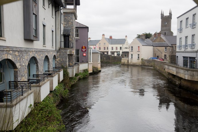
I really was excited as 12 of us boarded the first ferry of the day out of Portmagee, one of 15 that have permits, Twelve of the lucky 12,000 a year to visit.  Leaving the calm, blue harbour of pretty Portmagee, its painted cottages reflected as if by a mirror, we headed towards the mystical island.

IG3C8568

Leaving the harbour at Portmagee

IG3C8565

The village of Portmagee.  Reflective calm

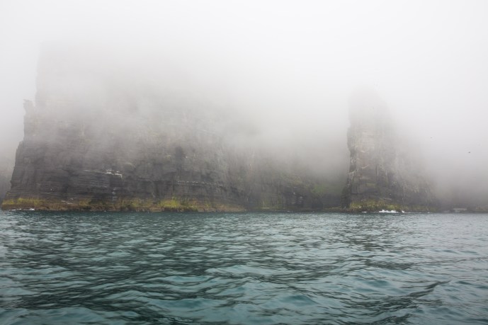
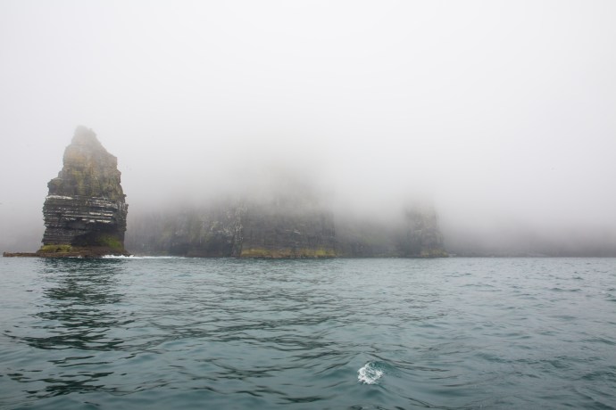
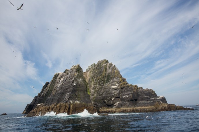
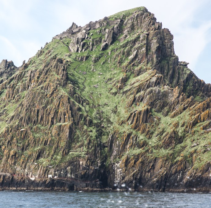
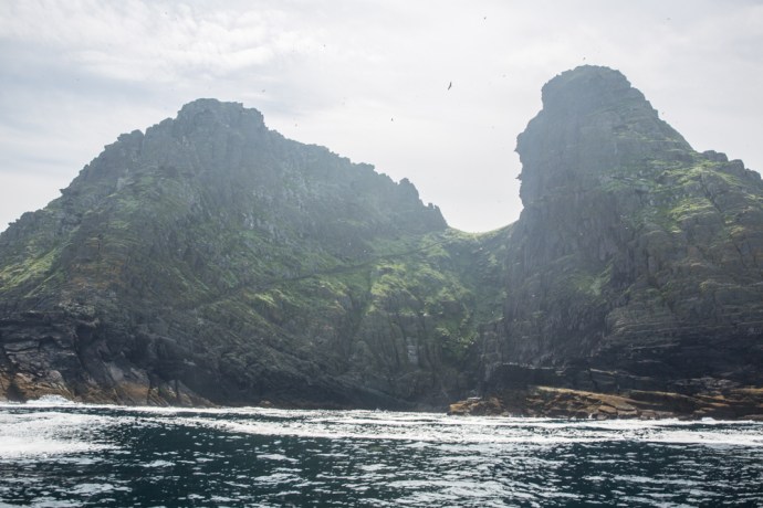
But first we sailed past the nearby Little Skellig, Skellig Michael’s twin rock. George Bernard Shaw said of Skelllig Michael following a visit in 1910, it was the most fantastic and impossible rock in the world”.  Like its big brother, Little Skellig is if anything more jagged and more precipitous and more impossible. As we sailed around the island constantly changing our view different faces were revealed.

IG3C8828

Little Skellig I

IG3C8833

Little Skellig II

IG3C8811

Little Skellig III.

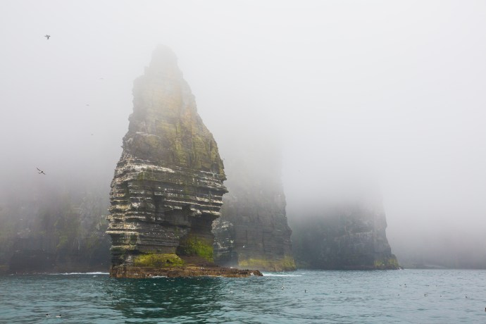
These islands defy geological truth. The Devonian sandstone protrusions shouldn’t be there. It is easy to see how the ancients would have believed they got there by the hand of God. Jagged needles of stone, rocky barbs, thrown into the sea by an angry deity.  Piled one on the other. I can see little vegetative life. Useful to no man.

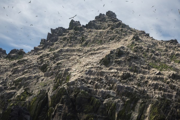
But useful to birds they are.  Little Skellig is painted white with birds and their droppings. Gannets, gannets and gannets.  Some say 50,000 of them. I can’t not think though of Monty Python and the Bookshop Sketch.  ‘Do you have Olsen’s Standard Book of British Birds? The Expurgated version. The one without the gannet.’

IG3C8720

Gannets on Little Skellig

IG3C8793

Did I mention gannets?

IG3C8785

Natural arch at the northern end of Little Skellig

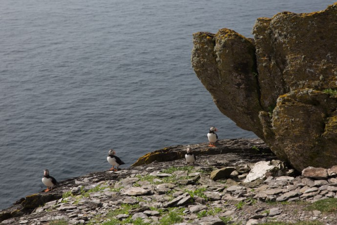
This is the second largest such colony in the world. There doesn’t seem to be room for anything else as every rock ledge is crowded. A majestic sea bird, second in size only to the albatross, the sky is filled with their gliding forms as some soar effortlessly around our boat.

IG3C8777

Every surface is occupied by a gannet

IG3C8728

A gannet glides past our boat

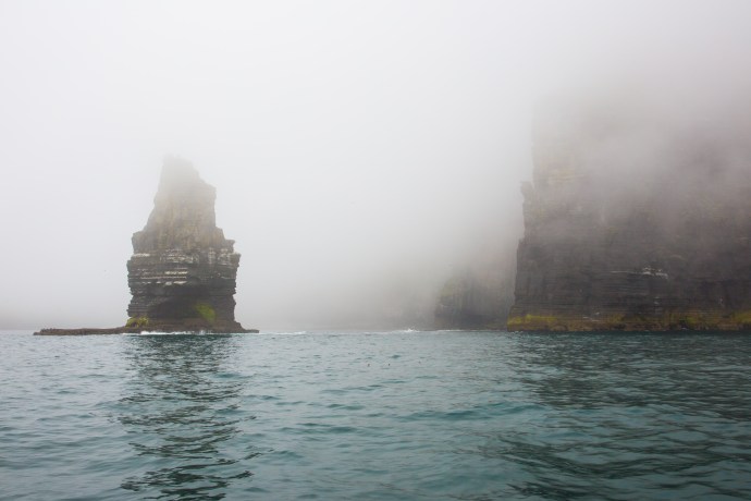
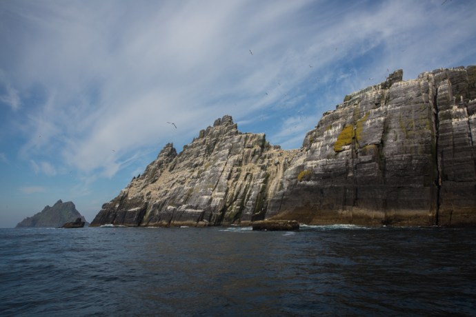
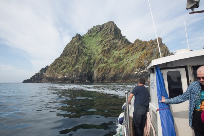
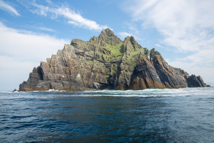
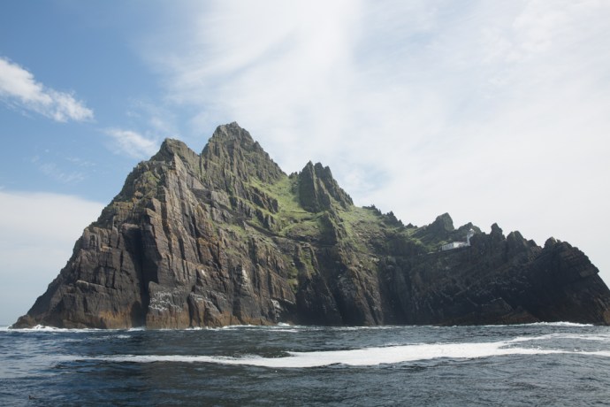
We head to the Big Skellig.  In much more comfort I should say than the monks who arrived in their curraghs in the 7th Century, or even George Bernard Shaw who in 1904 was rowed by 10 oarsmen who took 2½ hours for the trip. As the island loomed, its jagged peaks towering over us,  to me it seemed softer than the never-occupied Little. There were patches of seductive vivid green on its slopes.

IG3C8846

As we head to the south Skellig Michael is revealed

IG3C8873

Looking back northwards towards Little Skellig

IG3C8919

Skellig Michael looms.  Approaching from the north

We tied up temporarily against a set of concrete steps and you had to time your leap with the rising and sinking of the boat. They warned us about the steps to the monastery but no mention of this.  It would be impossible to land in any kind of swell. I have heard stories of visitors getting to the island but not being able to disembark.

This was not the first place the monks landed but one of three used over the centuries and the only one used today.  This choice  historically provided the opportunity to get ashore regardless of wind direction.  Above us winds a set of steps of stone heading straight up the mountain. This path is not now used.

IG3C8907

Steps rise to the monastery from the north landing place.  Currently not used.

Instead we follow a path that snakes south, clinging to the cliff edge past nesting sea birds on sheer cliffs to the start of another set of steps that is the current route up.

IG3C9392

The access road along the eastern face of the island.  The main steps to the monastery rise up the saddle between the two peaks.

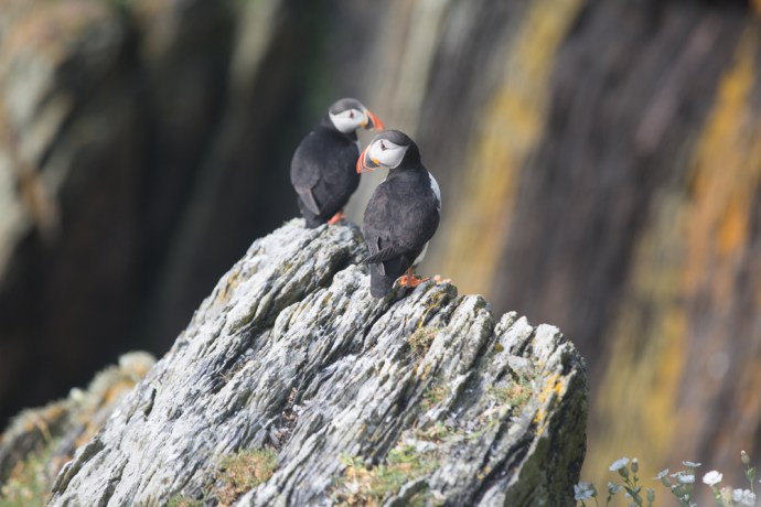
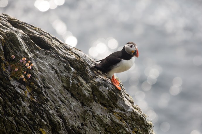
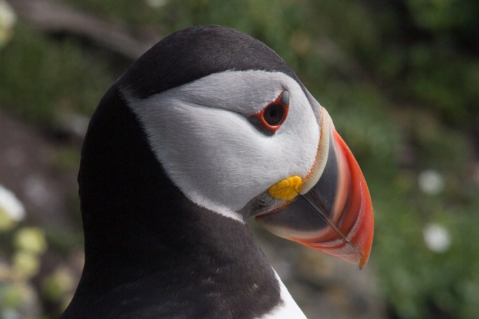
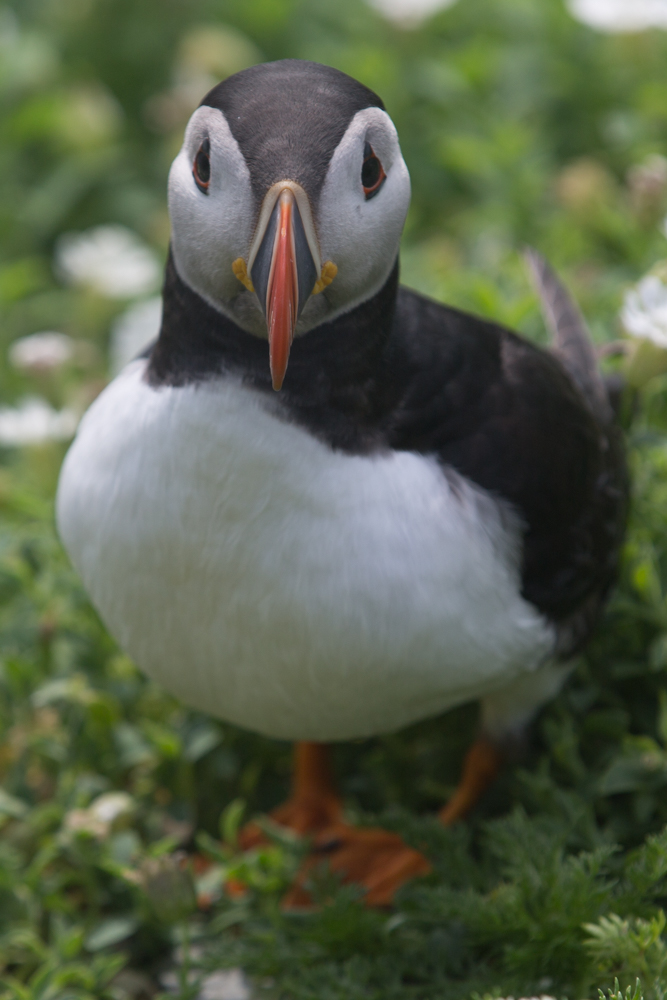
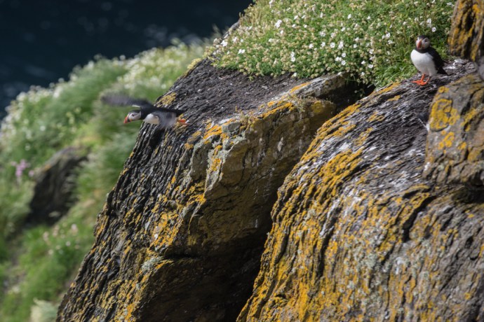
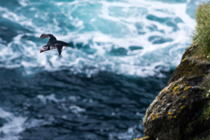
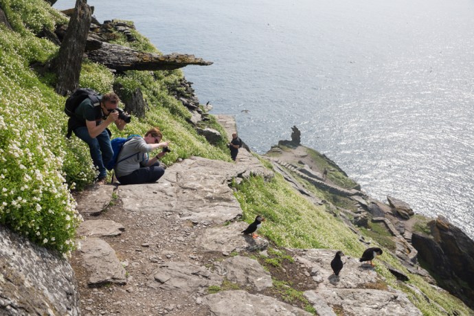
But then I see my first puffin and then another and then they are everywhere. These cute and protected birds are the stuff of legend and a reason alone to ensure your visit is in late Spring or early Summer. We all of us turn into expert wildlife photographers producing copy fit for National Geographic. It is impossible not to take a great photo.

IG3C9026

My first sighting of puffins

IG3C9104

Poser.

IG3C9154

Close Encounters of the Bird Kind.

But I am going to pass on the puffins for the moment. I will have more to say about them in another place. It’s not just puffins though. They share the rocks and crevices with many others. Guillemots clustered together with a similar upright stance on the narrowest of ledges, looking for all the world like penguins. Kittiwakes with specially designed claws that enable them to cling on to their precarious piece of rock. Razorbills with their distinctive white streaks to the eyes. Gulls, terns and others such as shearwaters that I didn’t see. An aquatic avian paradise.

IG3C9032

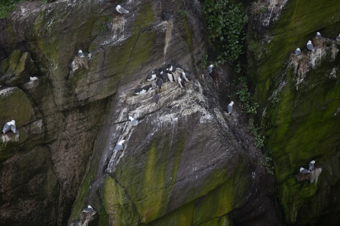
Guillemots and kittiwakes nesting on the cliff

IG3C9038

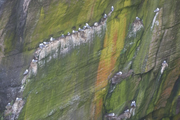
Kittiwakes grab their spot wherever they can
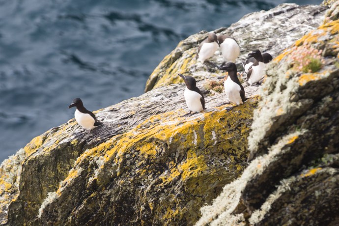
IG3C8979

Razorbills

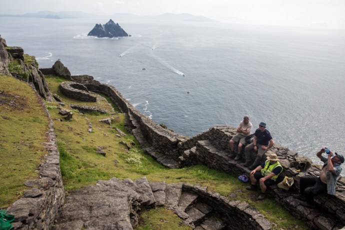
The main purpose of any visit to this place though is to see the monastery. Not tackling the 611 steps to the stone structures atop the northern peak would be like visiting the Guinness factory and not having a pint. The journey up is spectacular but so is the reward.

IG3C9054

Visitors start the climb

IG3C9065

In the footsteps of the monks

IG3C9182

The final leg heads up from Christ’s Saddle, the area between the two peaks

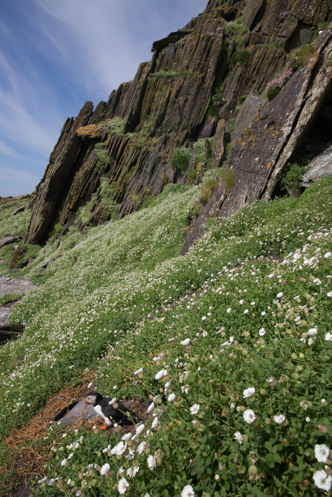
It is considered the best example of an early monastery in Ireland and is of world significance. Developed between the sixth and eighth centuries it is truly remarkable for its preservation.  A series of terraces contains six ‘clochán’-type beehive cells, two oratories, stone crosses, slabs and a later medieval church.   The cells and oratories are all of dry-built corbel construction. This unique method of overlapping stones giving an igloo shape to the outer wall but more regularly rectangular inside is very efficient at keeping out wind and water and have been doing so for 1,500 years.  Other terraces housed gardens. Vegetables were believed to have been grown but their main source of food was fish, birds and eggs. The monks led a simple life of foraging and prayer and sought out remote places such as this, as the hardship and sacrifice proved their devotion, until the island was abandoned in the 12th or 13th century.

IG3C9221

IG3C9289

Rich archaeological heritage including beehive huts and a high cross

IG3C9245

Inside a beehive hut

IG3C9259

View through the window of the church

While regaining our breath, one of the OPW guides Catherine, who has been doing this for 18 years gave us the benefit of her wisdom. And cheerfully took my photo as I and countless others posed for the de rigeur ‘selfie’ shot with Little Skellig in the background. Funny how small Ireland is.  I had met Catherine at a music festival, two years ago.

IG3C9286

Proof I was there

For some monks sharing this isolation with other monks was still not enough. On the higher south peak there is an hermitage, where a monk is believed to have led a solitary life. You can’t reach it now but just getting there involve huge risk and athleticism, No steps in places just toe holds cut into the rock face. And squeezing through the notorious Eye of the Needle. In the accompanying photo you can just see the terraces across the valley near the very top of the South Peak.

IG3C9201

The South Peak.  You can just see the stone walls of the Hermitage near the peak.

IG3C9200

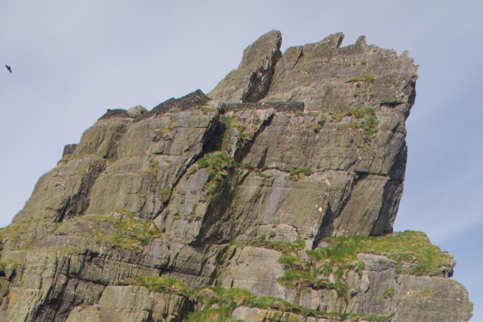
A close up of the terraces at the Hermitage site.

I can but wonder at the devotion and sacrifice of these people. Their zeal to be closer to God seemed almost to have given them super powers.

Our time at the top though was all too short. Conscious all the time of getting back to the boat I returned down the mountain gingerly negotiating the steps to the bottom. Just a little quicker I have to say than the way up. I surprised myself actually at how doable the climb was and though I saw many struggling I saw no one give up.

IG3C9400

The southern shore of the island.  One lighthouse is visible on the right

IG3C9407

view of the south peak and the road to the second lighthouse

IG3C9452

The main landing spot for the monks with the ancient steps up the valley

You can’t get everywhere on the island though.  The road to the lighthouses (there are two of them) is closed and they can only be seen from the ocean.  In fact on the way home our helpful skipper from Casey’s took us around the southern shore where aside from the lighthouse you can see the other landing points I mentioned.

I met Christina, a fellow Aussie, who was lucky enough to get onto the boat during her short visit to Ireland.  It was impossible not to be infected by simply being on this ‘impossible rock’.  The joy on her face was real as it was on the faces of the others that were privileged enough to get there on such a warm sunny day.

This will be a lifelong treasured memory for us all.

IG3C9345

IG3C9476


Categories: My Journey, Real Ireland, Wild Ireland | Tags: , , , , , , , , , , , , , , , , , , , , , , , | 6 Comments

Oh no! Not more pictures of the Cliffs of Moher.

With all this fabulous weather in West Clare recently I decided to take the cruise from Doolin to visit the cliffs. I’ve been to the Cliffs of Moher many times but never before have I seen them from the water.  I checked the forecast. Fine for the next couple of days.  Brilliant.  So I booked the late boat for the following day as I dreamed of perfect photos lit by the late evening glow.

The morning dawns and I open the window to the bay at Caherush shrouded in thick fog. I wasn’t worried and smugly congratulated myself at my foresight in booking the late boat. The fog will lift of course by midday and there will be blue skies. My optimism was rewarded as it did lift and by mid afternoon some blue sky appeared. A perfect plan?

So I drive the 40 minutes to Doolin.  Around Lahinch the fog starts to roll back in, getting heavier as I drive across the bog and down the hill to Doolin until by the time I reach the Pier visibility is just a few tens of metres. My heart sunk.  Visions returned of a trip to Jungfrau in the Swiss Alps many years ago.  Up the cog railway in a total wipeout.  I saw nothing of the roof of the world.

We set off nevertheless with, in my case, no real expectation.  So much for all those dramatic photos I was going to take of walls of rock framed by skies of blue.

But for fleeting moments as we approached closer the fog would shift and you would get glimpses of green through the grey.  You got a real sense of the powerful presence of these cliffs though you never saw them in their totality and could only imagine how high they actually were.  The changing  views were tantalising and somehow seductive.  As the boat rocked and shifted, the angles changed and I snapped away but with no real hope of capturing this feeling.

I’ve stopped looking for explanations of the Irish version of the way of the world.  An hour later the fog lifted. But never was the expression ‘go with the flow’ more apposite. Taking advantage of the extended daylight in June I spent the remaining hours exploring the rocky coast north of Doolin, in total thrall of the wonderful rock garden that is the Burren in spring.  I forgot about the the Cliffs.

But when I got home that evening (early next morning I should say, after tunes in Doolin and Ennistymon) and looked at the photos and I was surprised and happy at what I had captured.  I still have a lot to learn about photography but I think the images say just as much or perhaps more than if we were seeing every minute and vivid detail.  Sometimes showing just a little reveals a lot.

Turns out that fog was a lucky break.

IG3C6009

IG3C6032IG3C6135IG3C6154IG3C6049IG3C6012IG3C6182IG3C5917

Categories: My Journey, Wild Ireland | Tags: , , , , , , , , , , | Leave a comment

The Fergus. Ennis’ Forgotten River.

Many Irish towns are built on a river. This had obvious logistical, transport and strategic benefits and of course is not unique to Ireland.  Ennis’ name pays homage to this and derives from Inis Cluana Rámhfhada, an island formed by two forks of the river.  That river is the Fergus.  It rises west of Corofin and enters the Shannon Estuary after a journey of 60 km.

One dull April day, with spring making a late attempt to burst through, while I waited for my car brakes to be fixed yet again (one of the prices you pay for being shrouded in salt spray on the edge of Ireland), I decided to walk the Fergus River.  This proved to be more difficult than I thought.

IG3C1240

Fergus River looking south to the bridge at Abbey Street

While the river twists its way through the town, for most of its length it is well hidden.  It struck me that maybe Ennis doesn’t regard it as something to utilise or promote,  just an obstacle to be crossed.  Indeed six bridges cross it and the layout of the town is very much controlled by the loops of the river.

IG3C1535

Bridge at Bank Place looking west.

IG3C1480

Footbridge over River Fergus

IG3C1372

Clon Bridge

IG3C1655

Victoria Bridge

Where you can find it, the banks of the river either have a high stone wall that restricts view and access or are hideously overgrown and littered. Yes I know the river floods but surely space could be found for a park or a bit of open space where you can sit. And if there are seats they are facing the other way or you stare at a wall. You can’t even get to the river at the historic Steele;s Rock.

IG3C1255

Steele’s Rock on River Fergus

IG3C1311

Building on the banks

IG3C1317

River edge on New Street

IG3C1539

Riverside seating.  You need eyes in the back of your head.  Converted cornstores in the distance

In the town proper only very short bits of the river can be approached.  The one exception is the River Walk a part of which is a designated Sculpture Trail.  The walk runs from a car park near the town centre (unfortunately much of the river edge is used for car parking) to the Old Mill and then the short distance to Victoria Bridge. There is quite a bit of interest along the way in addition to the sculptures, including apartments converted from old cornstores, sluice gates and the remains of the Old Mill. But it’s all too short.

IG3C1560

Sculpture ‘Fishy Tale’ by Carmel Doherty on the Sculpture Trail

IG3C1605

Sluice Gates on Fergus.

IG3C1689

Sluice Gates.  Another view.

IG3C1588

Remains of the Old Mill.

If you try and follow the river the other way (to the east), you soon lose access.  It is built up all the way to the Clon Bridge.  Beyond this a small walkway runs parallel to a set of rapids but the weed covered banks seem only useful as a repository for abandoned shopping trolleys.

IG3C1429

Walkway on the Fergus near Clon Bridge.

IG3C1420

Cascades on the Fergus near Clon Bridge.

IG3C1427

Weeds and lost trolleys

I couldn’t help but notice one large area of apparent wasteland between St Coulmba’s Church and the river. There is direct river frontage,  and the geese and ducks seem to be the only inhabitants this time of the year. This would make a perfect Riverside Park. I asked a young traveler lad I met along the path why it wasn’t. “Too boggy” he said dismissively.  Maybe; but if there was a will I’m sure it could be overcome.

Unfortunately I found only one spot in Ennis, near Clon Bridge,  which you could loosely call a park and even it was walled off and paved with gravel.   Anyway just saying. It’s what this town needs.

IG3C1543

Suitable for a Riverside Park?

IG3C2601

A wide area of open land

IG3C2568

with direct access to the river… paddle boats?

IG3C2541

and with a beautiful backdrop


IG3C1437

Open space on the river edge near Clon Bridge.

Lastly there is hardly anywhere to eat or enjoy a coffee on the river bank except The Rowan Tree which is a wonderful exception and maybe O’Briens Cafe.  But again there is a wall. I hear it everywhere though.  ‘Ah, yes but what about the weather?’  but, hey, when the sun shines where do you go?

C’mon Ennis.  Embrace your river.

IG3C1487

The Rowan Tree Cafe.  Riverside dining.


Categories: My Journey, Real Ireland | Tags: , , , , , , , , , , , , , , , , | Leave a comment

Blog at WordPress.com.