Posts Tagged With: ferry

Will you meet me on Clare Island?

The Saw Doctors exploded into my life in 1991, when I first heard the album If This is Rock and Roll I Want my Old Job Back.  I eagerly awaited each new album through the 90s.  As someone mad about Ireland their songs helped to define my view of the country and in particular its western seaboard.  Their ability to paint simple word pictures and tell stories of daily life in Mayo and Galway resonated with me.  I saw them once in concert in Adelaide and they were as good as I had hoped.  Anyway, ever since I heard their song about Clare Island, I’ve wanted to go there.

Will you meet me on Clare island,
Summer stars are in the sky.
Get the ferry out from Roonagh,
And wave all our cares goodbye.

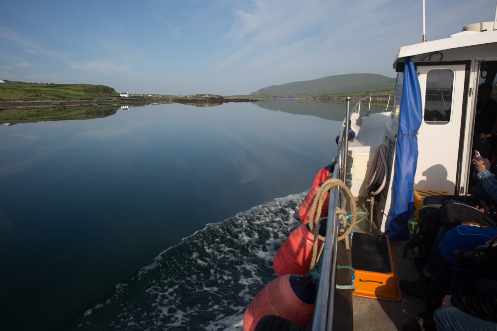
Let’s put aside for the moment that in my ignorance, at that time, I thought Clare Island was in Co Clare and had no idea for that matter where their home of Tuam was or what N17 meant.   Don’t know why I mentioned that.  Anyway, finally at the end of July 2019, I got my chance to visit the island which I had, by this time, worked out was off the coast of Mayo.  Turns out that I didn’t have to go to Roonagh, as the song said, as once a week there is a ferry service from Achill Island.

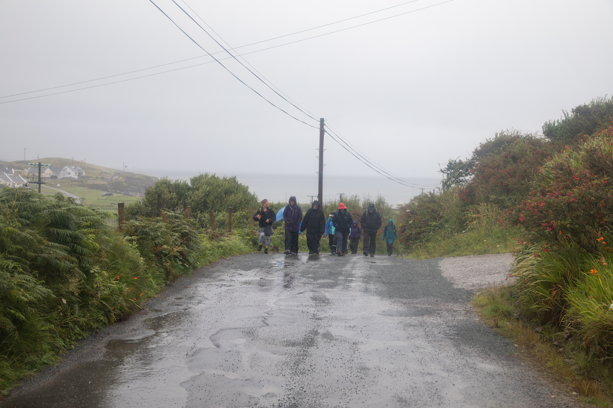
I discovered this when I was on Achill for the wonderful Scoil Achill which I try to get to every year.  “Booking essential” the brochure said. But when I rang the number y’r man said “just turn up”.  So turn up I did in the misty rain with a crowd of other day trippers that soon filled the boat.  I was lucky to get on.  Many were first timers like me but there were also Achill islanders such as Orla, travelling accross for a break with friends and family.  I like that; islanders taking a break on a nearby island.

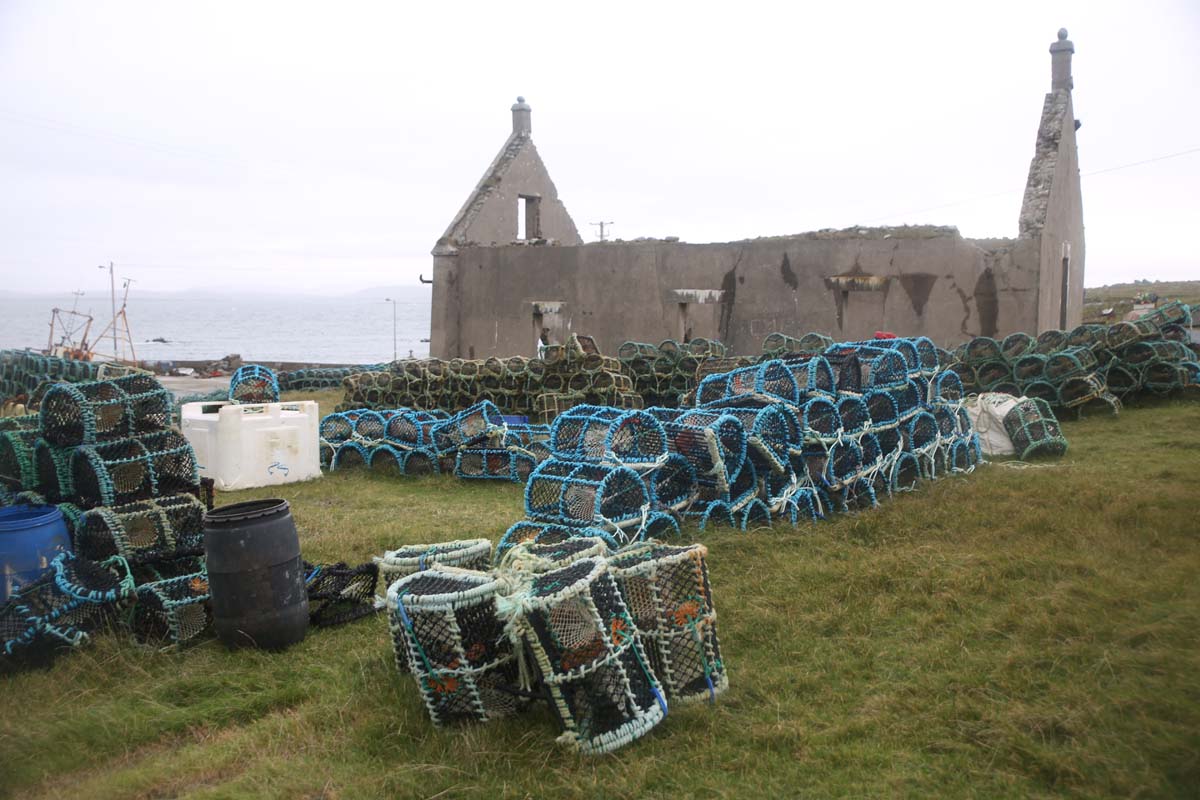
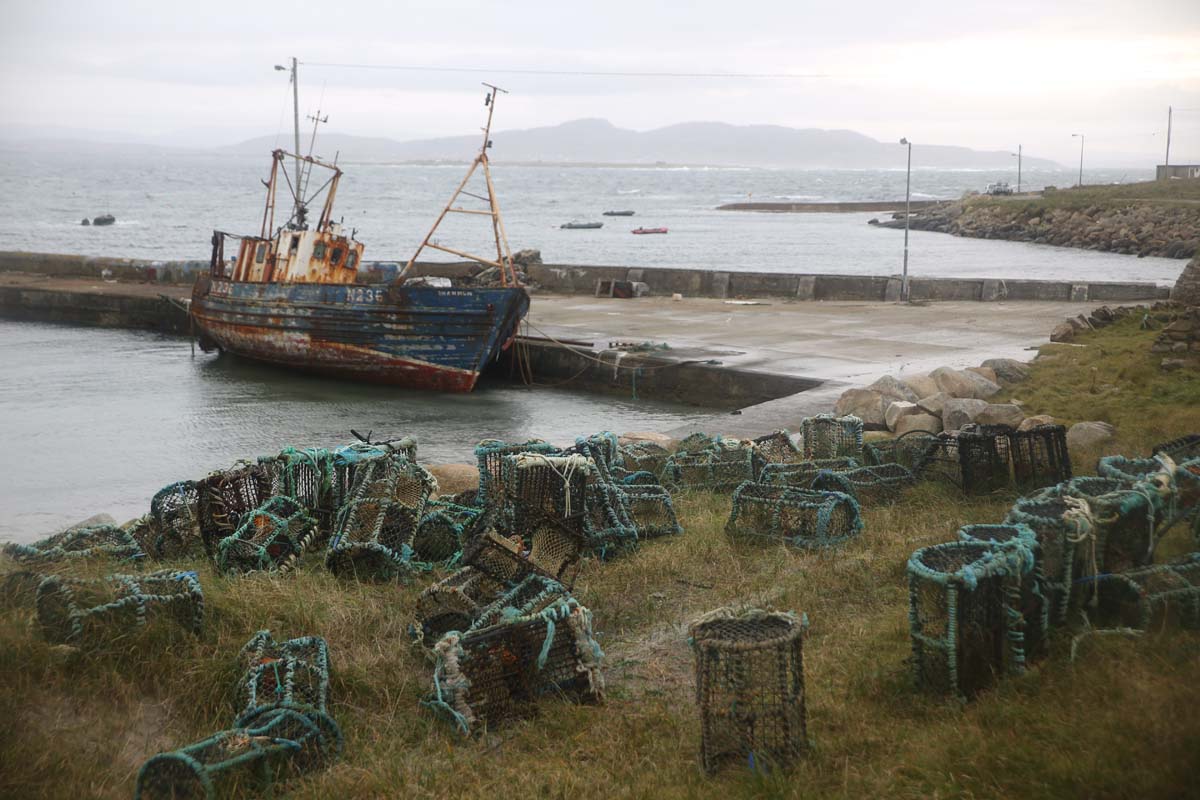
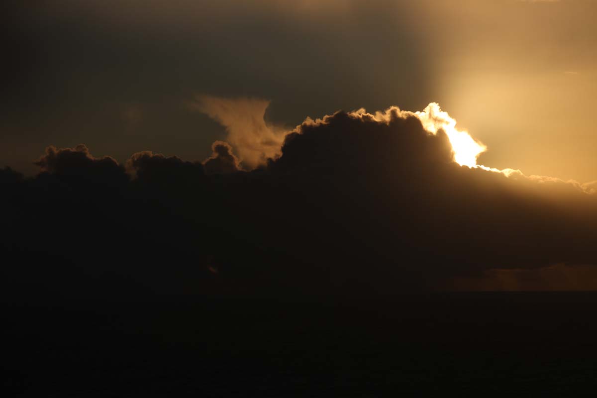
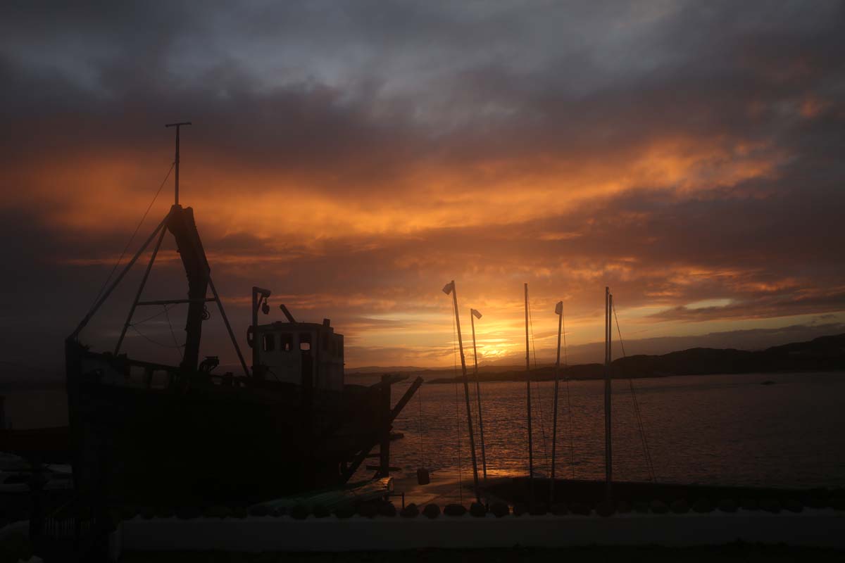
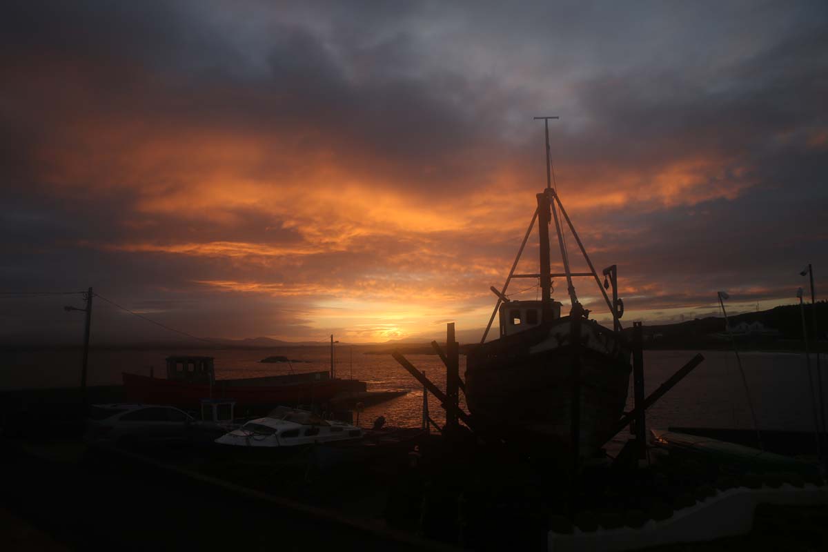
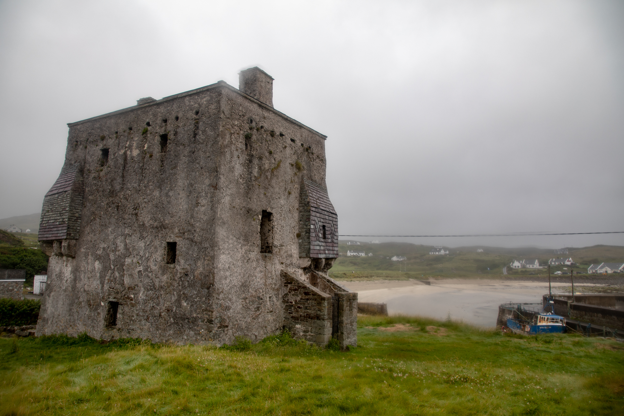
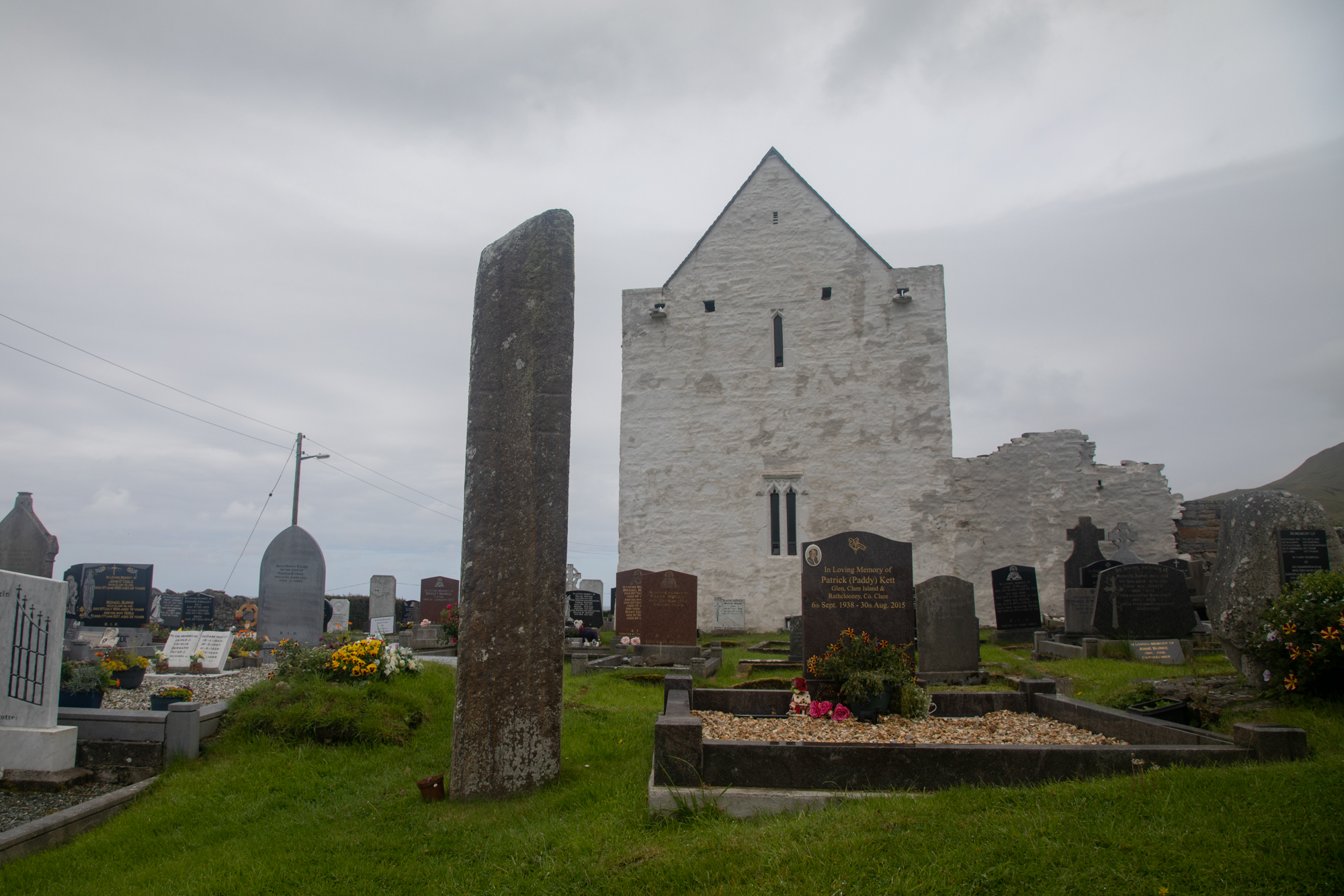
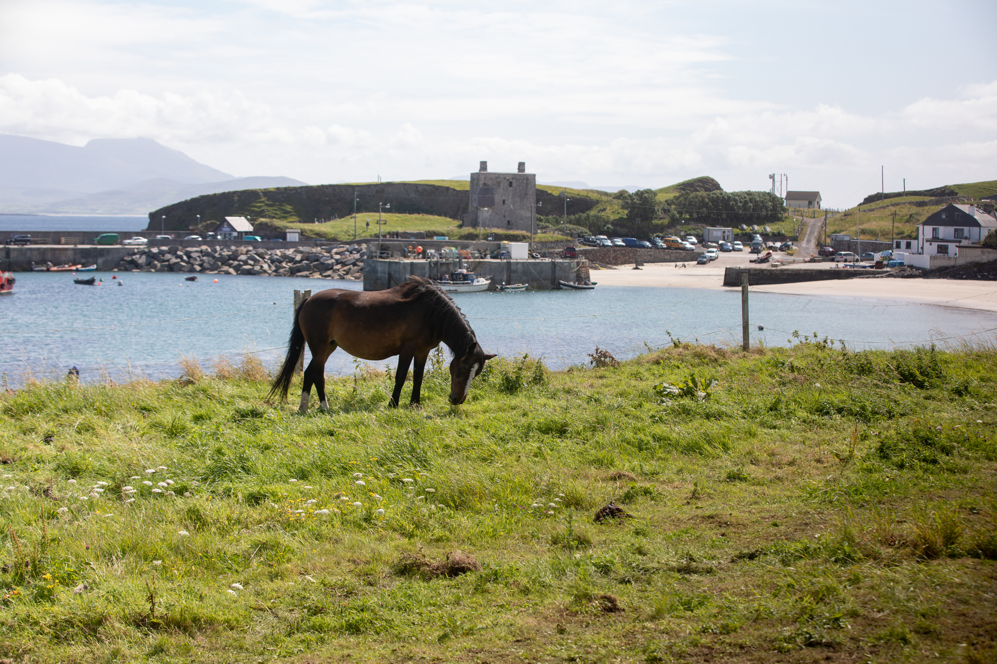
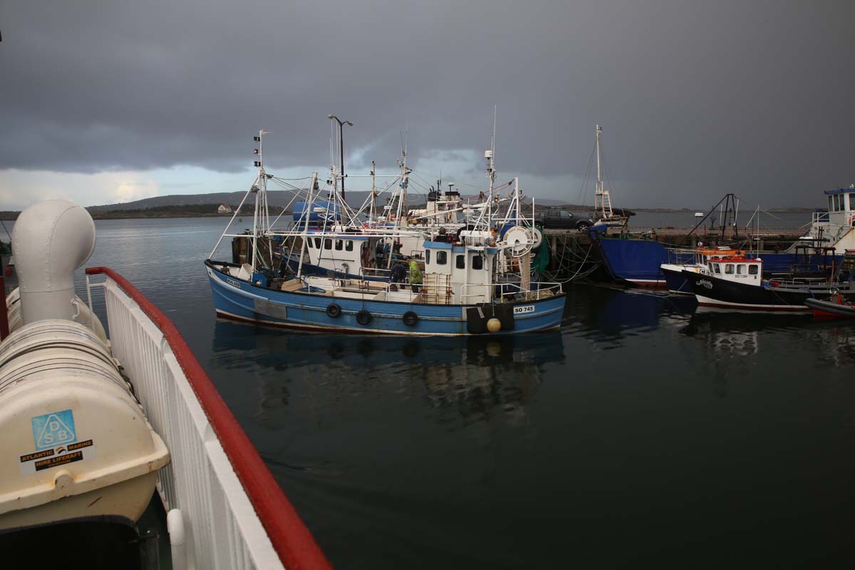
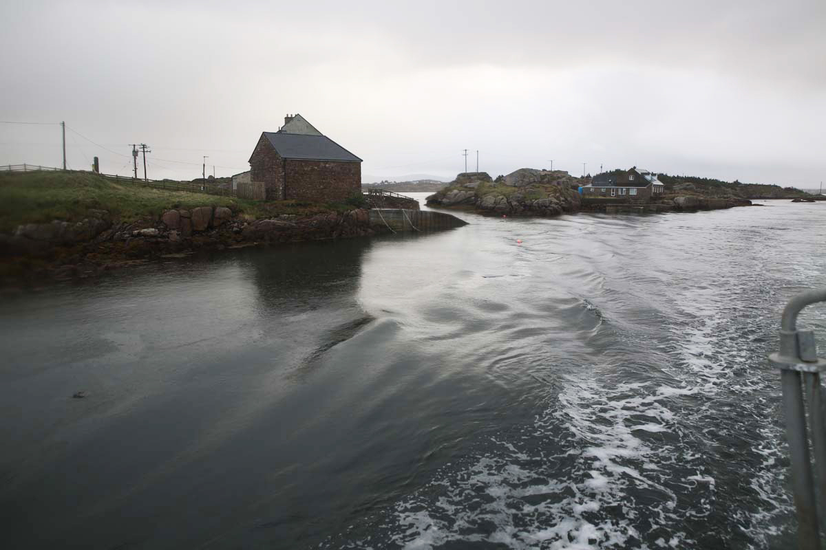
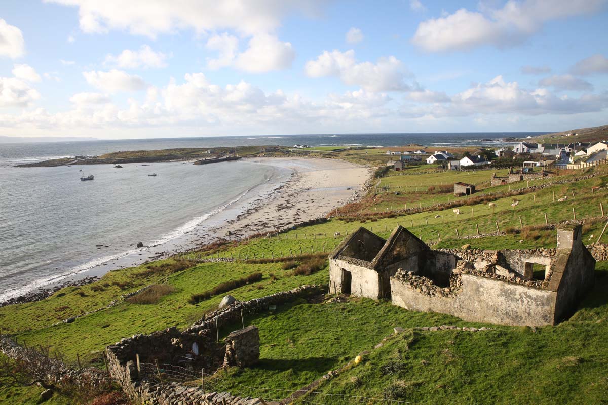
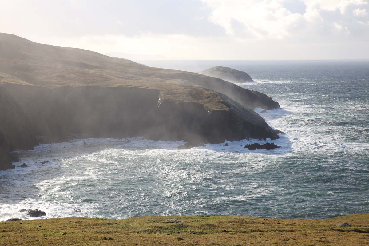
The boat leaves from the Cloughmore Small Pier (I guess there’s a Cloughmore Big Pier) near to the Kildavnet graveyard and church and Grace O Malleys Castle.  I found the graveyard at Kildavnet a moving place with its many reminders of famine times and I will post on it separately as I had spent time there the previous day.  The Castle was one of a number of Grace O Malley’s haunts. Grace also known as Grainne Ni Mhaille, was a giant figure in these parts, a pirate queen, who ruled the seas of Clew Bay.  We would see another one of her castles on Clare Island.    This day the castle looked inimidating on its point jutting into the sea and as we sailed off, we watched it  become rapidly engulfed in the mist and the driving rain.

clare island-9858
Kildownet Castle, Achill Island.  Built by Grainne Ni Mhail (Grace O’Malley)

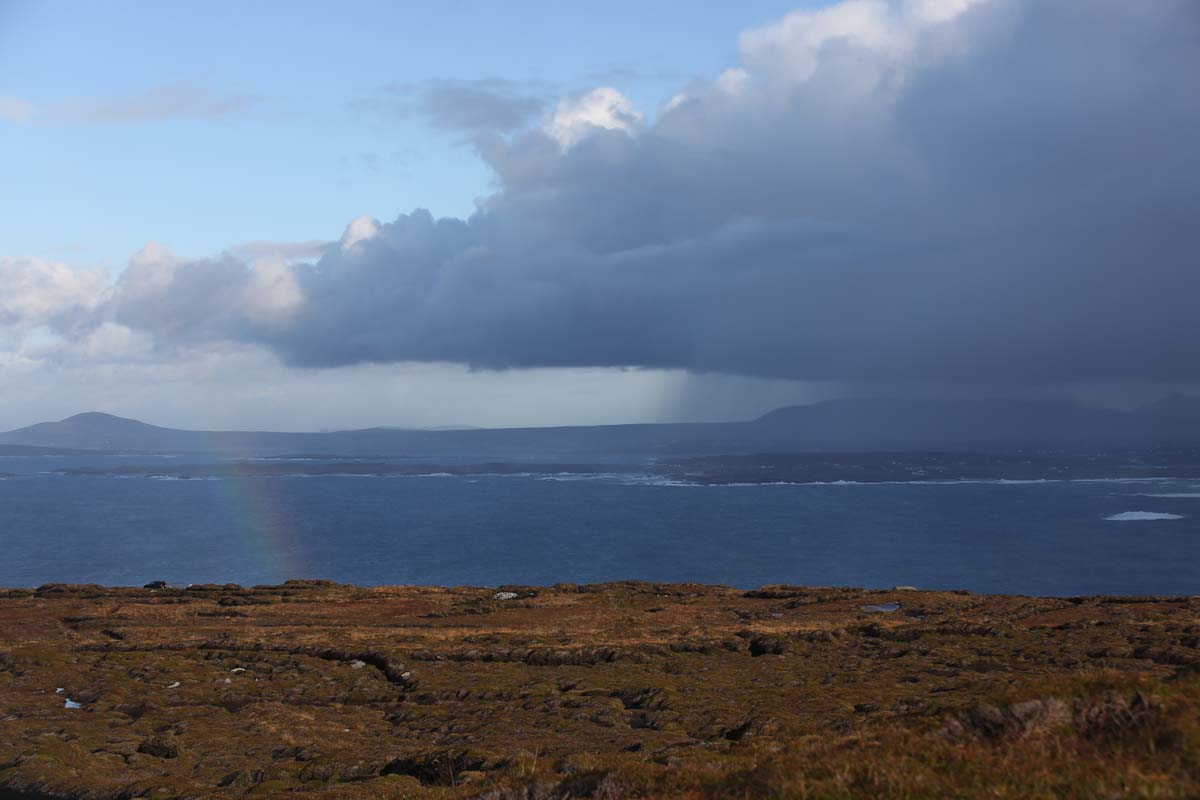
Things did not improve on the island.  This was looking to be a rather disastrous day for sight seeing.  I stood with others huddled under a shelter wondering whether to wait or brave it.  But I snuck in a quick visit to the other Grace’s castle, which dominates the view of the Quay.  It has battlement parapets over the entrance so that objects could be dropped on attackers and two well preserved  bartizans,  These protruding structures allowed the defenders to fire down and around the corners at intruders.  These are roofed now as was the whole structure when it was converted to police barracks in 1826.

clare island-9943
Another Grace O’Malley castle greets you at the Pier at Clare Island.
clare island-9917
Everyone is welcome to Clare Island.
clare island-
Undaunted by the weather, these two ladies enjoyed a swim at this secluded cove.
clare island--2
The main beach at Clare Island

I should talk a bit more about Grainne NI Mhaille.  She came to prominence about 1540 and in the latter half of the sixteenth century made Clare Island her stronghold.  Sea traffic to Ulster and Scotland or to Munster and  Spain had to pay a toll or have their cargo seized.  She terrorised the British but in 1593 went to London to petition Queen Elizabeth I  among other things, for a pardon.  Successful, she returned to Clare Island but apparently realised the futility of being nice to the British and continued her wicked ways until her death around 1603.

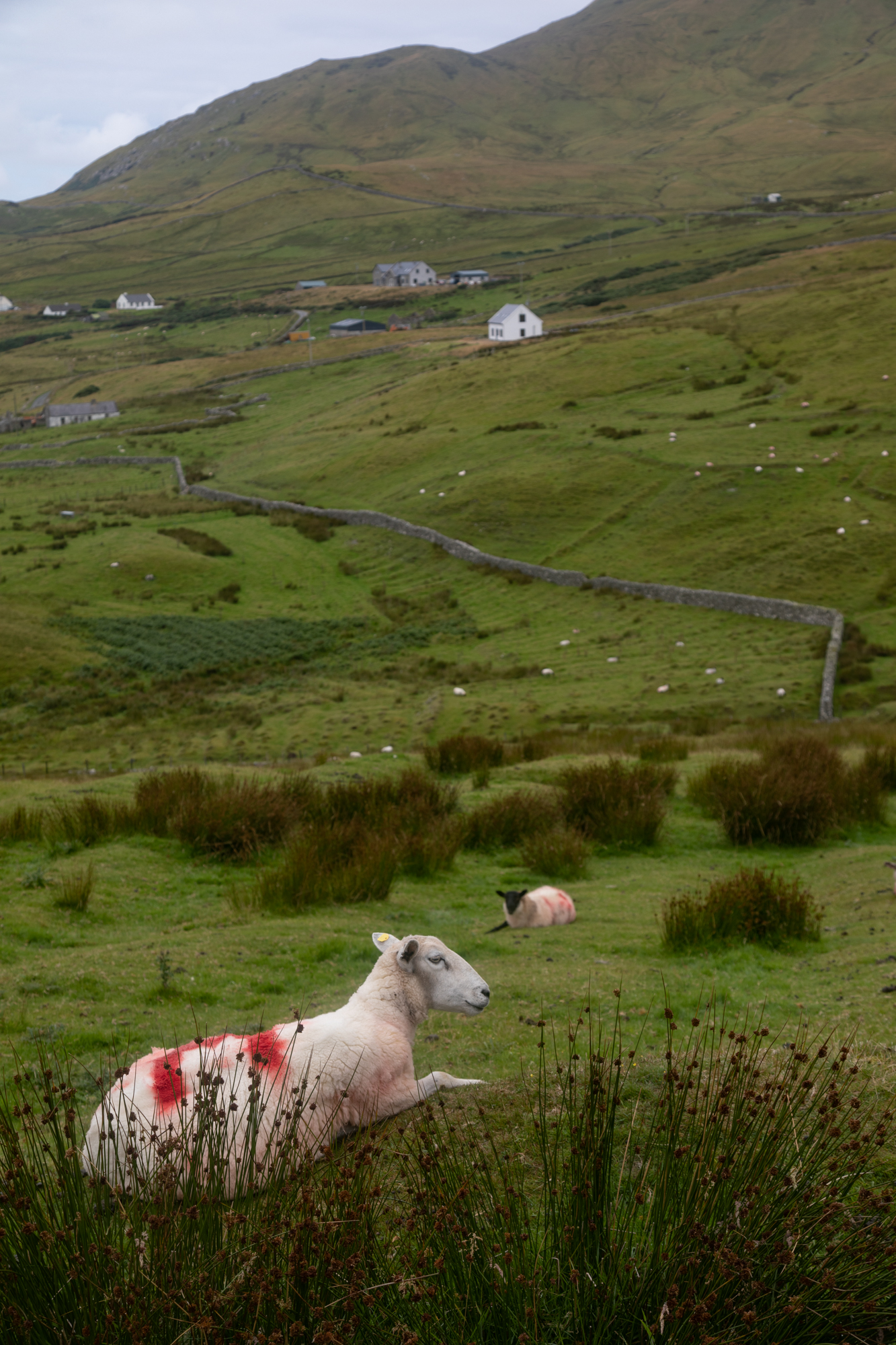
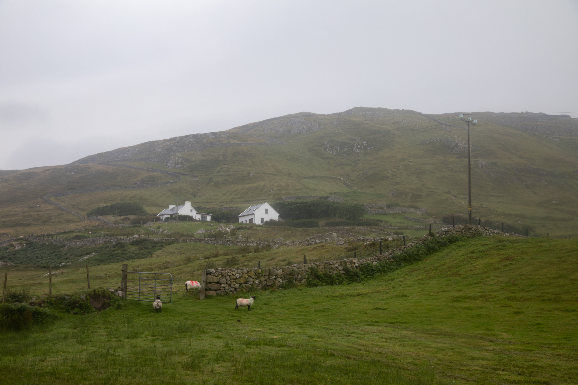
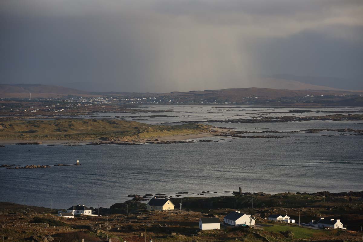
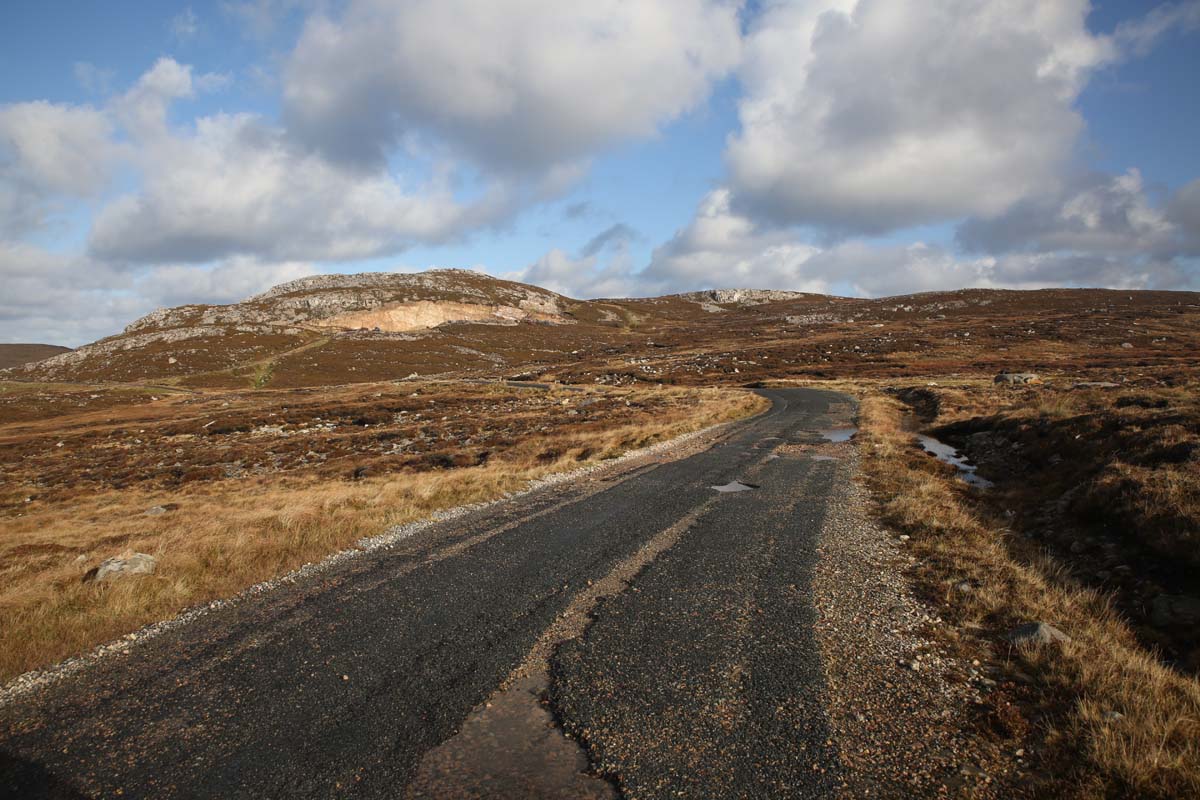
I took a punt and I set out walking to the west, trying to sneak in a few pictures between the raindrops.  Why do I always talk about the weather on these posts?  You have to love the scenery.  White cottages, as in Achill, dot the hills at a distance indistiguishable from the sheep.  Fields with furrows from potato farming are everywhere.     Letting a tour group of older people from Switzerland stride past me,  I chatted to a couple from Wexford who had been on the island for three days so they were a font of knowledge.

clare island-0005
Fields once used for potato growing
clare island-0170
Lord of the manor
clare island-9980
Visitors from Switzerland off to climb a mountain in the rain
clare island-9995
A Clare Island vista

They were headed to the Abbey so I walked with them.  They had visited the previous day and were told to collect the key from the local ‘store’ (which happened to be owned by an O’Malley).  It was closed.  No backstop there, so no visit.

clare island-0010
Heading to O’Malley’s store to pick up the key to the Abbey.  Better luck this time

They had better luck this day.  Key in hand we walked to the Abbey. It’s not really an abbey.  A tiny Cistercian monastery it was established around 1220AD.

clare island-0139
Clare Island Abbey with its Early Christian carved cross

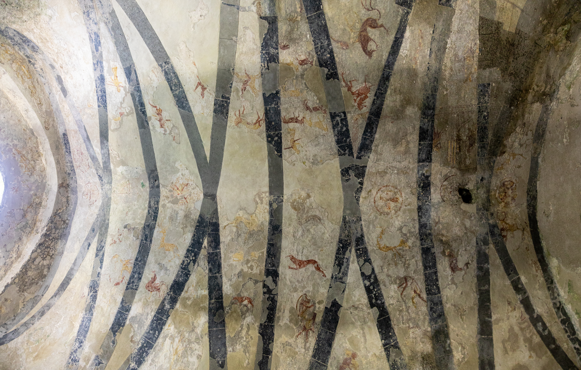
The remarkable thing about this place, and something I wasn’t prepared for, is the vaulted ceiling of the chancery with its coloured mural paintings dating from before 1500AD.  They were in serious decay and being destroyed by damp in the 1990s when the building was roofed and the art was cleaned and conserved.  Interestingly while it is no Sistine Chapel, these paintings are as atmospheric and astonishing as those of Michelangelo, being painted interestingly about the same time.  While Michelangelo was depicting elaborate religious scenes here we have a mix of simple secular and sacred themes with everyday images of horses and riders, wrestlers, harpist, archers and hunters, along with fantastical animals such as dragons and serpents.  The whole is housed in a simple whitewashed building which ceased as a monastery in the 1600s.  I took the photos included here before I read the sign that said No Photography.  Apologies to whoever for that but I hope they stimulate my readers to go and have a look for yourselves.  Outside the church is a much older inscribed cross which seems to indicate this was an Early Christian site before it became a monastery

clare island-0108
The chancery at Clare Abbey.  The ceiling is covered in 15th century frescos.  On the left is the O’Malley tomb
clare island--3
Clare Island Abbey.  Chancery  ceiling
clare island-0075
Grainne Ni Mhaille is said to be buried in Clare Abbey.  This plaque is next to her tomb.

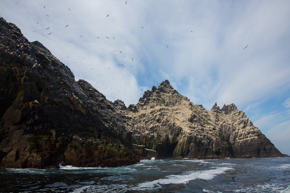
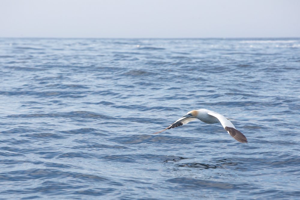
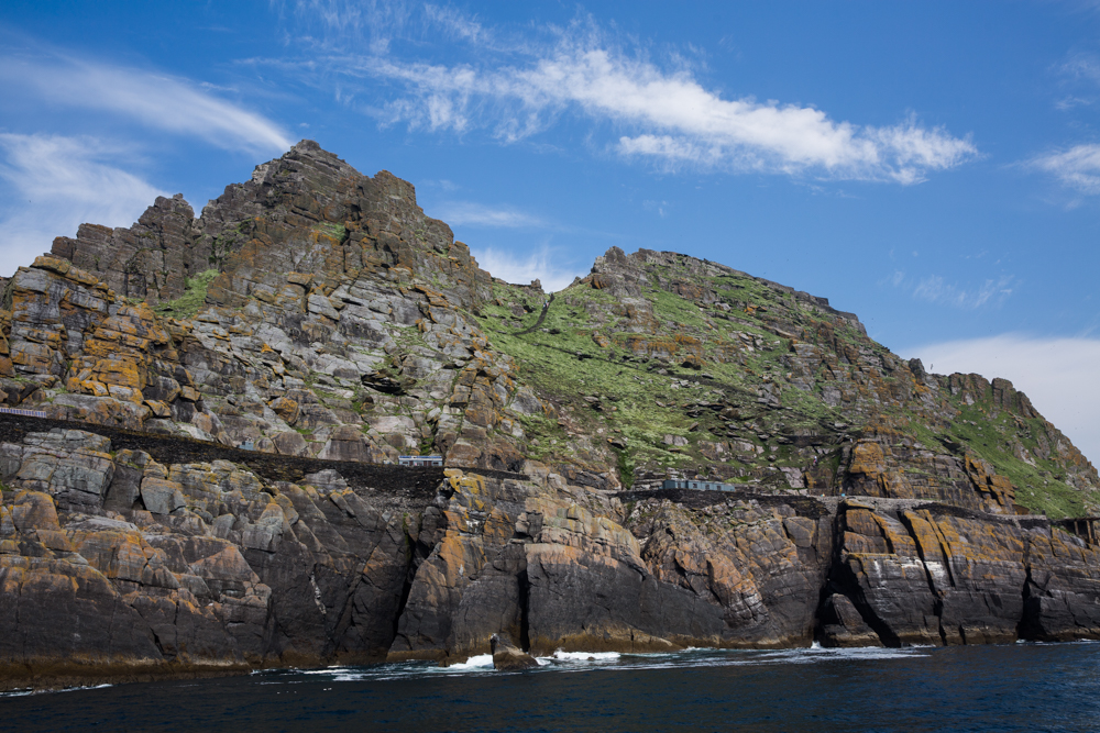
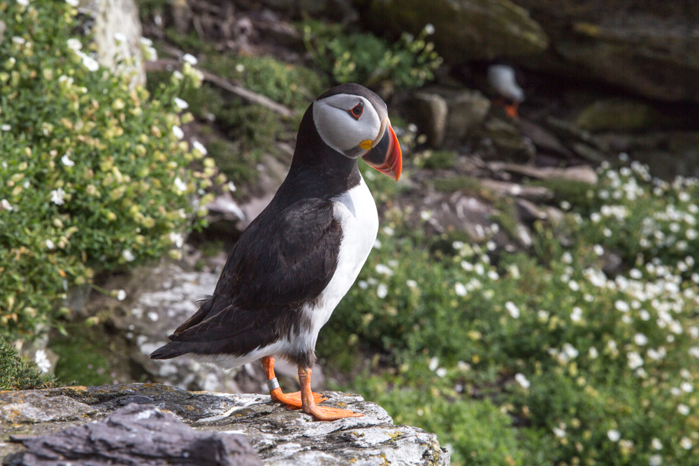
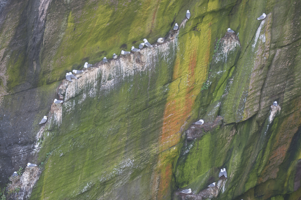
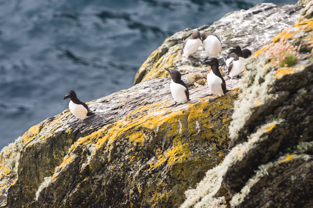
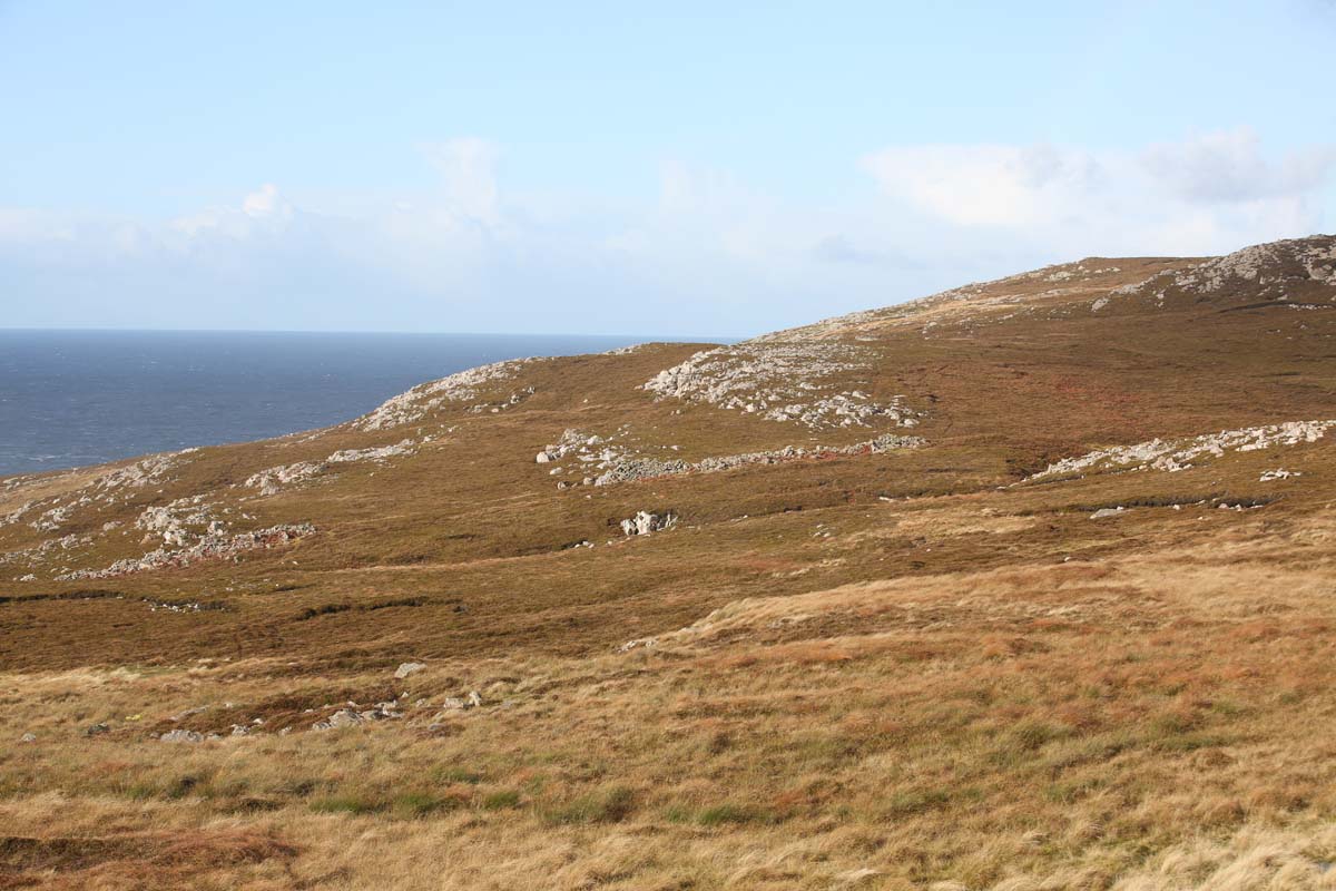
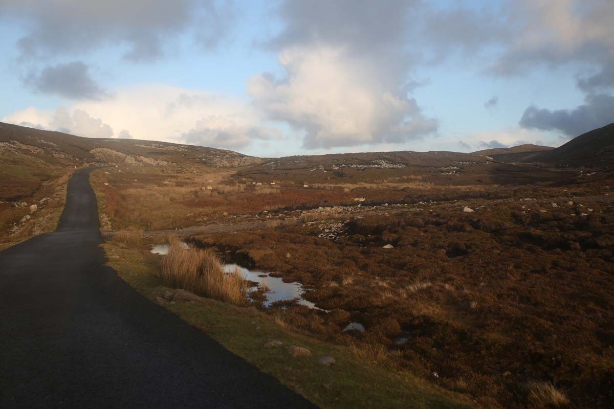
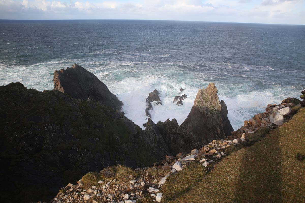
It was brighter now and I decided to return by a different route.  Heading north with the island’s highest hill on my left Knockmore at 460m the views are marvellous out over Clew Bay.  On the other side of this hill are inaccessible cliffs that provide some of the best nesting sites for sea birds in the country.  I’ll climb it another time.

I continued walking and on my right I saw a walking trail which I surmised would take me back to the more settled part of the island.  The scenery was magical – agreen treeless bog covered island, following a green highway as if a green carpet had been laid out for me especially.  Not another soul to be seen and this the middle of summer.  Unfortunately I had to amble with purpose as my return ferry would leave at 4 pm but I could have stayed out there all day.

clare island--4
Looking west over Knockmore
clare island-0235
Following the green carpet back to the boat
clare island-0203
View of the north coast of the Island showing salmon farms, which I was told produces among the best in Ireland.

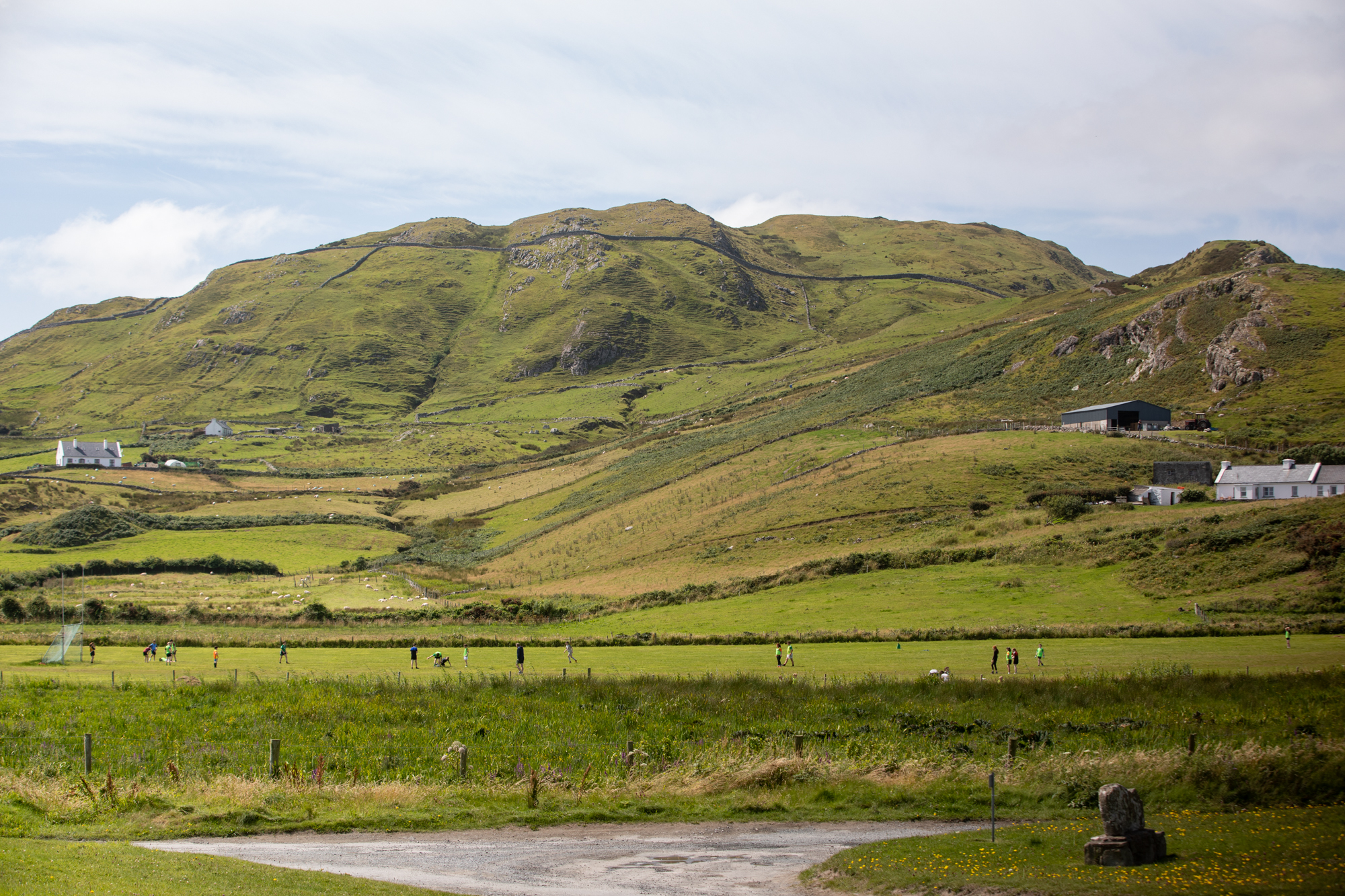
By now there were sunny breaks and the island was now showing off as I arrived at the Community Centre (or should I say the C M Unity Centre – took me a while to work that one out), one of the two places on the island you can eat and settled into a late lunch of traditional home baked Irish lasagne.  For the 140 or so residents of the island this would be the CBD and the main meeting place.  I am reminded that this is still Ireland and that you make your own life in these remote outposts as I watch the lads (and that includes girls) ferociously go at each other on the football ground.  No doubt vying for a spot in the All Island Championship (not a spelling error! seriously there is a GAA sponsored competition that is held every year and includes nine islands:  Inisheer, Inishmore, Inishman, Bere, Whiddy,  Inishbofin, Aranmore, Inishturk and of course Clare Island. )

clare island-0272
The C M Unity Centre.  Stop for a Lasagne.
clare island-0376
A game of gaelic football in progress.  

Another quick walk along the coast back to the wharf completed my introduction to Clare Island, on the way discovering a secluded beach and some sea arches and getting a real sense of the beauty of the place now drenched in sun.

clare island-0312
The eastern coastline.  Walking back to the ferry
clare island-0361
A friendlier view of the Castle than when I first arrived.
clare island-0394
A hidden cove with sea arches. 

Back at the wharf I had another look at Grace’s casttle.  Now bathed in sunshine and really looking the part from its vantage point on the hill

clare island--6
Grace’s castle and the beach and wharf at Clare Island
clare island-0428
Grace’s Castle in the sunshine

Somehow the one boat we had arrived on morphed into two and with limited space at the wharf the boats pulled in side by side three abreast and people and animals were shepherded across two boats to get aboard the third.

clare island-0457
All aboard!

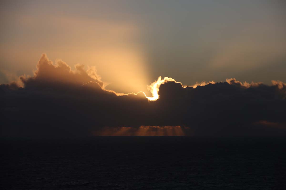
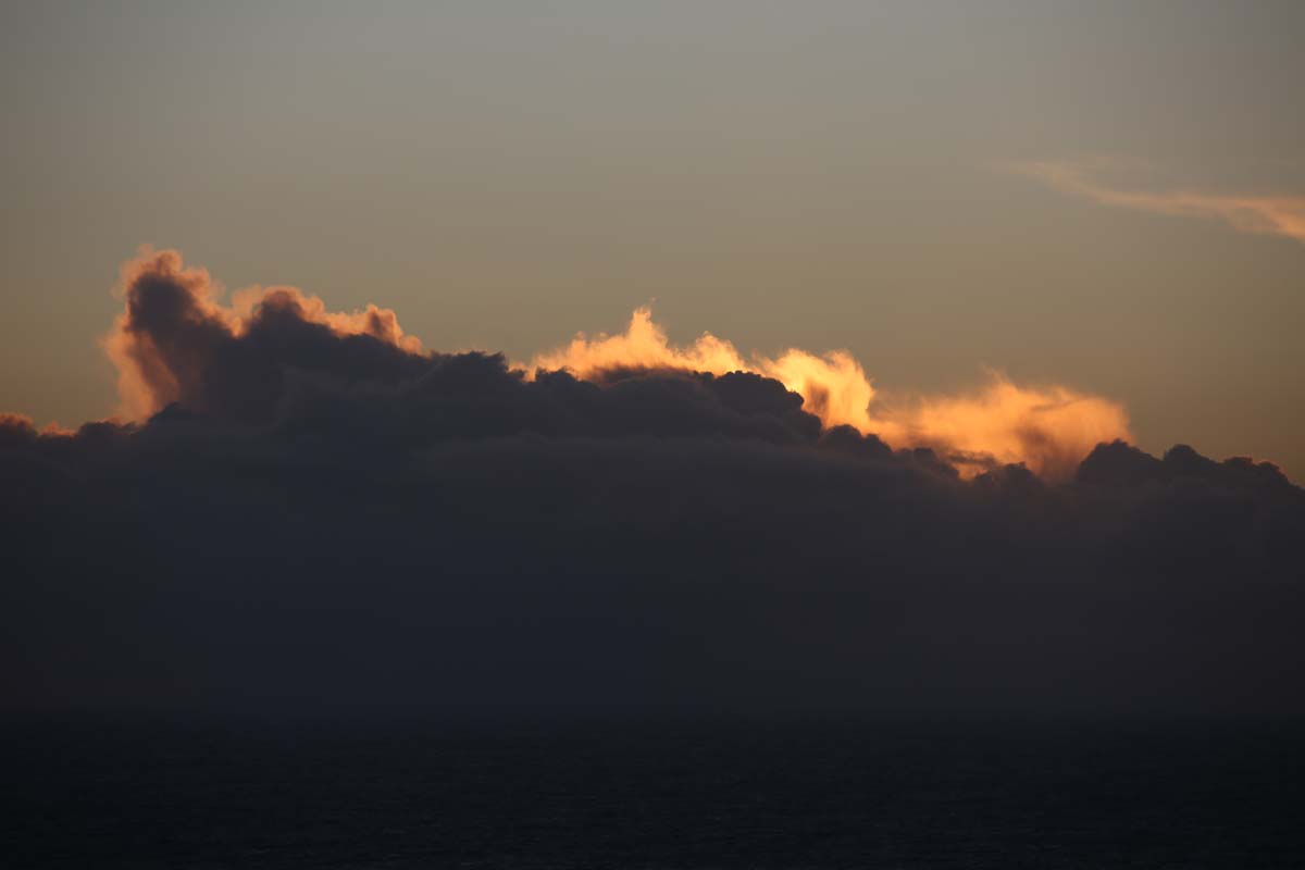
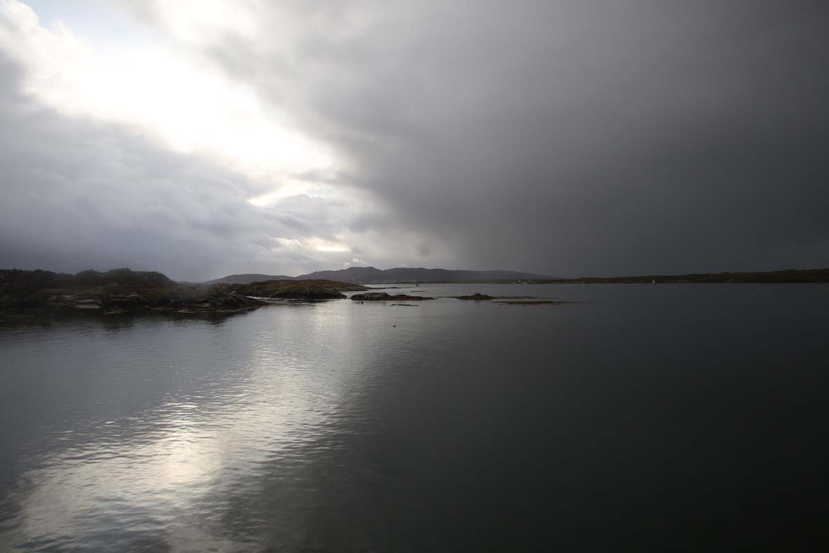
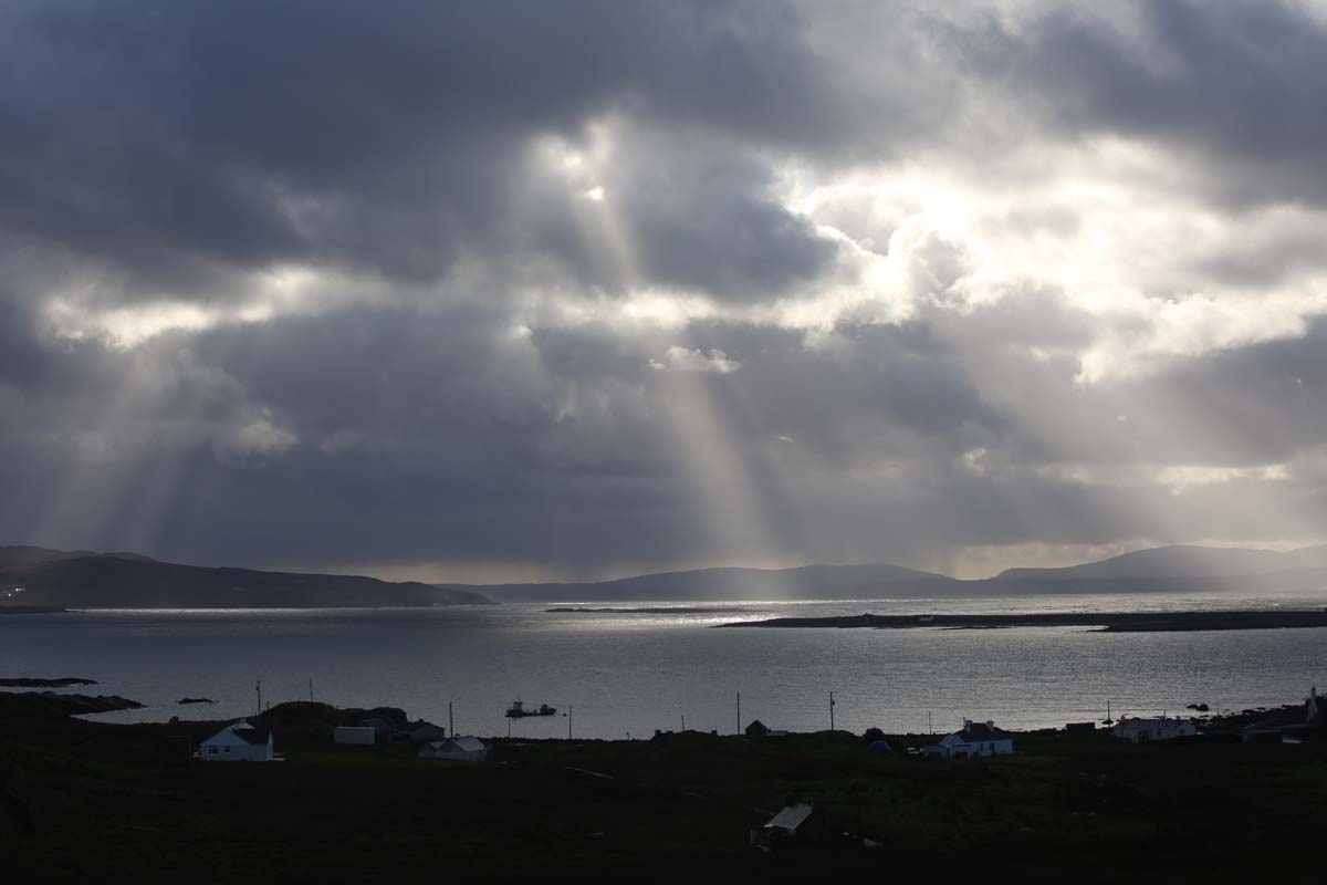
It was a very different trip home.  Dry and under a dramatic cloudscape.  But still we managed to get wet.  The boat we were on was known as the ‘fast boat’ and those of us  in the back were drenched by waves created by the wake of the speeding craft.  This was no problem for Orla and her sister who had the time of their lives with what was surely the highlight of their island adventure.

clare island-0521
The trip home
clare island-0532
Orla and her sister enjoying the trip back to Achill. 
clare island-0538

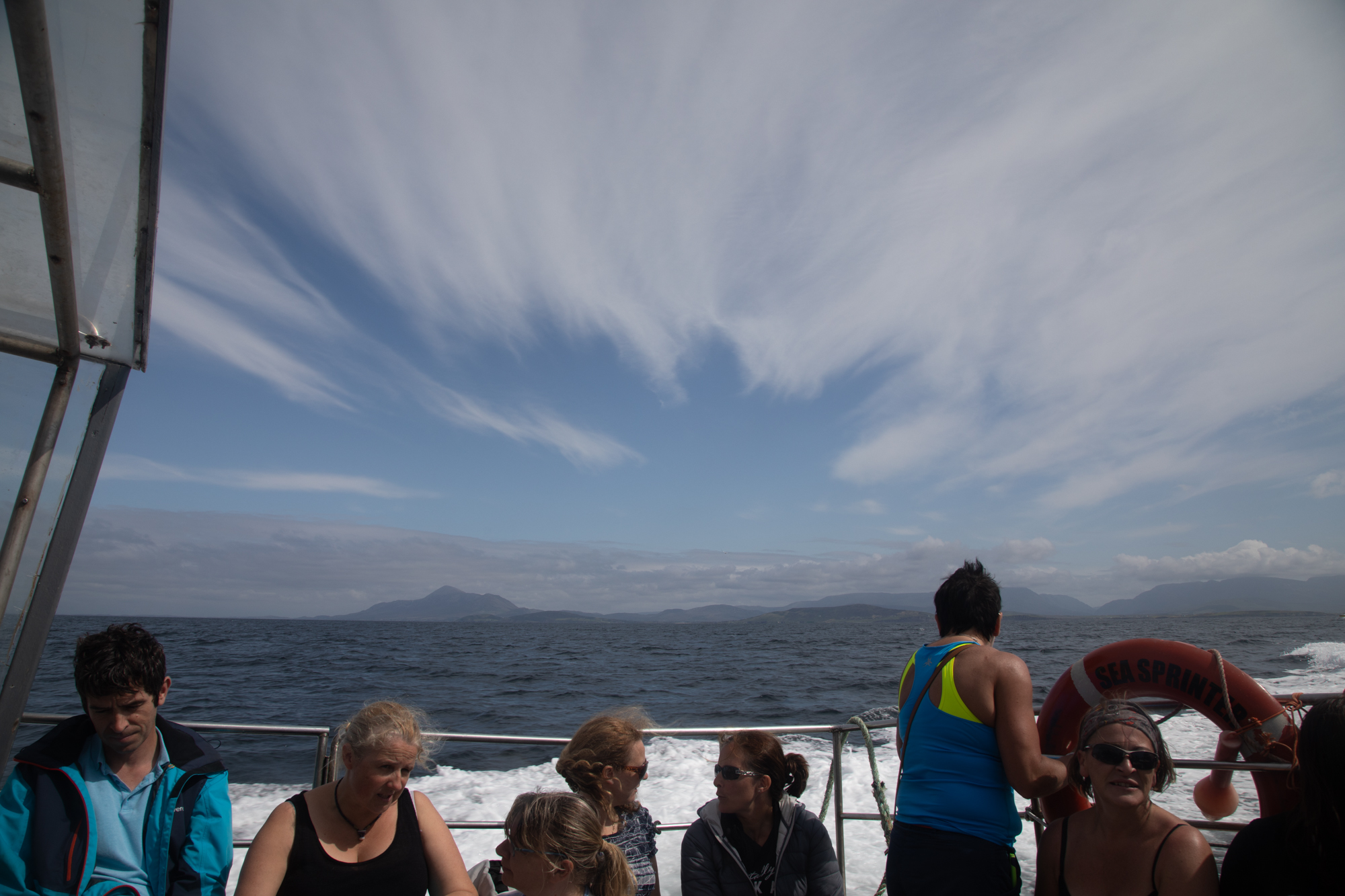
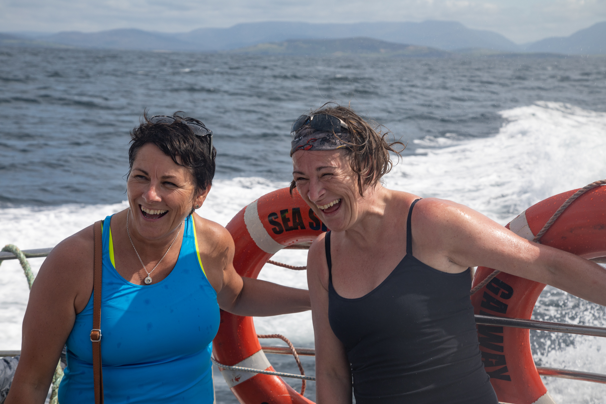
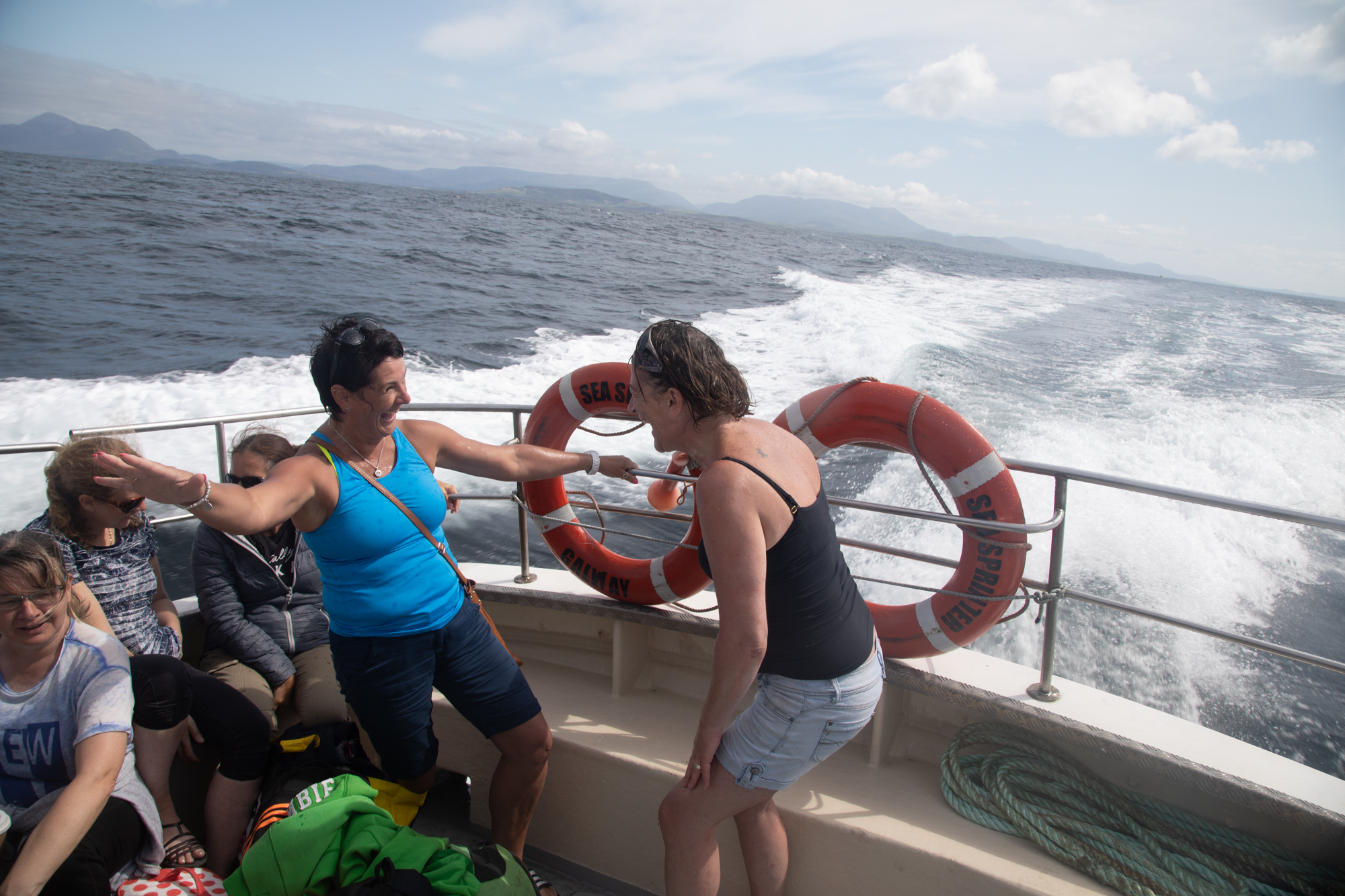
Why do my visits to Ireland’s islands never fail to deliver an unforgettable experience?

Categories: My Journey, Real Ireland, Wild Ireland | Tags: , , , , , , , , , , , , | 3 Comments

Skellig Michael. Forget ‘Star Wars’. It’s more like ‘Close Encounters of the Bird Kind’.

Finally I got onto Skellig Michael after three tries over two years. The island is 12 km off the Kerry coast and to get there you need quite a bit of persistence and a lot of luck. Fortunately the monks were smiling on an unseasonably warm day in early June. In fact we were in the third week of a sunny spell like no one could remember. Day after day over 20 degrees.

I really was excited as 12 of us boarded the first ferry of the day out of Portmagee, one of 15 that have permits, Twelve of the lucky 12,000 a year to visit.  Leaving the calm, blue harbour of pretty Portmagee, its painted cottages reflected as if by a mirror, we headed towards the mystical island.

IG3C8568

Leaving the harbour at Portmagee

IG3C8565

The village of Portmagee.  Reflective calm

But first we sailed past the nearby Little Skellig, Skellig Michael’s twin rock. George Bernard Shaw said of Skelllig Michael following a visit in 1910, it was the most fantastic and impossible rock in the world”.  Like its big brother, Little Skellig is if anything more jagged and more precipitous and more impossible. As we sailed around the island constantly changing our view different faces were revealed.

IG3C8828

Little Skellig I

IG3C8833

Little Skellig II

IG3C8811

Little Skellig III.

These islands defy geological truth. The Devonian sandstone protrusions shouldn’t be there. It is easy to see how the ancients would have believed they got there by the hand of God. Jagged needles of stone, rocky barbs, thrown into the sea by an angry deity.  Piled one on the other. I can see little vegetative life. Useful to no man.

But useful to birds they are.  Little Skellig is painted white with birds and their droppings. Gannets, gannets and gannets.  Some say 50,000 of them. I can’t not think though of Monty Python and the Bookshop Sketch.  ‘Do you have Olsen’s Standard Book of British Birds? The Expurgated version. The one without the gannet.’

IG3C8720

Gannets on Little Skellig

IG3C8793

Did I mention gannets?

IG3C8785

Natural arch at the northern end of Little Skellig

This is the second largest such colony in the world. There doesn’t seem to be room for anything else as every rock ledge is crowded. A majestic sea bird, second in size only to the albatross, the sky is filled with their gliding forms as some soar effortlessly around our boat.

IG3C8777

Every surface is occupied by a gannet

IG3C8728

A gannet glides past our boat

We head to the Big Skellig.  In much more comfort I should say than the monks who arrived in their curraghs in the 7th Century, or even George Bernard Shaw who in 1904 was rowed by 10 oarsmen who took 2½ hours for the trip. As the island loomed, its jagged peaks towering over us,  to me it seemed softer than the never-occupied Little. There were patches of seductive vivid green on its slopes.

IG3C8846

As we head to the south Skellig Michael is revealed

IG3C8873

Looking back northwards towards Little Skellig

IG3C8919

Skellig Michael looms.  Approaching from the north

We tied up temporarily against a set of concrete steps and you had to time your leap with the rising and sinking of the boat. They warned us about the steps to the monastery but no mention of this.  It would be impossible to land in any kind of swell. I have heard stories of visitors getting to the island but not being able to disembark.

This was not the first place the monks landed but one of three used over the centuries and the only one used today.  This choice  historically provided the opportunity to get ashore regardless of wind direction.  Above us winds a set of steps of stone heading straight up the mountain. This path is not now used.

IG3C8907

Steps rise to the monastery from the north landing place.  Currently not used.

Instead we follow a path that snakes south, clinging to the cliff edge past nesting sea birds on sheer cliffs to the start of another set of steps that is the current route up.

IG3C9392

The access road along the eastern face of the island.  The main steps to the monastery rise up the saddle between the two peaks.

But then I see my first puffin and then another and then they are everywhere. These cute and protected birds are the stuff of legend and a reason alone to ensure your visit is in late Spring or early Summer. We all of us turn into expert wildlife photographers producing copy fit for National Geographic. It is impossible not to take a great photo.

IG3C9026

My first sighting of puffins

IG3C9104

Poser.

IG3C9154

Close Encounters of the Bird Kind.

But I am going to pass on the puffins for the moment. I will have more to say about them in another place. It’s not just puffins though. They share the rocks and crevices with many others. Guillemots clustered together with a similar upright stance on the narrowest of ledges, looking for all the world like penguins. Kittiwakes with specially designed claws that enable them to cling on to their precarious piece of rock. Razorbills with their distinctive white streaks to the eyes. Gulls, terns and others such as shearwaters that I didn’t see. An aquatic avian paradise.

IG3C9032

Guillemots and kittiwakes nesting on the cliff

IG3C9038

Kittiwakes grab their spot wherever they can

IG3C8979

Razorbills

The main purpose of any visit to this place though is to see the monastery. Not tackling the 611 steps to the stone structures atop the northern peak would be like visiting the Guinness factory and not having a pint. The journey up is spectacular but so is the reward.

IG3C9054

Visitors start the climb

IG3C9065

In the footsteps of the monks

IG3C9182

The final leg heads up from Christ’s Saddle, the area between the two peaks

It is considered the best example of an early monastery in Ireland and is of world significance. Developed between the sixth and eighth centuries it is truly remarkable for its preservation.  A series of terraces contains six ‘clochán’-type beehive cells, two oratories, stone crosses, slabs and a later medieval church.   The cells and oratories are all of dry-built corbel construction. This unique method of overlapping stones giving an igloo shape to the outer wall but more regularly rectangular inside is very efficient at keeping out wind and water and have been doing so for 1,500 years.  Other terraces housed gardens. Vegetables were believed to have been grown but their main source of food was fish, birds and eggs. The monks led a simple life of foraging and prayer and sought out remote places such as this, as the hardship and sacrifice proved their devotion, until the island was abandoned in the 12th or 13th century.

IG3C9221

IG3C9289

Rich archaeological heritage including beehive huts and a high cross

IG3C9245

Inside a beehive hut

IG3C9259

View through the window of the church

While regaining our breath, one of the OPW guides Catherine, who has been doing this for 18 years gave us the benefit of her wisdom. And cheerfully took my photo as I and countless others posed for the de rigeur ‘selfie’ shot with Little Skellig in the background. Funny how small Ireland is.  I had met Catherine at a music festival, two years ago.

IG3C9286

Proof I was there

For some monks sharing this isolation with other monks was still not enough. On the higher south peak there is an hermitage, where a monk is believed to have led a solitary life. You can’t reach it now but just getting there involve huge risk and athleticism, No steps in places just toe holds cut into the rock face. And squeezing through the notorious Eye of the Needle. In the accompanying photo you can just see the terraces across the valley near the very top of the South Peak.

IG3C9201

The South Peak.  You can just see the stone walls of the Hermitage near the peak.

IG3C9200

A close up of the terraces at the Hermitage site.

I can but wonder at the devotion and sacrifice of these people. Their zeal to be closer to God seemed almost to have given them super powers.

Our time at the top though was all too short. Conscious all the time of getting back to the boat I returned down the mountain gingerly negotiating the steps to the bottom. Just a little quicker I have to say than the way up. I surprised myself actually at how doable the climb was and though I saw many struggling I saw no one give up.

IG3C9400

The southern shore of the island.  One lighthouse is visible on the right

IG3C9407

view of the south peak and the road to the second lighthouse

IG3C9452

The main landing spot for the monks with the ancient steps up the valley

You can’t get everywhere on the island though.  The road to the lighthouses (there are two of them) is closed and they can only be seen from the ocean.  In fact on the way home our helpful skipper from Casey’s took us around the southern shore where aside from the lighthouse you can see the other landing points I mentioned.

I met Christina, a fellow Aussie, who was lucky enough to get onto the boat during her short visit to Ireland.  It was impossible not to be infected by simply being on this ‘impossible rock’.  The joy on her face was real as it was on the faces of the others that were privileged enough to get there on such a warm sunny day.

This will be a lifelong treasured memory for us all.

IG3C9345

IG3C9476


Categories: My Journey, Real Ireland, Wild Ireland | Tags: , , , , , , , , , , , , , , , , , , , , , , , | 6 Comments

Oh no! Not more pictures of the Cliffs of Moher.

With all this fabulous weather in West Clare recently I decided to take the cruise from Doolin to visit the cliffs. I’ve been to the Cliffs of Moher many times but never before have I seen them from the water.  I checked the forecast. Fine for the next couple of days.  Brilliant.  So I booked the late boat for the following day as I dreamed of perfect photos lit by the late evening glow.

The morning dawns and I open the window to the bay at Caherush shrouded in thick fog. I wasn’t worried and smugly congratulated myself at my foresight in booking the late boat. The fog will lift of course by midday and there will be blue skies. My optimism was rewarded as it did lift and by mid afternoon some blue sky appeared. A perfect plan?

So I drive the 40 minutes to Doolin.  Around Lahinch the fog starts to roll back in, getting heavier as I drive across the bog and down the hill to Doolin until by the time I reach the Pier visibility is just a few tens of metres. My heart sunk.  Visions returned of a trip to Jungfrau in the Swiss Alps many years ago.  Up the cog railway in a total wipeout.  I saw nothing of the roof of the world.

We set off nevertheless with, in my case, no real expectation.  So much for all those dramatic photos I was going to take of walls of rock framed by skies of blue.

But for fleeting moments as we approached closer the fog would shift and you would get glimpses of green through the grey.  You got a real sense of the powerful presence of these cliffs though you never saw them in their totality and could only imagine how high they actually were.  The changing  views were tantalising and somehow seductive.  As the boat rocked and shifted, the angles changed and I snapped away but with no real hope of capturing this feeling.

I’ve stopped looking for explanations of the Irish version of the way of the world.  An hour later the fog lifted. But never was the expression ‘go with the flow’ more apposite. Taking advantage of the extended daylight in June I spent the remaining hours exploring the rocky coast north of Doolin, in total thrall of the wonderful rock garden that is the Burren in spring.  I forgot about the the Cliffs.

But when I got home that evening (early next morning I should say, after tunes in Doolin and Ennistymon) and looked at the photos and I was surprised and happy at what I had captured.  I still have a lot to learn about photography but I think the images say just as much or perhaps more than if we were seeing every minute and vivid detail.  Sometimes showing just a little reveals a lot.

Turns out that fog was a lucky break.

IG3C6009

IG3C6032IG3C6135IG3C6154IG3C6049IG3C6012IG3C6182IG3C5917

Categories: My Journey, Wild Ireland | Tags: , , , , , , , , , , | Leave a comment

Árainn Mhór Island. Donegal in a Day.

Arguably among the most beautiful counties in Ireland is Donegal. It is a different reality to the postcard bucolic scenery of Kerry or the treeless wilderness of West Clare but it is no less arresting. Visitors come to Donegal for a different experience. For me its the rolling russet-red hilly boglands, granite strewn boulder fields, jagged and sparkling quartzite hills, deep-blue loughs, whitewashed cottages, steep cliffs disappearing into the windswept spray, empty beaches, its fishing villages and maritime heritage, the language, its raw climate and its welcoming people. But Donegal is a big county and it can be hard to get around especially with the limited time many visitors allow in their rush to see everything. But I’ve found somewhere that has all of that and more wrapped up in a 22 square kilometre package that sits just a 15 minute ferry ride off the coast.

This is Árainn Mhór (Arranmore). Donegal’s largest inhabited island it was a complete unknown to me until I got a message from my friend Pauline suggesting we meet there for a day’s exploring.  Just one of those whims that makes Ireland so unpredictably delicious.   She lives on another special island, Achill in Co Mayo, and was looking for a break and, in the fashion of all true island residents, where better to go than another island? So I instantly agreed of course and made the trek from Co Clare arriving on a wet cold morning at the ferry terminal at Burtonport at the appointed time. Well, as is often the way with things in this country, Pauline’s car died so she never made it.  Having lost my guide and companion I headed over anyway with only the vicissitudes of the weather and the narrow winding boreens to lead me on my discovery.

I was captivated from the moment the ferry left Burtonport.  There are two ferries run by two companies.  Known to everyone as the Red or the Blue.  I took the Red. The port was busy enough but only with those who eke a living along the Donegal coast.  Children on the way to school, a delivery of Guinness and a little dinghy loaded with some of life’s other essentials presumably  headed to one of the remote islands.  We picked our way between these small rocky islands dotting the narrow channel.  Many of these islands have houses which I guess for the most part are holiday retreats.  It is only 5 km before we head into the Ferry port at Leabgarrow.  just as the Blue ferry in uncharacteristically, for Ireland, perfect time made space for us at the wharf.

IG3C0058

The Red Ferry heads out from the port of Burtonport

IG3C0020

Essential supplies for life on a Donegal island

IG3C0075

Can’t tell if it’s coming or going.

IG3C0114a

Towards Árainn Mhór

IG3C0142a

IG3C0226a

Approaching Leabgarrow, the ferry terminal at Árainn Mhór

I love this bit. Arriving at a place you’ve never been and know nothing about. Do I turn left or right?  Well I drove off the ferry and headed south and as I did the rain miraculously stopped, the sun burst through and the island glowed. This would be repeated all afternoon. Dazzling sunshine and stormy showers with even a bit of hail and of course wind. I shouldn’t go on about the weather because this is Ireland after all but as I was dead keen to try and capture the island with my camera I was concerned about the light and the rain and my freezing cold hands.  The south coast provides winding roads which snake through the hills giving views of seascapes across to the mainland and passing though hamlets  clinging to the hillsides and strung along the roadway.  Stone-walled paddocks flow down to the rocky shore.

IG3C0341IG3C0366IG3C0389

IG3C0427

As it turned out the island put on quite a light show. With the sun coming and going, the light changed every few minutes. You couldn’t plan; you just had to be ready to catch those fleeting moments.

The dominatingly dark greyscape would disappear and the sea would be lit by a fan of radiating beams streaming under the clouds.

IG3C0362IG3C0347

When the sun shone for those brief moments it would dazzle.  The real colours of the Donegal palette were displayed and intensified. The red and brown grass, deep blue lakes, sparkling rocky outcrops, sinuous black roads,  green paddocks and white cottages. IG3C0522IG3C0531

IG3C0421IG3C0437

Then the wind would be so strong it would blow the mist back over the land or even reverse the flow of rivulets making their way to the sea.

IG3C0637

IG3C1049aaaa

And the rain sweeping in across the ocean would provide interplay with light and dark, waiting for the hand of a skilled painter. The weather was so confused that at one point we had just a beautiful hint of rainbow and an approaching rainstorm juxtaposed.

IG3C1123

The weather can’t make up its mind

IG3C1196

Storms arrive on the east coast

IG3C0831

Storms arrive on the west coast.  Mainland visible in the distance

IG3C0843

Green Island off the west coast of Árainn Mhór

IG3C1189

Looking across towards Errigal

The south coast provides winding roads which snake throught the hill giving views of seascapes across to the mainland and passing though hamlets  clinging to the side of the hill and strung along the roadway.  Stone-walled paddocks flow down to the rocky shore. Then the road turns north and with a few hairpin bends rises to take you to an elevated bog land underlain by granite. That soon changes to quartzite hills – jagged and chaotic. The one lane road meanders across this magic land and you feel anything could happen. And it does.

IG3C0366

IG3C0400

village of Torries at the south of the island

IG3C0506

IG3C0462

Enter a caption

IG3C1232

Quartzite hills

IG3C1211

Bog land and granite

I see a figure in the distance walking in my direction. Due to our respective speeds it takes some time for me to reach him. He is wearing a reflective bright yellow jacket and dark glasses. And carrying a stick. Of course that is not unusual in Ireland but a closer look showed him waving the white stick in front of him. He was blind. This was kilometres from anywhere mind you. He stopped as he heard my car approaching and pulled to the edge of the road. I stopped and greeted him. “Lovely day isn’t it?”  he said. In his defence the sun was shining at that time. “Sure is”. A few more words about the weather and the chance of more rain and then quick as a flash he came back “Where are you from?”. I gave him the potted version and we had chatted briefly. It was clear then that he had had his fill of this outsider and wanted to continue his walk.  I watched him steadily and confidently stride away musing on the inner strength that many have to carry on a normal life especially, or perhaps because of, living in such a remote place.  A truly unexpected encounter.

IG3C0511

Off for a walk

The ‘ring road’ as it is known continues past the island reservoir which has a monumental sculpture immersed in the water and topped by two flags, one of which is the US stars and stripes and the other appears to be an Irish flag but missing the orange. It just looks like someone has cut the orange off.  But if any of my readers know more I’d be grateful to know.    The memorial remembers the terrible hardship of the Hunger in this part of Ireland and how many who were evicted escaped to Beaver Island, of similar size on Lake Michigan in the US. There have historically been strong links continued to this day.

IG3C0624

Memorial to the victims of the Famine and links to Beaver Island.

Every island worth its salt has a lighthouse. The elegant white and red structure was built in 1859 to replace a light first erected in 1798. It is still operational but not attended.  Indeed the former keeper’s residence is now a Bed & Breakfast.  In summer.

IG3C0750

IG3C0772

IG3C0727

The cliffs at Rinrawros Point

IG3C0745

The light and its exposed location at Rinrawros Point, atop jagged cliffs, reminded me of the precarious maritime history of this island. There is a plaque in the ruins of the RNLI building (Royal National Lifeguards Institution) on the south side of the island which chronicles the sea tragedies of the island and it is truly sobering.  From the death of Tom O’Donnell in 1839 and subsequent tragedies, many of which involved multiple loss it has been a rough existence for the Arranmore islanders. And how hard it must have hit some families as names such as Gallagher and O’Donnell which names regularly appear. Worst of all was the Arranmore Disaster when 19 lost their lives in a small boat trying to make it through the passage from Burtonport before the encroaching dark.  As I write this I suddenly realise it was 52 years to the day since this devastating event 9th November 1935. Most of those lost were Gallaghers, many form the one family, with 15 of them returning from working in Scotland.

IG3C1649

arranmproc3[1]

A poignant photo of the funeral for the victims of the Arranmore Disaster

 The fishing industry has been the backbone of life on Árainn Mhór. Which makes it all the sadder to see the abundant evidence everywhere of the decline in its fortunes and the ripple effect this has had on the island.  Just near the ferry port two fishing boats stand by the roadside, decaying reminders of the current circumstances.

IG3C1509

Abandoned fishing boats at Leabgarrow.


Alleged overfishing by island fishermen, paradoxically while EU super-trawlers vacuum up the sea floor beyond the 12 mile limit, Euro intervention and a ban on salmon fishing.  There are now only four fishing boats operating out of the island.  Previously I mentioned the RNLI building, which I thought initially was a church. Closer inspection revealed its real use.   Surrounding it is a sea of stacked lobster pots eerily reminiscent of a graveyard, which it clearly is, and piles of gossamer like netting resting against its walls. On the nearby jetty sits another decaying fishing boat leaning against the pier for support, in one last attempt to stay afloat.  It is very sad to see and testament to a forlorn hope that perhaps there will be better days .

IG3C1599IG3C1608IG3C1620

IG3C1652

With the permanent population continuing to decline to around 500 since its peak in the 1940s (around 1,400), tourism has become the main ‘industry’.  But tourism is seasonal. When I visited in the first week of November there were no hotels open. One large Guest House was for sale.   Early’s Pub, the only restaurant on the island,  only opens on the weekend. The other pub served only toasties (though they were delicious). BnB’s have virtually shut up shop. I was the ONLY overnight visitor on the Island. I am pretty sure of that.  And if it wasn’t for the help of a local resident who was able to contact Annie who kindly opened her BNB for me, I would not have been able to stay on the island.  It is hard to see three months of summer visitors being a viable alternative industry.  If you are going in the off season and I recommend staying at least one night, just arrange accommodation first.

IG3C1493

I’ve spoken of the changing light so I was in high hopes of a classic sunset. While inconveniently placed clouds thwarted me nevertheless the backlighting of orange light provided some remarkable cloudscapes. At time it was like the clouds were alight flames flaring upwards into the night sky and rays of orange directed down to the earth.

IG3C1289

Sunset behind cloud

IG3C1282

Clouds aflame I

IG3C1340

Clouds aflame II

IG3C1337

Glowing thunderheads

And fourteen hours later the display was repeated when I was rewarded for getting up early (7:45 am) with a spectacular sunrise before the clouds descended and killed the show. And then as if to say “Ok.   You’ve had your fun”, rain descended.

IG3C1491IG3C1441

IG3C1459IG3C1451IG3C1435

In all I only spent 24 hours on the island. Enough? Not really. I ‘saw’ everything I suppose but I only got just a little taste of the true feeling of the place.  Pauline, any time you want to try again. I’m up for it.

IG3C0659

IG3C1580

Categories: My Journey, Real Ireland | Tags: , , , , , , , , , , , , , , , , , , , | Leave a comment

Blog at WordPress.com.