Posts Tagged With: ruins

Ireland in Four Days (and Five Years). Day 4. Wondrous Wicklow.

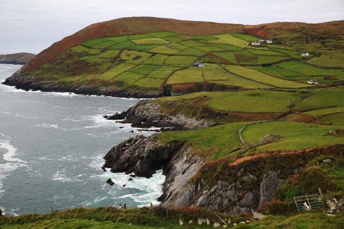
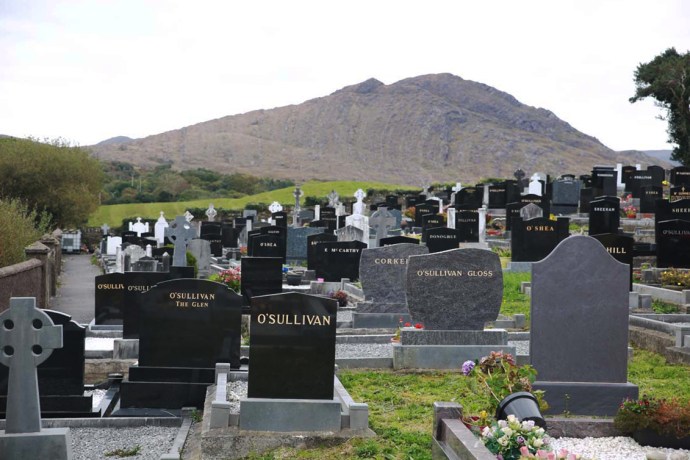
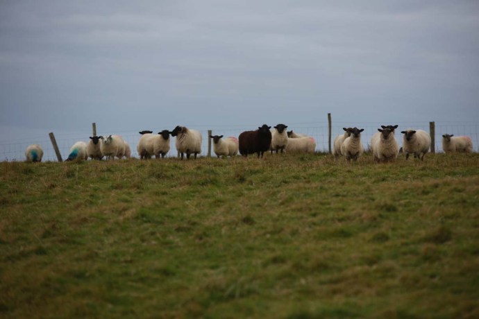
I left you at the end of Day 3 with me pulling into a parking bay at Sally Gap in the Wicklow Mountains at around 2 am.  That was my bed for the night.  After a very broken four hours of, what could only loosely be described as sleep, during which my poor little car was buffeted constantly by winds and rain, my hopes (and my reason for spending the night up here) of glorious sunrise shots were somewhat dashed.  The rain had stopped but the hills were lost in mist and only the sheep seemed to be happy.

Sally Gap-3714

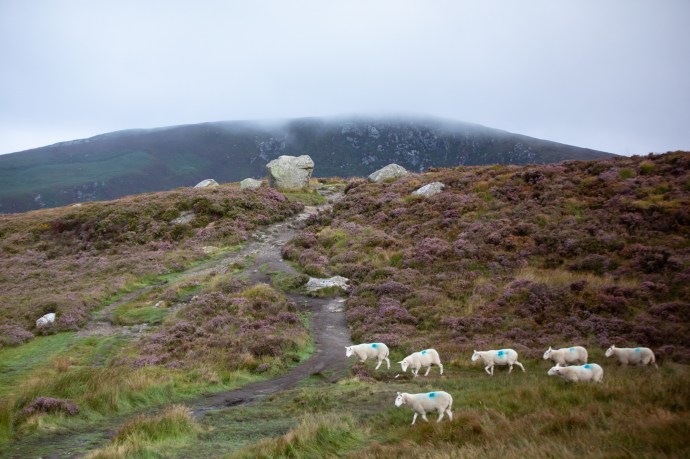
Good Morning.  Sally Gap, Wicklow

It was now 6:30 am. I was here now, and sun was predicted to arrive around midday.  So there was nothing for it but to wait.  I walked, I drove and, once my fingers had warmed up I practiced the whistle. And waited at the Roof of Wicklow, until eventually the sun began to make tentative forays.  The plus side of it was that there was a lovely soft light for photographing the hills and valleys, waterfalls and the gorgeous heather and I tried to make the best of that.

Sally Gap-3689

The wild mountain heather in the early morning mist

Sally Gap-3975

Will ye go Lassie go?

Sally Gap-3785

To pluck wild mountain thyme

Sally Gap-3838

All around the bloomin heather

Sally Gap-3857

By yon pure crystal fountain

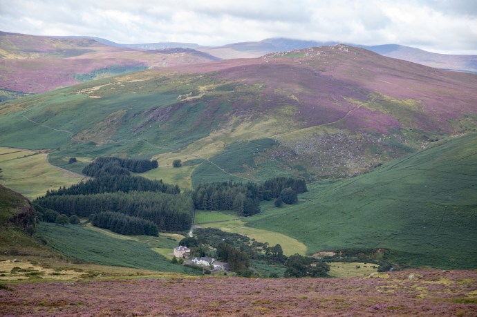
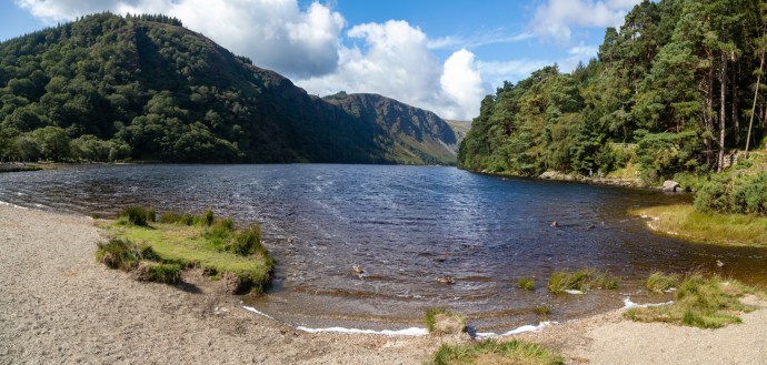
By 10 am I was rewarded, and I discovered Lough Tay sparkling in the dappled light.  Lough Tay is also known as Guinness Lake (because of its resemblance to a pint of the dark stuff complete with its creamy head).  The sand though is not original.  It was brought in from the coast by the owners (surprise, surprise, the Guinness family).  There is no doubt it deserves its spot as one of the most photographed views in Wicklow.  It is a corrie lake that lies in a glacial valley at the foot of Luggala Mountain.  Luggala Estate, historic home of the Guinness’, is part of the estate and lies in the verdant valley to the north.

Sally Gap--3

Lough Tay, Guinness Lake.  The Guinness mansion (the only building in the picture) is on the far right.

I am glad I waited, but it was time to move on now and I headed on to Glendalough.

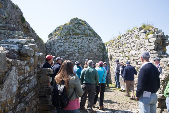
The main purpose of the visit was to see the old mine workings.  But as I drove through the tiny village I heard the sound of pipes.  I had to stop.  I stood and listened to the lone piper sitting under a blue sky, next to a spectacular double arched gateway.

Glendlough-3993

Pat Connery, lone piper at the gateway to Glendalough

Glendlough-3997

Singing and playing the pipes is not easy.  Pat Connery at Glendalough

This was Pat Connery and it was beautiful playing, lost for the most part on an unappreciative crowd, who would scurry past, stop to snap a selfie and head up the steps and through the gate, intent on getting back to the bus on time.  I chatted to to Pat, who has been playing this spot for years.  She was using a set of C pipes, which for the uninitiated have a deeper more plaintive sound than the regular concert pitch pipes.  She also sang beautifully, while playing (no mean feat).

Thanking Pat I too headed up those steps.  What I hadn’t realized was that this was the portal to the Glendlough monastic ruins.  In fact it is Ireland’s only surviving example of such a medieval gateway.  I hadn’t intended to stop as I had visited five years ago but hey the music, the sunshine, a warm Irish day; how could I not pop in for another look.  I never posted photos of Glendalough back then because I wasn’t happy with them.  Here was my chance to fix that.

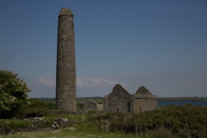
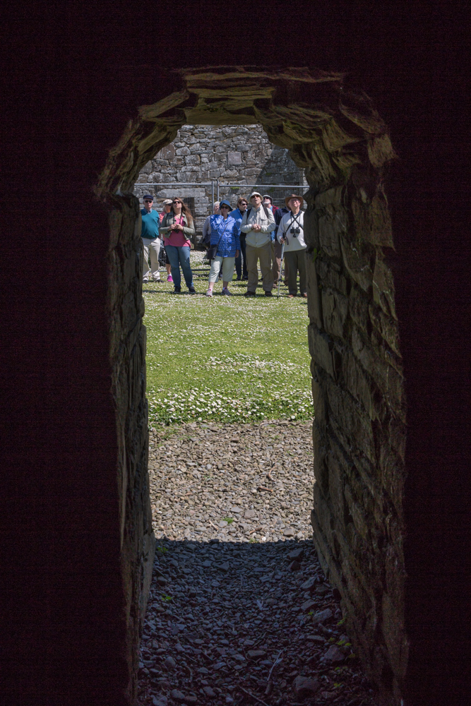
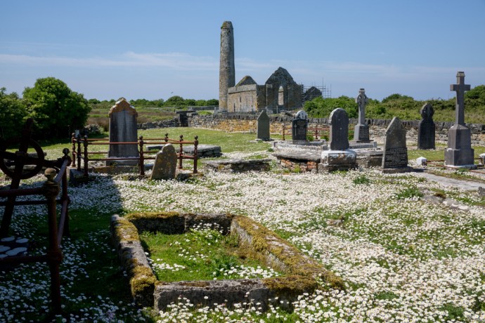
Glendalough is truly special.  Wandering its many sites and catching glimpses of its magic mountain setting will be, despite the fact that half of Europe, America and Asia are there with you,  one of your treasured memories of Ireland.  Even the name is evocative as it comes from the Irish Gleann da locha (Glen of the two lakes)  The site was founded by St Kevin and most of the surviving buildings date from 10th to 12th Century.  That’s old.  Since then it has experienced attacks from the Vikings, the sacking of the monastery in 1214 by the Normans  and its total destruction by the English in 1398.  Reconstruction of some of the ruins was started in 1878 and now you can visit a round tower, seven churches, two High Crosses and much more.  I’m not going to go through all its attractions but I have selected just a few pictures to give you, my readers,  some idea of the extent of these ruins and the calming ambience that you will feel when you are there.

Glendlough-4007

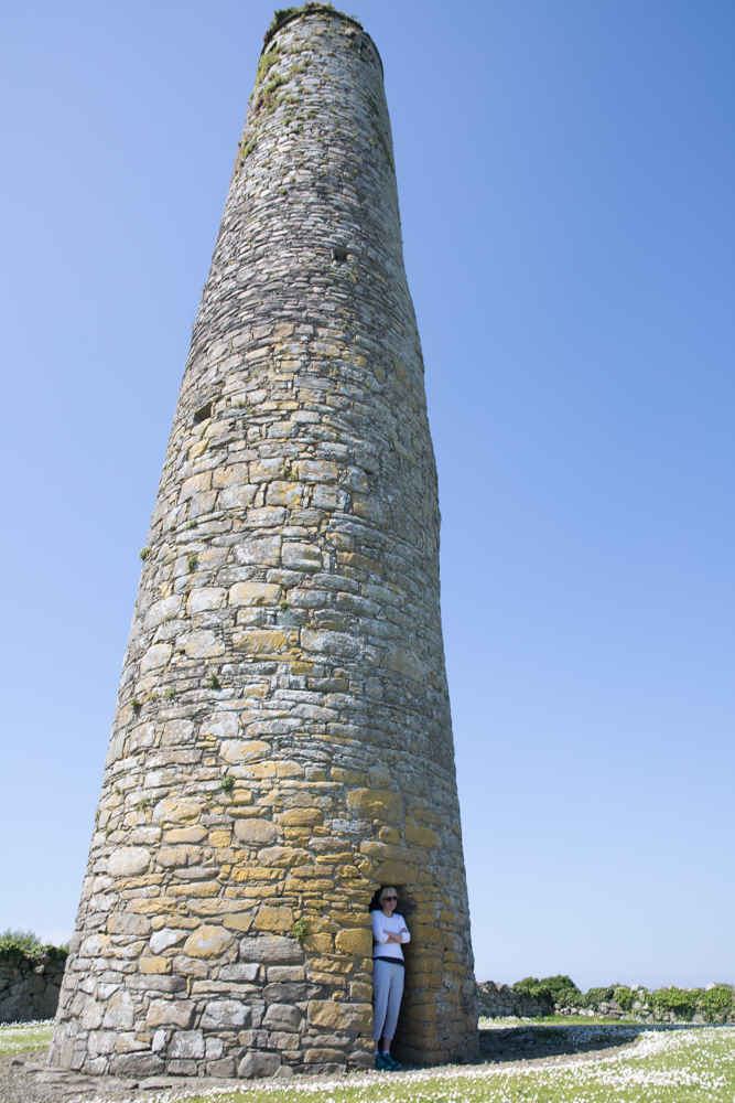
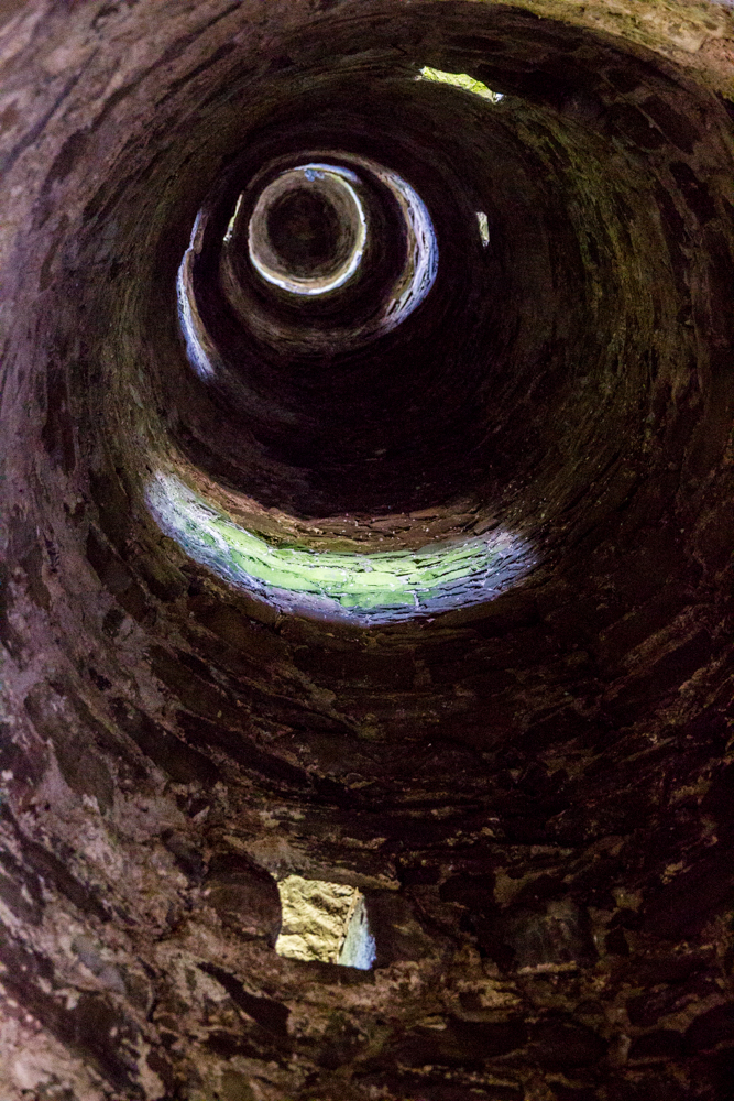
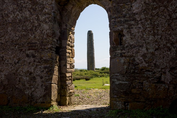
One of the best round towers in Ireland.  Beautifully preserved and original except that the roof was rebuilt in 1878 from stones that had fallen.  Built 10th century.

Glendlough-4052

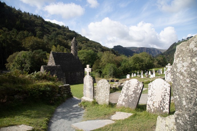
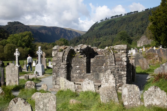
View of Glendalough past St Kevin’s Kitchen (wasn’t a kitchen) to the mountains beyond.


Glendlough-4035

View of the cathedral, built between the 10th and 13th century.   THe round tower perfectly framed through the window.

Glendlough-4049

St Kevin’s Kitchen I.  It was in fact a church.

Glendlough-4133

St Kevin’s Kitchen II.  Note the corbelled stone roof.  Same technique as used in beehive huts.

Glendlough-4164

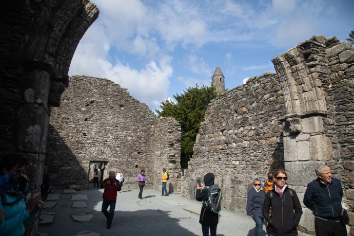
Inside the cathedral showing beautiful stonework on the archway.

Glendlough-4064

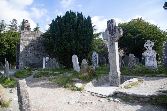
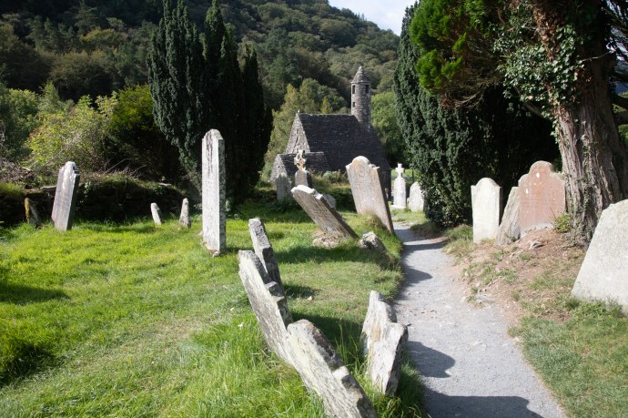
One of two high crosses.  One is in the Visitors Centre.  This one sits in place in the cemetery.  It is unadorned and known as St Kevins Cross and was carved from a single piece of granite.

Glendlough-4073

The Priests’ House.  Reconstructed from the original stones based on  a 1779 sketch. Compelte with romanesque arch.

Glendlough-4117

Archaelogy at the site continues today with a team at work from UCD.

Now I headed to the trailhead for the Miners Way.  It leaves from the eastern end of the Upper Lake where there is a beautiful beach (this time natural I think) and skirts the northern bank.  I had the tall straight timbers of a Scots Pine forest on my right and the deep blue waters of the lake on my left.

Mines-

View from the beach at the east end of the Upper Lake at Glendalough.  Looking west.


Mines-4205

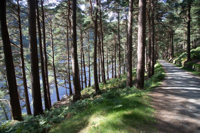
The Miners’ Way walk takes you along the northern bank of the Lake through a Scots Pine forest

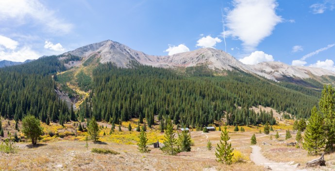
As I approached the end of the lake it opened up to a stunning U-shaped valley carved by a glacier 15,000 years ago.

Mines-4226

At the western end of the Upper Lake.  A classic U shaped valley carved by a glacier.

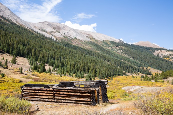
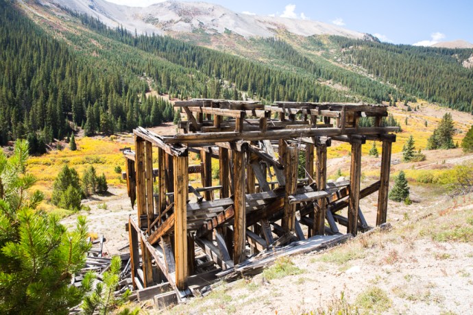
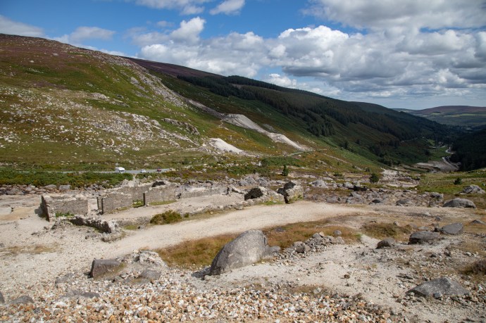
Another kilometre on and the ruins of the mine buildings come into view.

Mines-4274

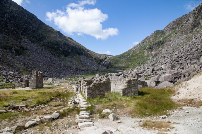
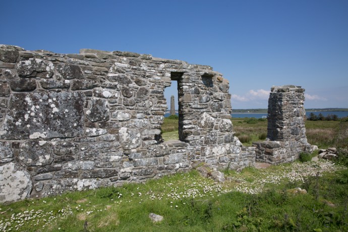
View of the ‘Mine Village’.  Actually the mine processing plant.

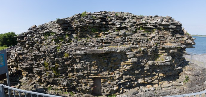
They call it the ‘Mine Village’ but its not really.  It is the ruins of the processing plant the ore extracted from the surrounding hills was processed and the lead and silver removed. No one actually lived here; it is believed the mine workers walked in every day from Larragh a distance of 6 km.  What is preserved here are the remains of the ore dressing floor (dressing is another name for processing whereby the ore is crushed, chemicals are added that assist in separating the ore from the waste, and then it is filtered and dried).  The most prominent building is the ruin of the the Cornish rolls crusher house, built in 1855. Part of it was recently rebuilt in an effort to forestall further deterioration.  The rolls crusher mechanism itself is well preserved and lies a short distance away on the valley floor.  It is such a thrill to wander round these ruins. 

Mines--3

View of the crusker on the left and mine buildings on the right.  Old shafts and mullock heaps can be seeon on the ridge,  A tramway (nothing remains) brought the broken ore to the crusher

Mines--2

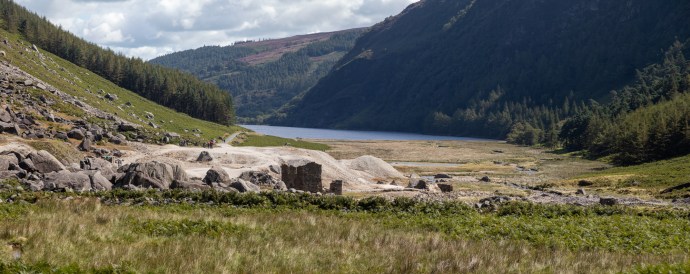
A view of the mine area from the west looking up the Upper Lake.  The white heaps are tailings (material  that remains after the valuable minerals are removed)

Mines-4343

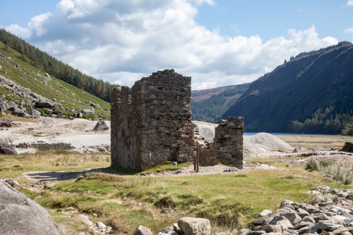
The Cornish Rolls Crusher building

Mines-4405

It is said that this is the best preserved example of a Cornish rolls crusher in Ireland. 

Mines-4277

Tailings from the Glendalough processing plant.  Timbers in centre of picture are believed to have supported the tramway used to transport ore from the mine shafts.

Mines-4361

A specimen of lead ore showing galena.

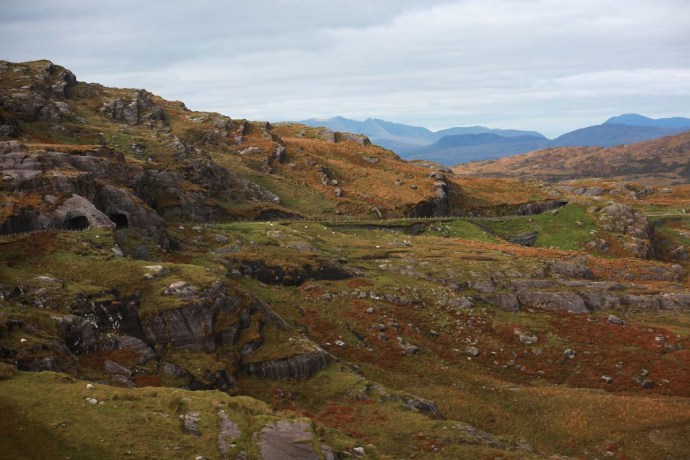
Mining also took place in the Glendasan Valley to the north of Glendalough on the other side of Camaderry Mountain.  The main mineral vein cuts through the mountain between the two valleys and mine workings along the veing connected the two valleys.

So I had to go and have a look there.  Another beautiful U-shaped valley greeted me.  This time however we are at the top of the valley where there are the remains of another ore dressing plant.  I can see other mines in the distance and on the mountain sides so I followed the river downstream. 

Glendasart-4510

Glendasan Valley.  View down the valley from the ruins of the Hero Mine processing plant

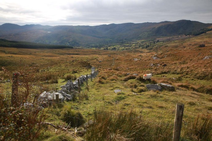
Unfortunately the telltale evidence of historic mining along the river does not tell a pretty story of environmental responsibility.  Much of the mining is very old, nearly 200 years, so I suppose that is some excuse, but some dates from the middle of the 20th century when they should have known better,  Tailings and waste stockpiles are scattered along the river valley and, in places, the river flows right through them or has found a path around them.  Considering the high levels of lead, one can only speculate on what this has done to the water quality.  There is no way approval would be given for a mine treatment plant to operate on the bed of the river theses days.           

Glendasart-4517

Glendasan Valley with tailings and mine spoil in the river bed

Glendasart-4524

Glendasan Valley 

Glendasart-4530

Mine workings on the north side of the Glendasan Valley and the processing plant ruins on the river bed.

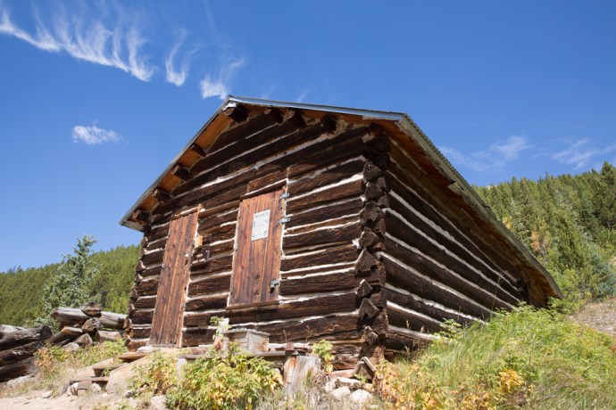
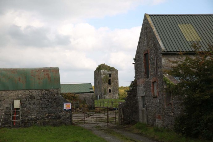
One last story that I came across during my reserch.  With the increase in the mining workforce in the 1850s,  demand for housing increased and the mining company built some houses for their workers. One row of houses close to the mining works is said to have once housed eight musicians and was thus given the name ‘Fiddlers Row’.  Love it.

Fiddlers_row_web

This row of houses was built in the 1850s and housed mine workers.  Due to the number of musicians it was known as Fiddler’s Row.

After walking maybe 10km around these two sites I was totally exhausted and a bit of a chill was coming into the air so well satisfied, I decided to end my jaunt here.

Glendasart-4550

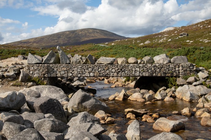
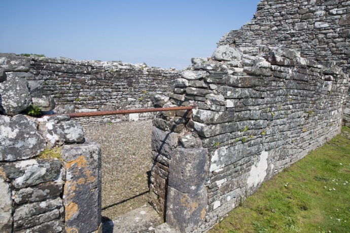
The unusual bridge across the Glendasan River

A four day journey across the country and through 5,000 years of history.  Thanks for coming on the trip with me.  I hope I have planted a little seed for those who have never been here and for those who know this place well, maybe I have given you some new ideas or a changed perspective.

For the time being that is the end of my travels in Ireland.  But there will be more.  Ireland’s like that – you keep coming back.  Try and keep me away.

Categories: My Journey, Real Ireland | Tags: , , , , , , , , , , , , , , , , , , , , , , , , | 1 Comment

The Colorado Rockies 4. Independence – a Ghost Town.

Independence ghost town

In my last blog on my road trip through the Colorado Rockies, I talked about Independence Pass and its close connection with the discovery of gold. Gold in this part of Colorado was discovered on 4th July 1879 at Roaring Fork River about four miles from the top of the Independence Pass and a town soon sprung upon the banks of the river and in the shadow of Mt Independence. It started as a tent city and one year later there were 300 people living in the camp.  The following year a single company, Farwell Mining Company, had acquired the leading mines such as Independence No 1, 2 and 3, Last Dollar, Legal Tender, Mammoth, Mount Hope, Champion, Sheba, Friday, and Dolly Varden.

IG3C1227-Pano-2

The ghost town of Independence at the foot of Mt Independence in the valley of the Roaring Fork River

Various competing interests battled over the name of the town.  During its short life it was variously known as Belden, Chipeta, Sidney, Farwell, Sparkhill and in its fading days optimistically Mammoth City and Mount Hope.  Ironically though and for obvious reasons, it was widely known as Independence though there was never a post office of that name.

By summer of 1881 there were 500 people and many permanent buildings including grocery stores, boarding houses and three saloons. It reached its peak in 1882 when there were 90 buildings containing 40 businesses and a population of 1,500.

As with most mining booms, the bust followed quickly when the gold ran out and by 1888 there were only 100 citizens eking out an existence at an elevation of nearly 11,000 feet and under a blanket of snow from October to the end of May.  The worst storm in Colorado’s history hit in 1899 and those residents still there were completely cut off for months. Running out of food, they dismantled their houses to make skis and 75 residents skied their way to Aspen. Only one resident remained after this. Jack Williams was caretaker of the stamper battery and treatment plant.  In 1912 Jack finally left and that was the end of the town of Belden-Independence-Chipeta-Sidney-Farewell-Sparkhill-Mammoth City-Mount Hope.

IG3C1276

A restored miner’s cabin now used as a summer residence.

IG3C1279IG3C1289

Incredibly a number of buildings have survived to varying degrees in this spectacular location. Some remain relatively intact and have been restored and some are piles of timber or just depressions in the ground. Ted Ackerman’s Hotel was one of five during its hey-day. Little remains of this establishment where miners could find a room for $2 a day.

IG3C1239

Ruins of Ted Ackerman’s Hotel

A general store stands proud, restored in the 1980s and a remarkable testament to the courage of these men (and a few women) and the lure of gold.

IG3C1261

Restored general store

As a geologist with a strong interest in the company history and social history of gold mining in my home country I have seen many Australian ‘ghost towns’ from the gold rush days. They were much more transient and rarely does any structure survive as here. Australians built with hessian and stone and corrugated iron, rather than timber, which is so abundant here, and material was transported to the next town following abandonment.  You’d have to say that heat was more of a problem than cold generally.  Its hard not to be impressed though by the simplicity of construction of the log cabin and its durability.  140 years later the v-notch joints still hold the structures together.


Just downstream from the town is the timber framework of a large stamper battery and on the slopes above there is a bit more mine infrastructure, the head of a mine shaft and a patch of Aspen covering what was obviously a spoil dump.  I would love to have had time to explore more.

IG3C1319

Remains of a  large stamper battery.  The treatment plant would have been on the flat area below.

IG3C1316

An old mine site.  The mound in the distance was the head of a shaft and the patch of aspen covers a spoil dump.

Preservation of these sites is essential.  They are one of the few tangible links to a hugely important part of the development of countries such as USA and Australia.  As in Australia, mining was responsible for opening up large tracts of the country and for the beginnings of many towns, some gone like Independence, some still surviving like Aspen, Leadville or Cañon City.  I’ll come back to this in a later blog.

Categories: America | Tags: , , , , , , , , , , , , , , , , , | 2 Comments

Dursey. An island at the end of Ireland.

Dursey Island lies at the end of the Beara Peninsula in West Cork. It has been inhabited since antiquity and though it lies only 200 m from the mainland it has always been one of the most remote and inhospitable places to live in in the whole country.

IG3C3006

Dursey Island looking towards the mainland.

It had a tortured early existence and was the site of one of the most horrific events in Irish history.  Following the Battle of Kinsale and the defeat of Donal Cam O’Sullivan at Dunboy in early 1602, the English moved to clean up the last of the rebels.  Many of the O’Sullivan Clan’s non-combatants had been sent to  Dursey to keep them out of harm’s way.  An English force attacked the small garrison guarding the island. They butchered the entire population of the island, women, children and the garrison. Three hundred people executed on the cliffs and their bodies (some were still alive) cast into the sea.  O’Sullivan survivors from the whole of the Beara Peninsula, about 1,000 of them, then marched 550 km north to seek shelter from the O’Rourkes of Leitrim, but that’s another story.

As with the rest of the west coast of Ireland, Dursey suffered during the famine with a 30% reduction in its population in the 1840s.  Its subsequent and continuing depopulation reflects that of many other Irish islands but its survival displays the resilience and strength of its people. In 1860 the three villages of Ballynacallagh, Kilmichael and Tilickafinna,  a population of around 240 eked out a lonely life on the treeless but well pastured island.  By 1969 this number was down to 53. A feature of the island now is the large number of abandoned houses from these times.  This eloquently tell the story of a disappearing population, but they also give the island its remarkable character.

IG3C2842

Abandoned village

Up until 1970 the only way to get on and off the island was by boat across the channel.  A channel that could become so treacherous with storms and a tidal surge  that for a month and a half each year the island was completely cut off.  Considering that there was no electricity, TV, doctor, priest, food supplies and no hall or pub, life must have been very bleak indeed.   After much agitation from islanders the Government agreed to build a cable car to provide a lifeline and, while that did save it from the same fate as the Blaskets, which were abandoned in 1953, it did not stop the population drain until, by 2011, there were only three permanent residents.

IG3C2411

Treacherous tides and surges made this channel very dangerous to cross.  Not these days.

IG3C2448

Approaching the island

IG3C2435

Anticipation. A picture window.

But the cable car opened the island to the tourist.  6.5 km in length, there is much of interest.

To walk the island takes at least 4 hours but I spent over 6 hours ambling and rambling, getting lost and finding myself again.  Just absorbing the ambiance and grateful for the glorious sunshine and the warm breeze that accompanied me. It is glorious to walk either along the sometimes paved road (which despite the alarming speed sign is almost devoid of vehicles;  I saw only one) or across the hills but best to stay on the marked paths unlike me.

IG3C2470

There is a marked walking trail across the hills.  Looking across to the mainland.

IG3C2486

If you leave the path walking through thick vegetation and across stone walls can be a challenge.

IG3C2790

I can never understand Irish speed limits.  100 kph!?

IG3C2880

Looking from the western tip of the island back towards the mainland.  A signal tower stands on the highest point.

On your walk you will come across the remains  of St Mary’s Abbey, a Napoleonic signal tower, historic ruins, spectacular views, rocky cliffs, birds galore, native orchids and your best chance  in Ireland to see dolphins and whales.

IG3C3170

St Mary’s Abbey

IG3C2623

Cliffs on the southern side of the island

IG3C2647

Dolphins

IG3C2727

I tracked this pod of dolphins for over half an hour down the coast

IG3C2928

Native orchids are common

At the western end of the island are three small islands.  Well, rocks really.  They are known as Calf Rock, Cow Rock and yes, you guessed it, Bull Rock.

IG3C2799

Looking west across Dursey to the imposing Bull Rock, two miles off shore

IG3C2889

Cow Rock and Bull Rock

A lighthouse was established on  Calf Rock in 1866.

Less than three years later a storm damaged the lighthouse.  This led to another tragic event in the saga of Dursey.  The Keeper, on Dursey, thought he saw distress flags and six boatmen were dispatched.  Those on the island were safe however, on the the return trip, the boat capsized and all six were lost

On 27 November 1881 in another  violent storm the the tower and lantern just snapped off above the steel base and fell into the sea. No one was hurt but it took two weeks to extract the four men stranded on the island. You can still see the base of the tower to this day.

IG3C2897

Calf Rock with the remains of the steel base of the light tower. Wrecked in 1881

To replace this lighthouse one was built on nearby Bull Rock, work commencing in  1882.  The light didn’t open until 1888.  It is worth pondering the challenge of constructing this on an island of precipitous cliffs measuring 230 m by 160 m and rising to 90 m above sea level.

The station consisted of an octagonal lighthouse tower, dwellings for the Keepers, and an oil-gas works.   This was a massive undertaking and the optic was the biggest in Ireland.

IG3C2915

Bull Rock with its lighthouse.  You can also see a gull colony and the entrance to a natural tunnel that goes right through the island.

The light still stands proudly today though it was automated in 1991. The island is swarming with gulls.  Also noteworthy is a natural tunnel that goes right through the island.  You can see the eastern entrance in the picture above.

That’s Dursey.   Take everything you think you’ll need because there are no supplies on the island and not even a toilet. And it won’t always be mild and sunny as it was for me; go prepared for bleak and wild.

But don’t miss it.

IG3C3225


Categories: My Journey, Real Ireland, Wild Ireland | Tags: , , , , , , , , , , , , , , , , , , , , , , , | Leave a comment

Scattery Island, Co Clare. An Irish Time Capsule.

At the southern end of West Clare, on an island just off the coast near the town of Kilrush, lies one of country’s best kept secrets.  But that’s changing. The word is out. Last year it was awarded a prestigious European Destination of Excellence award for Ireland for offering a ‘tangible cultural experience’ and visitor numbers are dramatically increasing.  In 2016 870 people visited the island.  This year they are expecting up to 6,000 people.

Before 2016 visiting the island was unpredictable.  If there was enough interest then a boat trip was organised.  That changed with the setting up of Scattery Island Tours two years ago.   They have just commissioned a spanking new ferry that comfortably accommodates 70 against the old one, which took 12, and this is certainly helping  but don’t let that put you off.  I spoke to Irene Hamilton, one of the principals of the company, about the her desire to open the island to a larger audience and at the same time preserve what it is that makes it special.  The island has so much to offer and you can tailor the experience to your own needs.  Join a guided tour and have the stories of the island explained or explore on your own.

Irene comes from a line of island residents.  Her father was born on the island and was a sea pilot as was his father.  This link and the remarkable foresight of the people of Kilrush has put the Company at the forefront of placing Scattery  as one of the must-see destinations of Clare.  Her vision is that visitors don’t just zip past on the way to Loop Head but stop overnight in Kilrush and explore the place at leisure.

So why is it special?  There’s actually nothing else like it.  A now uninhabited island with a continuous occupation that started over 1,500 years ago, beautifully preserved, easily accessed and in a spectacular location.

I had been trying on and off for a while to get onto the island but it just never happened. During an unusual warm spell in late May I tried again. The Gods were smiling this time and on a bright blue Thursday I boarded the An Breandàn for the short trip across the channel from Kilrush.  Irene told me that the boat was named for her father and it is no coincidence that Breandàn is also the patron saint of the sea.

IG3C6864

Boarding the ferry to Scattery

Actually the most time consuming part of the journey was in the lock at the entrance to the Marina. It was fascinating to see the water rush in as the gates opened to maintain the level in the Marina

IG3C7484

Water enters the lock

IG3C6919

Irene Hamilton, owner of the ferry company chats to patrons.

Once through the lock you see the island and its signature Round Tower rapidly approach you and in less than 15 minutes you are there. We were well looked after by  the efficient and friendly crew which included Irene’s sister Martina.  Irene was a mavellous host spending much of the time, when she wasn’t performing seafaring duties, chatting with patrons and and answering questions or helping with family photos or making cups of tea.

IG3C6922

Approaching the island.  The Round Tower dominates.

IG3C6968

The view from the pier,   The white cottage on the left is the Visitor Centre, Keane’s Castle is in the centre and the Round Tower can be seen in the distance.

When we arrived we were handed over to  Michael who acted as our guide. The guides are provided by OPW who manage the island.  They also maintain a small visitor centre.  The tour is roughly an hour and you visit all the monastic and archaeological sites with the exception of the lighthouse and the Battery.  This was certainly worth it as Michael has a wealth of background knowledge that fleshed out the story.   Next time however I will explore it on my own but I would certainly recommend the tour as a first time experience.  And anyway it’s included in the price of the ticket.

IG3C7004

The guided tour begins

The story of Scattery starts with the birth of St Senan, in 488AD in Molougha, a townland about 5 km from Kilrush in Co Clare. After a life of religious study including time in Rome he set up a monastery on Inis Cathaig in 532AD.  This is the original Irish name and over time it became anglicised as Scattery.  The name relates to the presence of a monster known as the  “The Cathach” which was said to inhabit the island.  On Senan’s arrival he apparently faced the monster and ordered it, in the name of the Trinity, to depart. Such was Senan’s power that The Cathach obeyed and retreated to Doolough Lake at the foot of Mount Callan.

Little is known of Senan’s life or life under him in the monastery.  Many miracles are attributed to him however and his grave has continued to hold a sacred place among the people of West Clare and beyond. The grave is supposed to be the site of miraculous cures.  Stones from St. Senan’s Bed were regarded as relics and a protection against diseases and especially drowning.  Water from St Senan’s Well had restorative powers.

We do know his rule on the monastery was austere and women were banned from even setting foot on the island.  St Senan died in 544, but it would appear that the monastery continued unimpeded until the arrival of the Vikings in Ireland in 795.  Scattery which lay on their route to Limerick was sacked between 816 and 835, being severely damaged. In 968 the Vikings were expelled from Limerick by Brian Boru and retreated to Scattery. Boru however pursued them and three years later the island was raided with up to 800 people being slaughtered.

In 1057 the Vikings had another go with the Dublin Danes plundering the island. Then again in 1101 Magnus, king of Norway attacked. The Normans arrived in 1176 and this led to an attack by William Howell, not even sparing the churches.  By 1189 the last Bishop of Scattery had died and the Diocese of Scattery was abolished. The English  now took possession of the island.  The end came however following the 1537 introduction of  the Suppression of the Monastries Act by Henry VIII.

Phew! That is some story.  It seems to have been touched by every major historical event that Ireland experienced.  There are many reminders of this tortured time in the ruins that can be seen on Scattery.  Churches that date back as far as the 8th century, the round tower built between 10th and 12th century,  St Senan’s well,  St Senan’s Bed.  I found this all totally absorbing.  Come with me on a virtual tour.

IG3C7082

St Mary’s Cathedral and Oratory.  Built in 8th Century and added to until the 15th century. The Round Tower in the distance.

IG3C7085

The eastern window of the Cathedral.  The carved stone head is said to be St Senan.

IG3C7104

View of the Cathedral from the west.

IG3C7165

Western doorway of the cathedral.  Note the tapered shape of the door under the heavy lintel.  The stone to the left is thought to be a balaun stone.

IG3C7217

A distant view of the Round Tower and the Cathedral.

IG3C7096

The Round Tower built between 8th and 10th Century. Note the unique doorway at ground level

IG3C7141

View from inside the Round Tower

IG3C7146

The Round Tower doorway.  Note the thick walls; over 1 metre.

IG3C7237

St Senan’s Well. During a drought St Senan prayed for water and an angel guided him to this spot.  The Sanit plunged his staff into the ground and water sprung forth.  


IG3C7166

Distant view of Cnoc an Aingeal (Hill of the Angel), One of the earliest surviving churches built on the site where Senan set foot on the island.


IG3C7188

Remaining early wall of the church on Cnoc an Aingeal.

IG3C7257

St Senan’s Church.  12th Century Romanesque style

IG3C7292

St Senan’s Bed, a small church built over the grave of St Senan.  The iron bar is supposedly designed to keep women from walking in.  Women who entered according to tradition will be cursed

IG3C7262

View of the Round Tower from the entrance to St Senans Church

IG3C7280

A stone table found near St Senans Church.  Thought to be a medieval grave slab carved with a beautiful celtic cross and with an inscription saying Or Do Moenach Aite Mogroin. (Pray to Moenach the teacher of Mogroin).

IG3C6999

Teampall Na Marbh (Church of the Dead). Built 14th and 15th Century.

IG3C7037

View across the graveyard of the Church of the Dead towards Cathedral and Tower

IG3C7032

Modern graves at the Church of the Dead

IG3C7449

The graveyard at the Church of the Dead continues to be used for burials.

But the island’s story did not end with Henry.  Its strategic position meant it was always in the centre of events.  The ruins of Keane’s Castle, a tower house constructed in the late 1500s can be seen at the pier.  The driver at this time was the invasion by the Spanish Armada and the Irish Rebellions which threatened English rule. Remains of gun installations are evident.

IG3C7477-Pano

The ruins of Keane’s Castle, a Tower House built in the late 1500s

The next phase of activity on Scattery though did not begin until the end of the 18th century. The French supported the Irish Rebellion in 1798 and in 1814 the impressive Artillery Battery was built by the English as part of the extensive defenses erected on the west coast of Ireland. Unfortunately I did not get to visit this time.  Or the lighthouse which was built later in the 19th Century.

IG3C7176

View of the lighthouse and Arillery Battery from Cnoc an Aingeal

In the early part of the 19th century secular settlement of the island picked up with the construction of a village to house families of river pilots who were based there.  This was when Irene’s descendants came.  The island replaced Kilbaha as the pilots base.  Considerably less rowing of the currachs was required now to reach the ships.

By 1881 the population had reached its maximum of 140 people.  Most of the residents lived in a small area known as ‘The Street’.   Many of these structures still remain and though boarded off  from visitors the closely spaced buildings give us a real feel for what was a comfortable and prosperous community until its eventual demise.

IG3C7342

The Street.  The village that housed pilots and their families from the early 1800s

IG3C7362

The Street.  Another view

Through the 20th century the population continued to decline especially after the pilots were transferred to the mainland in 1954. The last two residents eventually left the island in 1978.  This fact somehow puts the whole story of the island into context.  Its settlement is still in living memory.

There are many reminders of this time aside from the ruins of  The Street and elsewhere.  Many of the gravestones at Tempall Na Marbh, which although being  the youngest of the churches on the island  (14th or 15th century), are beautifully preserved.  Many date from pre-famine time and contain symbolic representations that not only represent religious iconography but tell the story of residents lives.  Though the church ceased to be operative centuries ago many descendants chose to be buried there and they still do today.

IG3C7438

Beautifully engraved gravestone at Church of the Dead.  Dating from 1828

IG3C7058

Engraved symbolic representations on a grave stone including images of a three masted ship and a hooker and perhaps shipwright’s tools.  Presumably the deceased was a mariner.

Following the end of settlement the island lay empty for many years,  This could have been the end of the story as the island eventually passed into the hands of a developer with grand plans for a marina.  Luckily this came to naught and the island was eventually sold to a Belgian group. We owe an enormous debt of gratitude to a group of Kilrush residents who pushed hard to regain ownership and ultimately bought the island back.  These residents still own the island and they ceded management to the State.

That is a great outcome.  It is not hard to imagine that in years to come Scattery will become one the essential Irish monastery sites to visit; right up there with Glendalough and Clonmacnoise.

Put it on your agenda for your next visit.

Categories: My Journey, Real Ireland | Tags: , , , , , , , , , , , , , , , , , , , , , | 3 Comments

Castle Gan Ainm. A castle in your front yard? Only in Ireland.

How would you like a castle in your front yard?  Well in Ireland you can have one.  They say a man’s home is his castle.  Or should that be a man’s castle is in his home.

IG3C5311-Pano

Just imagine the things you could do with your very own castle.  Like, use it to store your ride-on mower or maybe as a cubby-house for the kids.

IG3C5346

A home for the ride-on


I came across this one recently.  It is just on the outskirts of Liscarroll in Co Cork, which of course has its own Castle that dominates the village.  I could not find a name for this one though, so hence I have christened it Castle Gan Ainm, but it is just like the many hundreds of Tower Houses you find all over Ireland.

This one though is literally in the front yard of a farmer’s house.

It is in surprisingly good condition really and many of the features of such houses are preserved.  For example there is a chute from what would have been the garderobe (fancy name for medieval toilet – comes from the cry ‘garde robe’ made as a warning to those below, before effluent was unceremoniously tipped onto the street).  There are also a few modern additions such as the ‘rooftop garden’ comprising, at this time of the year, gorse in full bloom.

IG3C5368

IG3C5326

Chute for waste products from the ‘gardebrobe’

IG3C5343

A rooftop garden

And of course the resident border collie. The Keeper of the Keep?

IG3C5352

The Keeper of the Keep


Categories: My Journey, Real Ireland | Tags: , , , , , , , , | Leave a comment

The Beara Peninsula, Co Cork. My New Favourite Place in Ireland.

I hope my blogs on Ireland aren’t getting too boring. Each time I discover or rediscover a new place I can’t stop scraping up the superlatives.  I’ve blogged recently on the magic of Glencolmcille and south west Donegal, on the spirit of Achill Island, on the beauty of Doughmore in West Clare and West Connemara and many places in between. Recently I visited the Beara Peninsula again for the first time in twenty years. And I’m sorry but I have to regale you with more resplendent words yet again.

The Beara Peninula is one of those wonderful headlands that define West Kerry and West Cork, jutting prominently into the Atlantic and adding a whole lot of extra kilometres to the Wild Atlantic Way.  Many have well known and evocative connotations. The Iveragh Peninsula, better known as the Dingle Peninsula,  and the famous Ring of Kerry are the prime destinations for visitors and do not fail to disappoint. Less well known are the Beara Peninsula, Sheep’s Head and the spectacular Mizen Head.

The attractions of the Beara Peninsula are however becoming better known and I am told by the locals that this summer it was crowded with visitors. I chose to visit in late October. The weather was good (in Irish-speak that translates to ‘no rain’) and it has to be the perfect time. At the western end, the roads are almost deserted and you feel you have this magnificent landscape to yourself.

An obvious draw of this place is that it is more compact than the Ring of Kerry but there is so much variety, so much of interest and so much to fill the shortening autumn days that it was hard to leave.

So what does this little treasure offer?  For a start magnificent vistas are around every corner. You can approach from the Northern Road or the Southern Road but my strong recommendation is you find time to do both.

panorama-beara-3

ig3c3378aig3c3484ig3c3436ig3c3681ig3c3706a

And sometimes you see something that you know could not be replicated anywhere else in the world.  The patchwork quilt and stone walls that say Ireland, Ireland, Ireland.

ig3c4109aig3c4224aig3c4066

There are a number of mountainous rocky passes. I explored the Caha Pass this time, which links Kenmare with Glengariff. Here there is stunning scenery and four remarkable tunnels (known as Turner’s Rock Tunnels) built in the 1840s when they decided to go through the rock rather than over it. Quite an engineering feat for its day and very unique for road construction as most tunnels in Ireland were built for railways. Indeed the railway construction boom did not start until the 1840s so these tunnels predate any rail tunnel in Ireland.   From this impressive road there are craggy mountains, magnificent pasture and grasslands, and sweeping panoramas. Next time I will do the Healy Pass.

ig3c4805aig3c4741ig3c4801ig3c4826aig3c4731

Elsewhere you will see wild, coastal panoramas, verdant forests, jagged islands or houses perched on grassy knolls with staggering views or nestled into rugged rocky cliffs.

panorama-beara-4ig3c3780ig3c3820

ig3c3635a

ig3c3716ig3c3493

ig3c3916aig3c3841a

The drive to the end of the Peninsula and Dursey Island is not to be missed. But be prepared for perhaps a little disappointment. Ireland’s only cable car which links the island to the mainland and at this time of the year only runs between 9.30am and 11am was ‘fully booked’ and not operating for transport of people. It was being used for the day by the local farmers to transport hay across the narrow channel. Where else would tourists be turned away, some mind you who had travelled especially, in favour of bales of hay? Only in Ireland. But somehow it didn’t matter, there was so much else to do and it will be there (possibly) next time. You’ve got to admire the ingenuity of the farmers here. I saw an old ‘retired’ cable car in a yard being used as a chook house. Love it.  And love the little insect houses thoughtfully provided by one farmer.

ig3c4000ig3c4016ig3c4034

Then there is the colourful palette of the charming village of Allihies, which single-handed may be responsible for keeping alive the paint pigment industry in Ireland. Purples, pinks, indigo and every other colour merged harmoniously into the greys, greens and reds of its rocky backdrop.

ig3c4383a

ig3c4264a

And towering over the town is the architectural masterpiece of the Engine House of the Mountain Copper Mine built around 1810. Maybe you think masterpiece too strong a word  but it is at least the equal from a heritage perspective of the megalithic ruins or the monastic abbeys that populate the tourist guide books.   This is the finest example of an historical mine building I have seen in this remarkable condition. It speaks of the confidence and wealth that the mine brought to this remote outpost as it became one of the jewels of European copper mining during its heyday from 1810 to its closure in the 1920s. There are plenty of reminders of the mining period; old shafts and adits, mine workings, two other engine house ruins, stone walls and in places the tell-tale green and blue staining of copper carbonates.

ig3c4369a

Mountain Mine engine house

ig3c4362ig3c4290ig3c4275

ig3c4321

Chasing the copper


There is a museum which gives a very good account of the mining story but unfortunately it is a bit expensive which turns some away. All aspects of the story are covered including the geology, mining technology and social impact.   As a geologist it was of course fascinating. And even more so for me having met the next generation of miner there, young J and his mum Frances, locals who had come to see if they could find any copper. As it happened I had seen some workings with strong copper on the way up the hill, so I offered to show them and took them there. J’s wide eyed fascination and enthusiasm was enough reward.  Maybe I have helped kick start another geologist’s career.

ig3c4394ig3c4389

Still on copper, I stopped at Puxley Manor near Castletownbere. Actually the site of the mansion is right near the ruins of Dunboy Castle but more on that later. It would seem that the location is well cursed having witnessed a number of tragedies over the past 4oo+ years.

24_ctb_ah-635x402

Puxley Manor around 1910

When I first saw the Puxley mansion it was 20 years ago it was a shell of a ruin. It had been the home of the Puxley family since the 1700s. They pretty much owned the copper mining industry here and ended up fabulously wealthy.  As the industry declined so did the Puxley wealth and when his wife died in childbirth Henry Puxley, the last owner, abandoned the castle. Worried that the British Army would take over the abandoned house, the IRA torched it in 1921, destroying it and its contents. The shell was sold at auction in 1927 but remained a forlorn ruin as this photo shows.

b-and-white-puxley

Puxley Manor in the 1990s

This is what it looked like when I saw it in 1996. It was sold to a developer in 1999 and the Celtic Tiger roared. It was to be transformed into a luxury 6-star resort hotel, the only one in Ireland. Massive restoration and conservation work was carried out and all progressed swimmingly with a soft opening in 2007. That was until the money dried up in 2008 with the GFC. By 2010 the project was abandoned and a mesh fence erected. The bats returned but not the visitors.  This is how it appears today. The rotting hull of a large boat sits in the harbour as if to reinforce the tragedy.  Such a grand vision. The restoration did not however extend to the gate house which stands impressively ruinous.

ig3c4651

Puxley Manor.  restored but empty

ig3c4532a

Puxley Manor

ig3c4496

Gatehouse.  Puxley Manor


I said earlier that Dunboy Castle remains were nearby. This was the ancestral home of Donal Cam O’Sullivan, last of the Gaelic chieftains and a thorn in the side of Elizabeth I during the nine years war which started in 1594.  In 1602 she sent a large battalion of troops to destroy O’Sullivan and the 143 men, who tried to defend the castle, could not withstand the British canon. Surrender was not an option after an emissary sent to discuss terms was hung in full view of the defenders. This ultimate fate awaited all those remaining once the British destroyed it and the castle was never lived in again.

The name O’Sullivan however is everywhere on the peninsula.  You can’t avoid it.

ig3c3538

This little enclave of Cork is truly a gem and you could spend a week here or even a lifetime. There are plenty of stone circles, forts, monuments, holy places (such as the Mass Rock) and extraordinary natural wonders to explore and discover.  Oh, and sheep.  And there’s Dursey Island, if the cable car is running.  And if you’re up for it you can walk it all on the Beara Way.

panorama-beara-6

Ring fort

ig3c3756

Mass rock

ig3c4147

The black sheep in the flock

ig3c3540

There once was a church

The beauty though is not just in the grand vistas but in a host of other details for me that capture the personality of a place.  Here are a few photos that speak loudly about the struggle for life for both nature and man.

ig3c4151

Abandoned bucket near a well.

ig3c3769

Perfect bonsai tree growing wild.


ig3c4080

Window treatment

ig3c4404

Ingenuity

ig3c3556

Maintenance can be a problem

ig3c3519a

Fantastically fertile for funghi


ig3c3434

Life hangs on


ig3c4692

True love

ig3c4547a

Faded hope

ig3c4505

Was this to avoid the window tax?

So that’s it.    I’ll be back and very soon.

Categories: My Journey, Real Ireland, Wild Ireland | Tags: , , , , , , , , , , , , , , , , , , , , , | 9 Comments

A Visit to Ralahine, Co Clare. A Failed Experiment.

Ireland was a troubled country in the early part of the 19th century. Under the firm rule of the Crown, most Irish land at this time was owned by absentee landlords either in Britain or Dublin. The farms became a hotbed of discontent with tenants living in misery. This prompted organised groups such as the Ribbonmen, who launched deadly attacks on landlords and their tithes. Rural Ireland was not a happy place.

One man decided to try to change this. He believed he could bring peace to the land with a cooperative farm where he would rent the land to the labourers and they would work it under their own authority. This man was wealthy landowner John Vandeleur and a man of considerable influence in Clare.  He had been High Sherriff in 1823.  He found an estate of 638 acres at Ralahine near Newmarket-on-Fergus in County Clare and with socialist backer Englishman Edward Craig running it, started the colony with 40 farmers and their families. They had a school, a laundry and a pooled kitchen. All the capital (buildings, stock etc) was provided by Vandeleur and was communal property. There was no private ownership.  All 4 legged animals, even dogs, were the property of the group.  He charged rent in the form of farm produce.

2016-10-04-5b

Ralahine Estate as shown in the 1842 Survey map.  The location of buildings still standing is marked,

There were strict rules governing the running of the farm. It was no socialist Utopia. New members could only be admitted by ballot. Work was 12 hours per day. There was no gambling and no drinking.  There was however enshrined freedom of expression and religion.  If there was a proposed marriage to someone outside the colony, and the members did not approve, then both were excluded. There was no money. Labour was paid for in Labour Notes which could be exchanged for provisions.

It all seemed to work and the colony expanded after one year to 81. People came from all over the world to see the contented colonists. Then it all came crashing down.

Mr Vandeleur’s wealth was gone. He had lost his fortune, ironically through gambling and drinking. He fled from Ralahine. The arrangement with the members had no legal basis and all the assets were seized and the bold experiment came to an end after two years.

I wanted to see how much of Ralahine was left. It was easy to find; just a short drive out of Newmarket-on-Fergus. I met local farmer Niamh, who pointed out some of the original buildings from 1830 which are still standing. There is the old mill, very much intact and a long whitewashed building, which at first I thought was stables, was the old working mans’ cottages. Each “house” has a single room with a fireplace,  Probably very comfortable for its day. .

ig3c1004

Rear view of the Old Mill

ig3c1148

Front view of the Old Mill


ig3c0993

Workmans’ Cottages


There are a number of other buildings and many walls which also appear to date from the same time but these mostly seem to now be used for storage. And of course looming over it all is the Rathlahine Castle, a previous home of one of the MacNamaras,  possibly looking a little worse for wear now than it did then.

ig3c1064

Ralahine.  View to Rathlahine Castle.


ig3c1143

Rathlahine Castle


The original house, the residence of Vandeleur,  was apparently demolished in the 1940s. Niamh said it was due to the windows tax, but this sounds a little fanciful as the window tax ended in the 1850s.

ig3c1151

Ralahine.  The site of the original Rathlahine House.  Nothing remains. 


I found a few very old apple trees near the mill, laden with fruit and it would be nice to think that these date back to the days of the colony.  So maybe John Vandleleur, if he is looking down on his life’s work from his vantage point above, may take some solace in the fact that among the crumbling ruins of his dream apple trees, his farmers planted 185 years ago, are still bearing fruit.

Categories: My Journey, Real Ireland | Tags: , , , , , , , , , , , , , , | 7 Comments

A New Home?

It’s been so long since I blogged and so much has happened. The really big news for me which I got today is that I have approval to stay in Ireland for the next 12 months. The journey which I started three months ago is not over. I can now plan for the future. Buy a car and rent a house for starters. And see if Ireland is really for me. Everyone (and I mean everyone!) tells me I won’t be able to handle the winter. We’ll see.

In the last six weeks I have been on the Festival trail. A journey that has taken me through Clare (Willie Week, Tulla and Feakle Festivals and the Clare Fleadh at Kilaloe) to Galway (TradPhicnic at Spiddal), Sligo (Fleadh Cheoil and Tubercurry), Leitrim (Drumshanbo) and Mayo (Achill Island summer school). I have attended concerts, lectures, workshops, recitals and of course sessioned relentlessly. Indeed every day for the past 97 days! Is there a Guinness record for that?

It has been a wonderful experience but the festival season has come to an end. I haven’t dared look until I knew what my visa status was but I am sure there will be some fantastic events ahead of me. Perhaps more space in between them now!

It just occurred to me that the reason I have come here is to learn fiddle and while I have played fiddle every day, sometimes for 10 hours in a day I have not done any ‘practice’. Playing in sessions is not practice. I have hundreds of hours of recordings of workshops, sessions and concerts to sort. Great material for new tunes.

Of course I ’learnt’ heaps of new tunes at the Schools, from James Kelly, Paddy Ryan, John Daly, Liam O’Connor, Tola Custy, Siobhan Peoples, Martin Hayes, Eileen O’Brien and Yvonne Kane, but am having trouble recalling any of them. So there’s a lot of work there for me. Likewise I have literally thousands of photos to sort from the Festivals and from my travels through Mayo and Connemarra as well as here in Clare.

I have met some wonderful people and have some great stories to tell, so bear with me and I will start posting again when I can.

A quick thankyou to everyone who has supported me and encouraged me in what I am doing over here. I won’t name you all but you know who you are. I have been warmly accepted into the musical and broader community here in Clare and am really looking forward to the year(s) ahead.

In the meantime with my mind firmly on where I might live for the next year I have identified a few likely properties. The views can’t be faulted!

Stay Tuned…..

IMG_4237

Castle near Mullaghmore, Sligo


IMG_3465

House on Inishbiggle, Achill. Co Mayo


IMG_2989

House in Connemarra


IMG_4306

Benbulben, Sligo


IMG_8387

Connemarra, Co Glaway

IMG_1285

IMG_1371

Keel, Achill Island. Co Mayo


IMG_2283

Achill Island Co Mayo


IMG_2291

Achill Island. Co Mayo


IMG_4450

Co Sligo


IMG_7851

Innisheer, Co Galway


IMG_8377

Cottage, Connemarra, Co Galway


IMG_8432

Connemarra, Co Mayo


Categories: My Journey | Tags: , , , , , , , , , , , , , , , , | 2 Comments

Blog at WordPress.com.