Posts Tagged With: Causeway Coast

Giant Steps

Giants CausewY pAnorama 1

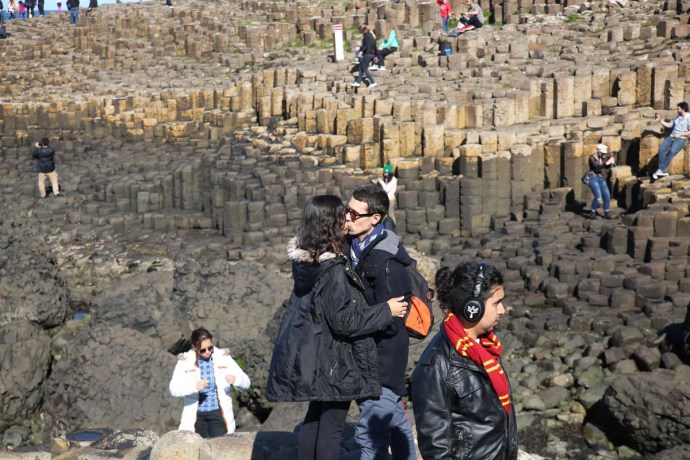
The Giant’s Causeway is on every visitor’s must see list on the island of Ireland. For lots of different reasons. It’s a beautiful place on a beautiful coast, It has mystery and mystique. It is intriguing and enigmatic. That’s why over a million people a year visit.

It is located in Northern Ireland in a part of Antrim known as The Causeway Coast.  I have been there twice in the past year – in January 2017 in the depth of winter and in September. Both times I was gifted with marvellous weather.

For me as a geologist it was like worshipping at a holy shrine. So I thought I would put together a few of my observations from the two trips.  Apologies if this is too dry for you but you can skip the words and just look at the pictures.

So what are we talking about here?

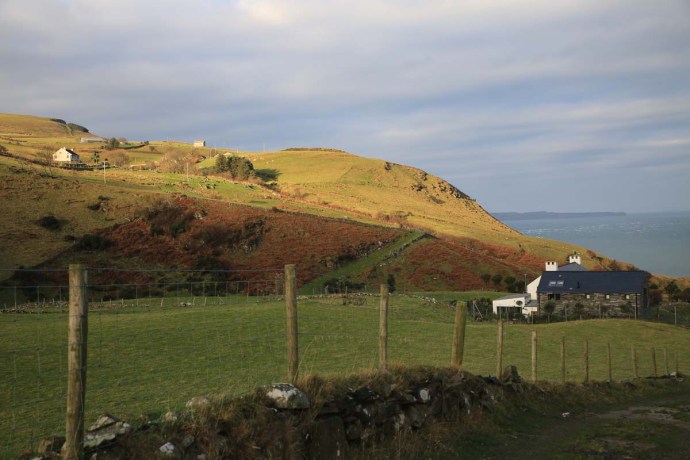
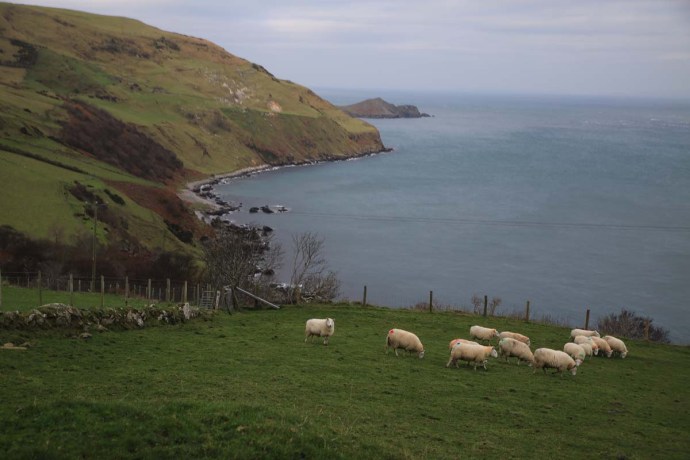
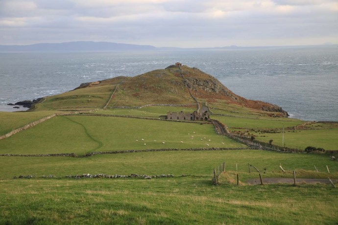
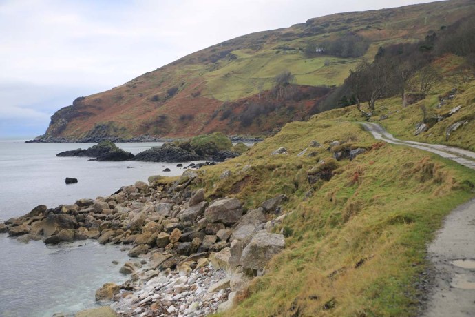
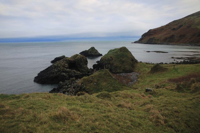
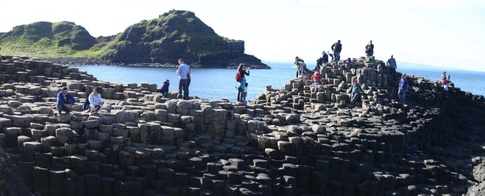
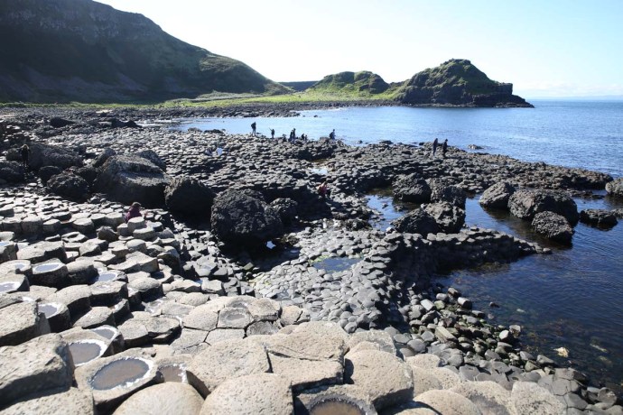
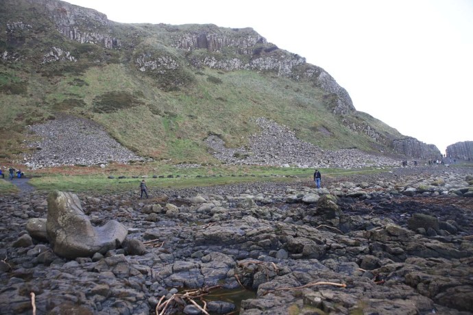
The Causeway is part of an extensive coastline exposing thick basalt flows.  The scenery is nothing short of spectacular with sweeping bays and jagged cliffs stretching as far as the eye can see.


IG3C1241

The Causeway Coast looking west with Giant’s Causeway in the foreground.  

IG3C1248

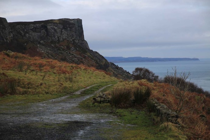
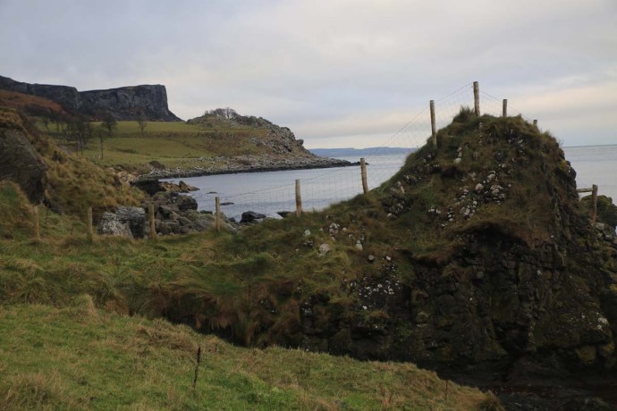
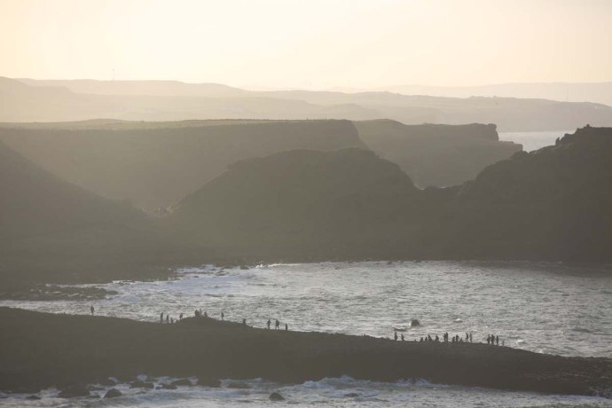
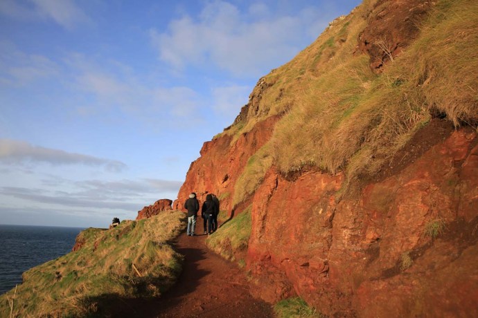
The coastal path from the Causeway to the Chimney Tops past the Organ Pipes

IG3C1423a

View west showing Causeway and Chimney Tops in the distance.

IG3C9835

Giant’s Causeway is on the right and the Camel Rock on the left.


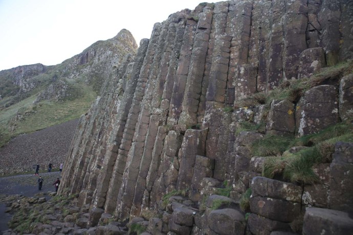
The Giant’s Causeway is most famous for the spectacular columns, or more correctly ‘columnar jointing’ in the basalt. The origin of the columns has historically caused all sorts of consternation. Our forebears did not believe such regular shapes could be created naturally. So if it wasn’t the work of the Almighty then it must have been Finn McCool. Hence the legend of the Irish Giant constructing the causeway to engage with his counterpart in Scotland, Fin Gall.


Giants Causeway 3

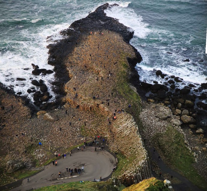
View from the clifftop down onto the Causeway.


IG3C9907IG3C9903IG3C9882

IG3C0976IG3C0961

And he left evidence didn’t he? In his haste to get back to Ireland and escape from his giant nemesis, Finn McCool lost a boot which remains to this day adjacent to the Causeway. There is a more prosaic explanation and I’ll return to this later.
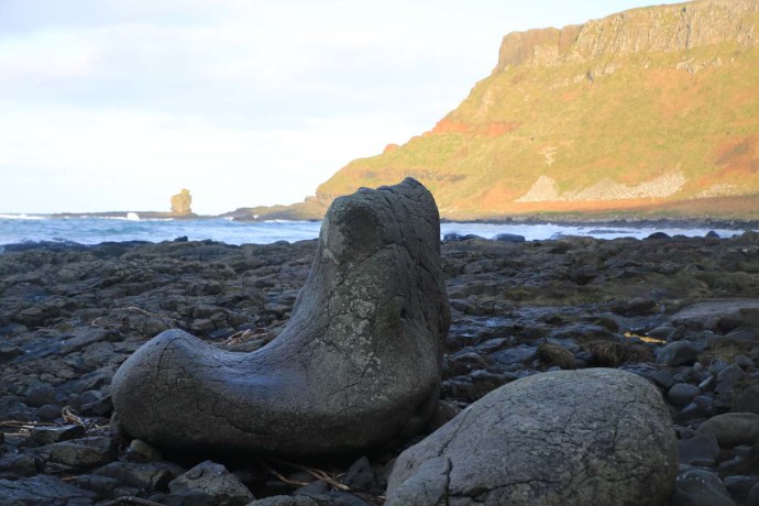
 

IG3C1038

The Giant’s Boot


The Causeway came to the attention of Science however in the late 17th century and right through the 18th century it was the focus of intense debate as to its origin. Geological science was then in its infancy. Two intensely opposed schools of thought developed. The Vulcanists, who believed the columns were basalt solidified from lava and the Neptunists who said that all rocks including basalt were sedimentary and formed in a great ocean. The Giants Causeway was at the centre of this debate. So it is one of the most significant places in the history of the geological sciences. That debate has long since been resolved in favour of the Vulcanists

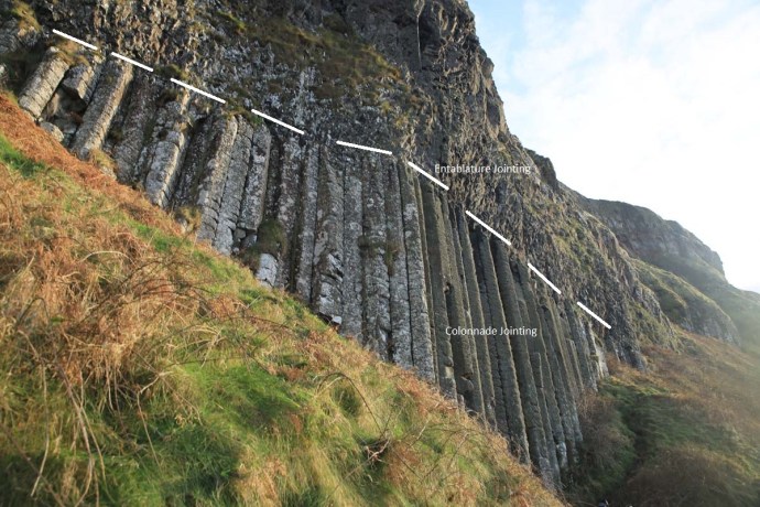
We now know, however, that the columns are caused by cooling cracks that developed at the bottom of a lava flow where it was in contact with the cooler rock beneath. As the lava continued to cool these cracks slowly propagated up creating regular, generally six-sided (though they can have from three to seven sides), columns. These regular columns are called colonnades. The hexagonal shapes are caused by the joints tending to be at 120º to each other. At the exposed tops of the flows cooling was more rapid where there was contact with air and water, so the jointing was irregular and blocky. This type of jointing is called entablature. You can see this very clearly in many places especially at the, so called, Organ Pipes


IG3C0876

Regular hexagonal columns

IG3C0947a

Columns with 4, 5, 6 or 7 sides.

IG3C1130a

Columnar jointing


IG3C1117

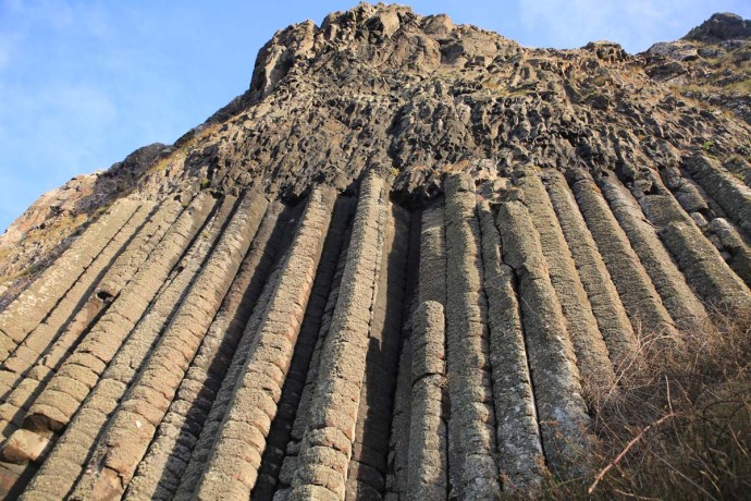
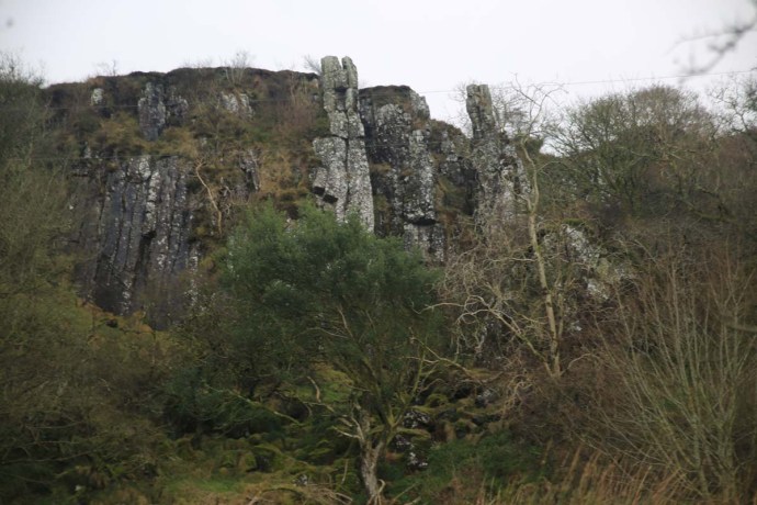
Spectacular columns at the Organ Pipes

If you look closer at the columns you will see that in addition to the regular vertical joints that create the columns there is also another set of sub horizontal joints which slices each column into regular segments. These were created by the release of stress during contraction within the columns.
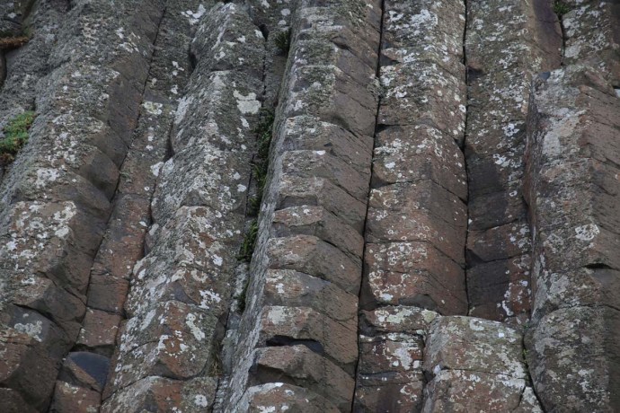


IG3C0989

Horizontal jointing


The really intriguing thing is that when these columns break along thee horizontal joints to form the rock platforms they are in fact ont horizontal.  Usually they are either  beautifully concave or convex and the segments fit perfectly together in a ball and socket arrangement. The concave joints are easily spotted on the rock platform as they retain pools of water.


IG3C9908

IG3C9880

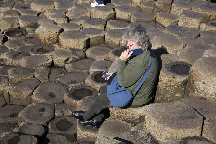
Detail of column surfaces.  water collects on convex surfaces


The columns make an impressive display whether on the rock platforms or in the cliffs.  There is a formation at the eastern end known as the Chimney Tops. If the illustration attached from an 1888 book is accurate, then the chimneys are considerably smaller than they were in the 19th century.   I suggest you go and see them before they disappear.
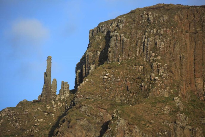
 

IG3C1229

Chimney Tops 2017


Chimney-Tops-Giants-Causeway

Chimney Tops 1888


It is easy to see how the Neptunists thought the basalts were of sedimentary origin.  There is a distinct layering which could be mistaken for sedimentary banding. Of course it represents different lava flows.  particularly confusing is a distinctive orange red layer in the middle of the cliff.  It is known as an Interbasaltic Formation; a laterite horizon, and is caused by the basalts below it being exposed to weathering for a considerable time before the upper series of basalt flows were deposited. It also suggest a warmer climate at the time as laterites require tropical conditions to develop. It is composed mainly of clays and is rich in iron and aluminium (most other elements were leached out) and has been mined for these ores elsewhere in Antrim.


IG3C9965

Layering in basalt flows

IG3C1232a

Interbasaltic laterite


IG3C1171

Laterite in detail


Within this laterite hori\on you can see relicts of the original basalt as paler partially weathered rock. There are also some excellent examples of preserved circular structures representing earlier spheroidal weathering within the normal basalt. This is caused by water percolating down vertical and horizontal cracks eventually creating rounded blocks. It is also known as ‘onion skin’ weathering.

Oh I forgot.  Finn’s boot.  It’s actually a glacial erratic, deposited by a retreating glacier at the end of the last Ice Age (about 10,000 years ago). Much more boring explanation.


IG3C1045

Giant’s boot.  Glacial erratic


I know I’ve gone on about the rocks but the spirit of the place is palpable.  The only word I can think of is Romance,.

IG3C9962IG3C9909

Romance and Rocks.  What a combination.


Categories: My Journey, Real Ireland | Tags: , , , , , , , , , , , , , , , , , | Leave a comment

The Torr Road Drive, Co Antrim. Lime Kilns, Game of Thrones and sublime beauty.

Travelling by car along the north coast of Antrim is spectacular to say the least. As seems to be the way of the world the drive has to have a label. So this is the Causeway Coastal Route because it features the Giant’s Causeway. I will blog on this and other places in due course because they warrant attention. But after Ballycastle, if you are heading east, the Causeway Coastal Route turns inland (away from the Coast – go figure!) towards Cushendun and Cushendall.  So most travellers miss a little pocket of Antrim that is staggeringly beautiful. This is the Torr Road which hugs the coast to Cunshendun.  Ireland is noted for its green of course but in many parts that green turns brown and red in winter.  Not here.  In this part of Antrim you seem to get the Forty Shades all year.

ig3c1463

View from the Torr Road, Antrim

ig3c1475

Green and gold.  Just add sunshine.  Torr Road.  Antrim

ig3c1607a

Green slopes that run down to the sea.  Torr Road, Antrim. That current looks pretty treacherous.  Scotland is visible on the horizon.

ig3c1616

Coastal view, Torr Road.

ig3c1670

Fences need repair whatever the weather.  Torr Road, Antrim.

Of course the road leads to Torr Head.  This is the closest point to Scotland and from here you look across to the Mull of Kintyre.  It was very cold this morning, so I resisted the temptation to climb to the top. At the top of the headland is a tower which watches over the Sruth na Maoile (Straits of Moyle), a former haunt for privateers, and acted as a signal tower, passing on messages of ship movements to Lloyds of London.  There is also a now ruined, customs station which was abandoned in 1922. Its stark ruin brings an evocative supernal element to the gorgeous views both along the coast and back towards the hinterland.  Awaiting you, at the end of this drive at Cushendun, is the gateway to the Glens of Antrim, but that’s another story.

ig3c1484

Torr Head.

ig3c1518

Ruined Customs House, Torr Head.  Antrim.

ig3c1500

Ruins of Customs House, Torr Head

ig3c1493

ig3c1576

Phone Box looking towards, Torr Head.

On my first drive along this road I went past a turn off to Murlough Bay. It was an inconspicuous sign and nothing drew my attention to it. If it hadn’t been for my B&B hosts that night at Teach an Cheol, just out of Ballycastle then I would have missed this little gem entirely. They insisted I go back there before leaving Antrim. Thank you  Micheál and Catherine.

The single lane road to Murlough Bay snakes off the Torr Road across brilliant green paddocks, and then suddenly drops off the plateau winding both perilously and picturesquely down to the sea. Remarkable views open up.

ig3c2107

Limestone cliffs at Murlough Bay.

ig3c2129

ig3c2412

I passed a solid stone structure which intrigued me, so I dragged my eyes away from the view.  It was like nothing I had seen before and I later discovered it was a lime kiln where broken limestone rock was melted to produce quicklime. This was used for mortar or for agriculture. It was a thriving industry wherever limestone and coal (for fuel) was found.

ig3c2080

Lime kiln near Murlough Bay.  Front view.

ig3c2093

Lime Kiln from above.  Showing hole where lime and coal are loaded.

ig3c2388

Limestone cliffs

A little simple chemistry.  Limestone with the application of heat breaks down to lime with the release of carbon dioxide gas as in the following reaction

CaCO3 + heat → CaO + CO2

The reaction requires about 1000 °C. They were extremely common around Ireland and Britain, indeed in the mid 1800s there were believed to be 23,000 in Cork alone. There was plenty of limestone here with the surrounding cliffs. I’m guessing there was also a good supply of coal nearby too. I am always impressed by the beauty and solidity of the industrial architecture I come across here in Ireland. The stone work of the multiple arches over the air intake is stunning.

ig3c2128

So continuing down towards the coast I see a sign reminding me that this area was used to film episodes of Game of Thrones that hugely successful television series, still running. Of course you can see why. Film tourism has always been a big thing in Ireland what with The Quiet Man, Ryan’s Daughter, Father Ted, PS I Love You, and it continues with Game of Thrones and Star Wars.

Murlough bay is a place of singular beauty. You leave the car and walk along the track which follows the coast to a whitewashed cottage with the most perfect location in Ireland. There is a second small abandoned cottage; padlocked but in reasonable condition. A peek in the window and I can see some bottles of disinfectant and cloths suggesting a level of optimism by the owner. What a place for a holiday batch. Nearby there is another lime kiln.

This place is everything that makes Ireland beautiful. Cliffs, washing waves on rocky shores, boulder beaches, jagged headlands, green fields rolling into the sea, craggy islands, little coves. The surprising variety of landscape is a result of a rich geological melange which I might talk more about at another time, but I saw metamorphosed schist and gneisses, basalts, sandstone and conglomerate, limestone and of course the ever-present carpet of bog over it all. A geological history of 600 million years on display in this little bay.  Again a sign tells us a little cove here was used in another episode of GOT.

ig3c2137

Distant view of Murlough Bay

ig3c2165

Murlough Bay looking east.

ig3c2184

Murlough Bay looking west.

ig3c2192

Basalt outcrops forming islands and bays

ig3c2211

Murlough Bay.

ig3c2264

Murlough Bay.  Sandstone rock platform with narrow bands of conglomerate.

ig3c2279

Murlough Bay.  This view has sandstone, basalt, gneiss and limestone.  A geological melange.

ig3c2294

Murlough Bay.  Abandoned cottage on the shore.

ig3c2178

Another lime kiln on the beach at Murlough Bay.

Again a sign tells us a little cove here was used in another episode of GOT.

It is hard not to use clichés in describing this spot. I was the only one there and it was so quiet and so still. the only activity was a fishing boat, way out in the channel and the only noise was the ripples lapping the shore and the occasional squawk of a gull. There was an undisturbed equanimity and you could feel tension disappearing with the tide. Just me and my thoughts. I didn’t want to leave. I have been to so many beautiful places in Ireland, but not felt this way before. Surrounded by natural beauty, yet somehow otherworldly.

Extraordinary.

ig3c2323

ig3c1741

Categories: My Journey, Wild Ireland | Tags: , , , , , , , , , , , , , , , , , , | 1 Comment

Blog at WordPress.com.