Posts Tagged With: history

The Torr Road Drive, Co Antrim. Lime Kilns, Game of Thrones and sublime beauty.

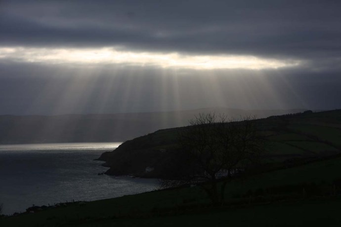
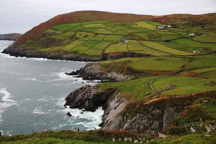
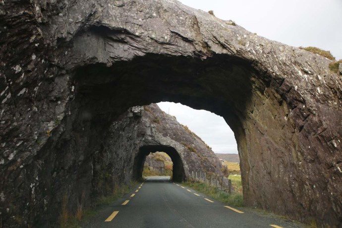
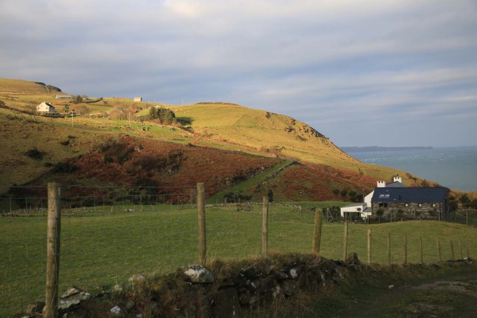
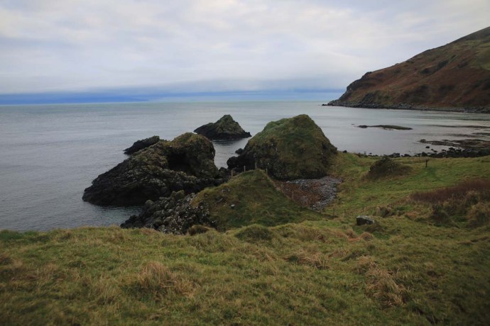
Travelling by car along the north coast of Antrim is spectacular to say the least. As seems to be the way of the world the drive has to have a label. So this is the Causeway Coastal Route because it features the Giant’s Causeway. I will blog on this and other places in due course because they warrant attention. But after Ballycastle, if you are heading east, the Causeway Coastal Route turns inland (away from the Coast – go figure!) towards Cushendun and Cushendall.  So most travellers miss a little pocket of Antrim that is staggeringly beautiful. This is the Torr Road which hugs the coast to Cunshendun.  Ireland is noted for its green of course but in many parts that green turns brown and red in winter.  Not here.  In this part of Antrim you seem to get the Forty Shades all year.

ig3c1463

View from the Torr Road, Antrim

ig3c1475

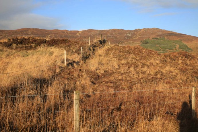
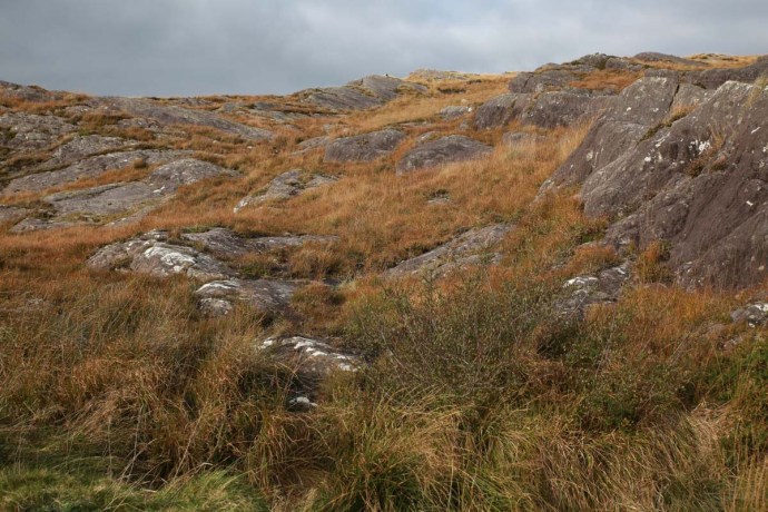
Green and gold.  Just add sunshine.  Torr Road.  Antrim

ig3c1607a

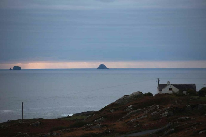
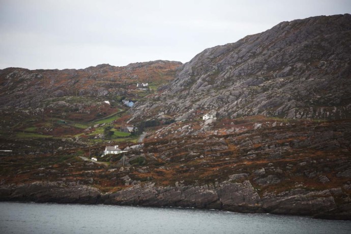
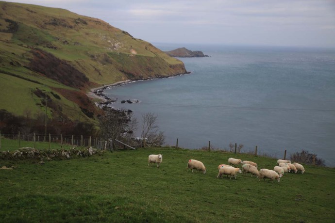
Green slopes that run down to the sea.  Torr Road, Antrim. That current looks pretty treacherous.  Scotland is visible on the horizon.

ig3c1616

Coastal view, Torr Road.

ig3c1670

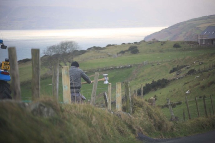
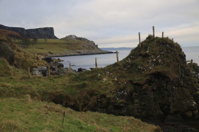
Fences need repair whatever the weather.  Torr Road, Antrim.

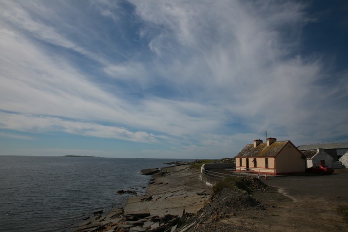
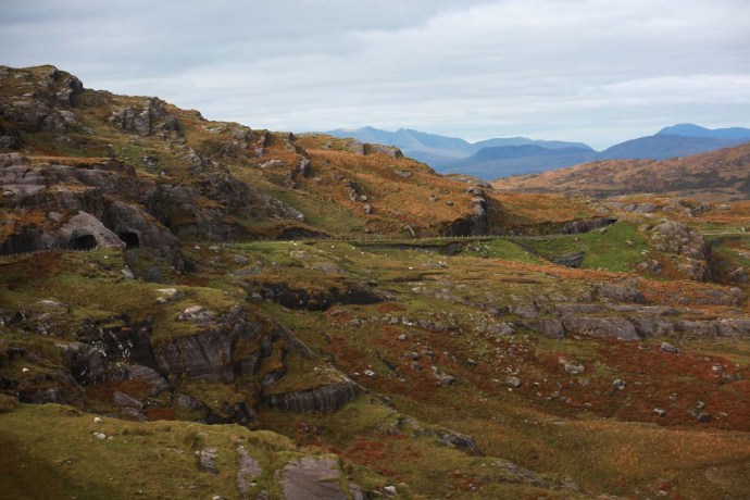
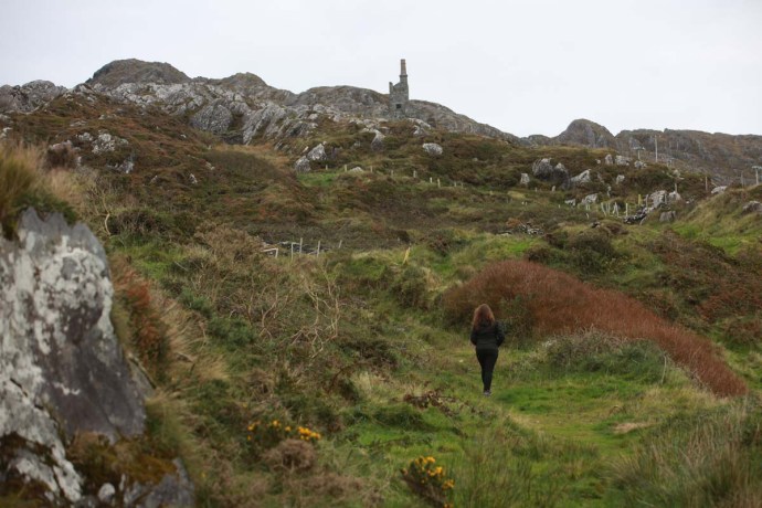
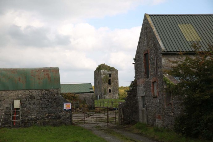
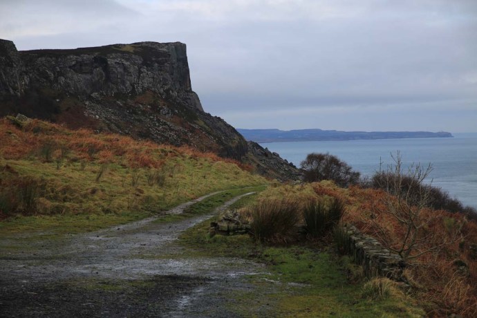
Of course the road leads to Torr Head.  This is the closest point to Scotland and from here you look across to the Mull of Kintyre.  It was very cold this morning, so I resisted the temptation to climb to the top. At the top of the headland is a tower which watches over the Sruth na Maoile (Straits of Moyle), a former haunt for privateers, and acted as a signal tower, passing on messages of ship movements to Lloyds of London.  There is also a now ruined, customs station which was abandoned in 1922. Its stark ruin brings an evocative supernal element to the gorgeous views both along the coast and back towards the hinterland.  Awaiting you, at the end of this drive at Cushendun, is the gateway to the Glens of Antrim, but that’s another story.
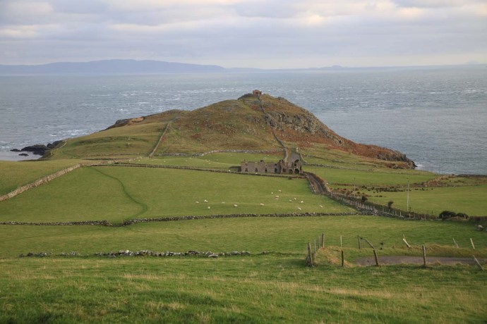
ig3c1484

Torr Head.

ig3c1518

Ruined Customs House, Torr Head.  Antrim.

ig3c1500

Ruins of Customs House, Torr Head

ig3c1493

ig3c1576

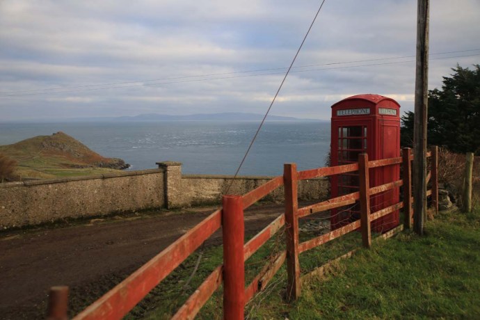
Phone Box looking towards, Torr Head.

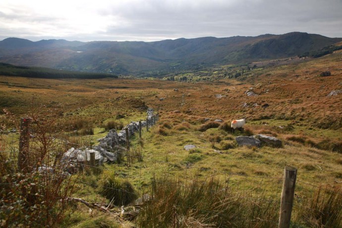
On my first drive along this road I went past a turn off to Murlough Bay. It was an inconspicuous sign and nothing drew my attention to it. If it hadn’t been for my B&B hosts that night at Teach an Cheol, just out of Ballycastle then I would have missed this little gem entirely. They insisted I go back there before leaving Antrim. Thank you  Micheál and Catherine.

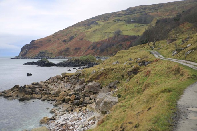
The single lane road to Murlough Bay snakes off the Torr Road across brilliant green paddocks, and then suddenly drops off the plateau winding both perilously and picturesquely down to the sea. Remarkable views open up.

ig3c2107

Limestone cliffs at Murlough Bay.

ig3c2129

ig3c2412

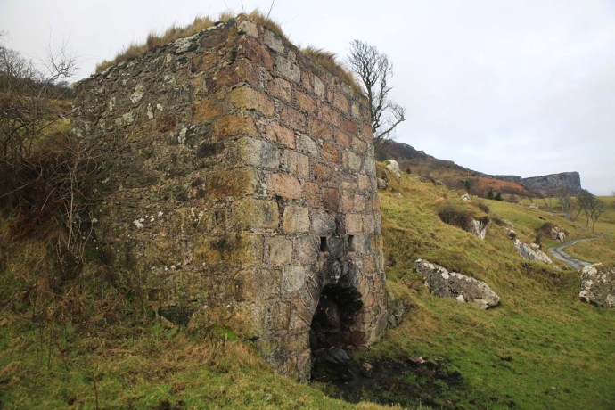
I passed a solid stone structure which intrigued me, so I dragged my eyes away from the view.  It was like nothing I had seen before and I later discovered it was a lime kiln where broken limestone rock was melted to produce quicklime. This was used for mortar or for agriculture. It was a thriving industry wherever limestone and coal (for fuel) was found.

ig3c2080

Lime kiln near Murlough Bay.  Front view.

ig3c2093

Lime Kiln from above.  Showing hole where lime and coal are loaded.
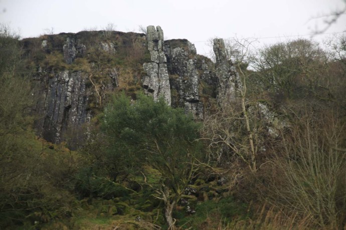
ig3c2388

Limestone cliffs

A little simple chemistry.  Limestone with the application of heat breaks down to lime with the release of carbon dioxide gas as in the following reaction

CaCO3 + heat → CaO + CO2

The reaction requires about 1000 °C. They were extremely common around Ireland and Britain, indeed in the mid 1800s there were believed to be 23,000 in Cork alone. There was plenty of limestone here with the surrounding cliffs. I’m guessing there was also a good supply of coal nearby too. I am always impressed by the beauty and solidity of the industrial architecture I come across here in Ireland. The stone work of the multiple arches over the air intake is stunning.

ig3c2128

So continuing down towards the coast I see a sign reminding me that this area was used to film episodes of Game of Thrones that hugely successful television series, still running. Of course you can see why. Film tourism has always been a big thing in Ireland what with The Quiet Man, Ryan’s Daughter, Father Ted, PS I Love You, and it continues with Game of Thrones and Star Wars.

Murlough bay is a place of singular beauty. You leave the car and walk along the track which follows the coast to a whitewashed cottage with the most perfect location in Ireland. There is a second small abandoned cottage; padlocked but in reasonable condition. A peek in the window and I can see some bottles of disinfectant and cloths suggesting a level of optimism by the owner. What a place for a holiday batch. Nearby there is another lime kiln.

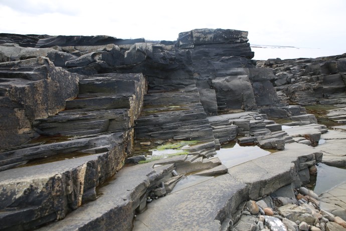
This place is everything that makes Ireland beautiful. Cliffs, washing waves on rocky shores, boulder beaches, jagged headlands, green fields rolling into the sea, craggy islands, little coves. The surprising variety of landscape is a result of a rich geological melange which I might talk more about at another time, but I saw metamorphosed schist and gneisses, basalts, sandstone and conglomerate, limestone and of course the ever-present carpet of bog over it all. A geological history of 600 million years on display in this little bay.  Again a sign tells us a little cove here was used in another episode of GOT.

ig3c2137

Distant view of Murlough Bay

ig3c2165

Murlough Bay looking east.

ig3c2184

Murlough Bay looking west.

ig3c2192

Basalt outcrops forming islands and bays

ig3c2211

Murlough Bay.

ig3c2264

Murlough Bay.  Sandstone rock platform with narrow bands of conglomerate.

ig3c2279

Murlough Bay.  This view has sandstone, basalt, gneiss and limestone.  A geological melange.

ig3c2294

Murlough Bay.  Abandoned cottage on the shore.

ig3c2178

Another lime kiln on the beach at Murlough Bay.

Again a sign tells us a little cove here was used in another episode of GOT.

It is hard not to use clichés in describing this spot. I was the only one there and it was so quiet and so still. the only activity was a fishing boat, way out in the channel and the only noise was the ripples lapping the shore and the occasional squawk of a gull. There was an undisturbed equanimity and you could feel tension disappearing with the tide. Just me and my thoughts. I didn’t want to leave. I have been to so many beautiful places in Ireland, but not felt this way before. Surrounded by natural beauty, yet somehow otherworldly.

Extraordinary.

ig3c2323

ig3c1741

Categories: My Journey, Wild Ireland | Tags: , , , , , , , , , , , , , , , , , , | 1 Comment

Glenties and the Blue Stack Mountains; The beating heart of Donegal fiddle music.

I hadn’t planned on going to Glenties. Don’t get me wrong it’s a delightful place in the west of Donegal set in mountainous country and its lovely leafy village setting is a surprising contrast to the treeless wild of this part of the world.

I had just spent a wonderful week of music at the Scoil Gheimhridh Ghaoth Dobhair (a winter school for traditional music at Gweedore) and was ready to go home. It was the last night and the final session was coming to a natural exhausted conclusion. I was saying my goodbyes when Sile Friel of the renowned Glasgow/Donegal based Friel Sisters asked if I was interested in attending a session the next night. This is how the conversation went.

Sile        “I’m trying to organise a session with a few of us and the Campbells at Glenties”

Me         “Um. Who are the Campbells?”

Sile        “You’ve never heard of them? Jimmy and Vince are fiddling royalty up here”

I felt embarrassed by my ignorance. But my interest was of course piqued and my travel plans instantly changed.

Next morning I headed south taking a detour to the Glengesh Pass (between Glencolmcille and Ardara), which ironically I had visited earlier in the year on a miserable summer day in stark contrast to this glorious winter’s day. Well worth the detour.

ig3c9620

Glengesh Pass.  On a sunny day in the middle of winter.  January 2017


ig3c7771

Glengesh Pass.  The same view on a foggy day in the middle of summer. August 2016


But my main objective was a little pub a few kilometres from Glenties in the middle of the Blue Stack Mountains.

I spent the afternoon discovering the Blue Stacks, also known as The Croaghgorms. It is the most significant mountain range in Donegal, separating the north from the south. Typical bare, rounded hills with the characteristic remote wilderness feel to it that makes Donegal so appealing. The special winter russet colour which takes on a red tinge when the sun shines.  And not a tree, except the occasional pine forest.  I took random roads, which turned into random lanes and then random boreens. It was beautiful but scary. The roads were so narrow that there was no chance for two cars to pass and there was bog on either side. And being so remote there were few houses and fewer laybys. I drove in fear of meeting someone and having my reversing skills challenged over distances measured in hundreds of metres.  This world though is well off the commuter trail and the major road traffic was of the four footed kind.

ig3c9732ig3c9649ig3c9676

ig3c9663ig3c9657ig3c9683

I arrived at the Glen Tavern (everyone calls it Dinny’s despite that name not appearing anywhere on the building) a respectable period before the nominated time of 7 pm. Of course I should have known better.

I had plenty of time to get to know the owners, Annie and Mary because it was at least an hour before the first patron arrived let alone musician. And then some. Of course, I was made to feel very welcome. I guess an Aussie fiddler tuning up was a bit unusual.  Or maybe it wasn’t.

ig3c9967

Mary and Annie.  Mine hosts at Dinny’s


The first surprise is that you enter the pub through a little shop. Just your basics mind you, but a shop nonetheless.

ig3c9950

Open for business.


As well as a shop and a bar it is also a residence. A door to the right took me into the now empty bar. Cosy and inviting with those corner lounges so typical in Ireland just waiting to be filled with musicians. This looked like a great place for music. But not right now.

I settled down for a chat with Mary and Annie and a glass of Jamieson and heard the stories of this place and its music. In my ignorance I had not realised that these mountains and this pub were at the beating heart of Donegal fiddle music.

ig3c9958

A bar with an house fiddle is my kind of pub.


The legendary itinerant master tinsmith and fiddler Johnny Doherty lived in these parts and played here and the Campbells (who Sile had mentioned) are a direct link to that legacy. Vince and Jimmy learnt their music from their father who played with him. Johnny had stayed with the Campbells as he had in many houses across the mountains.  I had inadvertently walked into this time capsule.

Gradually people arrived. Peter Campbell, Jimmy’s son, also a fiddler and Condy Campbell; not sure where he fitted in but he took up what looked like his regular spot in the corner and settled in for the night.

Two hours now and the musicians who were coming from Gweedore had yet to arrive. Occasional texts from the Friels advised they were ‘on their way’. But this is Ireland. Turns out they called in to visit Danny Meehan, another legend of Donegal fiddling and he wouldn’t let them go. I’m sure there’s a great story there.

So it was well after 9.00 pm when they finally arrived and then another half hour before the tunes began.

The place had gradually filled (I’m sure there were a few more Campbells among the crowd) as the pipes and fiddles took over. Joining Sile Friels on pipes and sister Clare on fiddle were brothers Fionnán and Iarlaith Mac Gabhann, from Dublin, on pipes and flute.

ig3c9822

Peter Campbell, Fionnan Mac Gabhann, Clare Friel, Sile Friel and Iarlaith Mac Gabhann at Dinny’s


The music was sensational. We were in full flight with, of course, a heavy smattering of highlands, mazurkas, flings and a waltz or two, which , for the most part, I had to sit out. We even played Donegal’s only polka. Well that was what I was told. We got the story of that tune from Condy but I have to be honest, I can’t tell you any of it because with his thick, but delightful, brogue, I didn’t get a word.

The musical visitors had decided to move on so about 11 they started to pack up ready to go. Then Jimmy Campbell arrived. That changed everything. “Just one for the road”.  Jimmy insisted that they keep playing and he just sat and listened. In that peculiarly endearing Irish way he would interject with “lovely”, “lovely”, which is surely the ultimate accolade. And it was meant.

ig3c9889

Jimmy Campbell watches and listens.


He was persuaded eventually to grab a fiddle. “I can’t play” he said wryly. “I can’t play like that”.

But he did and he could! No one joined. It was our turn to admire and just listen. He played solo and he played with son Peter.  The boys from Dublin had never been to Donegal before and I could see the reverence and joy writ all over their faces at hearing this music. I felt the same. Here was a whole world of playing I knew nothing about.

ig3c9907

Father and son.


ig3c9933

A good tune followed by a good laugh.


Of course no one left and the musical conversation continued until 1:30 am. Even the goodbyes took an hour.

I had the chance to sit and chat to Jimmy. A nicer gentleman would be hard to find. Nearly 80. He had left Donegal and lived in London much of his life but was now back home. His son Peter, born in England, followed him back. He is full of tales. A session with Jimmy is an experience. It is beyond now. Every tune has its moment. Often there are no sets. Just a single tune. We hear about where he learnt the tune or who wrote it or the story behind it or where the name came from. The tune is a window into a social history. With his words it ties us to people, time and place.

It was a special evening. Two worlds meet with both embracing each other. Music was just a facilitator for people to connect at completely different levels. A good session is more than just playing tunes together. This was a good session.

The beauty is though that I can take something away with me. On the wall is a framed musical notation of a tune, The Jack in the Tavern, written by Jimmy. It’s on my to-learn list now.

ig3c9945

To think that but for a chance conversation with Sile I would have missed this. That’s how it is in Ireland.

Happenstance and serendipity.

There is a music weekend every year in the Glen Tavern in September and I have marked it in my calendar already. Try and keep me away.

Hopefully I will have learnt Jimmy’s tune and a few more highlands and mazurkas by then.

.

Categories: Sessions, Stories, The Fiddle, Trad Irish Music, Wild Ireland | Tags: , , , , , , , , , , , , , , , , , , , , , | 2 Comments

All is not what it seems. A little story from the Wild Atlantic Way on the west coast of Clare.

I live in a remarkable spot and I have written of it and photographed it many times. Point Caherush lies between Quilty and Spanish Point along the spectacular west coast of Clare.  Indeed it was spectacular before it became part of the Wild Atlantic Way but now of course it is legitimately spectacular because it has a label with the word ‘wild’ in it. Anyway I live at the end of a one kilometre long boreen known locally as the Clogher Road. My front door looks out over Quilty and Mutton Island. Here’s a reminder.

ig3c5962

My little cottage nestled on the rocks at Pt Caherush


The rocks at my feet though are similar to the rest of the West Clare coastline from Loop Head to Doolin, and comprise shallowly dipping interbedded sandstones and shales.  For the whole time I have lived here I assumed that I was living at the edge of a wilderness (that’s the ‘wild’ in Wild Atlantic Way!). A thin strip of pristine land beyond the rolling green that is everywhere so heavily moulded by man.  I surmised, somewhat romantically, that only the hand of the sea had sculpted the shore. Despite this I was troubled by some observations I could not explain. Perfectly circular holes in the rock sometimes with radial joint patterns around them were disturbingly reminiscent of what I had seen in open cut mines. This made no sense. There was nothing to mine in these barren sandstones.

But I didn’t think of the sandstone itself.

ig3c6883

Perfectly circular holes and radial joint patterns on the rock platform at Point Caherush


One day I was chatting to Mikey Talty, a resident of this place all his long life. I have written about that day in a previous blog, when three generations of the Talty family were harvesting kelp from the bay. Mikey is full of wonderful stories but he really got my attention when he mentioned working as a young man in the 1950s at a massive quarry operation on the Point. He showed me where the crushing plant was and described how truckloads of rock were carted away to build roads as far away as Kilrush and Kilkee. This mining it would seem had changed the shape of the headland and much of the protection of the bay was lost.

ig3c6799

Mikey Talty talks about Caherush in his youth.


With this new knowledge I now see the evidence everywhere in my wanderings. Of course the drill holes were for the explosives, some still showing their perfect shape and probably unexploded, and others with radial shatter patterns showing they did their job. There are rock exposures that are not natural and there is angular rubble strewn, that has yet to be smoothed out by the ocean.

ig3c6873

Blasted face at limit of quarrying

ig3c6913

Quarried rock face and blasted rubble


It is hard now to understand the thinking that would have led to the locating of a quarry here when there would have been plenty of locations away from the coast. I would like to think that in ‘modern’ Ireland it would be impossible to conceive of permission being obtained today for mining on the seashore. Perhaps planning approval wasn’t needed then and certainly priorities would have been different.

I can find nothing in the literature about this operation and maybe the memory of it is only now with those who lived or worked here. But the record will stay in the rocks for hundreds of years and I am sure it will confuse and intrigue future generations of geologists and non-geologists, who wander around Point Caherush, as it did me.

Categories: My Journey, Real Ireland, Wild Ireland | Tags: , , , , , , , , , , , , , , , , , , , , | Leave a comment

Oliver O’Connell, Man of the Burren and the Track of Tears.

Ireland is a very popular destination with visitors. And for good reasons. I have met so many who have come here for a week and have rushed around to tick Dublin, Dingle, Cliffs of Moher and Galway off their list and happily report back home that they “did Ireland”. Don’t get me wrong most people genuinely enjoy Ireland, in fact love it. What’s not to love? There is of course wonderful scenery, friendly people, ruined castles, trad music, Guinness, bacon and cabbage, sheep on the road. Everything that brings people here. But very few of those short-term visitors would have tapped into the ‘real’ Ireland.  Ireland’s real treasure is its people. It’s through the people of Ireland you discover the Hidden Ireland.

I spent a day recently with one of these people. Oliver O’Connell may be known to some of you. Perhaps if I say he is Blackie O’Connell’s dad that may twig a few responses or the guy who started a session on an Aer Lingis flight last year, the video of which went viral; but really he should be better known as the great-great-great-great-great-great-great-great-great-great grandson of Maurice O’Connell ‘The Transplanted’. I’ll come back to that.

Oliver lives in an extraordinary spot in the middle of the Burren which is the beating heart of County Clare. Ten kilometres  from Corofin. You look out his kitchen window towards Mullaghmore , across a barren, stark tortured, limestone plain and you cannot see a single house. And at night the only light is the faint reflected glow from Galway City way to the north.

ig3c8720

View across the Burren National Park

Oliver is as much part of the Burren as the megalithic tombs and glacial erratics that dot the landscape. He took me for a little walk to show me a favourite spot of his; the so-called Famine Road. A little used part of the Burren Way walking trail.

Now I thought I knew what a ‘Famine Road’ was.  The walking tours of The Burren will take you to one and tell you these roadways were built as an assistance scheme to keep people out of the Workhouse.  This may indeed be the case but this one is different as Oliver tells it.  This road was here way before the Famine.  Indeed the 1842 map of Clare shows the route as a road in use and on the exact same line as the satellite image.  So it certainly well predated the Famine.

2016-11-04a

Satellite image of Famine Road.  Shown with red arrow.

2016-11-04-1

1842 Map showing same area as satellite image above.  Famine Road is clearly marked.

Oliver explained that it is called the ‘Famine Road’ for a very different reason.  The route was used by a number of families attempting to escape the deprivations of those terrible years but many did not survive. They are buried somewhere along the route in unmarked graves. It struck me as unusual that the road fell into disuse even though it would shorten the trip considerable from Corofin to Kinvara.  Oliver thinks the road has been there for perhaps a thousand years.  If this is true then it is a tribute to the engineering capabilities of the early residents.  It is roughly cobbled and raised in places, the summer grasses partly hide it now but its unique stone walls bounding it still stand proud today. They have regularly spaced jagged vertical stones. The road is straight as a die in places  and it traverses the country peacefully and silently.

ig3c8604

The start of the Famine Road near Aughrim.  Part of the Burren Way.

ig3c8716

View to the north along the Famine Road

ig3c8655

Cobbles forming the road base

ig3c8664

Detail of cobbling

2016-11-04-3

Detailed satellite view of portion of the Famine Road

ig3c8710

Jagged rocks standing upright form part of a wall along both edges of the road

So why was it no longer used?

Oliver is a poet. One whose poetry is raw, and highly descriptive.  It is personal and it is heartfelt.  It comes to him quickly almost as a stream of consciousness. He doesn’t massage it and as a result it doesn’t sound the least bit contrived.  In a poem he wrote about this road he describes what he calls the Track of Tears, thus:

Here in this place “bothar na muinne, ait ciunas gan uaigness”.

Where silence screams at you but the spirits of our people radiate a comforting presence as they lie here in peace in their final resting place.

You tread on their footsteps and on their tombstones as you weave your way through sacred structures and vertical stone walls in this land of myth and magic.

(‘bothar na muinne, ait ciunas gan uaigness’ translates to a ‘place of silence without loneliness’)

The silence screams. It quite literally does. Not a bird, no wind, no animals Just the sound of our footsteps and our breathing. It’s as if the Gods with quiet reflectance continue to mourn those who didn’t make it. And it is surrounded with a landscape of harsh but tranquil beauty described so well in Oliver’s poem.

It is perfectly fitting that the road is no longer used and it is tempting to think that this was by design as a memorial to those lost.

I was moved by the story of the road and this window into a distant Ireland.  Distant struggles, yes, but it recalls the many battles endured before and since by the Irish people.

But Oliver has a bigger story to tell.

ig3c8736

Oliver with the O’Connell Family Tree

ig3c8741

Detail of portion of the Family Tree

He has spent fifteen years trying to unravel it and his journey has as many twists and turns as a good detective yarn.

Oliver’s forebears have been in Clare since 1653. He has been able to trace them back continuously to Maurice O’Connell (The Transported) who led 59 members of his family from their home in Kerry, from where they were expelled by Cromwell. Those who survived resettled near Inagh and Liscannor. Clare was then part of Connacht and the expression To Hell or Connaught comes from that time and relates to this exodus. The barren plains of the Burren was the equivalent of being sent to Hell. But survive they did and Blackie’s children represent the fourteenth generation of O’Connell’s to live in Clare. But it’s even more interesting than that.

Oliver has managed to trace Maurice O’Connell’s antecedents back to 1340 when they were a well connected and important family in Kerry and Limerick and even earlier to Connaill Gabhra, “Connaill of the Swift Horses”, King of Munster, in the 1100s. What a fabulous heritage. Nearly a thousand years!

What is unique about this story is that documentation exists continuously since the 1300s. As Oliver explained most Irish families can only go back to the 1820s. Prior to that records were kept by the British only for Protestants and Military. The O’Connell’s have a long hsitory of military service so the story is still there for those with the patience and energy to root it out.

Oliver as well as being a poet and raconteur is a musician and has links to a generation of musicians sadly disappearing fast. He is full of stories all told with zest and enthusiasm, such as how Blackie started on the pipes, but I will leave that for Oliver to tell sometime as he surely will.

ig3c8753

How else would you end a day such as this but with some tunes, So I sat on a chair in the kitchen, a chair that I’m sure that Oliver’s old friend Finbar Furey would have sat on and it just seemed so perfectly logical that the fiddle and the box together would shatter that Burren silence.

Oliver has invited me back to see this place in a different mood. When the frosts arrive.

Keep me away.

ig3c8649_1

Categories: My Journey, Real Ireland, Wild Ireland | Tags: , , , , , , , , , , , , | 11 Comments

The Beara Peninsula, Co Cork. My New Favourite Place in Ireland.

I hope my blogs on Ireland aren’t getting too boring. Each time I discover or rediscover a new place I can’t stop scraping up the superlatives.  I’ve blogged recently on the magic of Glencolmcille and south west Donegal, on the spirit of Achill Island, on the beauty of Doughmore in West Clare and West Connemara and many places in between. Recently I visited the Beara Peninsula again for the first time in twenty years. And I’m sorry but I have to regale you with more resplendent words yet again.

The Beara Peninula is one of those wonderful headlands that define West Kerry and West Cork, jutting prominently into the Atlantic and adding a whole lot of extra kilometres to the Wild Atlantic Way.  Many have well known and evocative connotations. The Iveragh Peninsula, better known as the Dingle Peninsula,  and the famous Ring of Kerry are the prime destinations for visitors and do not fail to disappoint. Less well known are the Beara Peninsula, Sheep’s Head and the spectacular Mizen Head.

The attractions of the Beara Peninsula are however becoming better known and I am told by the locals that this summer it was crowded with visitors. I chose to visit in late October. The weather was good (in Irish-speak that translates to ‘no rain’) and it has to be the perfect time. At the western end, the roads are almost deserted and you feel you have this magnificent landscape to yourself.

An obvious draw of this place is that it is more compact than the Ring of Kerry but there is so much variety, so much of interest and so much to fill the shortening autumn days that it was hard to leave.

So what does this little treasure offer?  For a start magnificent vistas are around every corner. You can approach from the Northern Road or the Southern Road but my strong recommendation is you find time to do both.

panorama-beara-3

ig3c3378aig3c3484ig3c3436ig3c3681ig3c3706a

And sometimes you see something that you know could not be replicated anywhere else in the world.  The patchwork quilt and stone walls that say Ireland, Ireland, Ireland.

ig3c4109aig3c4224aig3c4066

There are a number of mountainous rocky passes. I explored the Caha Pass this time, which links Kenmare with Glengariff. Here there is stunning scenery and four remarkable tunnels (known as Turner’s Rock Tunnels) built in the 1840s when they decided to go through the rock rather than over it. Quite an engineering feat for its day and very unique for road construction as most tunnels in Ireland were built for railways. Indeed the railway construction boom did not start until the 1840s so these tunnels predate any rail tunnel in Ireland.   From this impressive road there are craggy mountains, magnificent pasture and grasslands, and sweeping panoramas. Next time I will do the Healy Pass.

ig3c4805aig3c4741ig3c4801ig3c4826aig3c4731

Elsewhere you will see wild, coastal panoramas, verdant forests, jagged islands or houses perched on grassy knolls with staggering views or nestled into rugged rocky cliffs.

panorama-beara-4ig3c3780ig3c3820

ig3c3635a

ig3c3716ig3c3493

ig3c3916aig3c3841a

The drive to the end of the Peninsula and Dursey Island is not to be missed. But be prepared for perhaps a little disappointment. Ireland’s only cable car which links the island to the mainland and at this time of the year only runs between 9.30am and 11am was ‘fully booked’ and not operating for transport of people. It was being used for the day by the local farmers to transport hay across the narrow channel. Where else would tourists be turned away, some mind you who had travelled especially, in favour of bales of hay? Only in Ireland. But somehow it didn’t matter, there was so much else to do and it will be there (possibly) next time. You’ve got to admire the ingenuity of the farmers here. I saw an old ‘retired’ cable car in a yard being used as a chook house. Love it.  And love the little insect houses thoughtfully provided by one farmer.

ig3c4000ig3c4016ig3c4034

Then there is the colourful palette of the charming village of Allihies, which single-handed may be responsible for keeping alive the paint pigment industry in Ireland. Purples, pinks, indigo and every other colour merged harmoniously into the greys, greens and reds of its rocky backdrop.

ig3c4383a

ig3c4264a

And towering over the town is the architectural masterpiece of the Engine House of the Mountain Copper Mine built around 1810. Maybe you think masterpiece too strong a word  but it is at least the equal from a heritage perspective of the megalithic ruins or the monastic abbeys that populate the tourist guide books.   This is the finest example of an historical mine building I have seen in this remarkable condition. It speaks of the confidence and wealth that the mine brought to this remote outpost as it became one of the jewels of European copper mining during its heyday from 1810 to its closure in the 1920s. There are plenty of reminders of the mining period; old shafts and adits, mine workings, two other engine house ruins, stone walls and in places the tell-tale green and blue staining of copper carbonates.

ig3c4369a

Mountain Mine engine house

ig3c4362ig3c4290ig3c4275

ig3c4321

Chasing the copper


There is a museum which gives a very good account of the mining story but unfortunately it is a bit expensive which turns some away. All aspects of the story are covered including the geology, mining technology and social impact.   As a geologist it was of course fascinating. And even more so for me having met the next generation of miner there, young J and his mum Frances, locals who had come to see if they could find any copper. As it happened I had seen some workings with strong copper on the way up the hill, so I offered to show them and took them there. J’s wide eyed fascination and enthusiasm was enough reward.  Maybe I have helped kick start another geologist’s career.

ig3c4394ig3c4389

Still on copper, I stopped at Puxley Manor near Castletownbere. Actually the site of the mansion is right near the ruins of Dunboy Castle but more on that later. It would seem that the location is well cursed having witnessed a number of tragedies over the past 4oo+ years.

24_ctb_ah-635x402

Puxley Manor around 1910

When I first saw the Puxley mansion it was 20 years ago it was a shell of a ruin. It had been the home of the Puxley family since the 1700s. They pretty much owned the copper mining industry here and ended up fabulously wealthy.  As the industry declined so did the Puxley wealth and when his wife died in childbirth Henry Puxley, the last owner, abandoned the castle. Worried that the British Army would take over the abandoned house, the IRA torched it in 1921, destroying it and its contents. The shell was sold at auction in 1927 but remained a forlorn ruin as this photo shows.

b-and-white-puxley

Puxley Manor in the 1990s

This is what it looked like when I saw it in 1996. It was sold to a developer in 1999 and the Celtic Tiger roared. It was to be transformed into a luxury 6-star resort hotel, the only one in Ireland. Massive restoration and conservation work was carried out and all progressed swimmingly with a soft opening in 2007. That was until the money dried up in 2008 with the GFC. By 2010 the project was abandoned and a mesh fence erected. The bats returned but not the visitors.  This is how it appears today. The rotting hull of a large boat sits in the harbour as if to reinforce the tragedy.  Such a grand vision. The restoration did not however extend to the gate house which stands impressively ruinous.

ig3c4651

Puxley Manor.  restored but empty

ig3c4532a

Puxley Manor

ig3c4496

Gatehouse.  Puxley Manor


I said earlier that Dunboy Castle remains were nearby. This was the ancestral home of Donal Cam O’Sullivan, last of the Gaelic chieftains and a thorn in the side of Elizabeth I during the nine years war which started in 1594.  In 1602 she sent a large battalion of troops to destroy O’Sullivan and the 143 men, who tried to defend the castle, could not withstand the British canon. Surrender was not an option after an emissary sent to discuss terms was hung in full view of the defenders. This ultimate fate awaited all those remaining once the British destroyed it and the castle was never lived in again.

The name O’Sullivan however is everywhere on the peninsula.  You can’t avoid it.

ig3c3538

This little enclave of Cork is truly a gem and you could spend a week here or even a lifetime. There are plenty of stone circles, forts, monuments, holy places (such as the Mass Rock) and extraordinary natural wonders to explore and discover.  Oh, and sheep.  And there’s Dursey Island, if the cable car is running.  And if you’re up for it you can walk it all on the Beara Way.

panorama-beara-6

Ring fort

ig3c3756

Mass rock

ig3c4147

The black sheep in the flock

ig3c3540

There once was a church

The beauty though is not just in the grand vistas but in a host of other details for me that capture the personality of a place.  Here are a few photos that speak loudly about the struggle for life for both nature and man.

ig3c4151

Abandoned bucket near a well.

ig3c3769

Perfect bonsai tree growing wild.


ig3c4080

Window treatment

ig3c4404

Ingenuity

ig3c3556

Maintenance can be a problem

ig3c3519a

Fantastically fertile for funghi


ig3c3434

Life hangs on


ig3c4692

True love

ig3c4547a

Faded hope

ig3c4505

Was this to avoid the window tax?

So that’s it.    I’ll be back and very soon.

Categories: My Journey, Real Ireland, Wild Ireland | Tags: , , , , , , , , , , , , , , , , , , , , , | 9 Comments

Fury. A dog’s tale.

There are many legends and stories in Ireland; the origins of which are often lost in time and who knows whether there is any truth in them or whether there has been serious embellishment over the years.  So, it’s great when one such legend is proved with physical evidence.

img_1678

If you visit Portumna Castle in County Galway you will of course be blown away by the splendour of the building, which in its time was the grandest castle in Ireland, outshining all others. Built around 1610, it is notable as the first building in the Renaissance style in Ireland and cost a massive £10,000. It was abandoned in 1826 after a fire and has been largely rebuilt. I don’t want to talk about the Castle and everything there is to see, the guidebooks and guided tours will show you all of these things, but the highlight for me was the display of the remains of Fury.

Fury was by some accounts an Irish Wolfhound, by others something else. The story was widely told that in April 1797, Fury was asleep on the grass underneath one of the windows of the castle when a young lady of the house, while watching the dog below, fell from the window. She landed on the dog breaking its back which resulted in poor Fury’s death. This though  saved her life by breaking her fall and in gratitude the family placed a plaque on Fury’s grave. Part of the inscription read

Alas! poor Fury.
She was a Dog, Take her for All in All
Eye shall not look upon her like again.

Excavation in 1997 indeed discovered bones of a dog and the skeleton was reconstructed. Analysis of the remains suggested the dog was a Whippet though this could not be conclusive.  A number of vertebrae were missing in the middle of its back and this supported the legend that  the likely cause of death was of a broken back. The presence of nails in each corner of the gravesite indicated that she was buried in a coffin.

img_1694

Sad it is of course, but also quite wonderful that 200 years after the tragic event archaeology confirmed the legend and that Fury’s deed is remembered.

Fury is on permanent display at the Castle. It’s worth a visit.

Categories: My Journey, Real Ireland | Tags: , , , , , , , , , , , , , | 5 Comments

A Visit to Ralahine, Co Clare. A Failed Experiment.

Ireland was a troubled country in the early part of the 19th century. Under the firm rule of the Crown, most Irish land at this time was owned by absentee landlords either in Britain or Dublin. The farms became a hotbed of discontent with tenants living in misery. This prompted organised groups such as the Ribbonmen, who launched deadly attacks on landlords and their tithes. Rural Ireland was not a happy place.

One man decided to try to change this. He believed he could bring peace to the land with a cooperative farm where he would rent the land to the labourers and they would work it under their own authority. This man was wealthy landowner John Vandeleur and a man of considerable influence in Clare.  He had been High Sherriff in 1823.  He found an estate of 638 acres at Ralahine near Newmarket-on-Fergus in County Clare and with socialist backer Englishman Edward Craig running it, started the colony with 40 farmers and their families. They had a school, a laundry and a pooled kitchen. All the capital (buildings, stock etc) was provided by Vandeleur and was communal property. There was no private ownership.  All 4 legged animals, even dogs, were the property of the group.  He charged rent in the form of farm produce.

2016-10-04-5b

Ralahine Estate as shown in the 1842 Survey map.  The location of buildings still standing is marked,

There were strict rules governing the running of the farm. It was no socialist Utopia. New members could only be admitted by ballot. Work was 12 hours per day. There was no gambling and no drinking.  There was however enshrined freedom of expression and religion.  If there was a proposed marriage to someone outside the colony, and the members did not approve, then both were excluded. There was no money. Labour was paid for in Labour Notes which could be exchanged for provisions.

It all seemed to work and the colony expanded after one year to 81. People came from all over the world to see the contented colonists. Then it all came crashing down.

Mr Vandeleur’s wealth was gone. He had lost his fortune, ironically through gambling and drinking. He fled from Ralahine. The arrangement with the members had no legal basis and all the assets were seized and the bold experiment came to an end after two years.

I wanted to see how much of Ralahine was left. It was easy to find; just a short drive out of Newmarket-on-Fergus. I met local farmer Niamh, who pointed out some of the original buildings from 1830 which are still standing. There is the old mill, very much intact and a long whitewashed building, which at first I thought was stables, was the old working mans’ cottages. Each “house” has a single room with a fireplace,  Probably very comfortable for its day. .

ig3c1004

Rear view of the Old Mill

ig3c1148

Front view of the Old Mill


ig3c0993

Workmans’ Cottages


There are a number of other buildings and many walls which also appear to date from the same time but these mostly seem to now be used for storage. And of course looming over it all is the Rathlahine Castle, a previous home of one of the MacNamaras,  possibly looking a little worse for wear now than it did then.

ig3c1064

Ralahine.  View to Rathlahine Castle.


ig3c1143

Rathlahine Castle


The original house, the residence of Vandeleur,  was apparently demolished in the 1940s. Niamh said it was due to the windows tax, but this sounds a little fanciful as the window tax ended in the 1850s.

ig3c1151

Ralahine.  The site of the original Rathlahine House.  Nothing remains. 


I found a few very old apple trees near the mill, laden with fruit and it would be nice to think that these date back to the days of the colony.  So maybe John Vandleleur, if he is looking down on his life’s work from his vantage point above, may take some solace in the fact that among the crumbling ruins of his dream apple trees, his farmers planted 185 years ago, are still bearing fruit.

Categories: My Journey, Real Ireland | Tags: , , , , , , , , , , , , , , | 7 Comments

Blog at WordPress.com.