
Loop Head is only an hour away from my house near Quilty. It is one of my favourite places to take visitors no matter what the weather. So serene and dramatic when it is calm; wild and scary in the wind and rain. If you have been following this blog you will have seen my earlier posts and photographs. Spectacular cliffs displaying contorted folded sediments, rock arches and caves, a lighthouse, dolphins and in the distance the mountains of Kerry.

Contorted rocks in the cliffs north of Loop Head
There is a rocky island at the end of the headland which looks like it was sliced off with a giant knife. It is mad with breeding sea birds through the summer. The picture below was taken in May and shows just a few early arrivals, taking up prime spots. A deep and treacherous chasm separates it from mainland Clare. As you would imagine, much mystery and legend surrounds this place.

The island is popularly known by some as Diarmuid and Grainne’s Rock, one of many places in island that reference the famous Irish legend of the love triangle between Fionn Mac Cumhail, his warrior friend Diarmuid and a girl named Gráinne.
The gap to the island is also known as Cú Chulainn’s Leap. And that’s another interesting story in its own right. Here is the short version.
Cú Chulainn was an ancient Gaelic hero warrior gifted with superhuman strength, speed and skill. He was leader of The Red Branch Knights, who in ancient times would be fighting battles, protecting the folk of Ulster from invaders. He would, however, often go travelling. On one of those trips, he met a ‘cailleach’, translated variously as a wise woman or a ‘hag’. Her name was Mal. She fancied him and as she had magic powers with which she could ensnare anyone she touched, he took flight.
She chased him all over Ireland eventually following him to this remote promontory in west Clare. He leaped across the channel to the island but she was fairly athletic as well and was able to follow. Still desperate to avoid her he hopped back to the mainland. She continued to give chase but she didn’t quite make it slipping on the edge and and ending up in the ocean below. Three days later her head washed up at what became known as Hag’s Head and nine days later her remains came ashore at Quilty. The bay here took the name Mal Bay (hence Miltown Malbay) and the site of the jump became Leap Head or later Loop Head.
All fascinating but I digress.
At the end of April with Spring desperately trying to make an appearance I paid yet another visit. Isn’t it amazing that you can walk past a spot a dozen times and just not realise the significance of what you are seeing? Well this day I noticed on the cliff edge two metal spikes fixed into the rock and a neat wall and some stone construction above them, including a large stone lined hole. It all was heavily disguised by the soft spongy grass and the newly budding sea thrift.

Two Iron spikes fixed into the cliff and a stone wall and hole above.
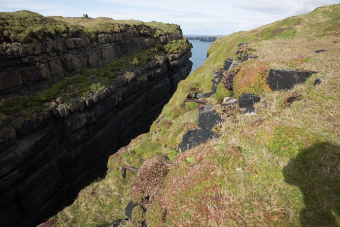
Looking from the north to the south
I was intrigued. My first guess was that it was evidence of a former bridge. Perhaps a rope bridge like Carrick-a-Rede, I thought. But why? And in any case, hard as I looked I could see no works on the other side of the island which I would have expected. It remained a mystery but unsatisfied I resorted to Google later that evening.
It didn’t take long to find this truly amazing photo in the archives of the National Library of Ireland.
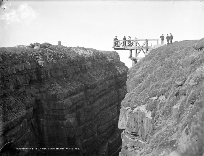
Viewing Platform Sampson Island. c1905
What I was seeing was in fact the remains of the foundation of this viewing platform. The photo is dated at c1905. and reveals a lot. You can see a sign on the Island that says ‘Sampson Island’ and proffers a date in the 1830s suggesting a landing then.

Detail of above photo showing sign and shelter.
Did Sampson stake a claim to the island? There is also evidence of a small shelter. Further the people on the lookout are identified by researchers as members of the Sampson family. But really it is all speculation. Why build this elaborate and hair-raising construction and how did they actually get across to put up the sign? Why even bother naming it?
Then I saw another image. God knows how the photographer got this angle
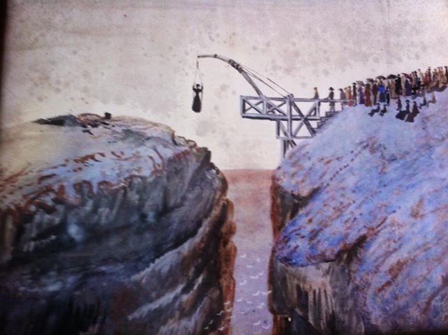
Crossing to Sampson Island?
That is one very brave woman in that sling. I am not exactly sure what is going on but it is possible that this was how they got across. There’s quite a crowd waiting to try. Perhaps Mal would have been better off to wait for the Sampsons to build this before attempting the crossing.
With Ireland’s long and convoluted history it is common to come across these hidden stories for which only scant evidence remains. Sometimes though you have to look very hard. Next time you visit Loop Head have a look for it. It’s close to the edge though so take care lest you end up like poor old Mal.
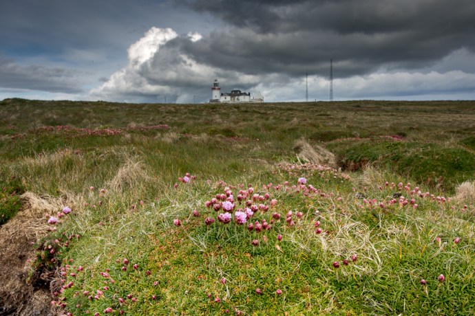
Loop Head lighthouse with the sea pink just starting to bloom

Great story Bob, but surely the second to last image is a painting?
I thought that too Myra, but it was referenced as a photo. The same comment about the angle would apply though. To get that view as a painter or photographer you would have to be suspended over the water.